Title: July 25, 2015 - Lassen Peak
Trail head: Lassen Peak Parking Lot
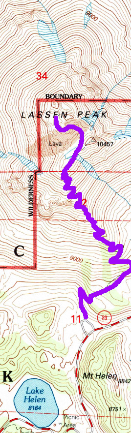
Hike Info:
Trail: Lassen Peak Trail
Destination: Lassen Peak
Start Time:8:50am
End Time: 2:30pm
Travel Time: 5:40
Elevation Rise: 2,000'
Maximum Elevation: 10,457'
1These mileages and stuff is from the official trail information from NPS. My GPS is low on battery so I did not bring it.
Description:
It is around 6 and time to get up. Lewis is taking us on a hike up
Mt Lassen and I suspect he will be pretty punctual, after all he is a lawyer (a pleasant one, and a fine hiker at that). We have pancakes for breakfast and get cleaned up. Right at 7:30 we are ready and Lewis rounds up the troops who want the adventure to climb the mountain. There are 16 of us total--nine who will be more like jack rabbits and seven who will enjoy breathing heavily the elevated air.
 |
| Lewis giving instructions |
We get to the Mt Lassen parking lot around 8:30. It always takes a few minutes to get everybody organized and today is no exception. I am designated the sweep, which in reality is recognition of my talent for going slowly.
 |
| Start of a long 2.5 miles |
 |
| Eye of the Vulcan |
But there are several of us who have banded together and will make it up the mountain. The first .4 of a mile goes fast. Why do we know that it is .4 of a mile? Not because I am wearing a GPS, that is for sure-I could not find replacement batteries so the GPS is about dead. But there is a sign which announces that it is so, even though it seems shorter. I suspect the other 2.1 miles will go a lot slower.
But the other thing this sign says is that above us is a rock formation called the Eye of the Vulcan. No, it is not where Mr Spock from Star Trek is buried as I was saying up on the mountain, but a hole which lava poured through during an eruption Still it is both fascinating to be watched by the mountain, and I must say, a little bit eery.
But we continue on. As steep as this trail is, and we are going up pretty well, The Park Service has done a pretty good job with it. For the last four or five years, there has been restrictions on using the trail. Restrictions like it can be used only four days a year because they were reconstructing it. For that amount of time, I sort of thought the trail may be paved in gold. But I admit, this path was done well. I suspect that there was only a few modifications from the time when BF Loomis first created this trail.
 |
| Chari's Goal |
 |
| Not the peak |
 |
| Looking southwest from trail |
Like a lot of upward trails, there is reason to stop and gawk. This one is no different.Not only do we get views of our objective, but also the surrounding area. We see
Lake Helen close to the parking lot.
Brokeoff Mountain loams in front of us a good part of our initial way up. When on the east side of the mountain, the
Kings Creek drainage is spread before us. So there is much to ponder as we head up. I make use of every possible moment to ponder too.
 |
| Sherri on top |
But we get to the top and enjoy the view. We see the nimble nine, ready to charge back down. But we are not-we want to enjoy the top of the world feeling. So our speedy friends return down the trail which we just came up for. They will be going on to further adventure.
 |
| Lassen Crater |
Now the top is sort of a misnomer. Yes it is the top, but not really the top. The trail ends and there are interpretive signs there, telling about what we are seeing. There is also the crater which we can go down into. But an eighth of a mile away is the east peaks which are 60-80' taller than where we are. Many of our gang want to ascend like others have. So we set out for the top of the top. But it becomes quickly evident where the NPS trail ends and the social trail begins. We do make it to the top and take some pictures and celebrate the achievement.
Now I am not very wild about going down this slope. Lots of scree and loose rock can come down this pretty steep slope. While only a class 2 route, it could be interesting in the right circumstances. The good thing about helping others over areas you have concerns about is that you can stifle your own fears and concentrate on relieving the fears of others-sort of a natural relaxer. Through this all, we all got down safely.
 |
| Switchbacks and Lake Helen |
Our group is not terribly fast going down. But for me, one of the good things is gaining a new perspective. Going up I have a tendency to be looking up at where we are going to go up to. But down down is so much more expansive. It seems like we have the whole world in front of us, and we do! At least the world around Lassen. It seems like there is a whole world before me which I am flying through, at least in my imagination.
 |
| Looking over the Kings Creek area |
Glad we have poles to go down. Even better that the Park has reconditioned this trail. Sort of frosts me to see someone, not in our group, cutting switchbacks. I know as a Christian I am not be vengeful or wanting too much justice-I am in much more need of grace and mercy than judgement. yet when I see someone doing inconsiderate things like this, I think I would not mind if they broke a leg or something. But then there is that rescue thing which puts others in danger. So best hope these switchback cutters see the light.
 |
| Sherri and Vic |
Off of my soapbox now and on down the trail. Our group of seven is getting a bit tired. Even though it is only about 2:30 when we get down, we all feel we are not up to doing
Bumpass Hell today. So we beat a leisurely return back to Lost Creek Group Campground to rest and enjoy conquering the mountain.
Tonight is potluck night. So each has a contribution. I will saw that either the food was really good or our hiking worked up our appetites. All of the food was tasty and we all had enough to eat. Our contribution was
Cowboy Casserole, first introduced to us by Lyndsey from REI Fresno. So it was time for good conversation around the campfire.
A ranger does show up and finds a quiet social group enjoying time together around a campfire. The only concern he found with us was needing to put food away in one of the camps, i.e., bears would not feast on our food. After that, he and I talked about the Park and where to backpack and stuff. Enjoyable and informative talk. He also had a discussion with Karol as well.
John and Cathey will be trying Mt Lassen tomorrow morning. They will come by the camp around 6am and see if anybody is going. I told them I would go with them. Sherri also volunteered to go up again. What kind of fools are we?
Hiking Fools. Time for bed time for an early get up time.
 |
| Lassen Crater on top of the Peak |


 At the start of July, there was a full moon. But there was also a very strong set of thunderstorms which came in. The top of a peak or dome would not have been the place to be. But the special thing about July 2015 is that we have an opportunity for a blue moon-yes two full moons in the same month.