Friday, January 15, 2016

January 15, 2016 - South Shore Trail


Title: January 15, 2016 - South Shore Trail
Trail head:
Hike Info:
Type:  Hiking
Trail: South Shore Trail
Destination: Millerton Marina
Distance: 3.36 miles 1
Start Time: 8:54
End Time:  10:54
Travel Time: 1:59 (1.69 mph)
Moving Time: 1:21 (2.48 mph)
Elevation Rise: 352'
Maximum Elevation: 598'
1I missed about a tenth of a mile at the start of the walk before turning on the GPS. So calling this an even 3 1/2 mile hike is probably fair.

Description:
Last night some showers took place and in the early morning, things did not look promising. But Karol in her wisdom had us meeting at 8:00am. Why wisdom? Because by that time, the skies were clearing and the day looked promising. So we had a good start to our eagle watching. We took off from Kohl's by 8:10 and the first cars made it to Millerton around 8:40. We waited for the rest of the cars to arrive-they took more of a scenic route to the lake.

Hike group on South Shore Trail
By the time we got to Millerton State Park, the clouds had scattered and the sun was shining in the hills on the north side of the lake. It was proving to be a great morning after all. There is nothing like being out on a trail after a light rain. The grasses are coated with drops of water; the air is so clean and clear; and for some reason the sun just seems more friendly.

Eagle


The 13 of us started off on this short hike. It is one which Sherri and I have done several times: our first meetup hike, three years ago, was here. It is close to Fresno, so I am not sure why we do not get over here more often.  I walked a lot of the way with Carey and Mike. We noticed the main group stopping and looking back towards us, but much higher. Sure enough, up on a perch on top of the ridge was a bald eagle, sitting around, looking pretty elegant up on his tree. This was an early success for our eagle watching hike.

Eagle
After gawking at the eagle for 10-15 minutes, we continued on. I was feeling a bit stretched-probably from the inactivity for the past month, even though the last 10 days I have started to get out a bit more. But today I can feel that I need to do a lot more to get back into shape. At least the legs do not feel like I can really give the push I would like them too. They seem to be tiring easily.

Tree and Water
Unlike the last time we were here, the grass is green. Even though the trees are in winter mode, minus leaves, they look so much more fresh than we have seen in quite awhile. Just refreshing walking along, enjoying-I think this is becoming a theme, and a good theme too I might say. The wildflowers are not out yet, but there is promise for a wonderful Spring.

Once we made it to the Marina, we stopped and talked before turning around. Looking across the Marina there appeared to be a tree with a mass on top of it. Looking through the binoculars, the form could be another eagle, but then maybe not.

I have often said  that you can walk the same trail twice in different seasons, it is like walking someplace familiar, but different. The same can be said for walking it in a different direction. Coming in we see the snow covered mountains with the waters in the foreground, even an eagle on a tree. But coming back no mountains in the distance, but Friant Dam looms across the waters in front of us, with the old Fresno Courthouse beside it.

Ft Miller and Friant Dam
Tree and Fence
Even better is being able to talk with friends, both new and old as we walk down the trail.  Most of it is just common talk. But there is always some talk which leads to deeper thought, such as talking with Lee about what we are doing with my Mom.  That is what hiking is about: enjoying the outdoors, sometimes alone, sometimes with friends, but always with a glad heart.

After getting back to the parking lot, most of us visit the old Fresno Courthouse. In the 1800's, Millerton was both an army base, Ft Miller, as well as the Fresno county seat. But we went over there to look for more eagles. But did not find any. So off we went to eat at Toledo's in Fresno. Enjoyable way to end a hike.


Mountains and lake

Clouds over Millerton

Before the Sun Rose


Tuesday, January 12, 2016

January 12, 2016 - Henness Ridge Lookout

Title: January 12, 2016 - Henness Ridge Lookout

Trail head: Yosemite West, Azalea Lane
Hike Info:
Type:  Snow Shoeing
Trail: Henness Ridge Access Road
Destination: Henness Ridge Lookout
Distance: 2.12 miles
Start Time:  10:06
End Time:     1:17
Travel Time: 3:11 (0.66 mph)
Moving Time: 1:44 (1.22 mph)
Elevation Rise: 424'
Maximum Elevation: 6,384

Description:
Lets try snowshoeing again. After the last time I got sick for two and a half weeks-not a cause and effect. But I am still recovering from it. Today four out of six people whom I am doing the JMT with this summer will be going: Sherri, Rose, Kim and myself.

We get out of our house at 7:00 and pick up Kim on the way to Rose's ranch. I suspect that the conversation in the car and on the snow will be similar to that on the trail this summer. But it could be worse. We stop in Oakhurst for a Starbucks, by popular demand. A short ways when we get into Yosemite, there is a sign saying carrying chain, but if you have 4WD and snow tires, continue on. So for one of the few times, our 4WD pays off and we go merrily on our way. We stop at Chinquapin to make use of the restrooms there-the road has gotten a lot more snow covered, but in most places it is not icy. Then back up the road to Yosemite West. Henness Ridge Road is fully snow covered, but it is easy to maneuver as long as I do not speed. By the way, Deer Camp trail-head has about 2' of snow where we usually park.

Snow Covered Tree
It was a bit slower coming in than what I thought we would be. But we get on our snowshoes at a turnout in Yosemite West's Azalea Lane at 10am and are off. I am in the lead and am breaking the trail along the Henness Ridge service road.  While the snow is not deep, about 2-4', it is the Sierra cement variety-not the most water I have seen, but not fluffy white powder. Most of the snow came down last week and there is a ski track, but not well used, and has some snow in it from the last time anybody was up here. Sounds like it will be a lonely day-oh goody!
The tracks we follow


I can feel how out of shape I am, particularly my lungs. Breathing not hard, but wanting to stop much more often than warranted by the slope and snow. The ladies are chatting away in back of me about a sundry of topics, including appropriate trail clothing. 3+ weeks of this :-) The day is warm enough that we start shedding some of the out wear. Occasionally, we do see snow falling from a tree, but do not get caught in it, that is until we stop and Sherri has a drenching. Kim takes pity on me and leads the way after about half a mile.

Rose, Kim and Sherri
There is a place which Sherri and I like to turn off and enjoy the southern side of the ridge. So we do that. It is not hard at all, and gets to be sort of scenic. Trees stripped of their leaves with some mistletoe over head-nobody thinks I am worthy of tradition I guess. Also, there are stones with snow caps on them and we get to see bits of the drainage to the South Fork of Merced River. I manage to muddle up some mountains, calling Chowchilla Mountain, Mt Savage, But I did get to explain who Savage was.
Tree in silhouette


South to Chowchilla Mountain
 After we pass by the data/communication towers, what I call the Martian tracks, we come to the Henness Ridge Lookout. I always enjoy the look of this building. it is one of the two "rustic" style lookouts left in the West-the other is at Crane Flat. Here we take a look from where the heliport is and gaze at a 180 degree view, from Horse Ridge to where Hite Cove is in the west. The view met my expectations. I will want to come up here again.

have we tired out Kim that much?
I can tell I am getting old. At one point I kneeled down. Between the snow and the position, I could not get back up again without a lot of struggle. There is an outhouse which got used up there, which lead to the methodology of relieving oneself out doors, including a somewhat embarrassing discussion, but not display of female urination devices.

We stop and have snacks close by the lookout. Kim loaned an emergency blanket to sit on, in which I promptly slid off of a rock with. This lead to two things: first was a wonderful recliner position to have a snack in. The second, was struggling to get up again. Old age again and overweight.

Henness Ridge Lookout
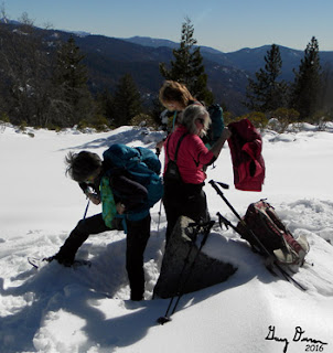
Gary, Rose, Kim and Sherri and the Lookout


After lunch packing


But now it was time to leave. We come back down the north side of the ridge, along the road. We have been spotting several tracks along the way, including squirrel, bobcat and coyote. The coyote being the smartest of the group as his tracks lead down the ski path. It was a lot easier to travel in our tracks on the way back. We decided to not go down and follow the road to Eleven Mile Meadow, but go back to the car and possibly to Wawona Meadow, But when we got to Wawona, none of us felt inclined to put on our snowshoes, so it was on to home. But we did stop at Pete's Place. It is just plain old good food. They were getting ready to close so we got a big platter of fries.


Wednesday, January 6, 2016

January 6, 2016 - Million Dollar Mile Road

Title: January 6, 2016 - Million Dollar Mile Road
Trail head: Italian Bar Road
Hike Info:
Type:  Hiking
Trail: Million Dollar Mile Road
Destination: Stevenson Falls
Distance: 7.1 miles 1
 1I did not have my GPS device on me for this hike. So the distance is a minimum from other hikes on the road. Also there is no elevation rise, max, ...

Description:
I approached today with some apprehension. It has been two months that I have been on a real hike. Sure, before Christmas Sherri, Steven and I went to Wawona and played around in the snow for a couple of hours, but that was relatively light weight excursion. Also since that time I have been sick. Sick enough that even a short walk around the neighborhood leaves me tired. Will walking in the rain cause me to relapse? Will I even have the stamina to do this walk? But we will see how I do.

We met over at Eddie's Bakery around 7am, that was 7am in the rain. Am I really going to go out in the rain? For a hike which started out with 40 people, we are down to 14. Our first stop is the Center of California.  The exact geographic Center of California is at 37°09′58″N 119°26′58″W. John and Cathey know how to celebrate this occasion with some non-alcoholic bubbly. Even in the rain, we feel pretty good about being here.

But now it is time to go on the the other side of the San Joaquin, to the Italian Bar Road and the start of the Million Dollar Mile Road, which is really an access road for Southern California Edison and the Big Creek Power Project. When all the cars got to the trail-head (road-head?), there was a discussion. Do we hike in the rain? Several cars turned around and went on to Prather and eats. I was a bit indecisive. I actually like hiking in the rain-you get to see so much of the terrain in a different light. But then again, I have had this nagging sickness which wisdom would say do not do this.

Ducks in the Rain
 Rose and Kim said they were going to walk a mile in and turn around. That sounded like a good compromise. So we started off in the rain, we all having an a-sundry of rain protection. I have borrowed Sherri's rain jacket as I forgot mine in Mountain View. Out of the 14 of us, six decided to walk today-Rose, Kim, Sherri, David, Delia, and I.

Jose Creek
The first thing we encounter is an SCE worker in a truck. There is a saying that good things happens to those who wait, and wait Sherri did. She did not have to go around the gate, but waited until SCE opened the gate.  After a five minute walk, we come to Jose Creek. Whenever we have seen this creek before, it has been a slow moving flow of water. But today, with the rain, the water is brown with scoured dirt and tannin from leaves. This is a good sight. We all stand around and see this sight of all of this rushing water in such a small creek.

Mist over the River
As we walk the road, we notice the various atmospheric conditions. David is the most observant as he notices the cold spot in front of us where there is a gathering of mist. But we also get to see the sun spotting through the clouds. Wait! There is sun? No wet stuff coming down? This may turn into a hike yet. It is a good sight with sunshine glistening off of the newly wetted road.

Redinger lake
Pavement Glistening
So since we all were feeling fresh and able to continue on, we decided to do so. And I think we were all glad we did. First, hiking with someone else makes for pleasant walking. You can talk and have a good conversation which taking those steps. Also time passes a lot more quickly enjoying the view together. And that is the second thing, the rain caused the whole area to be alive with color. Even Redinger Lake looked inviting.  Of course, what topped off the trip in was a rainbow over the San Joaquin River.


Rainbow over the San Joaquin
But now it is only a short ways until Stevenson Falls pops into view, and it has been worth the walk. The falls are flowing nicely-even though most of the water comes from Shaver Lake, it still is pleasing to see the falls flowing so full. We walk across the bridge and admire the water flow up close. The we go into the adit, a cavern dug to create a release and access to the main bores going from Shaver to the Big Creek Powerhouse we passed earlier. All are impressed with the size of this cavern. I should say they also wanted to get out of the rain. We have a little snack and turn around. But the rain does not go on for long and we are walking again under cloudy skies. Before long, we cross Jose Creek. There I ask the question: If there was no bridge, how do we get across? We ponder that question for awhile. In a half of year, when some of us are backpacking, this may be a real question. But until then we can enjoy the pondering and the water in the creeks. It will be a wet winter, one we can all use. Just when we get back to the cars, more rain. Just so good!. We stop in Prather at Velasco to have lunch. An enjoyable cap to the day.


Stevenson Falls
Stevenson Falls


Water Drops