Showing posts with label Presidio. Show all posts

Wednesday, December 18, 2024

December 18, 2024 - San Francisco, Legion of Honor


Title: December 18, 2024 - San Francisco, Legion of Honor


Hike Info : Description : BackgroundExtra Photo's 


Hike Info:

Type: Hiking 

Trail head: Point Lobos&46th St Bus Stop - Lands End Visitor Center

Trail: Coastal Trail, Camino del mar

Destination:  Legion of Honor

Distance:  2.1 miles

Start Time: 11:41

End Time:     1:10

Travel Time:  1:45 (1.20 mph)

Moving Time: 1:10   (1.80 mph)


Elevation Rise: 568 '

Descent: 236‘

Maximum Elevation: 392'

GPS Tracks


Description:

Mel's Breakfast
I got up after 7:30-was I that tired or was the room so dark that it lulled me into sleeping later? Whichever way, I was pretty rested up. I wrote a few cards before Sherri rolled over and started reading. While she got herself together, I visited the post office and deposited them. We went to breakfast about 9:20.

Breakfast was at Mel’s Drive-In across the street from us. It is a 50’s style place. First time we have been here. I had a ham & cheese omelet with a side of hash browns. Sherri had a French toast combo. Both good and filling.

We decided to take the bus to Lands End and walk the Coastal Trail to the Legion of Honor. We left the hotel about 10:50 to catch the bus on Lombard. We soon get on bus 28. It takes us over to the Golden Gate Bridge center and loops back around through the Presidio. When it gets to Geary, we get off and ride 38R to the end of the line-that would be 46th and Pt Lobos Ave, only a couple of blocks from Lands End.

Sherri up to Memorial
We first visited the gift shop at Land’s End. Lisa, a volunteer, talks with us about various things. While talking with her, I get the feeling we might be under-dressed, that is for the weather. Neither of us brought a coat and there is a cool breeze blowing out here. She confirms that. Oh well.

We did not buy anything. We start our walk going along the Coastal Trail. It is a trail which one day will stretch from at least the Mexican border to the Oregon border. Yesterday we walked another small section. This section follows the trolley bed of a train Sutro laid over a hundred years ago. A lot of the trail is level, except for getting up to that level.


 It is enjoyable walking about the trees with the ocean on one side and a hillside on the other. There are some stairs to start off with, but we ignore them. One set would go all the way down to Point Lobos. But we are on a mission and will not be distracted. We need to get to the Legion of Honor by 1:30. Onward we go.


There is one distraction. Another set of stairs goes up to the memorial for the USS San Francisco

. We take these stairs up to the memorial. There is something moving about reading the history of this ship and how it and the USS Atlanta turned the battle of Guadalcanal around. Without it, the Japanese next invasion attempt would have been Australia. We spend about 15 minutes before we descend the stairs again.

We continue on getting views of the Golden Gate and its bridge. The sun has come out illuminating it. There is the automatic lighthouse on Mile Rock marking a safe passage through the Golden Gate. It is glorious to view across the way into Marin. Being behind the hill, there is not much sun nor much wind. As long as we keep moving, we are comfortable.

There were some more stairs on the Coastal Trail just to the west of Eagle Point. Evidently part of the trail had slid off of a cliff and the trail was rerouted over a ridge. The stairs were long and we stopped several times for breath while those younger than us seemed to bound up them. Then on the other side of the ridge, more stairs down.

China Beach
Sherri sees an interesting building, which to me looks more like a railcar barn. But after looking at a map, we realize that this maybe an area called Playland. I have a memory of my Dad taking me here. But I may be mistaking it for a different place. But when we got home, I looked at a map of San Francisco and came to realize, that the buildings we were seeing was around China Beach-so I do not know what the buildings are. We shortly came to El Camino Del Mar. This dissects part of the Lincoln Golf Course. There is a path along it which climbs up the hill to the Legion of Honor.

Memorial for Peace
Before we enter the Legion of Honor, there is the Memorial for Peace-I think it must have been donated from Japan. Then we made it up to the parking lot and stopped at a bench commemorating Russians who died during World War II-I do not see it noted on any of the maps. We ate lunch on the bench then entered the Legion.


The Legion of Honor is having an exhibition of
Mary Cassatt at Work. Around the time when our first born was first with us, we visited the Huntington Library and saw a Cassatt painting called Breakfast in Bed. We fell in love with it. I got Sherri the poster for Christmas. Other Cassatt stuff saved me when I came short of Christmas gifts for Sherri.

The exhibition is in the basement and has its own entrance. Just as we got there, we joined a docent led tour which was just starting. I found out later we should have signed up for it. Oh well, it was interesting. I do not have a background in the painting arts, I learned a lot about materials and technique from the docent. Also about what Cassatt wanted to do with her paintings and the way she created emphasis. I think the techniques are interesting, but it does not add to my ability to be interested in a picture or not. It was a good thing to have gone over.


Woman in a Loge
We spent about two hours at the exhibition. I am not sure that I liked any of the pictures better than our original one which we fell in love with.There were some which resonated with me. Such as the Woman in a Loge, Children Playing on the Beach, and Maternal Caress.

Children playing on the Beach


Breakfast in Bed from the Huntington Library's web site

After viewing the Cassatt exhibition, we saw some ancient porcelain pieces. None really struck awe in me. I am wondering if I am just getting tired. Then we went upstairs to the Rodin collection. This is the largest collection outside of Paris. Lots of statues. There are pieces from his
Gates of Hell. I wonder what the full piece would have looked like.

We are a bit tired after Museuming for two and half hours. We decided that there is much more to see here and we definitely are not going to see it all. About 4, we left and walked about 15 minutes down to the bus stop. But not before noticing that the Legion of Honor is the western terminus of the Lincoln Highway. A while back, the OSHER book club read a book by Amor Towles by that same name. It resonates.

We get to the bus stop and the bus comes along pretty quickly. This is bus #1 which we ride to the Park Presidio Blvd and pick up 28. But not before thinking we might get killed in an accident. A car in the middle lane decided to make a right turn into where we were walking across the crosswalk. So he moves over and comes to a stop in front of a car going 45 mph. Fortunately everything worked out. I think I would have hit him if I was driving.

We get back to our room at about 5 and rest for a bit. Sherri takes a nap and I read some. Then off to Amici’s for dinner. [As a note: a week later, I looked up this Amici’s and it is permanently closed] We share a salad and a large cheese ravioli plate. Good and satisfying. By the time we get back to our room, it is 7:30. We read and rest more, take a shower and go to bed.


Background

Mel’s Drive-In. This is a 50’s style diner on Lombard St, right across from our hotel. My wife had a French Toast Combo and I had a Ham and Cheese Omlette. They both taste good and were very filling. The service was great-it seemed like every five minutes there was someone who came by to fill up my wife’s coffee cup.


Extra Photo's


China Beach

Coastline

Entrance to the Bay

Legion of Honor

Golden Gate Bridge

Memorial of Peace

Memorial of Peace


Tuesday, December 17, 2024

December 17, 2024 - Go to San Francisco


Title: December 17, 2024 - Go to San Francisco


Hike Info:

Type: Hiking

Trail head: Fort Funston, Nike Missile Site

Trail:  Coastal Trail, Horse Trail

Destination:  This was a wander with hope of doing a look

Actual Destination: 

Distance:  2.45 miles

Start Time:  2:09

End Time:   3:53

Travel Time: 1.44  (1.42 mph)

Moving Time:  1:15  (1.96 mph)

Elevation Rise:  286'

Descent: 292‘

Maximum Elevation: 177'

GPS Tracks


 Description:

I slept well last night dreaming that I had failed to get in a writing assignment for a class-which I do not think I ever took. At least I think I never took it. If I did, there is an assignment which I did not do-too late to worry about it. I still woke up at 6:30 refreshed. I had gotten most of my stuff ready yesterday. This morning it is things like taking out the garbage, loading my thumb drive, and a few things. Then breakfast. About that time Sherri gets up. By the time we are all ready to go, it is 9:30. Sherri starts off driving.

Battery Davis
She drives until Los Banos when she spots a Starbucks and pulls over for a latte. When she comes back, she decides that it is my turn behind the wheel. So I became the commander of the car. I drive over Pacheco Pass and down to Gilroy. There we stop and have lunch at In-An-Out. And then we are on our way. We take 280 into San Francisco, but instead of going on our regular route towards the Presidio and Cow Hollow, we go over to Lake Merced and to the Fort Funston of the Golden Gate Park Recreation area.

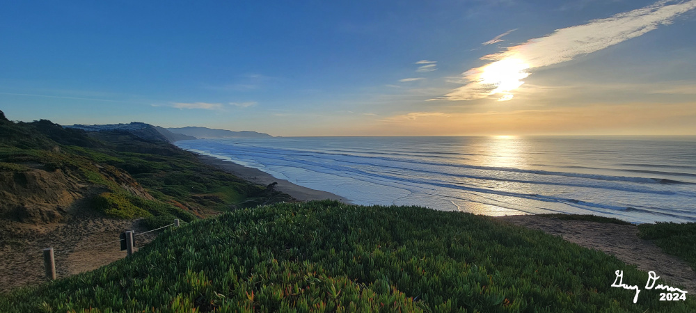
We park our car where the Nike Missiles used to be pointed skywards to defend The City. We start our walk along the Coastal Trail. This trail is paved and marked by the presence of crows and dogs. The crows seem to expect handouts. While this must be one of the favorite spots for dog walkers of the area. Most of the dogs are well behaved and off leash. There just is many of them.

View from Battery Davis

After a quarter mile, there is a big mound between us and the ocean. This is Battery Davis, a relic of pre-World War II. We walk through one of the tunnels and see where the cannon would have been mounted. Also enjoy the view of the ocean.

Sherri, the Sandwalker
Up until this point, the trail has been paved. But sand has a way of encroaching even the works of man. We start having to act as sand walkers to continue on the Coastal Trail. It is still good to look out and see the ocean beyond the sand dunes. Afterwhile we come to a junction and I ask Sherri if she wants to continue following the Coastal Trail all the way to Marin County or return via the Horse Trail. Put that way, she chose the Horse Trail.

Stairclimbing Gary
This trail is high on a dune above the Great Highway. We go along with the undulations of going up and down the vegetation covered sand, sometimes ducking under trees. Eventually we hit the pavement again and the walking is easier.


And then we come to the stairs. In San Francisco, we are suckers for stairs and start climbing them. These stairs offer access from John Muir Drive up to Battery Davis. From there it is a short walk back to the car.

Sherri notices on a map that there are some more stairs. We decided that if we have only walked about an hour, about 2 miles, we might as well find these stairs. We went out of the parking lot towards the Ranger’s Station. Google shows a path down to the beach. The idea is to go down and take the stairs up. But when we get to the cliff, there may be a way down, but for a couple of old people, we are using our acquired wisdom not to go down this. We just walked along a trail at the top of the bluff. We did find where the stairs are. But decided that there is not a lot of reason to go down them so we could go back up them again.


Gary wondering where are the Christmas lights

Once we get to the car, we take off for Cow Hollow, rejoining 280 through
Golden Gate Park into the Presidio. There we turned onto 101 and found our hotel, Cow Hollow Inn. We check in and the lady gives us the room we requested, 315. This is the same room as before. She also suggested rooms 338 and 339 being comparable with good views. Good to know.

By the time we get settled in, it is just past 5. We must be getting old as we both rest until 6. Sherri is getting hungry and I cannot say I am far behind. We decided to walk down to the Marina and see what Christmas lights there are. If we find a place to eat first, we will.

We do go down to the Marina as there are not any eating establishments which meet our fancy. When I was a child, my parents would take us up to the Marina and the boats were all decked out in lights. Also the houses along the waterfront were amazing to view. Either my childhood memories are vastly inaccurate or the Marina has lost its Christmas thrill. There was only a Christmas tree with lights and one boat. A bit disappointing. At least some of the houses had lights.

We returned to Chestnut ready to eat. We found an interesting Mexican place called Las Mestizas. A hole in the wall place. We each had a burrito. The helpings were ample. The food was satisfying, We waddled out of there and back to our hotel room. By this time, it is 7:30 and we pretty much pack it in for the night. Sherri watching a movie and I did my writing. It is a good day. Let's see if I make it to 10.


Background


Battery Davis

Battery Davis.
Major General Richmond P. Davis, a Coast Artillery officer who served in France in World War I. From Wikipedia

TripAdvisor

Las Mestizas. The sign at the entrance says authentic Mexican food. You can hear the meat frying for your order, so you know all is fresh. It is a small place on Chestnut in San Francisco’s Cow Hollow District. My wife ordered a burrito bowl-a burrito without the wrap-and I a wet burrito. The burritos were filling, and tasted good, but not overpowering. The seating was basic as they made the most of the small space they are in. The help was shy, but took care of us.


Extra Photo's

The lone boat with Christmas lights

Steps to the beach

Sherri going up the steps to Battery Davis

Top of the Golden Gate Bridge


Flowers and Plants


Wednesday, October 2, 2024

October 2, 2024 - Presidio


Title: October 2, 2024 - Presidio


Hike Info:

Type: Hiking :  Car 

Trail head: Cow Hollow Inn

Trail:  Greenwich, Lyon, Mountain Lake Trail, Park Trail, Presidio Promenade, Lombard, Chestnut

Destination: Loop 

Distance: 6.06/0.49 miles 1

Start Time: 10:27

End Time:  3:36

Travel Time: 5:09  (1.18 mph)

Moving Time: 3:10   (1.92 mph)

Elevation Rise: 782/94 '

Descent: 843/14‘

Maximum Elevation: 382'

GPS Tracks

  1I did not turn on the GPS until going about half a mile away from the hotel, on Greenwich. All of the mileage and elevations are in the format of aaa/bb where aaa is taken from the GPS, bb is from the hotel to when I turned on the GPS. bb is computed from Google Earth.
Lyon St Stairs

Description:

I slept in until about 7 this morning. I thought I might be sleeping a bit later, but I did not. The forecast calls for it to be warm today, but not as warm as yesterday. Maybe someplace in the 82-85 range. Turns out I saw that it got up to 89.

The first order of business is getting breakfast. Last night at Amici’s, Sherri asked the waitress for a recommendation for breakfast. She talked about the Cracked and Battered on Chestnut, a little more than a block away. So there we go. Sherri has eggs Benedict and I a breakfast burrito. Both were pretty good. Sherri had slightly more than she felt like she needed to eat, but she devoured it all. I finished mine without a problem and felt full. We passed by an Apple store, but it was closed. Sherri wants to talk to them about her email and calendar not syncing.


 By the time we get back to the hotel room, get ourselves ready-including Sherri making us sandwiches, and making our day packs appropriately suited for our trek today, it is a bit after 10 (how is that for a convoluted sentence?). We have decided to walk around the Presidio today. We will see how that goes, particularly if it gets hot.


We go over to Greenwich St and walk towards Lyon. We want to go up the
Lyon St Stairs
Us by upper end of golf course
today. Last December we went down them in the rain. I noticed when we reached Brodrick, there is a dip to get to Lyon, so we headed up Broderick until we got to Green. Here it is pretty level. This puts us to the base of the stairs.

These stairs are magnificent with landscaping on both sides and a handrail for those of us, like me, who are unsteady. The first section is both long and steep. We take our time, but do a steady ascent. At the landing, about two-thirds of the way up, there is a little garden with a big heart in the middle. The heart is part of a 2004 project which left hearts all over San Francisco-think Tony Bennett. We let our legs return to being somewhat solid after they started quaking like Jello. Then onward to the last third, which is not as steep. We get in a conversation with a person who is carrying a full backpack. She is training to climb a peak in South America and needs to bump up her pack to 55 pounds, about half her body weight. I do not envy her.

 The top of the stairs puts us at the Broadway entrance to the Presidio. After crossing Predisio Blvd, we get onto a trail which crosses the top of the Presidio, just under Pacific Ave. This is the southern border of the area. I was counting on the trails in this area to be well shaded, but there is a lot of exposure on this section. By the time we had done a little over a mile, we needed to find a bit of shade. We found it at the benches by the Presidio Wall Playground.

 After resting for probably a half an hour, we continue on. There is a bit more shade. Crossing Arguello Blvd, we get to a section which borders the golf course. This is also the start of the

Under Highway 1
Mountain Lake Trail. It is wide and paved with a large area on the side with mulch on it. This seems to be where all of the dog walkers congregate. At least, there were at least five clusters of dogs with multiple handlers in each cluster. But for the most part the dogs are well behaved and do not bother us.


At the end of the trail is
Mountain Lake. A sign says this is where the Spanish settlers originally stayed until they could find something more permanent. We go on the south side, find a grassy area with shade and plop down. Neither of us are hungry, but feel like we should have something. Out comes a package of fig bars I have been carrying around for a couple of months. They are appreciated.

National Cemetery

I do not know if it is the grass, the rest, or the weather, it seems cooler after we have laid down for a while. Probably 45-60 minutes. We both are feeling tired, so we start our return trip by going to the North of Mountain Lake and taking the trail under Highway 1. This leads us onto the Park Trail.

The Park Trail wanders down the hill we are on and heads to where all the more modern-thin World War II-buildings are. At the top, the trail skirts the golf course with a warning that this is an active course-I guess if we are struck by an errant golf ball, we will not have recourse. We also went past a store where many years ago we got some hot food. No hot food today and Sherri is not interested in the soda. The trail recrosses Highway 1, this time over it, but you would never know as the highway is buried. It follows some streets down. We see the National Cemetery there. After Arlington

Us and Golden Gate Bridge
, there is always a pause to honor those who died.

As we approach the buildings, we go off of the Park Trail and take the Presidio Promenade. This heads us more easterly. We also rest for a few minutes when we come across a bench. Then we continue on. While warm, it is bearable. Sort of a fun fact, the Promenade goes right over Highway 101, where we drove yesterday. We are able to gaze at the Golden Gate Bridge from on top of the highway.

The downside of this, is that the Promenade now is pretty exposed to the sun. We go behind the Walt Disney Museum. It goes right past the Visitor Center, so we go in. It is several degrees cooler inside. Plus we get to see on a relief map where we walked today. Sherri asks Joseph, a volunteer, if he knows of any good places to eat in Cow Hollow. He names off a couple taco places and a sushi establishment. Also Original Joe’s. We will see what we are up to tonight. Turns out that Original Joe’s is a ways walk from our hotel. But the taco places gives us some ideas.

We left for the remainder of today’s walk. The Promenade leads us past Letterman Hospital and then to the Lombard Gate. Now we have about a half mile to the hotel. The intersection of Lombard and 101 looks pretty confusing, so we cross 101 at Chestnut. This gets us down to Steiner and our hotel is a block away.

Getting into our room about 3:15 provides a relief. Sherri is content to lay down. I consumed a great deal of ice water and then laid down and rested. Feels good. I needed about half an hour. Sherri fell asleep for a while longer. I continue my hydration consumption for several hours.

After 6, Sherri would like to go to the Apple store around the corner and see if they can help her with a few problems on her phone. We canceled our participation on Zoom tonight and went to the store. They only can tell her that the problems have a common denominator and she will need to make an appointment with the Genius Bar.

Now to find dinner. We walk down Chestnut, rejecting some as being too filling-I am not that hungry. We decided that Tacolicious fills the ticket. I have chicken verde and carnitas tacos. Sherri also has a chicken verde taco with a Baja fish taco. She also imbibed with a margarita fresca After an hour, we were filled up and walked back to the hotel. There we just lounge around and try to figure out what we are up for tomorrow. We end up in bed a few minutes after 10.


Extra Photo's

View from Top of Lyon st Stairs

Sherri coming up the Lyon St Stairs

Lyon St Stairs

Golden Gate Bridge from top of Highway 101

Top of Golden gate Bridge from the Presidio

Heart of San Francisco

Playground at Mountain Lake

Gary on Park Trail

Alcatraz

Lyon St Stairs from Lombard St