Showing posts with label Woodward Creek. Show all posts

Thursday, August 8, 2024

August 8, 2024 - Starlight Trail


Title: August 8, 2024 - Starlight Trail
Hike Info : Description : Extra Photo'sFlowers and Plants


Hike Info:

Type: Hiking

Trail head: Big Meadows Snow Trailhead

Trail:  Roughly the Starlight Trail (SNO-29E14), 14S11G, 14S14

Destination:  7704

Distance:  3.24 miles

Start Time: 9:54

End Time:  1:32

Travel Time: 3:38  (0.89 mph)

Moving Time:  2:38  (1.23 mph)

Elevation Rise: 687'

Descent: 648‘

Maximum Elevation: 7,832'

GPS Tracks


Description:

Start of Starlight Trail
It is a normal morning for me. By about 7:00 I am ready for a 7:30 start. But we do not leave until 8:15. I drove straight through to the Big Meadow Snow Trailhead, arriving about 9:40. It does not take us long to get ready and by 10:00, when our boots go for a walk.

Even though the Starlight Trail is mostly a snow trail, we have gone over it about evenly between snow travel and a walking trail. In previous years, there has been a track to follow, this year there it is more overgrown with lupine which is past the bloom stage. But we know to look for the blue diamonds which mark the Winter trail. The one problem is that the diamonds are old, some are faded, some are no longer on the tree and some trees are no longer standing.

Sherri crossing Woodward
Still, we know that trip goes up the ridge and we pick our way up it. It is refreshing to be out again. It has been two weeks since we went backpacking and I feel the need to get out. When we get to the top of the ridge, we come to road 14S11G along with the dispersed camping sites. These are large sites with large campfire pits.

This is where we typically lose the Starlight Trail and today is no different. We follow the ridge away from the road, sort of paralleling the Big Meadows Road. When we cross Woodward Creek, we start heading more southward. All of this I would consider more light cross-country work. Not much navigation as I know where the roads are, but not following a trail. I am picking my way up and along ridges and down ravines. I think I am doing it pretty well-I do not hear complaints. Maybe I am going deaf?


We pop up on the road 14S14. The
last time we were on this road, we were bounding over snow drifts and snow puddles. Today, it is dry, slightly dusty. As it is after 11, I am aiming for an area where we have eaten before, a nice area to eat. When we got there, an RV was parked at my eating spot. Sigh, why are my good places always infringed upon?

We dip down a little ways and find a place under a tree which looks comfortable. Too comfortable as we spend about half an hour there just enjoying life. Breaks are one of the pleasures of a hiker.

Two FunGuy, a FunGirl and a fungi
About 11:50 we pick up and leave for our return trip. Rather than following the road back, we decided to pick our way back. I really had been aiming for a spot we had taken Rachel too a couple of years ago. But the last couple of times, I could not find it.

But when I look to find a route back, there it is!. So we climbed up the granite slabs which lead to the top of 7704. Here we enjoy another break, but a lot shorter than our 11ish break. Up here we have a pretty nice view to the west. I see Chimney Rock and the antenna on top of Big Baldy. Buck Rock peeks out from just above the ridge in front of it.

We now head down the ridge and re-cross Woodward Creek. Here we pick up the blue diamonds from the Starlight Trail. They follows the ridge up. Except for it being uphill, the walking is pretty easy. There is a series of small knolls which we climb. Eventually this gets us back to the campsites along 14S11G.
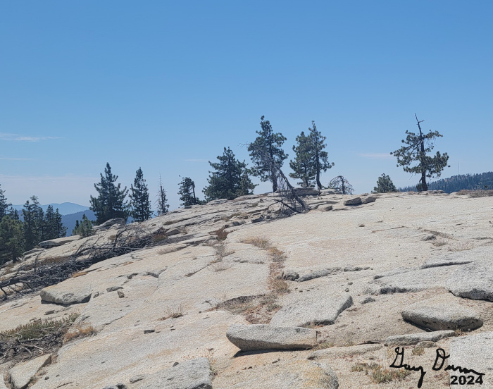
Hill 7704
Andrea, Steven and Korra
I lose the Starlight Trail again, but find what I think is an old fire road. But it is an extension of 14S11S. When I realized where the road is going to, we veered off to the left and more towards the trailhead than the Big Meadows Road. As we approach the parking area, we wade through the lupine-with its dried flower pods. The result was the pods clinged to our socks and clothes.

Our return time to get back to the car was 1:30. We got back at 1:40-not bad. After getting the pods off our clothes, we get into the car with Andrea driving. We got back around 3:30. Showers were in order and then time for a good dinner at DiCicco’s. I am content. Then to end the day, we went to my book group where we talked about The Book Woman of Troublesome Creek.


Extra Photo's

Hill 7704

Coming down Hill 7704

Buck Rock Lookout

Photographers setting up

Fungi

Interesting: A tree pulled up a wall of rock

Clouds to the south

Gary and Sherri


Flowers and Plants


Red Elderberry?

Red Elderberry?

Red Elderberry?

Alpine Aster

Saturday, September 2, 2023

September 2, 2023 - Delilah Lookout


Title: September 2, 2023 - Delilah Lookout
Hike Info : DescriptionBackground : Extra Photo's 
Hike Info:
Type:Lookout

Description:

I woke up a couple of times last night to go pee. But at 0400 I woke up again and realized a couple of things: I needed to go pee again and it was raining. The first I try to ignore, but the second becomes urgent when a light flashes across my eyelids: lightning! The opening of my lightning report says it well

Clouds below Delilah
There is nothing like the gentle patter of rain on a tin lookout roof to awaken you at 0400. And then the flash of lightning at 0415 to get your heart beating faster. And now there is the gentle sway of Delilah in a pretty good wind to get me going. And when I opened the door this morning, there was the smell of smoke-but none observed yet coming from the ground. So you are getting this lightning report straight from a direct observer as well as my usual source. Even as I am writing this email, the area around Buck Rock is getting additional lightning-looks like on Spanish Mountain.

For the next hour I sat on a lightning stool. Sherri stayed in her bed. Once the threat of lightning went away, I fired up my trusty laptop and put together my lightning report. And now my troubles begin getting out the report. I got a couple of strikes from yesterday, which does not surprise me. But where are the strikes from this morning? Maybe I tried too quickly? I inquired again and again for another hour, and still got nothing. So I issued the report with only yesterday’s lightning with the caveat that this morning’s lightning was missing.

Where is Smith Meadow
We have our breakfast of oatmeal, granola and a cinnamon roll. Then after Buck Rock goes in service at 0728, we go in at 0730. Buck Rock does not have visibility-and as it turns out this is for most of the day. We both have had precip-he reports wind and we report lightning. And now begins our long 11 ½ hour day on duty.


Gary trying to see smoke from Smith Mdw

Most of this time is spent doing scans, listening to the radio and lounging around. Our visibility is about 10 miles, But there are so many water dogs and low clouds that I am not sure we would be able to find a fire even if there was one. Several of them give me pause, such as one on Dude Ridge where the water dog looks like it comes from a stack of wood. I stared at that for a long time before deciding it was not a smoke. We also took the weather-no worries about low humidity.

Ar 1000 there is a report of smoke at Smith Meadow. Where is that? Once we figure that out, we start looking for smoke in that area. Smith Meadow is just south of Wishon. We cannot see into the meadow, but the area around it. There is a big, long, gray cloud stretching from where the meadow is westward to close to Black Rock. We radio in what we see. Also if this is a smoke plume, which we have our doubts, that what we are seeing is a smoke. Sierra gets a response team to identify where the smoke is. There is an occasional question throughout the next several hours on what are we seeing? Just more clouds. Also one of the patrols emails me and wonders if I have anything further on the lightning from this morning-nothing. By mid-afternoon, clouds have come into the area. Also the roads in the area have been impacted by Hurricane Hilary. So they have looked over the area, they call off the search for the fire.

Could you spot the smoke? Bottom frame-filtered

While we are looking into this area, we scan in other areas with negative results-like a COVID test, this is good. But we do pay attention to what is going on around us. Near Woodward Creek, there is a tree threatening the General’s Highway. So Division 3 gets a crew together, including a borrowed frontloader to bring down the tree and clear the highway.

Or later on that afternoon, there was a report of a lost group down in the Millwood area. So a patrol is sent down road 13S70. He eventually found them: in Abbott Creek. First the people had gotten hung up on a log and in the process of freeing the vehicle, it ended up in the creek. This was a job for tomorrow to bring in a tow truck to get the vehicle out. Tomorrow there will be a continuation to the story.

Then at 1627 there was a report of a fire in Watts Valley. We should be able to see this. But there is a lot of haze today which is blending anything white with it. But after looking for about 5-7 minutes we are able to see it coming over a ridge to the east of Hog Mt. We report what we see to Sierra. It is a Fresno-Kings CalFire incident. So we tune into a CalFire station. We see the smoke decrease and disappear.

We usually go out of service at 1800. But being a holiday weekend, we have been asked to stay on until 1900. This is better than the 2000 which we do on other holiday weekends. Nothing else happens to us. There is a fire in Sierra National Forest called the Providence fire, but it is beyond what we can see. Sounds like it is a single, large tree.

We have our dinner, a pulled bar-b-que pork for dinner. No, Sherri did not roast it up here, but had made it Thursday night for dinner. Still tasty after a long day. After going down, we hit our beds around 2100. It has been a tiring day.


Background 

 Lightning Stool. I should add or chair. While the lookout is pretty well grounded, occasionally a lookout is struck, after all, it is a steel structure sticking high up in the air. To doubly secure the lookout, there is both a stool and chair in each lookout with the old glass electrical insulators attached to its legs. The idea is that if there is any electrical seepage from a lightning, the glass insulators will provide a barrier to electricity.
 
Extra Photo's
Evening Clouds

Looking east from the base of Delilah

Clouds by Goat Saddle

Park and McKenzie Ridges

Where we were trying to spot a smoke

Pine Ridge Clouds

Clearer picture of Watts Valley Smoke


Friday, January 27, 2023

January 27, 2023 - Indian Basin Loop Snowshoe


Title:  January 27, 2023 - Indian Basin Loop Snowshoe


Hike Info:

Type: Snowshoeing

Trail head: Princess Campground Entrance on Highway 180 

Trail: Indian Basin Loop

Destination: Loop

Distance:  1.67 miles

Start Time: 1:29

End Time:  3:32

Travel Time:  2:03 (0.82 mph)


Moving Time:  1:26  (1.17 mph)

Elevation Rise: 231'

Descent: 246‘

Maximum Elevation: 5,968'

GPS Tracks


Description:

Today Steven has off, so we will go up to the snow. I am thinking of going towards Big Meadows or Woodward Creek. Both Steven and Sherri are onboard with this-Steven independently suggested it as well.

Steven
Sherri
I got up at my usual time and did a few things. This will not be an intense day, so it is OK to get a late start. And that is what we did. We left about Fresno 11:40-I love that we are that close to my playgrounds. When we got to the Wye, I saw a wall of snow with only a narrow gap, space enough for one car. The gate is closed, so Big Meadow is out of the picture for today. There are several other places we can go, with Korra. We thought about Converse Basin or the Thorpe area. But we decided to see what Indian Basin looked like. We had heard that earlier in the rain storms it had flooded out.


The road down is snow bounded with walls up to six feet high. Parts of the road had snow on it and a little bit of it had ice. Fortunately we have AWD with snow tires so we hold the road pretty well. When we get to the Princess Campground entrance, it is about 1:15. The snow is only about three feet above the roadway. Also it looks pretty good. So we decided to walk the Indian Basin Loop.


Indian Basin Meadow


Korra, the snow dog


Sherri and I will be on snowshoes while Steven decided to slide along on his cross-country skis. And then there is Korra with her snow paws. Already there is a big doggie smile on her face as she gets out into the snow. About 50’ in, there is a gate across the road, but that is nearly buried. Of course, that does not stop us. We continue on down the road, making a left turn to the Indian Basin trailhead. There is an outhouse as well as some semi-buried picnic tables. We have our lunch there.
Sherri navigating the unsnow

And then we are off on the loop. I have done this loop twice in the snow and several times walking it during the last year. So it is a route pretty familiar to me. Still with all of the snow, there are places it is hard to pick out where the path goes. And then again, all through our route, there are places where water has cut through the snow, leaving the bare ground. Go figure. It is just enjoyable being on this path. Plus, it is pretty level. So we walk pretty well, with no issue, except for Steven who has to occasionally unclip and walk across bare spots.

One of the pleasures of this trail is the wide and long meadow. We can look down it, and across the Kings to the snow covered Wren Peak. Such a great sight. While the temp is cool, we are either moving enough or in the sun so we feel warm-not warm enough for shorts and a T-shirt, but feeling comfortable.

Before we know it, we are back at the trailhead. Steven ski’s on with Korra, while Sherri and I plod on our snowshoes. We considered going up into the campsites, but decided to save it for another time. By the time we get back to the car, it is 3:30. A good, but short time in the snow.

We travel directly back to Fresno getting back a bit after 5pm, in the rush hour traffic.


Extra Photo's


Korra, the snow dog

Snow covered bridge

Ice


Sunday, May 9, 2021

May 9, 2021 - Starlight Trail


Title: May 9, 2021 - Starlight Trail
Hike Info : Description : Extra Photo'sFlowers and Plants


Hike Info:
Type: Hiking
Trail: Starlight Trail, Road 14S14, and Big Meadows Road
Destination:  Wander
Distance:  3.66 miles
Start Time: 1:35
End Time:   5:10
Travel Time:  3:35  (1.02 mph)

Moving Time:  2:10  (1.69 mph)
Elevation Rise:  428'
Descent: 428‘
Maximum Elevation: 7,799'

GPS Tracks

Description:

It is Mother’s Day. Rachel has joined us this week. Most mothers when asked, “what would you like to do on Mothers Day?”, they might say have a nice dinner out, spend time with their kids, maybe take in a show or a movie. When Steven and Rachel asked what Sherri wanted to do, she said she wants to go hiking. That is my woman!


Start of our wander
But that does not mean that Sherri has changed into the crack of dawn person. We do not get off until a bit before Noon. The drive up is uneventful, as it should be. The Big Stump parking lot does not have many people in it. That is a sign that not many people made the trek up here for Mother’s Day. We continue on to where we park at Big Meadows to go snowshoeing or cross-country skiing. The actual road to Big Meadows is open.

Why park here? There is a Winter Trail which I had suggested we try to walk when it is dry. We are able to follow the blue diamonds of the Starlight Trail. We did a little of this last January. As we follow the diamonds, there is not much of a Summer Trail. But when you are on a wander, even if we lose the diamonds, which we do, that is not much of an issue.


Sherri crossing Woodward Creek

Rachel and Sherri approaching hill 7704

We did find evidence of an old dispersed campsite, followed by a dirt road on top of a ridge. When we get home, I will try to figure out what road this is (looks like Road 14S30). It looks pretty easy to drive on the part we can see. 


And then we continue on, picking up the blue diamonds for a ways. We get to a creek, which I guess is Woodward Creek-the same one which another Winter Trailhead is named after. After that it gets a bit more interesting. We come across a bog turning into a meadow. We get out of that quickly, our steps can be pretty disruptive on a surface like that. (Looking at a map, the Starlight Trail is a bit to the West of our track and further down the creek.)

We had spotted a clear rock not quite a dome which we have been gradually heading for. After the meadow, we gain the harder surface of the ridge. It is a quick trip to the top.. Turns out this is marked as 7704 on my topo map. A very good view from here.


Buck Rock Lookout

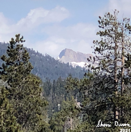
Steven gets out his hammock, stringing it between a couple of trees. The rest of us look around. Montecito-Sequoia Lodge is visible, along with the General’s Highway. Behind that is the ridge which Big Baldy rests on. Looking a bit east of north, I spotted Buck Rock. Then to the south and east of us is Shell Mountain, along with Mt Silliman. Much of the Alta Peak area is visible as well. A really good place to stop.

Evidently none of us felt like traveling further as we either wander around the area, sit down or lie down just to enjoy being here.


Steven and Korra


About 4pm, we decided we had better head back. But rather than going through the bog, we go a bit higher up. Here we hit another dispersed campsite and then a road. We learn this is road 14S14 which is part of the Starlight Trail route. We head northerly, back towards the Big Meadow Road. Along the way, we see evidence of burnt slash piles. Looks like the Forest has been hard at work this Spring.

We hit the Big Meadows Road and start our mile and a half walk down it. Several vehicles pass us by. We see a Forest patrol truck coming up and we recognize it as our friend, Patrol 33. She stops and talks with us for a while. Good to see her. She offers us a ride back to the car-but we do so no. It is not that far, maybe half of a mile from where she stopped. Evidently they just opened up the road today.

Monticeto-Sequoia Lodge
We get back to the car a bit after 5pm. A nice short walk, perfect for a Mother’s Day outing. We get back to Fresno at 6:40. We have been on the phone for our Sunday Zoom call. So we transfer over to video once home. From my perspective, it was an enjoyable Mother’s Day, but then again, I am not a mother.


Extra Photo's
Gary and Rachel

Duck on top of 7704

Big Baldy Ridge

Hammock

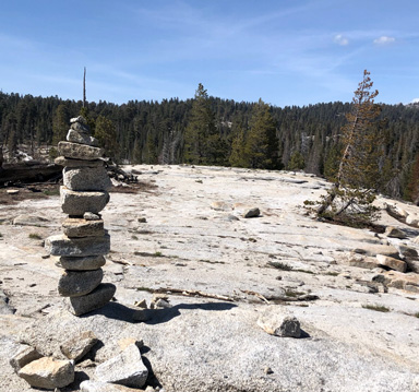
On Top of 7704

Cloud-Cumulus Humilis

Mt Silliman

Mt Silliman

Mt SIlliman

Well Shaped Tree

Family: Gary, Sherri, Kora, Steven and Rachel

Strocumulous over Shell Mountain


Flowers and Plants


Possibly an emerging Corn Lily

Phlox