Showing posts with label Lee Vining. Show all posts

Friday, July 17, 2015

July 18, 2015 - Sonora Pass

Title: July 18, 2015 - Sonora Pass
Trail head: Sonora Pass
Hike Info:
Type:  Hiking
Trail: Pacific Crest Trail, south of Sonora Pass
Destination: Undetermined
Distance: approx 4  miles 1
Start Time: 12:30
End Time:    3:00
Ascending Elevation: 600'
Maximum Elevation: 10,220'
 1No GPS information
Description:
Sherri and I were invited to backpack with the Millers on a stretch from Sonora Pass to Tuolumne Meadows. We had other commitments so we could not walk with them. But we did volunteer to shuttle their car around from Sonora Pass to Tuolumne Meadows. It gives us a good excuse to be out and about, explore areas we normally do not visit, and even better yet, enjoy the friendship we established on the Trail a couple of years ago.


Sherri and I went up the night before to close to Sonora Pass.to stay the night. On the way up we stopped in at Mariposa and visited Faith Rumm at her studio. She is an artist. A good talk with her. I had been here once before, but Sherri had neverseen her. Sort of ironic since it is Sherri who had the original contact with her through Facebook. Also on the way up we stopped in Sonora for a sort of lunch/dinner at El Jardin.
Ate well, food was good. There is also an El Jardin in Turlock which Joe and Margaret have taken us to.
Sherri at camp

It is starting to get a bit late in the afternoon. While I do not mind pitching a tent at night, I feel more comfortable finding a place to camp and pitching the tent in the day.  So on the way up, we stop at the MiWok Visitor Center. Purchased a map for the Stanislaus National Forest-mine is at least 30 years old. On the way out, we met a law enforcement officer. Friendly fellow. He was very enthusiastic about a smart phone app called PDF Maps from Avenza. He showed us all sorts of things he could do with it and the map we just purchased was cheaper on the app than over the counter. Will look at it when we get back.

Night Lights
But now to find a campsite. As we go up, we would rather not stay at a place like Pinecrest just because of the crowds of people. But we do find a place to stay at a forest service camp ground called Mill Creek for $8 a night. Pretty nice and quiet. Even has a a friendly campground host who came over to greet us (and take the camping fee). We chatted for 20 minutes or so. It is quiet, but bring your own water. We had enough water from lookout to deal with this situation.

It was a quiet night and we get up before most of the other campers. Breakfast is quick and we are on the road to meet Ray and Rachel by 8am. They are schedule to get to Sonora Pass by 9:30. This is beautiful territory and we must explore a little more.

We arrive early and no sign of them. So we just wait around. I do walk over to a day use area just in case they are there. There is a couple which does PCT restock with their truck-store there. They are called the Sonora Pass Resupply. I get into conversation with Sherri-not mine, but the restocker. They have a mini-store  catering to the needs of PCTers.

Red Tailed hawk
But our friends are not there, so I go back and sit under a tree. In the meantime Sherri, my Sherri, has found what looks like an eagle perched in a close by tree. It may look like one from a distance, but we figure out it is a red-tailed hawk.
One problem with Sonora Pass is that there is.no cell phone reception.  As the hour goes to 10, then 11, we wonder what to do. But we figure we can wait at least until 5, if not later.
View from Sonora Pass


Rachel and Ray
At 12:30, the Miller's show up. Explanation? After traveling for about an hour, Ray's Jeep had issues and they had to go back and get Rachel's Prius. But they are safe and ready to hike. We get off around 1. We will probably turn around pretty soon as we have a 4+ hour drive back to Fresno.

The trail up goes pretty good. At first I am thinking Ray and Rachel have an 8 day pack on them are they going to buzz by me with just a light day pack? But no fears there. They settle down into a pace which even I can fit into. Some of it, this section of the trail is a the steepest they will face all day and it looks like they will need to go between 10-13 miles before they camp tonight.
Rachel, Sherri and Ray


But the redeeming part is with each step, the view becomes prettier. Wildflowers are poking their heads out from underneath stone and log. All of this makes even this steep hike enjoyable.As we go up, we catch up on how things are with the Millers.

Gary and Rachel talking

Ray and Gary looking over packs
After about a mile we stop and Ray and Rachel adjust their packs. Not much for me to do except to look wise.Where we stop is the last section of trees before we pop out above timberline.

Ray, Sherri and Rachel


By now, we have traveled two miles. The time is later than we anticipated, but it is well worth the time on the back end. From the time we met them on the JMT in July 2013, we have enjoyed their company. So every step we take with them is one we can enjoy their fellowship. But it is time for us to turn around. We saw our goodbyes and wish them God's speed on their way.
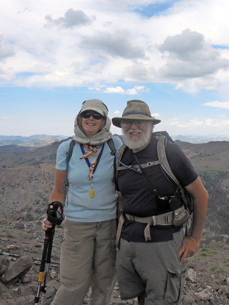

Sherri and Gary
Rachel and Ray


Parting shot


West of Sonora Pass
 Now it is time to hurry down. We are retracing our steps. But instead of being ho-hum, we see things from a different perspective. We see west of Sonora Pass, an area of many ridges. We see ravines we traveled up where there is pygmy trees lining the path. We see rock outcroppings, with flowered borders. In essence, we see things better the second time around.


 We get down pretty well in good time, about 3:30 or so. Now it is my turn to drive Rachel's Prius. Seems pretty straightforward. We come down Sonora Pass on the east side, pretty cautiously-me because I am driving someone else' car; Sherri because she is not used to driving in the mountains. All is safe and at least neither of our cars had that burnt brake smell. We hit 395 and pass through Lee Vining. We stop at the Mobil station or if you prefer, the Whoa Nellie Deli. It did not disappoint. Then through Tioga Pass and then Tuolumne Meadows. Rachel's car is left at the stables parking area and we are off home.

Small trees and PCT


Trail head: Tuolumne Grove Parking Lot
Hike Info:
Type:  Hiking
Trail: Crane Flat Lookout
Destination: Crane Flat Lookout
Distance: approx 2.5  miles 2
Start Time: 7:00pm
End Time:  8:15pm
Ascending Elevation: 450'
Maximum Elevation: 6,844'
 2No GPS information

Well we thought we would head straight home, but on the Stanislaus National Forest map I had bought yesterday, I noticed a trail to the Crane Flat Lookout. It looked pretty short, and since we still had sunlight, we thought we would try it.

The trail comes out of the Tuolumne Grove parking lot. But instead of heading north to the grove, you go to the western end of the parking lot There you find the remnants of a road-is this part of the old Tioga Road?  The trail is unmarked, but we follow it anyway. It is pretty gentle. After a little ways, we pop out onto a paved road heading northwest. We do not see any sign of our road, so we follow this one. It seems a lot longer than the map I had, of course that map had little granularity and it was not concerned with Yosemite, but Stanislaus National Forest.

Fire Helicopter
But after a ways, we find a helicopter standing through some trees. Then a imposing looking chain link fence. But it looks like it is not necessarily to keep people out. I had known there was a heliport at Crane Flat because last year when we reported our Facebook fire around Vidette Meadows, a helicopter from Crane Flat came out to pick up the division chief at Kings Canyon to fly him up there.


Crane Flat Lookout
While interesting, that is not why we are here. But there is a large paved area and we are looking around. Sherri finds a couple of people crossing this area and engages them in conversation. They point us to the lookout. And as the conversation progresses, it turns out they were the crew which came down to Kings Canyon last October. Small world isn't it?

They said to go on up and take a look around. There is the usual tools of a lookout sans radios. Things like maps and an Osborne Fire Finder.  We also get a good view. The pilots said to be sure to look to the west for Pilot Lookout. We find it as the sun sets. Now it is time to return back to the car. We do get back about 10 minutes after it turns dark. Then we take off and don't stop on our trip back to Fresno, getting home around 11pm. A good day.
Pilot Lookout


Looking east at sundown from Crane Flat Lookout


Pictures:

Eastern Sierras

West of Sonora Pass
Gary at Crane Flat Lookout


Flowers: 


Friday, June 28, 2013

June 28, 2013 - Lyell Canyon and beyond

Title: June 28, 2013 - Lyell Canyon and beyond
 (Preliminary)

Trail:JMT-Lyell Canyon
Starting location:  Tuolumne Meadows
Destination: above the Lyell Footbridge
Actual Destination: pond at 10,185'
Distance: 10.6 miles 2
Start Time: 7:30
End Time: 5:00
Travel Time: 9:30 (1.12 mph)
Moving Time: 5:07 ( 2.07 mph) 2
Elevation Rise: 1,506' 2
Maximum Elevation: 10,185'

Description:
Steven
Slept OK at Murphy's Inn in Lee Vining. Even though we had the A/C running last night I thought it was a bit stuffy. Woke up several times, but feel asleep. Sherri was up some also. Finally turned on the iPad around 5:30and read my devotions before getting up around 6. Got the last minute items put away, then off into the car at 6:30 and stopped at the Whoa Nellie Deli for breakfast on the way out. Steven and I had a breakfast burrito-which I did not finish, and Sherri had a eggs and ham croissant. Good eats with lots of food. Nice combination. Got to the trail head at 7:30.  Pretty good for us.

Morning Start
Our third instance of doing a little bit of cheating. There are two places where we could pick up the Trail. The first is the wilderness ranger station, where Steven picked us up.  Then there is the long term parking about a mile down the trail-see the purple line on the map. We opted for the mile down the trail-it cuts off a mile of walking beside the road, particularly since we have done this section of the trail several times and so far it had not added anything, except being tired.

So off we went, waving goodbye to Steven, thanking him for driving us around and the food drop off. We hiked this first piece three weeks ago with Betty. Not much has changed, except some of the mud has dried up. The Lyell Fork still is running strong and the grass is green. Before hitting Rafferty Creek, we see a buck and five deer. Nice sight. 

View From the Trail
Even though the pack is heavy on Sherri, mine is only a little more than the first days, we make good time, averaging about 2.5 mph. We meet the father of the PCTer which we talked with at Sunrise Meadow a couple of days ago. The opening comment he made was that this was the second JMTer who was carrying a Kelty which he had met, before realizing the first and the second were the same person. His daughter, Jessica-trail name Night Crawler1, because she traveled at night in the desert, is with him. We chatted for a few minutes, then headed our separate ways.

We pass the Evelyn Lake trail junction and continue on. A little bit later, we stop and have lunch. Thanks Steven for making our peanut butter and Nutella sandwich. Tasted good. A little bit later, we came across the hidden campsite which Andrea, Sherri and I found.   This is the one which Zander stumbled across while we were there.

Campsite from six years ago
We keep going up Lyell Canyon, it is slowly rising, about a hundred feet in a mile. At the end of the level part, we stop for a Clif Bar and a break before a climb. There was a bit of frustration with some miscommunication. Also with the iPod not working how we thought it should. But when we started walking again, that gets shoved aside and our energy is concentrated on climbing 600' in the next mile to the footbridge which crosses Lyell Creek.  It is hot and dry, so we walk a bit then breath a lot. But step by step we get up it.

Lyell Glacier
Along the way, we talk with a guy who will be going up to Lyell Glacier. We then see him by the footbridge. We talk for a time, getting rested.  Clouds are gathering, cooling the air. So we decide to go another mile and 500' up to a pond. This will help out tomorrow when we go over Donohue Pass. This climb was a lot better than the first one. Being rested and cooler really helped.

Our Bedroom View


We have a spot  to camp (37.95887, -119.12091) at with a view, you would pay big bucks to have-we only needed to perspire.  This is at an unnamed lake, only known by its elevation-10,185'.  We watched several people cross the creek we will be crossing tomorrow. We do take some interest in observing peoples styles of crossing-some decide quickly to plunge right in and wade across, others try to keep dry and go across some marginal rocks-only one person was successful. Most decide to wade. One of the people is Lucy who is writing her blog. We exchanged cards. it was informative watching various groups crossing the outlet to our pond. Dinner was tamale freestyle-filling and tasty. We resolve some of the iPod problems. Then it is time to go to bed, around 9. The sunset was pretty good off of the snow above us.

 Today's JMT Lesson: Known and own* your equipment.
*The owning is not so much possession, but mastery of what you bring.


Breakfast Lunch Dinner Snacks
Oatmeal and add-ins, such as dried peaches, strawberries, nuts, granola. Tang. Peanut Butter and Nutella on crackers Tamale Pie Freestyle Clif Bar, Jelly Bellies, CytoMax, Propel, GORP


Notes:
1We have a strange world which we live in. After reading a draft of this blog, Lindy, a PCTer and a person who is doing the JMT this year, met Night Crawler's Dad up in Seattle. Also Night Crawler gets mentioned in several blogs: PJG and Guy on a Buffalo.
2The supplied figures come from either the book John Muir Trail: The essential guide to hiking America's most famous trail by Elizabeth Wenk. Also some information comes from topo maps as well.The tracks from my Foretex did not get saved. This will become a problem for the rest of the trip. Getting either no or incomplete set of tracks. Below is the readings from today's status on the GPS. I view it as only somewhat accurate.
Distance: 11.3 miles
Moving Time: 5:07 ( 2.2 mph)
Elevation Rise: 996'
Maximum Elevation: 10,185'


Monday, January 12, 1970

Place: CA-Lee Vining

Lee Vining-town, Creek, Peak(11,691) (Mono Craters 15', Tuolumne Meadows 15')
(Long, Lat)

Description:

“Leroy Vining and a few chosen companions, with one of Moore’s scouts as guide, went over the Sierras to the place where the gold had been found [in 1852], and established themselves on what has since been known as Vining’s Gulch or Creek.” (Bunnell: Discovery of the Yosemite, 1880, p. 278.) From Place Names of the High Sierra (1926) by Francis P. Farquhar

Trips:


Pictures:


References:
  •