Title: January 22, 2020 - Million Dollar Mile to Stevenson Falls
Hike Info : Description : Background : Extra Photo's
Trail head: Italian Bar Road
Hike Info:
Type:
Hiking
Trail:
Million Dollar
Mile
Destination:
Stevenson Falls
 Distance:
7.88
miles
Distance:
7.88
miles
Start
Time: 11:27
End
Time: 2:51
Travel
Time: 3:24 (2.32
mph)
Moving
Time: 3:15 (2.43
mph)
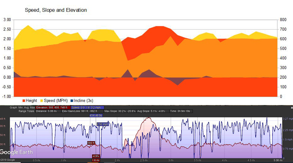
Elevation
Rise: 928 '
Descent: 726‘
Maximum
Elevation: 2,338'
Originally Sherri was going to
go on this Meetup
hike, but she came down with a cold, so a no-go. Also our son Steven
had thought about going, then realized he had other obligations. So
it will be just me, along with around 20 old and new friends. I got
up at 6:30 and left the house at 7:40. A bit cool, but not bad.
Cathey has three people riding with me: Meagan, Carol and Nita. Nita
is a person I have not met before. Always interesting finding a new
person.
 |
| San Joaquin River |
Now normally, going to the
Exact Center of California works out. We just continue on down Road
225, cross the bridge over Redinger
Lake and
go up a third of the say on the other side to get to the starting
point of our hike. But the bridge is under repairs, so we take a
longer way around. We stop at an outhouse by Redinger Lake, then
continue west to Powerhouse Road. This crosses the San
Joaquin River
and goes up the other side. We pass by Smalley Road-where we hike the
San
Joaquin River Gorge
and continue on the Audberry. We then head down Audberry Road to
Jose
Basin Road.
The road is a bit interesting. We then turn off onto Italian
Bar Road,
which is even more interesting. Finally when we get to a horseshoe
turn, we are at the trailhead-three hours after we left the parking
lot this morning. On the other hand, I have been down roads I have
not been down before. That should be worth something. Before we
started our hike, three SCE vehicles have gone through. Each are
friendly enough.
 |
| Jose Creek |
We start off close to 11:30-a bit late. Jose Creek is always a good refreshing start. It has a tendency to tell how Stevenson Falls will be. Today, the water is calm. With the dried up stocks it is pretty tranquil. I am back at the pack. But today it is not so much from lack of energy or oomph. Rather just playing my part-helping to herd those at the back. I pick up some information on cameras from Karl. Eventually it is just John and I at the back. We talk about a variety of stuff. Some serious, some just for fun. For example, of what use is a buckeye? We were finding a whole bunch of nuts along the road. We also have time to look around and observe that the San Joaquin does not seem to be a bustling river, but more wet spots between boulders. Still all of this makes for the walking to pass nicely, even though we are the last.
 |
| San Joaquin River where Stevenson Creek Enters in |
After a bit of a sandwich, I
take Nita into the adit-not really one of your scenic areas of the
Sierra. But it is interesting because most people have not heard the
term adit. Even if you have, chances are that you may not know what
it is. Or have even seen on. She is impressed enough by it in an
appropriate measure.
 |
| Bridge over Stevenson Creek |
 |
| Stevenson Falls |
 |
| Jose Creek |
The three of us walk on,
enjoying a leisurely pace. Even though each time we went up a slope,
we were ready to see the end of the road. Instead of the end of the
road, Jerry comes up the road to escort us the last stretch. When we
reach the SCE gate, we are glad to be back at the cars. I am tired,
but feeling like I still have a bit of energy in the tank. Things are
much better.
After we get packed up, we
head to Prather and Velasco’s
Mexican Restaurant.
A bit slow for hungry people. But there was one waitress for 15-20
people. So be patient. Food was good. On the way out, I met
Jeannette, a co-worker whom I had not seen in 30+ years. A good
little chat. We make it back to the parking lot by 5:30 and home at
5:45. I slept well.

Background
Center of State
There was a list of the geographical center of each state. You can
find it on Wikipedia.
There is also a Wiki
list of extreme points for each state.
Buckeyes.
What use is a buckeye? Evidently, unless properly prepared, they are
toxic because of tannic acid. But they are high in protein. The
Native Americans would open up the balls and pound the contents
making a flour, then leach out the acids. Or I was reading that some
people roasted the outside. Sounds like it was best not to use it to
munch on, except as Rebecca pointed out that in Ohio they make a
Buckeye candy, made to resemble the tree's nut, is made by dipping a
ball of peanut butter fudge in milk chocolate, leaving a circle of
the peanut butter exposed. The ones found in California is different
than the ones in Ohio.
Extra Photo's
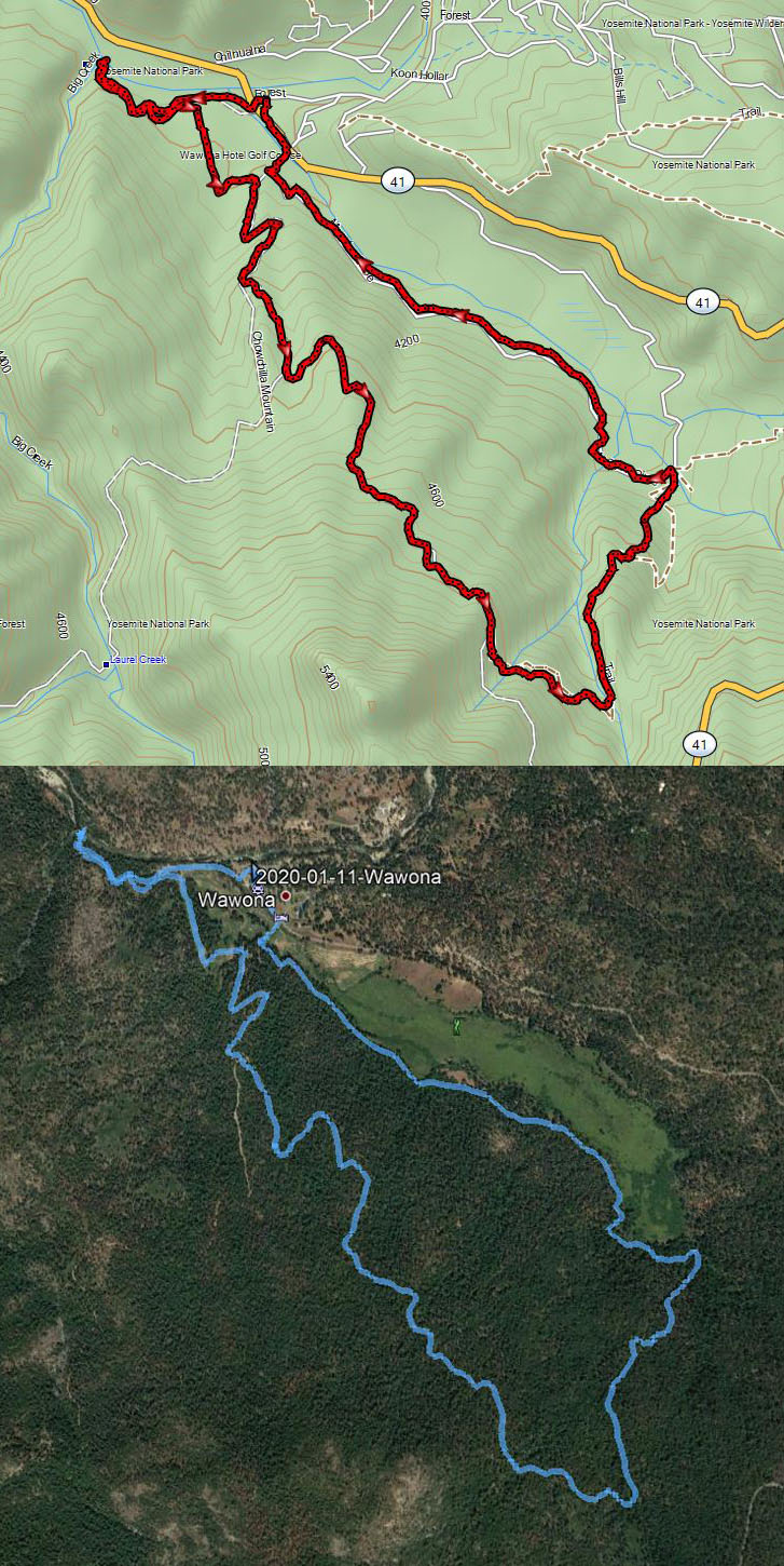
 |
| Stevenson Creek and Falls from Google Earth |
 |
| Below the Bridge |
 |
| From the adit looking at Stevenson Falls |