Showing posts with label Paradise Valley. Show all posts

Wednesday, May 19, 2021

May 19, 2021 - Weaver Lake


Title: May 19, 2021 - Weaver Lake
Hike Info : DescriptionMenu : Extra Photo's 


Trail head: Big Meadows Trailhead


Hike Info:
Type: Backpacking
Trail: Weaver Lake Trail
Destination:  Weaver Lake
Actual Destination:
Distance:  3.81 miles  1
Start Time: 11:25
End Time:    3:51

Travel Time: 4:26  (0.81 mph)
Moving Time:  2:54  (1.24 mph)
Elevation Rise: 1,297'
Descent: 201‘
Maximum Elevation: 8,740'

GPS Tracks

  1Originally the GPS said we did about 4.7 miles. But looking at the tracks, it went crazy at lunch time. Based upon previous hikes, this seems much more reasonable.

Description:

Last year was a bust to go backpacking and I am not getting much younger. Our initial thought was to go to Alder Creek in Yosemite, but the logistics of getting a permit in this COVID-19 times would eat up a large chunk of our enjoyment. So Plan B was to go to Paradise Valley in Kings Canyon. As the day approached, I felt less and less ready-both in preparation, physically and mentally. Plus someplace over the weekend I lost my medicine bag (sounds like I am making excuses). So come Monday night, I thought, let us postpone this a day-we can do that. So on Tuesday, the more I thought about things, the more content I got with Plan C-a short hike to Weaver Lake. Definitely less apprehensive the night before the hike.

Bridge across Big Meadow Creek
Now, when was the last time I was at Weaver Lake? I think it was about five years ago with our meetup group. Now to see if I can make it.

We get in the car at 9:40-a bit later. Then it is a straightforward drive up 180. We go to the Grant Grove Visitor Center to see if we need a Wilderness Permit for Weaver Lake. The quick answer is now. We already have a California Fire Permit, so we are ready to go. It is another 20 minute drive to the Big Meadows Trailhead.  

At 11:45, our boots hit the trail. It is a pleasant 57o. This is the moment of truth. That moment gets deferred for a few minutes as the trail starts by going downhill-I can tackle this. Then there is a new twist-instead of crossing on logs like I have before, there is a nice sturdy bridge crossing Big Meadows Creek. 


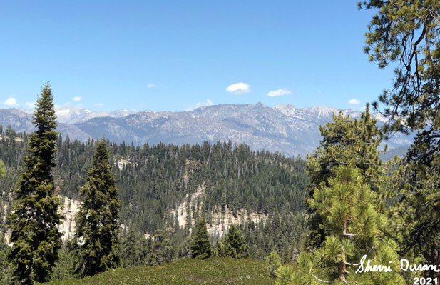
Trail and Shell Mountain

And now the moment gets realized. The trail starts off by going gradually up-I am able to do this. And then it turns up the intensity. While I am able to go up this, my pace shortens and my breaths become more frequent. But at least I am consistent. It looks like the weight of the pack will not be an issue. By the way, the weight is 34 pounds. Maybe a bit heavy for overnight, but very doable.

Sherri, the hiker


Gary inching up a hill
We cross a small creek, rock hopping over it. Even if we fell in, only our shoes would get wet. There is a log across the trail, but very doable in getting over it. By the time we have gone a mile and a third, we are seeing some great views, including the glint of Buck Rock Lookout. We meet a few people leaving, but not a wild weekend crowd. Also it is after 1pm, so we think this is a wonderful place to have our PB&Nutella sandwich. 

 There is a downhill, which I am sure we will need to gain back. The trail meets another trail from the Fox Canyon trailhead. Then a short way, but steeply uphill, to the junction with the Jennie Lake trail-later we found out a friend of ours was at Jennie Lake at the same time we were here.. Now it is more uphill, climbing up a ridge.


We are now on the last half of the trek, and there is still a need to climb. While the trail starts out just as steep as before, we know there is an end. That is always something to look at. Good thing it is not a warm day, just comfortable for walking a trail like this. One thing, our good views have left as a ridge now blocks the view.

Once on top, we are anxious to see the junction to take us to Weaver. But the trail has other plans. We think we are close, but the trail goes ever on. Several low ridges and a couple of dry creeks, one we think is big enough that it should be coming from Weaver. That leaves us to wonder how much, or more concerning, how little water may be in the lake. We know there will be some, it is not a mud puddle. Still in May there should be water coming down a creek from the lake.

Buck Rock Lookout
We come to the trail junction which will lead us up to Weaver Lake. A short climb brings us to the lake. There has been a series of signs along the way which indicate the campsites are numbered, instead they are more approximate locations. We do not see signs of people occupying, so we have the whole lake to ourselves. And it is a good lake, pleasant to the eyes with the base of Shell Mountain rising from it.

We cross the creek, which is flowing. This raises the question, where is that water going? Many more campsites here. It reminds me of the west side of Ostrander Lake how the campsites are laid out. Continuously. We find one which will be sheltered by a log if the wind picks up and set up our tent. It is a little after four by the time everything is ready for habitation. We rest for a bit and then Sherri gets dinner ready.


Dry Creek Bead

Our dinner setting is one of the finest, sitting on a log, looking out west watching the start of evening to set in. I cannot say it is romantic as we share a bag of Mountain House freeze dried. But there is an element of 101 Dalmatians where Pongo and Perdita share a plate of spaghetti. Romance is wherever two hearts meet.

We clean up. While Sherri is off for a few minutes, I hear her phone ping. Evidently we have reception here. Andrea will be late for our family Zoom call. If we can get a text, can we get a phone call through? Yes! So we join the Zoom call. Sort of wild being able to be up here and enjoy a family time remotely.


Weaver Lake

The air is cooling, Sherri decides a warmer place is in her sleeping bag. While it is still light, I wander around a bit, towards the south. I am not intending to walk very far, just enough to enjoy the area. As I approach the boulders on the south, I notice some unnatural colors and a bit of movement. We are not alone! We talked a bit. He was to go to Mineral King, but the road was still closed. So he came up here for a few days. It is better than being in Los Angeles, which is where he is from, actually pretty close to Redondo Beach.

Enjoyable little chat, but now darkness is coming and it is time to head to bed. Sherri is reading. And I read for about thirty minutes. And now the eyes are closing and it is time to sleep. A pretty good first outing.


Menu

Breakfast

Lunch

Dinner

Snacks

Home

Peanut Butter & Nutella Sandwich from home

Mountain House Fusilli Pasta

energy bar


Extra Photo's

Tired Old Man

Our Camp Spot

Gary entering the Jennie Lakes Wilderness

Looking North

More north looking

Small Creek Crossing


Wednesday, May 8, 2019

May 8, 2019 - Azalea Trail to Park Ridge Lookout


Title: May 8, 2019 - Azalea Trail to Park Ridge Lookout
Hike Info : Description : Background : Extra Photo'sFlowers and Plants
Hike Info:
Type: Hiking
Trail: Azalea Trail
Destination: Park Ridge Lookout
Distance:  5.50 miles
Start Time: 12:02
End Time:    6:05
Travel Time: 6:02  (0.91 mph)
Moving Time:  4:35 (1.20 mph)
Elevation Rise:  1,474'
Descent: 1,306‘
Maximum Elevation: 7,538'
Description:

We sort of doddled around this morning. While we left earlier than yesterday, it was still 10:15 by the time the garage door closed. Sherri is driving and we are heading towards Grant Grove. The idea is to go up to Panorama Pt and hike the Park Ridge Trail to the Lookout.
But first we stop in Dunlap, but the coffee place at Clingman’s Junction is closed. So we continue on up and stop at the Visitor Center for a bathroom break. Sherri also gets some info about backpacking into Paradise Valley. Does not look promising.
So we continue on, but the gate to Panorama Point is closed. But this does not stop us, only delays us. We go to the trailhead at the South Boundary Trail. Across the highway is Azalea Trail. This goes up to the top of Park Ridge where we can follow a trail to Park Ridge Lookout.
We get our boots on and start hiking after 11:45. Right away we get an inkling of what we are facing. Much debris covers the trail. Also some branches which needs to be gotten over or gone around. But all of this is pretty passable. The trail goes up a ways, hits the the top of a little rise and descends slightly into a little soggy meadow. This is just the start.
Little unnamed creek

After about half of a mile, we leave the Wilsonia area and continue our climb. There is a little unnamed creek which will eventually flow into Sequoia Creek over Ella Falls and into Sequoia Lake. This creek we will follow for a a ways as we climb Park Ridge.
Considering my last two years of hiking, anytime I climb, I get out of breath and fatigued, I am doing OK today-definitely better than I have been doing. Still not what I visualize myself when I walk. Sherri later on makes a comment that “the natural order of the words has been restored.” I suppose by this she means that today I am walking pretty good, or Sherri is struggling. Because we have not had lunch and will not have it until we get to the top of the ridge, it may be more that Sherri is losing energy at a faster clip than I am doing.
Gary going over log

The path is going upwards, more than I really remember. But by taking it slowly and taking lots of breaths, I am doing well. When following the creek, we seem to be free of snow. But there are trees to climb over. After we climb away from the creek, we start hitting patches of snow. For the most part, the trail is pretty easy to follow, even covered by the snow.
Sherri and a patch of snow


When we got to the top of the ridge, there is a trail junction. We stopped there for our lunch. We needed it-at least I devoured my sandwich. Then it is off, going along the Park Ridge Trail. Not sure if this is a good choice or not. Depends on how much snow there is. If lots, it will be easy to lose the trail vs the road which will be easy to find.
As it turns out, my apprehension is overblown. Yes, there is patches of snow which we are wandering through, but between seeing the trail on the dirt between patches and the ski markers, we keep pretty much on the trail’s route. Some of the path is on a good slant. If it was icy or slushy, we would have gone skidding. But the snow is pretty firm and holds us.

Sherri and Gary
In a short ways, we start our final climb to the lookout. The road is mostly covered with snow, but not deep. It is good to get back to Park Ridge, even if it is just to look from the outside. The lookout is still shuttered and waiting to be occupied. But that may not happen until well into next month. 

 
Almost to the lookut
 

Park Ridge Lookout


The Road
After munching on a Clif Bar, and taking a few pictures, it is time to start heading back. It is getting a bit late and the clouds are billowing around us. So if something breaks loose, we do not want to be out, particularly in the dark. We will go back via the road till the junction for two reasons:
  1. To get a feel for the condition of the road, and
  2. Just because it gives us a different route back.
As we go down the road, it becomes more and more snow covered until we only rarely see the ground. A few trees are down on the road as well. Through openings in the forest, we are able to see across to the north of the Kings River. Just a flat out nice sight. But the main thing here is the snow just keeps a coming. After awhile, the plodding through the snow is taxing on our muscles and energy.
Fortunately, it was just about a mile and a half walk on the road and the snow was relatively stable so we did not post hole very much. Once we got back to the junction, we had a quick bite to each before starting down. Our return trip was uneventful, even though it was slower than anticipated-probably because of being tired.
It felt good getting back to the car with daylight still available, even though the shadows were a bit long at that point and the cool air was definitely setting in. We decided that we would stop at Bear Mountain Pizza for dinner-ordered a medium half meat lovers and half Hawaiian. Was hungry and it tasted good. We got back home around 8pm.


Background

The report I filed with interested people from the Buck Rock Foundation:
Today Sherri and I took a hike up the Azalea Trail to Park Ridge Lookout. The road to Pan Pt is still closed so could not go over the Park Ridge Trail. We went up the Azalea Trail until we got to the top of the ridge. Then followed the trail along the ridge until just before PRLO. We continued our walk to PRLO. Then we took the road back to the Azalea Trail and back to the car on the highway-South Boundary Trail trailhead.
PRLO: From the bottom, it looked like it was in good shape. We did not go up on the catwalk or the stairs, but looking at things from the bottom, it looked pretty good. The covers were still on the windows.
Road from PRLO to Azalea Trail:
  • Trees
    • I counted five trees across the road. Most were about a hands width.
      • One was about 3-4' across.
    • A couple more were buried in the snow. I could not tell how big they were.
  • Snow
    • Covered about 80% of the road from PRLO to the Azalea Trail
    • it looked like the depth was 2-4'. But there was some 5' drifts.
  • Debris
    • Towards the trail junction there was a lot of debris
    • Top of snow looked pretty clean0unknown underneath.


Observations:
  • The road we walked was on the east side of the ridge and was pretty shaded.
  • The trail on the west side of the ridge had patchy snow and looked like it was only a max of about 2' deep
    • Much of the road is on the west side of the ridge, so that section may not be covered as much
  • Rain is forecasted the next five days with fairly warm temperatures. That should melt some of the snow.
  • While we found patches of snow close to the highway, 6500'. Most of the major snow was started 6900-7000'
  • Much of the debris and logs were closer to the trail junction than PRLO.


Extra Photo's
Snow patch on trail

Unnamed Creek
Sherri and the log crossing

Unnamed creek

Snow Crossing

Buck Rock in the distance

Looking Northeast

Shell Mountain

Looking north

North Looking

Sherri traversing a snow bank

Gary returning to his usual self

Hill up to Park Ridge Lookout

More snow
More north looking shots

Another blockage from getting to Park Ridge Lookout

Sherri walking on frozen water

Park Ridge Lookout


Flowers and Plants


Saturday, May 14, 2016

May 14, 2016 - Alder Creek

Title: May 14, 2016 - Alder Creek
Hike Info : DescriptionMenuFlowers and Plants
Trail head: Mosquito Creek

Hike Info:
Type:  Backpacking
Trail: Alder Creek
Destination: Trail Junction at Alder Creek and the Deer Camp Trail
Distance: 4.99 miles
Start Time:  11:15
End Time:     3:41
Travel Time: 4:25 (1.13 mph)
Moving Time: 2:36 (1.92 mph)
Elevation Rise: 1,467'
Maximum Elevation: 6,012'


Description:

There is something special when your daughter asks you if you want to go backpacking with her. That is what happened in April. So we figured out a weekend and then worked on what place to go into. We talked about Paradise Valley in Kings Canyon or the High Sierra Trail-just an in and out for the weekend. But none of these felt right. Sherri and I love doing Alder Creek each Spring, so this seemed like a good place, particularly since Rachel had not been there before. (For the record, I have two daughters and one son, and whenever any of them talk about going up to the Sierra's with me, I am a happy camper-literally.)

Rachel came up Friday night and we got our act together that evening about what to take. I want to carry most things since I am training for the JMT and this is the first backpacking of the season for me. Alder Creek is not a long hike, so I knew we did not need to get an early start.  On the way up to Yosemite, we stopped in Oakhurst and got the traditional sandwich-both for lunch and dinner. I got a turkey sandwich from Pete's Place. Then off to Yosemite-excitement! That is until we got into a 45 minute line to enter into Yosemite. What a wait! But we got in and headed over to Wawona and the Wilderness Office where Ranger Dave issued our permit.

Rachel going through the ghost forest
By the time we got to Mosquito Creek, our trailhead, it was starting to get warm, There were also several official looking vehicles parked there. So we just lined ours up and started hiking around 11:15.This a trail I know well. The first 3/4 of a mile is a pretty good haul up. When I walked it at the start of April, the buck brush was over-growing the trail. But today, it had been very nicely trimmed back, about 2 yards away from the trail. The trees are now part of a ghost forest from a prescribed burn about 8 years ago. It is nice walking. Just a good haul up. Rachel does not seem to be too taken back with the climb up. I on the other hand is sweating a bit and huffing and puffing.

Alder Falls

Once we got to the Wawona junction, the trail leveled out some. But as we walked along, I could feel that my legs were not used to wearing boots-this was the first time with boots this year, as well as the first over-nighter this season. Someplace in this section, my loving daughter provides motivation to get the job done. How, you might ask? Well the story goes like this. Since I am preparing for the JMT, I thought I would carry a load to prepare me for it. Things like the tent, food, JetBoil, ... Rachel's loving comment was. if you need to take some weight off, ... So what kind of response do you think that elicited? A sneer and determination to get the job done.

Top of the Falls
Somehow, being older, the motivation gave out after a mile or so. So we took a Clif Bar break.  Evidently at this point, one of my sandals dropped off my pack. Why didn't the pack feel lighter then?  But it wasn't until we reach the old railroad bed before I noticed it. I thought, Oh Well, it should be there when we go back down this trail tomorrow.

Coiled Cable Snake
The good part of the old Yosemite Lumber Railroad/Sugar Pine Railroad is the the trail is nearly flat. Even with my decreasing stamina, we made some pretty good time. I do need to warn Rachel about the dangers of cable snakes, particularly if they are coiled. When we round the corner, the Falls are there in full flow. It is a sight which does not fail to take my breath away. I thought we would be the only ones here, but the CCC crew is working close to the falls. So we stop and have lunch from my viewpoint.

Tail Crew from Greenwood CCC
Lunch is the turkey sandwich I got from Pete's Place this morning. Just a pile of turkey and bread, with a ton of mayo. Tastes real good about now. After looking and relaxing with the falls, time to head on. Rachel experiences the trail hazard of walking with me: I stop and talk with people. This time it is with the Trail Crew. I always thank them for working on the trail I am walking on. In conversation with them, they say they are from Greenwood, up near Auburn. They are around Yosemite for eight weeks, and then back at the camp for eight weeks. I tell them about my lost sandal.  The women I am talking with says that she will keep an eye out for it.

Crossing our tiny creek
We walk on. While the trail is not as level as the last mile along the railroad bed, we do continue to follow remanents of the bed for a ways. One question which keeps popping into my mind, where did the railroad cross Alder Creek? I have several thoughts, but nothing definitive. Maybe one of these days I will find some of the older maps and be able to tell.

After a ways, we cross a tiny creek. But the flow is enough that we use a log to help us across. Much more fun anyway than rock hopping across. I do my semi-wabble across; Rachel is a bit more cautious. We continue on and any semblance of a railroad is lost and a real trail takes us up the creek. Having boots on instead of trail runner shoes continue to take a toll on me. But I am still going ok. Just slowing down. But there is a section where the trail crosses Alder Creek. nothing dangerous, just need to take off our shoes for this crossing. I know what to expect: cold water. I cross with my one sandal which feels better than bare feet-still is cold, but the rocks do not hurt as much. Rachel, on the other hand does not have any clue on how cold it is. So her first step into the water is an exercise in eye and mouth opening. She is a bit more sensitive to the cold than I am. But we get across.

Alder Creek Crossing
After resting a few minutes from the trauma of the crossing, we continue on. I do not have the heart to tell her that we will be crossing the creek again in 5 minutes. Which we do. But this time it is on logs. Our campsite is just across the creek-Sherri and I have camped here many a time.

Hot Chocolate
Camp gets set up and dinner is eaten-same as lunch. One of those nice secrets we have learned: a sandwich is usually too much for lunch but can be split between lunch and dinner for a satisfactory meal. We then go on a two mile hike, round trip, towards Deer Camp. Even spot a patch of snow-just a small patch. When we hit a creek about a quarter mile before Deer Camp, we decide we have had enough creek crossings for the day. Back at camp, it is time to retire to our sleeping bags, and then a "special" showing of The Martian. The specialness is being able to see it out here with my daughter, on a Samsung Galaxy phone-talking about a small screen. With that we fall asleep.


Menu
 Breakfast Lunch Dinner Snacks
At Home Turkey sandwich from Pete's Place in Oakhurst Turkey sandwich from Pete's Place in Oakhurst Clif Bar, Jelly Bellies


Flowers and Plants
Snow Plants

Dog Vomit Slime Mold