

Title: November 5, 2020 - Giant Forest
Hike Info : Description : Background : Extra Photo's : Flowers and Plants
Trail: Rimrock (Moro Rock), Soldier’s, Bear Hill Trails

Destination: Loop
Distance: 3.81 miles 1Start Time: 9:51
End Time: 2:09
Travel Time: 4:18 (0.89 mph)
Moving Time: 3:18 (1.15 mph)
Elevation Rise: 1,024'
Descent: 571‘
Maximum Elevation: 6,807'
1For about .2 of a mile, the GPS was not syncing with satellites, I plotted it out on Google Earth for the distance.
 |
| Start of Rimrock/Moro Rock Trail |
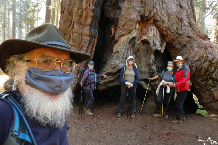
We gather at our house, a little after 7am. The “we” are Rose, John, Cathey, Sherri and myself. It is the first time hiking with John and Cathey in over 8 months. With the pandemic, Sherri and I are particular about who we walk with. Each of these people are people whom we think will take the appropriate precautions against the COVID virus.
We go up Highway 180 and have no issues entering the park. Along the General’s Highway, we know there is construction. Surprisingly, we hit the various spots so we have a minimal amount of wait. At one of them, we come to a stop, the flagger asks where we are going. I say Giant Forest and the next two cars are going there as well. He ponders for a few seconds, calls up the flagger at the other end. He says to me, “You are the lead car, be safe. There are people walking the road.” I guess I must have that look about me.
 |
| Autumn Color |
We get to Giant Forest after 9am. Getting unloaded and booted up, we take off for that place which all hikers know to start with: the restrooms. So the trail gets hit a bit after 9:30.
The trail starts just to the south of the road going into Crescent Meadows. Even though a large sign says Moro Rock Trail, I know it as the Rimrock Trail. Why? It goes along the south side, heading towards Moro Rock, sometimes you even get to see a view or two of the Kaweah River Canyon.
After about fifteen minutes of walking, there is what looks like a full out display of fall colors. But this is just a prelude of what we are to see coming up the trail. There is no point of trying to put the scenes to words, especially my pitiful ways of expressing the glory of Creation. Maybe if I was a musician, I would be writing a symphony, an ode to beauty. All which you will have to be content with, dear reader, is pictures.
 |
| Rose being swallowed by a tree |
We go along this first trail, content with enjoying the colors. Rose and I play a game of naming the burnt stumps by how they appear to us. While the Sequoias have been around us from the beginning, they are more prevalent as we make our way to the Moro Rock area. While we are close to the road into Crescent Meadow, the traffic is light enough and the road is at such an angle, we are not bothered by it.
We reach the end of the trail, at least as far as we are going to do. The trail goes on to Moro Rock, but we have other places we want to go. We walk the road for a ways. There is a fallen tree with a gigantic-aren’t all Sequoia’s gigantic? And then there is the Parker Group. We hang around there for a few minutes. Rose pushes apart a couple trees. And then we meet the Ives tree, at least that is what I call it. The Ives tree has a huge burl-think about it. And then it is on to the tunnel tree. But we do not go quite that far. For we meet up with the Soldier Trail.
 |
| "Ives" Tree with the Burl |
To me, this is the heart of the heart. The colors are more varied and intense. The surrounding Sequoias reddish hues blend nicely with the Autumn coloring of the seasonal trees and bushes. And then there are the shapes which offset the roundness of the bushes and the low trees. Upended tree roots with a spray of color at the end; a wall of chromatic plants surround columns of red bark; open glades are surrounded by dirt and spots of purple, reds, and yellows.
There is a gentle rise to start the trail. But then we climb a ridge which will eventually lead us into the Little Deer Creek drainage. We lose much of the brush and foliage and enter into an area where fire has burnt through-I think this was a prescribed burn from a couple of years ago. We pass by a burnt tree which is called the Burnt Arrow. When we reach the top, it is time to break out lunch. Very considerate of the Park to have a couple of logs cut there-the stumps make for a nice place to sit.
 |
| Roots and Color |
And now it is about 80% downhill for the rest of the trip. I am not sure if it is because of the rest or being downhill, I am feeling a lot better, The first part is rather steep. The Sequoias still accompany us. All is quiet, we still have not met anybody on our trek, except when we walked the road. That seems so appropriate as a Sequoia forest should be experienced in peace, letting the stately old ones fill your heart.
As we go down, we return to more of the shrubs and leafed trees, and back to the colors again. There is a section where the trail looks like it disappears into this cataclysm of color-it only does a switchback, still an exciting visual. As we progress down, we see another trail. That is the one we will take to Bear Hill.
 |
| Burnt Tree |
From this junction, it is an uphill climb, of over a hundred feet. While it does not sound bad, and really is not bad, it takes a bit out of me. Still, I feel so much better than I have on past hikes. Still, the beauty of the Fall is refreshing. At the top of the hill, another trail junction greets us. But I tell the group that I am going about 50 yards further. That is to Bear Hill. All which really remains of the old Bear Hill is a wide space on the trail and a weather station. We inspect the station and wonder about a wire mesh laying on the ground. Unknown what this is about.
And now for the final stretch, which I am sure you readers will appreciate. We descend a long stretch towards the General’s Highway. Evening shadows have long overtaken us, even though it is still mid afternoon. This also darkens the Fall colors, even a different hue to the vision of the area. As we approach a fallen tree which has a tunnel carved out for hikers, we come across the first hikers of the day. While we are a ways off, they slip on their masks and we have a conversation about what is up the trail for them.
 |
| Cathey, Sherri, Rose and John |
A couple hundred more yards and we hit a paved path which parallels the highway. We head left and in five minutes time we are back at the museum. All of make a pit stop before heading up to the cars.
We talk about what to do next. There is the Beetle Rock area, but everybody are done with hiking today. SO off we go. But we do stop to pick up pizza at Bear Mountain Pizza in Squaw Valley. It has been a year since we ate there. We have our meal on a grassy area with picnic tables. Good conversation before we all head home.
Background
Soldier’s Trail. The trail was created by the men under Colonel Charles Young command. They had built the road from Crystal Cave up to Giant Forest. The trail was named after these Buffalo Soldiers both because they built the trail and the road, but also because they secured the area, keeping in mind the dual mission of preserving the area and making it accessible for recreation.
Extra Photo's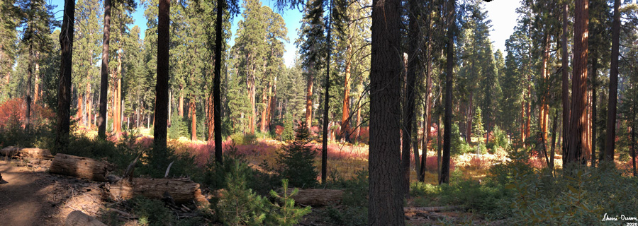


 |
| Gary and Rose |

 |
| On the wire mesh at Bear Hill-John, Gary and Cathey |


 |
| John |

 |
| Cathey |

 |
| Rose and Cathey disappearing into the Autumn colors |


 |
| Burnt Arrow |


 |
| Tunnel Log, right before we turn off on the Soldier Trail |
 |
| Gary and Rose on the road, again |
 |
| The Burl on Ives |

 |
| Cathey at the Parker Group of Sequoias |

 |
| Cathey, John, Rose and Sherri |


Flowers and Plants
 |
| Last Columbine of the season |


