Monday, August 21, 2017

2017-08-21-Azalea Trail to Park Ridge Lookout


Title: 2017-08-21-Azalea Trail to Park Ridge Lookout 


Trail head: South Boundary Trail
Hike Info:
Type: Hiking
Trail: Azalea Trail, Park Ridge Trail
Destination: Park Ridge Lookout
Distance:  5.25 miles
Start Time: 10:05
End Time:    3:25
Travel Time:  5:20 (0.98 mph)
Moving Time: 3:04  (1.71 mph)
Elevation Rise:  1,400'
Maximum Elevation: 7,559'
GPS Tracks


Description:
We really were supposed to be backpacking today. But things happened such as a fire, Butte, which was causing smoke at a couple of lakes. But that fire got contained, only another fire, South Fork, pop’s up making most of Yosemite smokey. So after three of our places being smoked out It also closed out another one just outside of you semi which caused is not to go there so we just decided we just do a series that they hikes.
Rose and Sherru
We decided to go up to Grant Grove today. On the way up, we decided that we would like to go to Park Ridge Lookout. When we got to Grand Grove, about 9:30, we found out Rose had never done the Azalea Trail. So we park by the South Boundary Trailhead and started in.
This is a trail Sherri and I did with Andrea five weeks ago. Lets just say, I was pathetic. Going up, I stopped at least three times to rest and close my eyes. Each time for have an hour each. So I am interested in seeing how I will do today.


The trail starts outside of Wilsonia and it starts going up. Mind you, it is not a terribly steep climb but it is a good incline for me these days. A meadow, maybe about a third of mile in, which was sopping wet vice weeks ago, is drying out today. Enough that we can just walk in the solid mud.
Buck Rock Lookout
We stop to see if we can bring in the solar eclipse through our binoculars-no success. I have not had success before with binoculars, but there was some clouds playing peek-a-boo with the event. We did see the sky darken though. Then it was on our way again.
The trail follows a little creek up a pretty good acclivity. This little area between two small ridges is lush. The little creek is spotty right now, while when we went through in July, there was running water. But it still.provides moisture for the dogwoods and azaleas. Earlier in the season we would have seen wet-loving flowers, such as leopard lilies.
At the top of the ravine, Sherri and Rose take a small break. I surprisingly can go on after a minute or two. I am thinking that I am the weak link here, so I push on. While not going fast, I am steady, which is a bit surprising to myself. The upper part of the trail goes steadily up, but does not feel as steep as the earlier part. Or maybe I am in delusion, I don’t know. There is more exposed area.
As I get close to the top of Park Ridge, I hear the sound of blades turning. Looking around I see helicopter H522 flying up north. Then in about 10 minutes, he flies back going back to Ash Mountain. He must have dropped someone off at Pan Pt where there is a heli-pad.

Clouds gathering
Portents of this afternoon
About 10 minutes later I reach the apogee of the trail. Here it joins the Park Ridge Trail and the service road into the lookout. A couple from Australia talk with me for a few minutes. Then a couple of men pass by with a nod of their heads. After a short wait, Rose and Sherri join me. I feel somewhat revitalized-either the downtime I had, or maybe the few jelly belly’s consumed. We take off towards the lookout via the Park Ridge Trail.
The trail rises up maybe another 100-150’ from the junction. Not bad, just more rolling than anything else. We meet the couple of men on one of the humps. They have their binoculars trained on a rock. Why I wonder? They were eyeing a Yellow-Rumped Warbler. I do not think I could have seen it if they had not pointed it out to me. We meet them coming down from the lookout again. They said it was too noisy-a crew was cutting logs. Sounded like they wanted to go up into the tower, but were unsure if they could(they could have). */span>
Towards Monarch Ridge
The three of us make it up to the Park Ridge Lookout around noon. Before going up into the lookout, we stop and have lunch. Rose and Sherri are busy organizing Sherri’s pack, so I go up. There are two visitor’s already there. The person in the lookout is Carol M-when we came up five weeks ago, she was also there. Her two visitors from Tennessee was really interested in how a lookout works. While up there, I notice that there was a new fire posted close to Poop-Out Pass called the Trail Fire. Looks small. I try to spot it, but could not get a visual. But we were able to get a bearing on it.
We spent an hour at the lookout before moving on. As much as we liked being up there, it was a good thing to move on. For the 15 minutes before I was observing clouds moving in, some Cumulonimbus to be a bit more exact. Or in everyday vernacular, I am thinking these may be thunder clouds, We made an easy decision: return along the ridge or use the service road which is lower than the ridge. We use the service road. Turns out this is a good thing. About 15 minutes from the lookout, we hear the first of an afternoon of rolling rumbles above us. No flashes of light, just the sounds of a bowling alley. Our pace does speed up some.
Clouds


Do you hear what I hear?


Rose and Sherri returning back to car

When we get to the Azalea Trail junction, we take off down it, a bit quicker than what we came up it. Actually, a lot quicker. The thunder was still sounding, only more quickly. Not too much stopping, even for picture taking. A few times there was a few sprinklers, not enough to get us wet, but enough to remind us, it could rain.
Its back to the car without getting wet. Yipee! Now following hiking tradition, where do we eat? We decide on the DNC restaurant in Grant Grove. So up the road we head and get in to the restaurant. And probably not too quickly. Within five minutes of being seated, the sky opens up. We eat watching the storm dump. This went on for about an hour. Then we escape and get back to Fresno.


Background

* The general rule on going into the three lookouts which we are involved with: Buck Rock, Park Ridge and Delilah is that the cabin is open for visitors between 9:30am to 6:00pm. There may be times when a lookout is busy doing a task-responding to a radio call, reporting a fire or taking weather readings. During those times, the lookout may request you to wait outside. Also if there is a dangerous situation, such as a lighting storm, the lookout will have you get off the tower into a safer area.


Extra Photo's


Butt Tree

Buck Rock Lookout

Oblisk, probably


Animals

A Wild Bovine, maybe?


Flowers and Plants
California Milk Maid

Unidentified Plant

Elderberry

Corn Lily

Sierra Daisy


Wednesday, August 9, 2017

August 9, 2017 - Fremont Peak and Mission San Juan Bautista


Title: August 9, 2017 - Fremont Peak and Mission San Juan Bautista
Hike Info : DescriptionExtra Photo's 


Trail head: Fremont Peak State Park
Hike Info:
Type: Hiking
Trail: Fremont Peak Trail and Service Road
Destination: Fremont Peak
Distance:  1.25 miles  1
Elevation Rise:  350'
Maximum Elevation: 3,169'
 1I did not turn on my GPS. The times and mileages are from a previous hike Sherri and I did five years ago for Capture California


Description:
When I saw this hike posted on meetup, I had two things: 
  • Yeah! John and Cathey are leading hikes again. 
  • Oh wow, a three hour drive for a mile and quarter hike.
Start of trail
But we signed up and are going. This will be a good short hike for me. The last hike I did, I rested as much as I walked. Lately my caloric intake is pretty low so my energy levels have been lacking. So a short hike, with others with a good uphill will be a challenge for me.
We meet at Eddie’s Bakery at 7am. There will be 12 on the trip, most of of them we know so this is a good group to crash and burn, if I do. This event will be in three parts:
Transmitter Towers
Sherri starts off driving and goes all the way to Casa de Fruita. We have in our car Nancy B who we have hiked with before and her friend Zar. After Casa de Fruita, I drive and am the lead car. First, Sherri prefers I drive on the curvy roads which is the final 10 miles up to the Fremont Peak State Park. Second, John wants me to lead us up the way to Fremont Peak State Park because he thinks I know where I am going-foolish man. So glad to take a quick peek at a map before we start off.


Fremont Peak State Park
Betty on the trail


We pay our fee and go up to the trailhead parking area-you can tell we are from Fresno because I find one of the few spots of shade. We gather up-by this time it is 10:15 and are ready to tromps off. John asks me to take the lead. We will see how I do. Even though it is a short hike and not much of a climb, I know I cannot go very fast or far and am concerned about even pushing myself after a hike a couple of weeks again. The good part is that my caloric intake has increased the last couple of days.


Sherri and Mike
We start out for a short distance on the paved service road, but then quickly turn off to the right (north) on a dirt trail. This part is only a gradual up. I can feel my lungs a moving even on this, but I am walking at a decent pace, at least nobody is on my back. Fortunately there is enough places to stop and enjoy the views. There is a cloud bank to the west covering both ocean and land, which I admire often. But we must stop and take a look at it. Then later we come across some stone steps which I comment it must be “natural” steps-they are not. But it is another stop and breath place for me.
We cross a small ridge and all of the small trees disappear with dried grass replacing it. But the cloud bank stretches as far as we can see. The trail gradually slopes up with a switchback or two before landing us on an unused road out of a transmitter station. Fortunately for me, this is a good place to stop and peruse the landscape, which I do.
View from the top
Now it is only one more section to the top. Lien advances in front of the old man, scrambling the last little bit. That last 100’ of the trail is an easy class 2 scramble up some rock, nothing hard, just not trail quality walking. I am glad to have made it to the shelf before the peak. Several others go up to the top, including Sherri, John and Betty. But I noticed that I was a bit wobbly on the rock below, so I stay on the shelf rather than climb. While up their Lien’s daughter sits close by and we talk a bit about schooling, life and photography. An enjoyable young woman. She even soothes my ego by saying that a lot of old people-my words-are not as active and interesting as us.
Lien, Cathey and Jeffery
We start down the peak. I manage to lag behind, but not from feeling bad, but just enjoying the time out. A short ways further, John and Jeffery are waiting for me, so we walk down together. Going down, I feel pretty good. We take the service road back instead of the trail-a bit shorter and much steeper. An enjoyable short walk. 


Fremont Peak


Eating
Our next stop is at Jardine’s de San Juan, a good Mexican restaurant. They have a garden eating area. Very relaxing. We sit with John, Cathey, Betty and Maria, enjoying the food and company. Evidently most of us do not feel like moving much because nobody makes an effort to get up or summon for the bill.


Mission San Juan Bautista

Mission Bells


But there is one more stop for our day: the mission. So we saunter over to it, walking around to it—all of a block or two. We stop by the livery, examining many of the coaches and wagons used in the various era’s of Euro occupancy of the area. Then over to the mission. But the mission is the Earthquake walk. Because she asked where the San Andreas Fault was I take her down to it.


Inside the Mission
Sherri, Betty and I go into the mission and see the various parts. There is a museum which explains its construction and life on the mission. Also a couple of old hymnals are under glass-both in Latin. The museum also contains a study of the different missions in silver gelatin. Finally to the interior of the mission.
I drive back to Fresno. Seems like this trip tired us out since I was the only one who stayed awake-a good thing since I was driving. That was OK as I was not sleepy or that tired. We made it back to Eddie’s by 6:00pm. Now it is time for me to flop on the couch and rest.


Extra Photo's
Sherri coming down from Fremont Peak-those are our cars!

View from Earthquake Walk

Mission Wall


Monday, August 7, 2017

August 7-8, 2017 - Delilah Lookout


Title:  August 7-8, 2017 - Delilah Lookout
Hike Info : Description : Trail Lessons : Background : Extra Photo's : Animals 
Type: Lookout
Trail: Delilah

Description:

August 7, 2017

Do not let it be said that being a lookout is boring! We started a bit late from Fresno so we knew that we had to rush to go in-service with Sierra and Sequoia National Forests in time, that is 9:30. But usually that part is routine. When we make the turn off of Highway 180, we see shortly a crew of CCC workers clearing off dead trees from the side of the road. This is a good thing as with the pine bark beetle having done a number the last five years, it is good getting these potential dangers down.
Early clouds above the crest
A short time later, some bovines stare at us from the road side. But they are not bothersome. After passing the High Sierra Camp, there is a cat which takes off running down the road in front of us. We only get a quick look before it heads off down the hill. Sherri thinks it might be a mountain lion; I speculate on a bobcat.
When we pull in to Delilah, I go and get the keys while Sherri unpacks. When I come back I see that Sherri has company-a friendly doe has snuuck up behind her. I call attention to her-she seems friendly. We find out after reading a diary in the tower that this deer is called the Delilah Doe.
I charge up, well actually sort of make it to the top of the 80 steps of Delilah Lookout. Turn on the radios and read the board. Taking the weather will have to wait until after we go in-service. I notice on the board that there are channel restrictions* to the radio, so I call Mich at Buck Rock to see if these are still in effect-none.
So I go in service with Sequoia NF, or at least I think I do. I hear myself over at Sierra’s channel**. I explain I want to go into service with them as well. How did this happen? Probably the base radio was left with Sierra, usually it is with Sequoia. I change the priority and set it to Sequoia Command 3 and key the mic and I still hear it on Sierra. How is that? I am now concerned, not sure how I can talk on this. So I use the handheld to go into service with Sequoia. Next up, another call to Mich. She thinks I am set up right. So we leave it at that. I guess she will become my best friend while we are up here.
Later that morning we hear Shuteye Lookout call in a fire close to Junction Butte in the Ansel Adams Wilderness. Way outside of our line of vision-about 45-50 miles away, behind a couple tall ridges. But as the day progresses, we hear more and more activity. It does not seem large, but they are saying it has room for growth. It was interesting how they go about some of the simplest things. Such as the helicopter requesting to land, because it is a wilderness area. Mechanized items need to go through a process within a Wilderness area. Later on, there is a request to “dip” into a lake. They needed to talk with their aquatics to see if it is OK-it was. Also permission was granted to use chain saws as well.
The rest of the day was pretty routine. Look around about every 20 minutes for smoke-only the general smokiness in the skies now. Also we make sure we are getting the important radio messages.
Turkey Vulture
In addition to the other wildlife, we see a turkey vulture roosting on a tree to the west of us. Later on there is the screech of a hawk. Sherri picks them out of the sky-I do not see them. She also sees a hang glider over Dude Ridge.


At 6pm, we go out of service. Sierra is easy, they take roll call. But Sequoia does not respond for a couple of times, raising the fear that the radio is not really reaching them. But eventually I get a response.
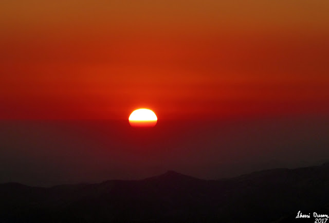
For my part, I am tired, so quitting time does not come soon enough. Sherri fixes a dinner of chicken and pasta. Not bad and it does me OK. Usually after dinner we will go down and walk a ways just to stretch our legs. Tonight, I am content with just sitting around talking. Night eventually comes and we are treated to a colorful, smoky sunset sky. One of those reasons why we keep coming back to the lookout. This is followed by a full moon. Only wish I was awake enough to enjoy it. But I fall asleep by 9:30.
Windcock against setting sun
Firefinder and evening sky


August 8, 2017


That was a good night sleep. Only got up once to go pee-in a bucket. I definitely did not want to walk down and then back up to go to the outhouse.
The thing about a lookout is you want to have a good clear view all the way around you, 360 degrees. So all the walls are windows. But this also means that all the light outside comes in. The full moon last night illuminated the lookout interior. It also means that morning light gently breaks over you around 5:30am, which is the time I woke up. By 6:00am I was up and about. It is a beautiful morning.
Pine Ridge morning shawdows
I have been thinking about our radio problems and decide that I would clear off all of the scanned channels and the priority channel and then reset them up on the base radio. That I do. I then click the mic and still hear it over on the Sierra side. Something is wrong with the base radio, so my plan of attack is to use the handheld for both sets of communication, leave copious notes and notify Mich and Wendy about the situation. That I do. When I talk with Mich, she says she is only hearing my clicking on the Sequoia NF side, not the Sierra. Why? She has one more suggestion-check the handheld for scan’s. Sure enough, that has been set to scan Sequoia channels-the source of my clicks, but not my original issue. Thank you Mich.
Oat Mountain
At 9:30, we go into service with both forests and begin our calm day. I find more web pages which we can use to help out hearing the status of the forest. Each morning we get the morning staffing as well as weather. All of this information is written down in the lookout logs. This a communication tool for the next people who staff the lookout after us.
There is much more buzz throughout the day about the Butte Fire we heard about yesterday. In the afternoon, we hear an order for a Type One Helicopter. These are the largest helicopters the forest has available to them. They are able to lift 700-2,300 gallons of water. The Butte Fire must be really going. It is now on InciWeb as well.
More clouds
By now it is getting a bit late. Sherri cooks another meal of chicken and pasta while I do another final scan-still no smokes. Delilah has one more radio trick for us. When Sierra calls our name to go out of service, our handheld is a low battery, so it will not transmit. Mich calls over to let us know and we issue a phone call to go out of service, after changing out the battery.


Fallen Branch
It is now a 90 minute drive home. Still like a bad horror movie, Delilah will not let us go. Delilah does not get many visitors and we find out why. A pretty good size oak branch has fallen across the road just inside of forest service area. We are able to move it and be on our way. We are glad to be back home, but wanting to go back up to Delilah again in September.


Trail LessonSometimes we jump to the unnatural conclusions being blinded to the more obvious answers.


Background
*Channel Restrictions-Within the radios the frequencies we use get put into channels. Each channel is assigned a purpose. With Sequoia NF there are channels used for administrative or command channels. When there is a critical need, such as a fire which needs coordinating for its efforts, a channel will be used only for that purpose. Hence a channel restriction.
**Sierra and Sequoia. Delilah sits at the edge of both Sierra and Sequoia National Forests, as well as Kings Canyon National Park. Each has its own command centers, not only for fire but for law enforcement and other administrative purposes. Each uses different frequencies to communicate with its personnel. So when we need to communicate with each entity, we use different channels. At Delilah we have a base radio which we talk to Sequoia with; a handheld radio to talk with Sierra.


Extra Photo's
Gary at dusk

Sunset over Pine Flat Dam

Setting Sun

Fresno lighting up


Animals

Turkey Vulture