Saturday, April 9, 2016

April 9, 2016 - Morro Bay State Park

Title: April 9, 2016 - Morro Bay State Park
Hike Info : Description : Trail Lessons : Extra Photo's : Animals : Flowers and Plants
Trail head: Quarry parking Lot
Hike Info:
Type:  Hiking
Trail: Quarry Trail, Canet Trail, Crispi Trail, Chumash Trail, Park Ridge Trail, Live Oak Trail
Destination: End of Quarry Trail
Distance: 4.95 miles 1
Start Time:  11:24
End Time:     2:01
Travel Time: 2:37 (1.89 mph)
Moving Time: 2;17 (2.17 mph)
Elevation Rise: 1,020'
Maximum Elevation: 406'
 1The GPS did not track for about a fifth of a mile. So I doubled the segment coming to get a truer reading.
Description:
 We stayed last night at the Beachwalker Inn in Cayucos. It looked like the owners have made an effort at upgrading itself from a Motel 8 look-a-like to a low cost, comfortable lodging. The breakfast was basic: cereal and bagels. We did a walk to the Cayucos Pier before checking out. Pleasant enough morning.
We wanted to do a hike before heading back to Fresno, so we went to Morro Bay State Park. A few years ago we did a series of trails to the east of the bay. Today we shall revisit many of these trails.we park at the Quarry trail-head. The skies are threatening, but we will at least get a little walk in.
Cerro Cabrillo
Tiki Man
There is three things I notice right from the get-go:
  1. this first quarter of a mile has gotten steeper since we last walked it;
  2. mosquitoes are out and they are certainly buggy;
  3. because this is a spur of the moment, we do not have a map, so we shall rely on memory.
There is overcast skies, so no direct sun. During the couple of weeks we have hiked ails where there is a riot of color. But the flowers are more points of light than an easel. Both are good on the eyes.

Hollister Peak
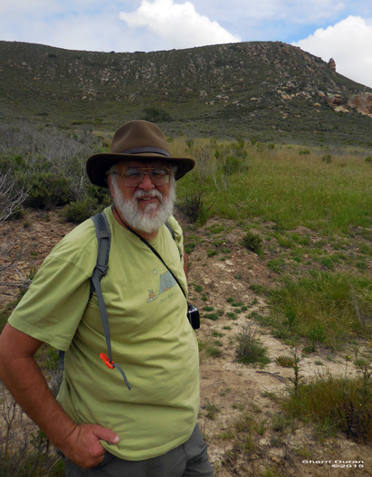
Gary and the Tiki
Once we make the first trail junction, the trail eases up and our pace quickens. But I do feel more of the need to continue my hiking beyond the occasional hikes I have been doing. On our left is the Tiki Rock. Yes it really looks like one of the Disneyland tiki characters. As we travel towards the southeast, Hollister Peak rises higher directly in front. Now to the left of Hollister is the quarry, and the park boundary.  Here we climb 70' and the trail magically changes into the Canet Trail.
With as many trails as there is, most of them sort of crisis-cross the area. But rather than feeling crowded, the waist high brush tends to hide them, except when we look down on them. We meet two bikers on the trail, and five other hikers over the five miles. I also meet a tick, which I brush off. When we hit the Chumash and Crespi Trail Junction, it is decision time: go back to the car or hike for another hour. We hike.

The Crespi trail, named after Father Juan Crespi, leads south from our junction. It contours, or at least follows the edge of the hills above a plain before hitting a ravine. So we get a good view of the Morro Bay Estuary and enjoy some pleasant walking. There is a checker butterfly which dances along with us. Then the trail dips into a ravine where we encounter a small group of moss covered trees. Enjoyable.
Shortly after the moss trees, would be a great horror show, the trail does a short climb to the top of the ridge then descends to the Chumash Trail. The Chumash Trail is follows a gas line which bisects the State Park. So it pretty much is a straight shot, which makes it short walk. But as come back to the trail junction with the Canet Trail, we rise up steeply. At the junction we turn and go Park Ridge Trail. In reality, it is a road. We quickly realize that this is going to the wrong trail head. But it is not a worry as we can see the Live Oak Trail coming up and off we go on that.
Portola Hill

Now why is it called the Live Oak Trail? I do not know as I do not see that many oaks which would make it a noteworthy oak trail. But we are tiring and ready for lunch. So we do not go up the Portola Hill Trail, but head straight back to the Quarry Trail and now back to the car.

Once back at the car, it did not take us long to decide where to eat: Sylvester's in Los Osos, home of the best burger in the world! It did not disappoint as I got a Desperado and Sherri a California. So good and so filling. Then it is time to head back to Fresno. But on the way back, we stopped at Bravo Farms for ice cream in Kettleman City. Such a good way to end a day.
Trail Lesson: Be prepared for mosquito's anywhere, anytime.


Extra Photo's


Morro Bay and Estuary from Canet Trail

Sherri on the Canet Trail

Gary on Live Oak Trail

Quarry Trail carrying Gary
 
Crespi Trail

Morro Rock from a distance

Animals
Cricket maybe after being digested?


Our friendly checker

Flowers and Plants


Friday, April 8, 2016

April 8, 2016 - Down the Coast

Title: April 8, 2016 - Down the Coast
Hike Info:
Type:  Car
Trail: Highway 1
Destination:Morro Bay
Actual Destination: Cayucos
Description:

Anytime you go down California's Central Coast, it is simply awesome. But today with the threat of rain and the clouds playing in and out of the coast, it gets beyond that.

I am leaving my brother for a week with my Mom. It will be a time of respite for us. Today we go down the coast and tomorrow it is back to Fresno. We head south on 85 and then 101. A stop in Gilroy has us at two outlets: Columbia and Jelly Belly. We got some rain stuff at Columbia. I bought a pair of rain pants while Sherri got pants and some other things. Of course at the Jelly Belly store, you can guess what we got there.

Then we head down 101 until we get to highway 156 until we joined until highway 1. That is when the scenic part of a trip begins. We travel through Monterey and Carmel. Then the clouds started coming in along with some rain. Does that make it a bad view? No, Clouds coming down and covering the mountains and the waters, poking their headings through the clouds. It was this way all the way down the coast. Even the flowers stand out in this environment. So lots of pictures-you can tell that from everything below.


As we got towards Cambria, we realize we had no lunch, so the Main Street Grill is looking attractive. And it is and fills us up with some good burgers. Then where do we want to stay tonight? We go through Cayucos. We tried to find a room at a place we stayed 10 years ago, but they were much more expensive and there was no more room. But then we stopped at the Beachwalker Inn and found a room there. Pretty decent place. Good night sleep.


McWay Falls

McWay Falls


Thursday, April 7, 2016

April 7, 2016 - Lands End

Title: April 7, 2016 - Lands End
Trail head: Lands End Visitor Center, San Francisco
Hike Info:
Type:  Hiking
Trail: Lands End
Destination: Loop, but at least do the Lands End Trail
Distance: approx 7 miles 1
Start Time:  1:15pm
End Time:    5:30pm
 1I did not wear a GPS for this trip. so the mileage is a guess based up maps.


 Description:
My brother David is with my Mom for the next 10 days, so Sherri and I are able to do a few things. One of the things which we talked about doing was spending a few days in The City. But the forecast calls for rain, so we decided to make it a single day here. Andrea has her Spring break going this week so she decided to join us.


We picked up Andrea from the Colma BART station and drove over to the Lands End Visitor Center in the Golden Gate National Recreation Area. Of course if there is a Visitor Center, you need to be sociable and visit it. And that is what we did. We picked up a walking map of San Francisco and a book called Stairway Walks in San Francisco. We saw this book on a previous visit and fell in love with a few stairs we climbed before. So if nothing else, it will be a good reference book. By the way, did you know there is at least 671 stairways in this city?

Gary and Andrea looking out into the ocean

Gary and Andrea on a wall
By the time we start walking, it is 1:15. The first place we go to is the Sutro Baths ruins. If you like looking at old walls and places where people used to swim, this is for you. But it does take a bit of imagination to visualize the grandeur this place had a hundred years ago.  Andrea and I walk the walls, while Sherri is content in taking pictures of us. This keeps us off the Streets of San Francisco for 20 minutes or so. The we start walking back up the path we came down-both ways seem steep.
Sherri climbing out of Sutro Baths

Sutro Baths-Ruins


Just above Sutro Baths we traveled through a tunnel where you could hear the ocean waves pounding against the rocks under you. Then the path leads us out onto an old observation deck. I think if you know what to look for, you might be able to look for where the Ohioan sank in 1937. We look around and then head up these stairs back to the Lands End trail. For such a gentle path, these stairs are pretty steep. Once at the top, the Lands End trail continues along the bluff. We pass underneath the USS San Francisco Memorial-deciding not to go up to it. Evidently I am not the only one who feels a bit fatigued by this walk.

There is a little trail, with lots of steps, to a place called Mile Rock Beach. Not sure why it is called Mile Rock, but on top of the rock used to be a lighthouse. Now there is a helicopter landing pad with a beacon. So we go down these steps to the beach. At this point, I think I need something to eat. Something is not right. So out comes a couple bars to consume. Feeling better afterwards, but still not there yet. We climb back up the stairs-did I mention there is a lot of steps on this stairway?  We do find out that this stairway is mentioned in the book we just bought.

Afterwards, we find out we should have taken a side trail as there is a labyrinth there. But we did not. So onward we go. The Lands End Trail continues to be mostly flat, but there is a detour around the Painted Rock area which has, you guessed it, more stairs. But eventually, we make it out to the Eagle's Point Overlook where we get a good view of the Golden Gate. Along the way, we have been enjoying the flowers growing by us. I do not know enough about botany to identify, but they are nice to look at.


Golden Gate
Now it is getting to be mid-afternoon and we have not eaten, so we decide to head towards a place on Balboa Street. This has us going along a path at the edge of Lincoln Park Municipal Golf Course which drops us out on Clement and 34th Street. From there is is a few blocks of walking before we get to Chino's Taqueria. Sometimes when you go to a hole in the wall place, you think well, I do hope the food is edible. This is really good. We all had burritos, which they have an assortment of tortillas-flour, spinach and red-maybe chipotle? I had a regular and was well fed, I do not think I could have finished off the grande.

Having been revived, off we go down Golden Gate Park, enjoying the walk, seeing bison and windmills. Once we hit the ocean highway, it is time to head back to the car. But not without stopping at the Cliff House-not going inside, but enjoying the view from the patio. The Camera Obscura was closed.

After getting back to the car, we take Andrea back to Colma and the BART station there. Then instead of returning to Mountain View, we take a leisurely ride down the coast. Many places to see. Of course, once we make it to Santa Cruz, still stuffed from the burrito, there is only one place we can go-that is MariAnn's for ice cream. Good stuff. Now we can go back to Mountain View and rest up.


Saturday, April 2, 2016

April 2, 2016 - Alder Creek

Title: April 2, 2016 - Alder Creek

Trail head: Mosquito Creek
Hike Info:
Type:  Hiking
Trail: Alder Creek
Destination: Alder Falls
Distance:  8.24 miles
Start Time:  8:46
End Time:   1:37
Travel Time: 4:51 (1.70 mph)
Moving Time: 3:52 (2.13 mph)
Elevation Rise: 1,689'
Maximum Elevation: 5,842'


Description:
Sometimes this blog does come in useful. Earlier this week I got an email from Dana whom I had not seen in awhile. She is taking some people on a hike up to Alder Falls and was wondering if there was poison oak (None that I have ever seen). But the thing which I would be concerned about would be snow. We have had soon up on the railroad bed in mid-April in a drought year and this is a normal year, two weeks earlier. Dana also invited me along. So after making arrangements for Mom care, I accepted.

We are meeting 7:00am and it looks like there is five of us: Dana and I, as well as Betty, Konnie, and Cece whom we will meet in Oakhurst.  We leave Starbucks in Oakhurst, but make a pit stop in Wawona, before hitting Mosquito Creek Trail Head around 8:40. But the excitement starts before we reach Fish Camp. There on the  side of the road is a coyote, waiting patiently to cross it. Then just before Wawona a couple of young deer go bounding up the embankment. But except for a few birds, that is the end of the wildlife for us.

Burnt forest from 2008 burn
Downed tree crossing
From the parking area at the horseshoe bend at Mosquito Creek,  we cross the road and start our trek up. Because of a 2008 prescribed burn, much of the big growth has gone away, to be replaced with brush. While this sounds like it is no big deal, for the first 3/4 of a mile we are fighting through this brush which have grown more obstructive each year since.Now they are overgrowing the trail. You combine this with many new logs falling across the trail, it is becoming an adventure just  going up the trail.

Hikers on trail
Now you throw in that I have not had any real uphill in months, I quickly go to the back of the line, huffing and puffing. I am not too far behind, but if there was masculine pride, it would have been severely wounded. I think between the weight, lack of exercise, and a pretty good climb, it is taking its toll on me.You can hide some of this by stopping to take pictures, but I do not think anybody was fooled. But the one advantage I have is that I know this trail and am looking forward to the trail junction with the one coming in from Wawona.

Betty and a dead tree
Why you might ask? Well the trail will be more rolling than up and I can use my longer stride to make up for the lack of conditioning. But the walking becomes a lot more pleasant and the miles start to go by along this stretch. The brush becomes more sparse, but there is still logs to cross. I enjoy talking with Dana about books. Some of the books concern the history of the early explorers of the region and I am able to regale my fellow hikers with some of the background of the area, including the railroad bed we are aiming for. (I hope it is regaling, and not just polite boredom.)

Alder Falls
Once we reach the railroad bed, we can really make good time. It is flat and the stride is easy. We see many of the ties still in the ground or stacked on the side. Also when we pass a couple of creeks, I admire the stonework which the builders did to make the crossing easy on the trails. But one the greatness of the trail is that when you round this one corner and the falls come fully into view. Even as often as I have seen the falls, today they are a lot fuller than I have seen in awhile. But it is special because of my fellow hikers have not seen the falls before. Even common sights take on a specialness when you see how it affects those seeing things for their first time.
After Lunch

We stop and eat lunch below the road bed, close to the creek. Cece and Dana have made cookies and are sharing them with us. Konnie provides Wasabi peas. All are good. Then we climb back up to the road bed and start off a little ways above the falls. I think the ladies would like to go all the way back to where I have told them there is a camp site.

Tromping through snow
But this is Spring and we get stopped by a creek about 3/4 of a mile beyond the falls.  While not wide, it is now something we can jump over. There is a log across it about 10 feet above the trail, but it does not look too passable-it is, even Sherri has gone over it before. But just getting here, we have had to go through snow, not bad snow. It is crusty and most of the time you do not sink and when you do, it is only 6" at most.  Still everybody sees the handwriting on the wall and we decide to turn back.


Alder Creek above the Falls
Coming back I walk with Cece and have a wide-ranging and pleasant conversation, going from John Muir in Yosemite to diabetes to conditioning for my upcoming JMT trek in August. All in all a good and encouraging conversation. We also get to take in some of the sights, such as the prettiness of Alder Creek above the falls.  Or just the pleasantness which water in this area brings. Let us hope for more.

We get back to the cars around 1:30. There was several comments about how early it is still. The decision is to go on back to Fresno rather than stop in Oakhurst for food. That is good since Sherri and I and the family will be eating Chinese tonight at the Shanghai restaurant.  But then Dana mentions that she really likes a Mexican restaurant I recommended to her a while back, and that gets me to thinking Mexican for dinner. We get back to Fresno around 3:00pm, dropping everyone off and I head home.

I am a bit tired. My mom has just woken up when I get home so it does not seem like I get much rest. But neither do Sherri or the kids since they just rode 32 miles in the Classic California mini-metric bike ride. Tomorrow we do a half-marathon which should tire us out even more. It is good that I still have a body to do these things. Today is a reminder to take care of it.

P.S. That snow I was concerned about-none to the Falls and a pretty thing layer afterwards. Moral of the story? Do not fret over possibilities, but enjoy the adventure. Of course, if there is a good possibility that what has you concerned will come about, heed the warning.


Trail Lesson: If you want to enjoy a commonly used trail, just re-adjust your eyes and see things like this is your first time.

Top of Alder Falls.