Title: September 1, 2014 - North Boundary a Trail to Panoramic Point
Hike Info:
Type: Hiking
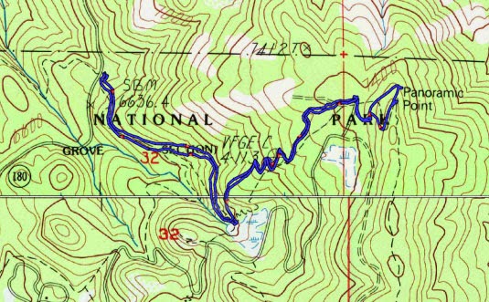
Trail: North Boundary Trail and the General's Highway
Destination: Panoramic Point
Distance: 3.34 miles
Start Time: 10:48
End Time: 12:54
Travel Time: 2:06 (1.59 mph)
Elevation Rise: 864'
Maximum Elevation: 7,513'
 |
| Fritz and Gary |
Today we say farewell to Fritz, but not without breakfast and a hike. I have a hearty meal of pancakes. Then we get packed and ride up to our trail head. This is a familiar trail which we hike in the Spring or even tackle with snow shoes. Fritz knows about it from the 80's when he worked up here.
 |
| Gary and Sherri |
The North Boundary trail is usually one where solitude is encountered. Not many people use it. It starts up at a pretty good incline, but then moderates it slope. It quickly turns into an old road bed for a short ways. That is until we reach a meadow. Here we turn up a sort of hidden trail instead of cutting across to the road to Panorama Point.
Our hidden trail involves a bit of "fern wacking", but then it cuts across a slope and we have a lot gentler time than we usually do. In the past we have gone up a trail which allow access to some power lines. But Fritz finds the real trail which goes up at a more trail-like incline.
 | |
| Buck Rock From Panorama Point |
But then we return back the same way we came up, except we do travel faster. This puts us right about lunch tine.so we go Grant Grove and say goodbye to Fritz. Sherri and I head back to Fresno. But Fritz, according to his Facebook page must be a bigger hiking fool than Sherri or I as it seems line finished in the late evening. It has been a good three days.


No comments:
Post a Comment