
Title: July 18, 2015 - Sonora Pass

Hike Info:
Type: Hiking
Trail: Pacific Crest Trail, south of Sonora Pass
Destination: Undetermined
Distance: approx 4 miles 1
Start Time: 12:30
End Time: 3:00
Ascending Elevation: 600'
Ascending Elevation: 600'
Maximum Elevation: 10,220'
1No GPS information
1No GPS information
Sherri and I were invited to backpack with the Millers on a stretch from Sonora Pass to Tuolumne Meadows. We had other commitments so we could not walk with them. But we did volunteer to shuttle their car around from Sonora Pass to Tuolumne Meadows. It gives us a good excuse to be out and about, explore areas we normally do not visit, and even better yet, enjoy the friendship we established on the Trail a couple of years ago.
Sherri and I went up the night before to close to Sonora Pass.to stay the night. On the way up we stopped in at Mariposa and visited Faith Rumm at her studio. She is an artist. A good talk with her. I had been here once before, but Sherri had neverseen her. Sort of ironic since it is Sherri who had the original contact with her through Facebook. Also on the way up we stopped in Sonora for a sort of lunch/dinner at El Jardin. Ate well, food was good. There is also an El Jardin in Turlock which Joe and Margaret have taken us to.
 |
| Sherri at camp |
It is starting to get a bit late in the afternoon. While I do not mind pitching a tent at night, I feel more comfortable finding a place to camp and pitching the tent in the day. So on the way up, we stop at the MiWok Visitor Center. Purchased a map for the Stanislaus National Forest-mine is at least 30 years old. On the way out, we met a law enforcement officer. Friendly fellow. He was very enthusiastic about a smart phone app called PDF Maps from Avenza. He showed us all sorts of things he could do with it and the map we just purchased was cheaper on the app than over the counter. Will look at it when we get back.
 |
| Night Lights |
It was a quiet night and we get up before most of the other campers. Breakfast is quick and we are on the road to meet Ray and Rachel by 8am. They are schedule to get to Sonora Pass by 9:30. This is beautiful territory and we must explore a little more.
We arrive early and no sign of them. So we just wait around. I do walk over to a day use area just in case they are there. There is a couple which does PCT restock with their truck-store there. They are called the Sonora Pass Resupply. I get into conversation with Sherri-not mine, but the restocker. They have a mini-store catering to the needs of PCTers.
 |
| Red Tailed hawk |
One
problem with Sonora Pass is that there is.no cell phone reception. As
the hour goes to 10, then 11, we wonder what to do. But we figure we can
wait at least until 5, if not later.
 |
| View from Sonora Pass |
 |
| Rachel and Ray |
The trail up goes pretty good. At first I am thinking Ray and Rachel have an 8 day pack on them are they going to buzz by me with just a light day pack? But no fears there. They settle down into a pace which even I can fit into. Some of it, this section of the trail is a the steepest they will face all day and it looks like they will need to go between 10-13 miles before they camp tonight.
 |
| Rachel, Sherri and Ray |
But the redeeming part is with each step, the view becomes prettier. Wildflowers are poking their heads out from underneath stone and log. All of this makes even this steep hike enjoyable.As we go up, we catch up on how things are with the Millers.
 |
| Gary and Rachel talking |
 |
| Ray and Gary looking over packs |
 |
| Ray, Sherri and Rachel |
By now, we have traveled two miles. The time is later than we anticipated, but it is well worth the time on the back end. From the time we met them on the JMT in July 2013, we have enjoyed their company. So every step we take with them is one we can enjoy their fellowship. But it is time for us to turn around. We saw our goodbyes and wish them God's speed on their way.
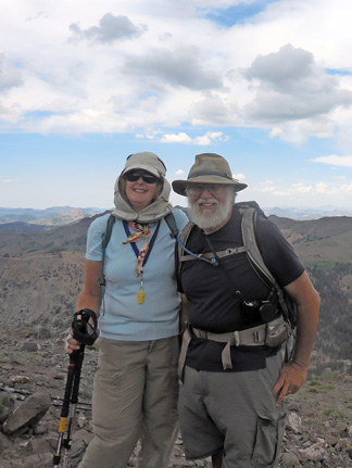 |
| Sherri and Gary |
 |
| Rachel and Ray |
 |
| Parting shot |
 |
| West of Sonora Pass |

We get down pretty well in good time, about 3:30 or so. Now it is my turn to drive Rachel's Prius. Seems pretty straightforward. We come down Sonora Pass on the east side, pretty cautiously-me because I am driving someone else' car; Sherri because she is not used to driving in the mountains. All is safe and at least neither of our cars had that burnt brake smell. We hit 395 and pass through Lee Vining. We stop at the Mobil station or if you prefer, the Whoa Nellie Deli. It did not disappoint. Then through Tioga Pass and then Tuolumne Meadows. Rachel's car is left at the stables parking area and we are off home.
 |
| Small trees and PCT |

Hike Info:
Type: Hiking
Trail: Crane Flat Lookout
Destination: Crane Flat Lookout
Distance: approx 2.5 miles 2
Start Time: 7:00pm
End Time: 8:15pm
Ascending Elevation: 450'
Ascending Elevation: 450'
Maximum Elevation: 6,844'
2No GPS information
2No GPS information
Well we thought we would head straight home, but on the Stanislaus National Forest map I had bought yesterday, I noticed a trail to the Crane Flat Lookout. It looked pretty short, and since we still had sunlight, we thought we would try it.
The trail comes out of the Tuolumne Grove parking lot. But instead of heading north to the grove, you go to the western end of the parking lot There you find the remnants of a road-is this part of the old Tioga Road? The trail is unmarked, but we follow it anyway. It is pretty gentle. After a little ways, we pop out onto a paved road heading northwest. We do not see any sign of our road, so we follow this one. It seems a lot longer than the map I had, of course that map had little granularity and it was not concerned with Yosemite, but Stanislaus National Forest.
 |
| Fire Helicopter |
 |
| Crane Flat Lookout |
They said to go on up and take a look around. There is the usual tools of a lookout sans radios. Things like maps and an Osborne Fire Finder. We also get a good view. The pilots said to be sure to look to the west for Pilot Lookout. We find it as the sun sets. Now it is time to return back to the car. We do get back about 10 minutes after it turns dark. Then we take off and don't stop on our trip back to Fresno, getting home around 11pm. A good day.
 |
| Pilot Lookout |
 |
| Looking east at sundown from Crane Flat Lookout |
Pictures:
 |
| Eastern Sierras |
 |
| West of Sonora Pass |
 |
| Gary at Crane Flat Lookout |
Flowers:


No comments:
Post a Comment