
Hike Info:
Type: Snowshoeing
Trail:
Burton Road, 14S02
 Destination:
Weston
Meadow
Destination:
Weston
Meadow
Distance:
3.44
miles
Start
Time: 11:38
End
Time: 2:50
Travel
Time: 3:12 (1.08
mph)
Moving
Time: 2:12 (1.56
mph)
Elevation
Rise: 361'
Descent: 251‘
Maximum
Elevation: 6,919'
Description:
It has SNOWED! Today is our
first opportunity to snowshoe this year. Sherri is all gunho to go
out-not sure how my energy level is, though. But only one way to find
out.
 |
| Oh No! What have I gotten into? |
We leave Fresno at 9:30 with
Sherri driving. We are not sure where we will be going, but we think
one of four places along the General’s Highway: Quail
Flat,
Big
Meadow,
Big
Baldy or
Buena Vista Peak. We sort of would like to do Buena Vista-2 miles
with 650’ elevation gain. A stop at Big Stump and drivers
change-Sherri does not like to drive when there is a hint of snow.
As we go down the General’s Highway, the decision on where to
snowshoe is made for us-there are gates across the highway at Quail
Flat. So we will snowshoe down the road towards Little
Boulder Grove-this
is the same one we went down last August to hike the grove. But we
will not be doing the 10 miles to get to the grove.
 |
| Start of our Trip |
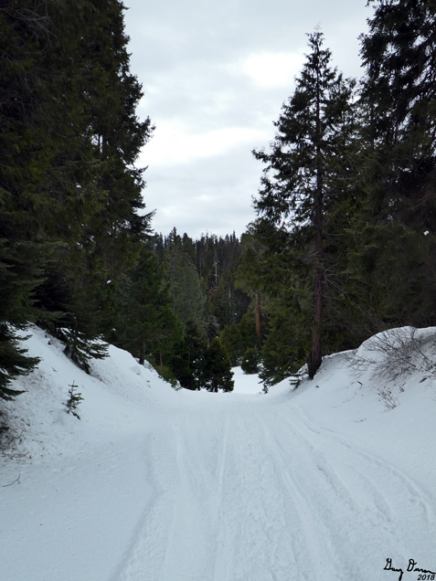
We get our snowshoes on and
are on the trail by about 11:30. Our route goes down a paved Forest
Service road, 14S02, also known as Burton
Road.
The slope is a gentle down. The forecast said it would be clear and
sunny, but we see nothing but overcast. Does not look like rain.
 |
| Gary gazing out |
 |
| Sherri marching on |
Nothing spectacular at the
start. But occasionally we will see a scene in the distance. Not sure
if it is Spanish
Mountain
or part of the Monarch
Divide.
We go at a nice pace. But because we are going down, I am not sure
how well I will be doing coming back up again.
There a plaque saying this is
the site of the Kirkland Meadow Plantation. Looks like it was planted
beginning in 2003-lists several donors. Wonder if this is something
to be explored?
 |
| Gate to Private Property |
As we round a ridge, we get
our first good look at the ranges across the Kings
River.
There is a bit better look further on down when we cross an unnamed
meadow. Still this is not jaw dropping stuff. But we do start to see
Buck Rock and its lookout. This is really good as we do enjoy
staffing lookouts associated with Buck
Rock.
 |
| Unnamed Meadow and mountains behind it |
Then we come to Weston
Meadow-the
road splits the meadow in two. But we thought we would like to follow
a split in the road, but then we got to a gate which said private
property. After talking about it for a few minutes, we decided to
continue to follow our road and find out about the private property
later on. That is when we got to Weston Meadow along the road.
Pleasant place with a nice fence.
 |
| Weston Meadow |
 |
| Our Route |
About a quarter mile later, we
found a stump, covered with snow, near a cabin. After clearing off
the snow from the stump, we sat down and had lunch of peanut butter
and nutella-life is good! We decided, that even though we had only
gone about a mile and three-quarters, we felt, or more accurately I
felt, it was a good place to turn back.
 |
| Buck Rock Lookout |
We retrace our route coming
in. But I can feel like I am going slower and needing to stop more.
Fortunately, there are new views to see-one of the good things about
retracing steps. You get to see what you missed going in. Such as at
Weston Meadow, there was a young Sequoia tree tucked away at the edge
of the meadow. A little later, we came to another ridge and had a
really good view of the mountains beyond the Kings River.
 |
| Mt Goddard on left in background and Finger Peak to its right |
 |
| Snow Snail |
We got back to the car just
before 3. I was tired. But a good tired, also a disturbing tired.
Disturbing is that I should not have been so tired with so little
walking. But the encouraging part is that I am still out doing it and
enjoying it. As we traveled down the mountain, we realized how clear
the air was. The comment was made, really wish that when we are in
the lookout we had air this clear. On the way back to Fresno,we
stopped at Bear
Mountain Pizza.
it is under new owners, but still the same menu. Might be changing up
a bit before summer.
Background
Kirkland
Meadow Plantation. Apparently this has to do with restoration of
clear cutting done by a lumber company, and then the replanting.
There is also a project
to thin the forest to restore a more natural balance in the area. As
far as exploring, it looks like it is in more of a conjunction with
the Sequoia groves in the area.
 |
| Buck Rock Lookout |
 |
| Buck Rock Lookout |
 |
| Buck Rock Lookout |
 |
| Buck Rock Lookout |
 |
| Buck Rock Lookout |
 |
| Tombstone Ridge |
 |
| Young Sequoia at edge of Weston Meadow |
 |
| Snow Snails |
 |
| Finger Peak |
 |
| Obelisk and Tombstone Ridge |
 |
| Mt Goddard and Finger Peak |
Flowers and Plants
 |
| Sugar Pine Cone |
 |
| Chinquipin |

 Destination:
Weston
Meadow
Destination:
Weston
Meadow


No comments:
Post a Comment