Wednesday, March 16, 2016

March 16, 2016 - Hite Cove

Title: March 16, 2016 - Hite Cove

Trail head: Savage Trading Center
Hike Info:
Type:  Hiking
Trail: Hite Cove
Destination:Hite Cove
Distance: 7.23 miles
Start Time:  9:10
End Time:   2:38
Travel Time: 5;27 (1.33 mph)
Moving Time: 3:52 (1.87 mph)
Elevation Rise: 1,549'
Maximum Elevation: 1,713'


Description:
And why do you worry about clothes? See how the flowers of the field grow. They do not labor or spin. Yet I tell you that not even Solomon in all his splendor was dressed like one of these. If that is how God clothes the grass of the field, which is here today and tomorrow is thrown into the fire, will he not much more clothe you—you of little faith?   Matthew 6:28-30

It has been awhile since doing a meetup hike and I am a bit apprehensive that I will be able to be strong enough to do this. Caring for Mom is rewarding and draining. It does not let a lot of focus be on my needs for fitness and more on taking care of her. But one must start someplace. Sherri is taking care of her today, so I can go on a hike-thank you.

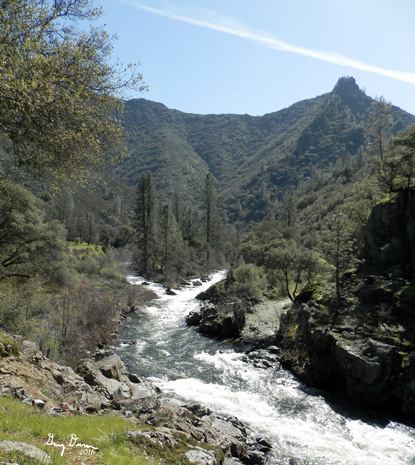
 Merced River
Carol comes by at 6:10 and we get to Eddie's Bakery a little before 6:30. When coming in, we notice steaming coming up, but not from my car. It was Betty's right beside me. After conferring, Betty decided to go back home courtesy AAA while the rest of her contingent would get a ride back with Richard. (Water pump went out, but the car and Betty made it back home ok) So off we go, all 19 of us. After stopping at the Burger King in Mariposa for coffee and bathroom services, we hit the trail head at 8:30.

South Fork of the Merced River


The morning is brisk and we start in without too much ado. Bruce is in front with Jerry K at the end, with Dan. They both would stop frequently to take pictures. I would walk someplace between Lora and them. I can feel that both the lungs and legs both feel the lack of use-what other body part has an "L" can hurt? But the walking is good and on the level ground I am able to hit my stride.


Sunlight and Flower
Field of Flowers
While that is an interesting sidelight, at least from my perspective, the real show is the flowers. Poppies were the main show, but there was an assortment of a strong supporting cast: the white flowered chamise, redbud-even though it is purple, larkspur showing its royal violet color, even some Baby Blue Eyes. You throw in walking beside the South Fork of the Merced River for 3 3/4 miles, it made for a spectacular show for the eyes and ears.


Field of Flowers


Log Jam causes Trail Jam


But there are serpents in this garden which is called poison oak. It seems like this nuisance was determine to reach out and touch us every chance we got.  It was growing all along the side of the trail and intertwined with other bushes, making it hard to avoid. Then there were many fallen trees to provide for extra exercise. Some we climbed over, others scooted underneath. Then there was one one where branches were scattered across a creek. Going across one of these logs, the battery cover on my camera opened and I ended up chasing my batteries, But what can you say? This is how an outing should be: not tame, maybe not too wild, but not civilized either. We want to see nature out there and trees down and poison oak help to give us appreciation of the world we live in.

Field of Flowers

Seasonal Creek by trail
Seasonal Creek flowing into Merced
This trail, even though you rise only a net of maybe 300'. has plenty of ups and downs to get your legs into that rubbery feeling pretty quick. Plus there are places where the trail is narrow and a bit rocky where care is needed. In addition to the flowers, there is water coming down the sides of the hills which I had not seen before on my hikes. Both on the trail side and across the Merced. Fun to walk in a year when there is actually water.
Field of Flowers


Trail to Hite Cove
Lava Rocks and Merced
By the time you get to Hite Cove,  you are ready to have a good break in the walking. Hite Cove itself is not a glorious place, but a bit of history. The area was mined and as you go along, you see old machinery laying around.


Field of Flowers by the Merced


The trip back was a bit more brisk and I was definitely more tired, so in places I lagged behind. The heat, evening though only in the low 70's was definitely bothersome. I kept sucking on my water bladder. You could tell my the number of red faces I was not the only one. But we all got off the trail and then proceeded to Mariposa and an after hike meal at Happy Burger.
 
Henness Ridge and South Fork of the Merced River
Three warnings if you decide to travel this trail:
  • The signage is not accurate. The first sign you see says 4 1/2 miles, I think one way. It is more like 3.6-3.7 miles. My GPS has been pretty consistent about it. About a a mile in you will see a sign saying you have gone 3/4 of a mile.
  •  The first mile is on private property, but from what I can tell, the Forest Service must have been given an easement for this trail.
  • This is not a well maintained trail. Several places you need to use caution.
Poppies along our path


End of the trail in sight


Larkspur, I think

River and flowers

Redbud by the Merced

Baby Blue Eyes

California Golden Poppy

Hite Cove Area


Saturday, February 27, 2016

February 27, 2016 - Pincushion Peak

Title: February 27, 2016 - Pincushion Peak

Trail head: Cow Chute on Finegold Road
Hike Info:
Type:  Hiking
Trail: Pincushion Alternate
Destination:Pincushion
Distance: 2.38 miles
Start Time:  9:51
End Time:  12:42
Travel Time: 2:50 (0.84 mph)
Moving Time: 1:30 (1.59  mph)
Elevation Rise: 913'
Maximum Elevation: 1,538'

Description:
We have been up Pincushion before-a 1,500' mound surrounded on three sides by Millerton Lake. But it has been by the trail from the State Park side, not from the FineGold Road side. So this should be a fun adventure for us.

Also, this is the inaugural hike for the Moving Mountain Hiking Group on Facebook, put together by Shawn for some friends of hers who wanted to hike with her. We meet at 9:00am, a totally ridicules time to start a hike. Aren't all hikes to start at 6am, 8 at the latest? But it is just a short drive from the Four Corners area in Madera to Table Mountain Casino and then down Sky Harbor/FineGold Road.

East to Table Mtn
There we find some old hiking friends: Lee and Donna, and Lori and Wayne by the trail-head at the cow chute.  After grouping up , we take off.  Immediately the trail starts it's ascent, and not your gentle rolling hills, but a let's tackle this Hill straight on trail. Turns out this is about an 800' climb per mile,  or a 15% grade.
But there are several things making this an enjoyable walk. The rains we got in January are making the hills be covered with shimmering emeralds, or at least the color there of.  On top of that a pattern of whites, purples, orange and rose sprinkle through this covering. The one thing marring. The scene is a layer of gray which only more rain will wash out of the sky.
Gary and one of the new hiking friends
Most of the people I am hiking with today are new to me. But as one person noted,  these are friends  of Shawn, so they must be nice. This is a true statement, at least with these  friends.  I enjoy walking with several of therm. It also gives me a chance to catch up with Lori and gain some new knowledge, such as what EMDR therapy is-will at least an overview.
By this time, we have reached Pincushion's top. We spend some time up here, gawking at its 360 degree view.  If only a it was a clear day. Even the coastal range would be in view. So we are content with seeing only the shadowy form of  the snowy Sierras to the East. Even Delilah is fuzzy.

Peaks seen from Pincushion Mountain from the PeakFinder application

Pincushion Mountain
Millerton Lake and Beyond


But now, all good things come to an end and we do need to start getting down the mountain. But instead of retracing our route, we come down northeast instead of southwest. This is the trail going to the State Park. it is a bit more  interesting going down than what we came up. Even though they both are not your straight forward walk in the park hiking. But we get down, then loop back on an old dirt road which circumscribes the Pincushion. This gives new sights and a bit more walking
San Joaquin River Trail cutting through a poppy field
Like usually, I am the last off the mountain. But it was a good hike. Then it was off to the Pizza Factory in Friant for a Dam Pizza. We get home someplace around 3:45pm, slightly tired, but doing good.


Popy and Lupine fields

Fields of Color

Popcorn Flowers

Maybe Fiddlenecks?

To the North


Saturday, February 6, 2016

February 6, 2016 - Corrine Lake


Title: February 6, 2016 - Corrine Lake
Trail head: Road 222, out of North Fork
Hike Info:
Type:  Hiking
Trail: Road 8S48
Destination: Corrine Lake
Distance:  6.52 miles
Start Time:  9:07
End Time:  12:13
Travel Time: 3:05 (2.11 mph)
Moving Time: 2:38 (2.48 mph)
Elevation Rise: 748'
Maximum Elevation: 2,557'


Description:
Generally I do not like hiking dirt roads, and today's meetup hike is along a dirt road. So we shall see how I like it. We gather at 7:00am in front of Eddie's Bakery, 22 of us; many I know and some will be new to me. Bruce who is leading this hike is new to me, but from my understanding he has a vast amount of experience. Always interested in another person whose brain I can pick.

The hike starts a little out of North Fork, along Italian Bar Road where the Exact Center of California is located-but that is further down the road. Where the road crosses a flume coming from Manzanita Lake. We will come familiar with this flume as we walk today.  We park a couple hundred yards on the Corrine Lake Rd, at a wide spot and take off down the road.

One of those trees
This road turns out to be pretty nice to walk on. We able to hold conversations, many people abreast. The hills are rolling, making for a bit of exercise. Sometimes you get these dirt roads being pretty dusty, but either because we are in winter or the clayishness of the dirt, the footing is firm.

But what makes this hike good is the trees. I am a sucker for oak trees, particularly when they silhouetted against the sky. There is something which makes me just want to gaze at these trees. I cannot say they are stately or awe-inspiring. Maybe it is that they survive and thrive against odds. Whatever it is, they cause me to look and enjoy, and that is what this walk is doing for me, causing me to enjoy these trees.

Flume at our parking area
The road does follow the flume as it flows in and out of hills, or goes under the road and disappears someplace only to reappear again a half mile later. Sort of fun to ponder this and where it comes from (Manzanita Lake it turns out.) . John's and mine ponder picks up the pace when we notice a pumping station along the flume. Why would they have a pumping station? For what purpose? Corrine Lake is a bit higher up than the flume. But if the water is to create electricity, why pump it higher? These life questions one ponders while we are walking.

Speaking of Corrine Lake, we have arrived there. This is a man-made lake, almost rectangular with a pumping station on one end. We can tell where we walk over the penstocks. There is a small point where we can look out over the San Joaquin and where I think the Million Dollar Mile is. We break here at the lake and I pass out my brownies, which are appreciated.
Corrine Lake


Pumping/Powerhouse at Corrine Lae

Ducks on Corrine Lake


Across the San Joaquin River
Now it is time for our trip back. Sort of the same walk back. Jeffery, Jerry K and another are picking up garbage as they go along, including an assortment of what may have been balls in a previous life. That gets things into a playfull mood. Before we know it, we are back at the cars.

Walking the Road
Of course, what is a hike without stopping for eats. So we stop in North Fork at a Mexican restaurant called La Cabana. Food was pretty good.  Not quite set up for a large group, but we make do. As we were leaving, Cathey asked about some neighbors of ours. Turns out they are in the restaurant, so I turn around, go in and talk with them for awhile. At this point, one of our hikers discover that her wedding ring's diamond had gotten lose from its settings and was lost. We looked in my car and around the restaurant and could not find it. That set a low tone for our drive back. But we got back to Fresno safe, but a bit tired.