Showing posts with label Eleven Mile Meadow. Show all posts

Tuesday, January 12, 2016

January 12, 2016 - Henness Ridge Lookout

Title: January 12, 2016 - Henness Ridge Lookout

Trail head: Yosemite West, Azalea Lane
Hike Info:
Type:  Snow Shoeing
Trail: Henness Ridge Access Road
Destination: Henness Ridge Lookout
Distance: 2.12 miles
Start Time:  10:06
End Time:     1:17
Travel Time: 3:11 (0.66 mph)
Moving Time: 1:44 (1.22 mph)
Elevation Rise: 424'
Maximum Elevation: 6,384

Description:
Lets try snowshoeing again. After the last time I got sick for two and a half weeks-not a cause and effect. But I am still recovering from it. Today four out of six people whom I am doing the JMT with this summer will be going: Sherri, Rose, Kim and myself.

We get out of our house at 7:00 and pick up Kim on the way to Rose's ranch. I suspect that the conversation in the car and on the snow will be similar to that on the trail this summer. But it could be worse. We stop in Oakhurst for a Starbucks, by popular demand. A short ways when we get into Yosemite, there is a sign saying carrying chain, but if you have 4WD and snow tires, continue on. So for one of the few times, our 4WD pays off and we go merrily on our way. We stop at Chinquapin to make use of the restrooms there-the road has gotten a lot more snow covered, but in most places it is not icy. Then back up the road to Yosemite West. Henness Ridge Road is fully snow covered, but it is easy to maneuver as long as I do not speed. By the way, Deer Camp trail-head has about 2' of snow where we usually park.

Snow Covered Tree
It was a bit slower coming in than what I thought we would be. But we get on our snowshoes at a turnout in Yosemite West's Azalea Lane at 10am and are off. I am in the lead and am breaking the trail along the Henness Ridge service road.  While the snow is not deep, about 2-4', it is the Sierra cement variety-not the most water I have seen, but not fluffy white powder. Most of the snow came down last week and there is a ski track, but not well used, and has some snow in it from the last time anybody was up here. Sounds like it will be a lonely day-oh goody!
The tracks we follow


I can feel how out of shape I am, particularly my lungs. Breathing not hard, but wanting to stop much more often than warranted by the slope and snow. The ladies are chatting away in back of me about a sundry of topics, including appropriate trail clothing. 3+ weeks of this :-) The day is warm enough that we start shedding some of the out wear. Occasionally, we do see snow falling from a tree, but do not get caught in it, that is until we stop and Sherri has a drenching. Kim takes pity on me and leads the way after about half a mile.

Rose, Kim and Sherri
There is a place which Sherri and I like to turn off and enjoy the southern side of the ridge. So we do that. It is not hard at all, and gets to be sort of scenic. Trees stripped of their leaves with some mistletoe over head-nobody thinks I am worthy of tradition I guess. Also, there are stones with snow caps on them and we get to see bits of the drainage to the South Fork of Merced River. I manage to muddle up some mountains, calling Chowchilla Mountain, Mt Savage, But I did get to explain who Savage was.
Tree in silhouette


South to Chowchilla Mountain
 After we pass by the data/communication towers, what I call the Martian tracks, we come to the Henness Ridge Lookout. I always enjoy the look of this building. it is one of the two "rustic" style lookouts left in the West-the other is at Crane Flat. Here we take a look from where the heliport is and gaze at a 180 degree view, from Horse Ridge to where Hite Cove is in the west. The view met my expectations. I will want to come up here again.

have we tired out Kim that much?
I can tell I am getting old. At one point I kneeled down. Between the snow and the position, I could not get back up again without a lot of struggle. There is an outhouse which got used up there, which lead to the methodology of relieving oneself out doors, including a somewhat embarrassing discussion, but not display of female urination devices.

We stop and have snacks close by the lookout. Kim loaned an emergency blanket to sit on, in which I promptly slid off of a rock with. This lead to two things: first was a wonderful recliner position to have a snack in. The second, was struggling to get up again. Old age again and overweight.

Henness Ridge Lookout
Gary, Rose, Kim and Sherri and the Lookout


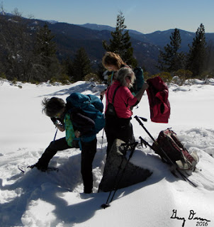
After lunch packing


But now it was time to leave. We come back down the north side of the ridge, along the road. We have been spotting several tracks along the way, including squirrel, bobcat and coyote. The coyote being the smartest of the group as his tracks lead down the ski path. It was a lot easier to travel in our tracks on the way back. We decided to not go down and follow the road to Eleven Mile Meadow, but go back to the car and possibly to Wawona Meadow, But when we got to Wawona, none of us felt inclined to put on our snowshoes, so it was on to home. But we did stop at Pete's Place. It is just plain old good food. They were getting ready to close so we got a big platter of fries.


Monday, January 5, 1970

Places: CA-Eleven Mile Meadow


Eleven Mile Meadow-5,338' (El Capitan) (37.6327089, -119.7037767)
Eleven Mile Creek-4,390 (Wawona) (37.6127099, -119.6973863-Mouth)

Description:

Another branch of the trail starting at Azalea Road. Take the path to the left and proceed a quarter mile northeast distance, the trail turns south. You are now on the Eleven-mile Trail also known as the Old Wawona Road, which parallels the current Wawona Road. Follow this old road bed south. The trail branches at the Eleven-mile Creek. Follow the trail, which parallels the creek bed, to the right to arrive at Eleven- mile Meadow.

Eleven-mile meadow has had many different uses through the years. The Meadow had been used for cattle grazing operations until the early 1930s, as a logging camp and as a CCC camp which was established in 1933.[4] Earlier on, Stage coaches brought travelers to the area with a stop at the Eleven Mile Change Station which was near Chinquapin.[5] As the 20th century approached, the roadbed was converted to a rail bed. The Yosemite Lumber Company used it transport logs to the incline at Henness Ridge. The incline lowered logs to the Merced River far below.

Using the old railroad bed, the hike to the 11 mile trail meadow is an easy walk from Yosemite West and is about 2.8 miles in length, each way.
From Wikipedia

From GNIS:
  • Eleven mile creek: 
    • Heads on the southeast slope of Henness Ridge, flows southeast to Bishop Creek 17.6 km (10.9 mi) southwest of Yosemite Village.
    • Also called North Fork of Bishop Creek: Browning, Peter. Yosemite Place Names. Lafayette, California: Great West Books, 1988. p40
  •  

Trips:


References:
Pictures: