Type: Hiking
Trail head: Curry Village Parking Area
Trail: Fen Trail and then various wanderings-see the map
Destination: Yosemite Falls
Distance: 6.91 miles 1
Start Time: 12:35
End Time: 4:38
Travel Time: 4:03 (1.71 mph)
Moving Time: 2:27 (2.82 mph)
Elevation Rise: 591'
Descent: 607‘
Maximum Elevation: 4,077'

1All of the figures are computed. I turned on the GPS around the time we got to the backpacker’s parking area. Then after seeing Yosemite Falls and waiting for the tram, I turned it off. But then we ended up walking from Yosemite Village to Curry Village. All of the time the GPS was off, is an approximation, based upon plotting out the route on Garmin’s BaseCamp, along with some guessing.
 |
| Bridalveil Falls |
The Park is finishing up on
revamping the area, so the parking area is closed and as it turns out
the trail up to the Falls is also closed off. We found a parking
place. While Sherri gets her boots on, I wander around, looking at
the Falls and the Falls close to
El Capitan-Ribbon
Falls.
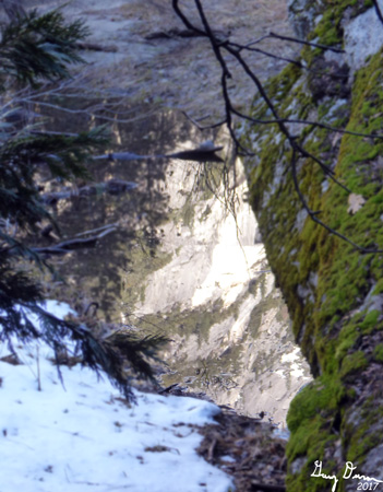
Ribbon Falls
I look around for Silver Strand, but I think it is behind a ridge. We take a short walk around the area. Almost all of the trails in the area are now paved. We took many shots before climbing back into the car.
 |
| Staircase Falls |
With the roof window unsheathed, we, well at least Sherri, can look up at the top of the rim. Such a wonderful sight. We head to Camp Curry There I get my boots on.. Staircase Falls has waters in it. An Indian family is trying to figure out what I am staring at-so I give my mini-tour guide explanation.
 |
| Part of the Fen |
 |
| Our lunch view |
Happy Isles and its bathroom is a short walk from the Fen. We stop there, then cross the Happy Isles Bridge. We decided to go along the Merced River i
 |
| Sherri during lunch break |
And now we follow the river. It is a peaceful walk. We sauntered along, enjoying the water. Eventually we crossed through the North Pines Campground. Then Tenaya Creek. Instead of going through the Backpacker's Camp to join the Valley Loop, we continue to follow the River. Eventually we get to the lawn area of the Ahwahnee Hotel. Then we hit the bike path which follows Northside Drive.
 |
| Yosemite Falls from the Ahwahnee |
And now we do the surprise of the day. We see a sign for the Yosemite Public Library-a branch of the Mariposa County Library system. We are suckers for libraries, so we step in. It is a bit small, but for being a small branch, it is well stocked. Many of the books we have read.It is an indication of the quality of books there. We talked with Christine, the librarian, for a while. She explains that the people in the Valley tend to be pretty transitory. So a lot of times, the person cannot take their books, so they donate them to the library. As a note: Christine was an enjoyable person to talk with, you could tell she enjoyed being in Yosemite and enjoyed her work. We continue on our walk after this delightful time.
 |
| Gary looking at Yosemite Falls |
We continued our walk along Northside. Drive and then turned north toward Yosemite Falls. Going this way is just a bit less crowded plus it is a more gentle climb. In general, I like this way better anyway-the rest is just an excuse for going this way. When we get to Yosemite Creek, we cross it on the wide bridge. Considering this is April, we are missing the normal spray blowing from the Falls. Just shows how little moisture there has been this Winter-and it does not seem like there will be too much more.
 |
| Sherri, Gary and Lower Yosemite Falls |
We take a few pictures and then hurry on. The viewing is not crowded by Yosemite Falls standards, but I think we are just ready to check this stop off of our list. We go down to the bottom and visit the bathroom. It looks like the trams are running. We wait a few minutes and a bus comes along. I try to enter through the front-but COVID protocol says go in through the back. The driver says there are now two loops and we will need to transfer at Yosemite Village. So on we go. He takes a long stop at Yosemite Lodge and then off to the village.
At the village, we wait for the next bus. While we waited a large group of kids, well-behaved, came up. We decided to walk the rest of the way, a little more than a mile. I guess the time in the bus rested my legs for I felt the spring back in my step. The path we follow goes by the Merced River, on the north side-a bit further down from this afternoon. It is pleasant with only a few people. A good way to end the day. We did come across a man in a wheelchair enjoying his time. A short walk later, we come to Stoneman Bridge, which we cross.
On the other side is Stoneman Meadow and a short walk to the car. I think we are ready to sit down and enjoy the ride home. It is now around 4:30 and we have been walking a lot more than what we anticipated, but it does not appear like we have overdone it. We leave the Valley with only a brief stop at Wawona. Then on to Carl’s Jr at Oakhurst for dinner. We get home by 7:30. A full day. Glad we were able to see the Valley.

Extra Photo's
 |
| Yosemite Falls |
 |
| Bridalveil Falls |
 |
| Merced River and Sierra Point |
 |
| Part of the Fen |
 |
| Passageway under Clark's Bridge |
 |
| Yosemite Falls and Lost Arrow |
 |
| Yosemite Falls |
 |
| Yosemite Falls |
 |
| Gary at Yosemite Falls area |
 |
| Panorama from Stoneman Meadow |
Flowers and Plants
 |
| Sticky Current |
 |
| Sticky Current |
 |
| Dogwood |
 |
| Dogwood |
 |
| Dogwood |