Showing posts with label Goddard Canyon. Show all posts

Friday, June 13, 2025

June 13, 2025 - Park Ridge Trail


Title:  June 13, 2025 - Park Ridge Trail
Hike Info : DescriptionAnimals : Flowers and Plants


Hike Info:

Type: Hiking

Trail head: Panoramic Point

Trail: Park Ridge

Destination: Park Ridge Lookout

Actual Destination: Saddle about a mile before the lookout

Distance:  3.24 miles

Start Time: 1:09

End Time:  4:08

Travel Time: 2:59  (1.09 mph)

Moving Time:  1:46  (1.83 mph)


Elevation Rise:  605'

Descent: 595‘

Maximum Elevation: 7,720'

GPS Tracks


Description:

A month ago I fainted. I was hoping to be able to stress myself during this time just to see if my body reacted or came close to reacting the same way to the stress. Unfortunately, today is the first time I have had the opportunity to do so. A couple of weeks ago we went to Big Stump for a short walk which showed I could at least hike OK.

We have a few things we want to do before we go up to Panoramic Point and start our walk. I do my lightning stuff, take Friday for a walk, and spend time weeding. Sherri works around the house and does some trimming of the lavender out in front. By 10:30, we have done the needed chores and we get ready to go. We leave our house about 11:15 with Sherri driving.

She drives all the way up, including the narrow road up to Pan Pt. This may be the first time she has driven it and I am happy that she is doing it. She parks the car and we find a log in the shade and have our lunch. As I wait for Sherri to return from the bathroom, I talk with a couple who;we license plate holder says Drink Coffee. Read a Book. Be Happy. I comment on it and we talk for a while. They used to live in Coarsegold and now are in Ventura. It is their first time in Kings Canyon and are wondering about some easy hikes. I give them the Indian Basin Grove Interpretive Trail. I guess I cannot help being a tour guide.


We start our own hike at 1:10. We have walked this trail so many times, you can see the description on my other blog entries. What seems different today is how I am affected by both the altitude, about 7300’, and the uphill. I am glad when we reach the bench at Pan Point where we can enjoy the view. Many of the peaks we know, such
Mt Goddard or Spanish Mountain. What catches our attention is Buck Rock. I think our friend Kathy is there, but we do not see her-she would look smaller than an ant from this distance.

Now we start on the Park Ridge Trail. As we go up this trail, I can feel that I have not been at altitude enough and feel the lack of oxygen in the body. But then there is the thing that my body has not done much uphill and it shows. I stop and take pictures of flowers and butterflies. And also a few of the scenery. Anything to give my body a rest.

Fortunately, not all of the trail is uphill. As we head to the saddle, the trail goes on a long downhill. I do much better on this stretch. I would really hope that I would do better. Sherri has noticed that I do not have a bounce in my step.

When we get to the saddle, we find that our favorite logs have been moved around and are in the sun. But there is a stump which will suit our needs. We have our lunch and sit for a while, a long while. We have decided that we are turning around here instead of going on to Park Ridge Lookout. 


As we are thinking about doing our return trip. A mom and her adult son came up the Azalea trail. They look like they are wondering what to do now. I, being every so helpful, tell them about how far away the lookout is. We talk about and find out that they are from England-that part was obvious. They give us some recommendations for our July trip to Ireland. They suggested the Guinness Factory Tour, the Blarney Stone and Castle, and the Ireland Eye.

They take off and so do we. We take the service road back. There is more uphill than what I remember. But this is gradual and I do not feel like I am struggling. The road can be a bit exposed, but today it is good for our strolling pace. We got back to the car about 4:10.

Once we get settled into the car, Sherri allows me to drive down to Grant Grove Village. We have decided to have dinner at DNC before going back to Fresno. It is a good choice. DNC is practically empty, so we get served pretty fast. Which means that Sherri gets us to Fresno about 6pm.

I cannot say that it was a good hike, but it was a hike that I am glad we did, if for no other reason than to let me know what kind of status my body is in


Animals
Tiger Swallowtail


Flowers and Plants


Buck Brush


Philox


Indian Paintbrush

Sunday, June 16, 2024

June 16, 2024 - Bearskin Grove, Not quite


Title: June 16, 2024 - Bearskin Grove, Not quite


Hike Info:

Type: Hiking 

Trail head: Junction of 13S02 and 13S45

Trail: 13S45

Destination:  Bearskin Grove

Actual Destination:  On top of a ridge on a different road

Distance:  2.25 miles

Start Time: 2:26

End Time:  4:17

Travel Time: 1:51  (1.22 mph)

Moving Time: 1:17   (1.76 mph)

Elevation Rise:  558'

Descent: 514‘

Maximum Elevation: 6,630'

GPS Tracks


Description:
Sequoia in Bearskin

Today is Father’s Day. As my Father’s Day wish it was to go hiking, particularly to a place I have not been before, Bearskin Grove. I have seen it on the map and heard it on the radio-but more in connection with the campground than the grove. Plus a couple Facebook friends went there a couple of weeks ago, so it is fresh in my mind.

We decided to go after church. But first we need to load up the car. The car had been in for a facelift after its encounter with a deer last month. We just got it back Friday. We reload it with the necessities of life: hiking boots and poles and a few other things. Then have lunch and are off by 12:30.

The drive up is without incident. It is slow though as it seems like a good many people have the same idea of going to the mountains. Also it is Sunday and Hume Lake Christian Camps are getting a new load of their campers. But we make it up to Quail Flat and then down Ten Mile Road about five miles until we see road 13S02. Surprise! A forest service road which is paved and seemingly paved to nowhere. Where it stops being paved, the Redwood Hikes website says to park. But Hume Lake has established a drop off site there for something called Wildwood. After asking about parking there, we decided to move a little ways further down 13S02.


Steven

So I lightly blame Hume Lake for my confusion which exhibited itself when I parked. The confusion you might ask? Is road 13S45 the right road? What is the right one? The right one is road 13S98 and 13S98A. This road is 13S45. Rather than go back, I decide that we can do Bearskin another day and we will see where 13S45 leads us. It looks like on the map that we will be looking across to Bearskin.

We take off at 2:30. It is amazing how late things can be if we get a late start, have slow traffic and am confused at the start. The start of the road is steep, and exposed, and steep. It feels like around a 20% grade. We shall see how long we go, but at the latest, I am looking at a 3:30 turn around time.

The good thing about climbing up steeply is that you get to see things. First, there are the Sequoias of Bearskin Grove. The next best thing to being among them, is being able to gaze at them completely. Almost all of the Sequoias which I have seen are majestic and are worthy of our admiration.

The second thing we see is Buck Rock

Buck Rock Lookout
standing guard over the area of the forest. It is really prominent above us.-about 2,000’ higher than we are. The one thing which is lacking on our trip is a view of Hume Lake. It is out there but not visible.

Once we get close to the top of the ridge, the elevation gain starts to level out. Also we enter into an area where the trees provide shade. The walking becomes a lot more pleasant. It is amazing how the road can be the same, and yet the surroundings change, making such a difference in my outlook. Something to remember that as I continue on this road of life, there will be dry spots, but be sure to have those areas of refreshment.

At the end of the ridge, the road doubles back with a horseshoe bend. We stop here and rest and enjoy the sight. We look across the Kings with a good view of Spanish Mountain. But no view of the closer Hume Lake. There are trees blocking my view of the Mt Goddard area, so we just have to be content with some of the other snow-covered mountains to the east.

We decided that since it is close to 3:30, which is my turn around time, we will turn around now. Going down has a lot less strain on my muscles. But it is a lot more jarring to my bones. The first part back gives me many stops to take pictures of the flowers, but when we reach the section which is exposed to the sun, I am ready to get down the slope a bit quicker-not fast, just quicker than to lally-gagg around.

Sherri on the trail
But Korra has other ideas than a speedy time to the car. She catches the whiff of something, which turns out to be a deer. She gives chase and runs after it. After a minute or two, Steven calls her back, but she is not responsive. We have not heard a yelp so we think she is OK, but the concern is where is she? After ten minutes she comes back to Steven. I wonder what she would do if she actually caught the deer?

We get in the car and leave at 4:30. I drive us back to Big Stump, passing the WildWood people on the way out. At Big Stump, Sherri calls in the order to Bear Mountain Pizza and then Steven takes over driving. When we get to Bear Mountain, and I am getting out of the car, I hear the shout, Gary! Looking around, there is Brianna from Snapps, our car mechanic’s receptionist. We talked for a few minutes. She warns us that it is an hour wait, but we have ordered ahead, so it is only a ten minute wait.

After being fed, Steven takes us home. Road 13S45 is definitely not a must see. Still it was a good enough walk, particularly with the flowers and seeing Buck Rock. Looking at the roads which connect with it, I think there is a connection to some of the Forest areas behind Park Ridge Lookout where we cannot see. Maybe another day when I have more energy.


Trail Lesson:

Know where you are going before you get going.

On the road of life, there will be dry spots; that is part of the journey. Appreciate those areas of refreshment.


Background

The actual directions to Bearskin Grove is: Park on paved road 13S02; there’s a pullout just a few yards past road 13S98.

Two old logging roads run through the grove. Road 13S98A climbs through the best part of the grove. The short road is open to vehicles and is in drivable condition, although it’s a little rough. The road climbs past about 10 or 12 massive sequoias, including two especially large giants on the left that have very little taper. A lot of logs are scattered around from the 2022 fuel reduction program. From Redwood Hikes


Extra Photo's
Garlic Meadow


Sequoia in Bearskin Grove

Spanish Mountain on the right


Flowers and Plants


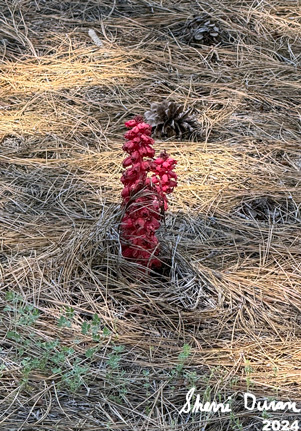
Snow Plant

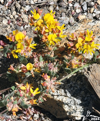
Mountain Misery

Penstomen


Hartweg Lily

Mariposa Lily

Friday, June 24, 2022

June 24, 2022 - Weaver Lake to Jennie Lake


Title:
 June 24, 2022 - Weaver Lake to Jennie Lake
Hike Info : Description : : Menu : Extra Photo's : Animals 


Hike Info:

Type: Backpacking

Trail head: Weaver Lake

Trail: Cross-Country, Jennie Lake Trail

Destination:  Jennie Lake

Distance:  4.42 miles 

Start Time:  11:19

End Time:     4:40

Travel Time:  5:20 (0.83 mph)

Moving Time: 3:28   (1.27 mph)

Elevation Rise: 1,505'

Descent: 1,158‘

Maximum Elevation: 9,282'

GPS Tracks


Morning Light

Description:

Last night was interesting. I was sleeping pretty well when I realized there was a flashlight shining through the tent’s vestibule. After a short dialogue, I found out that the hammock was not working out for someone-too cold. So I now have company in my three person tent. I think it is Rachel since she had expressed concerns earlier. But I am assuming since she is snuggled in her sleeping bag and has her back to me.


Discussion around a non-lit fire pit


I slept in until 7:00am. Even at home that is pretty late. Out backpacking, almost unheard of. I go off up the ridge a short distance and read for a while. A little while later, Korra comes up and greets me. I return back to camp and find Andrea and Steven in the eating area. We talk for a while and Andrea talks about sleeping in the tent. But I am convinced she is talking about Rachel. She finally gets it through my head, she was the one who was in the tent with me. You would think I would know my own daughters.

Start of going cross-country
When Rachel gets up, we have our breakfast. We have a group discussion. One thing which I am interested in is if they are seeing anything which says I should not solo backpack. The concern is as I age, I may not be able to respond as well. We came up with several things:

  • Get a PLB to let Sherri know my status

  • Stay on trail, the more popular the route, the better. This is just in case something does go wrong

  • Do not push or approach my limits, but leave something in reserve

Rachel and Mitchell Peak
When we started our trip, We did not really have a plan for today. But we decided to go on to Jennie Lake. I had talked about a cross-country route, which all seem to be interested in. I show them on the map how we will be going.


We get packed up and ready to leave Weaver Lake by 11:30. Seems a bit late, but today should not be too strenuous. 


View from a break area
Instead of returning via the trail, we head more along a diagonal of our imaginary triangle for about a third of a mile. Walking is pretty easy until we meet the trail. It looks like a bit of a water run off. But Steven asks the key question: how do I know this is the trail? I had spotted a log which had been cut.

We go along the trail just a few minutes when we meet a couple of hikers-the father from Missouri and the son lives in California. The latter is the first time away from his wife and one year old child. We talk about Weaver Lake. They are appreciative when I tell them they can get cell service from on top of the ridge on the west side of the lake.


Clouds over Goddard

Korra watching over the resting travelers


We continue on, to a little saddle and then take off cross-country again. This time, we will travel a bit further. Our first task is to climb up the present slope. While our route has a pretty good slope, it does not present a problem. Korra just takes to going up it without breaking stride. 


We reached a nice place to stop and have lunch. As Babs says, On a clear day, you can see forever. And that is how this spot is. We spot Mt Goddard, Mt Reinstein and many other far away peaks. We take this opportunity to take many pictures.

Looking eastward
 But Jennie Lake is not getting closer, so we thow on our packs and start going up. We have been aiming for a gradual shelf about a hundred feet above us. So it is up, up and away. We hit the shelf and it is even above where I think we need to be. The shelf is a bit above Poop Out Pass. So just walk on some fairly even ground and head south to where the trail should be. I do not want to go east yet as there is a bit of a drop off.

We hit the trail and take a break. Then we follow it east. We actually have come out a bit east of Poop Out Pass. So we will save going over that until tomorrow. And now I know why I never really liked this trail, even though there is a lot of beauty. We drop, according to the map, about 300’-pretty much the same 300’ we climbed cross-country. But the climb has a lot of rocks which I have to let my old legs gently lower down. I wonder how it will be tomorrow going up? I really slow everybody down now. 


More clouds


When we come close to the bottom of the drop, I need to rest a few minutes. After that, I tell Steven and Rachel to go on ahead and find us a spot to camp. Andrea is stuck with the anchor. Fortunately it is not far now to Jennie Lake, about a third of a mile and a hundred foot climb. When we get to the lake, Andrea and I stop and wait for Rachel and Steven to lead us to a campsite.
Rachel resting in comfort


They have found one on the west side of the lake which looks comfortable. It is warmer, so Andrea will try the hammock.I pitch my tent. And we all get to rest for a little while. Well almost. Steven’s hammock experiences a failure. So Steven and Korra will sleep with me tonight.

Tonight’s feast is Beans-Rice with Fritos & Cheese. Sherri did real good as we had very little in the way of dehydrated beans. So she did a couple of different types. Mixed together, quite tasty. After that I think we are ready for bed. Korra is not quite sure what to make of a tent. She marches back and forth, but eventually settles down. By now it is about 9:00pm. I read for a bit and then close my eyes.


Menu
 Breakfast Lunch Dinner Snacks
Oatmeal and add-ins, such as dried peaches, strawberries, nuts, granola. Tang. Ritz Crackers, Tortillas, Peanut Butter, Nutella

Beans-Rice with Fritos & Cheese

Clif Bar, GORP, Propel, CytoMax, Scratch, Coffee Candy, Jelly Belly


Extra Photo's


Steven and Korra

Lunch Time: Gary, Andrea, and Steven

Picture taking

Andrea, Gary, Steven, Korra, Rachel

Admiring the view

Coming up the slope

Scenic view to the north


Mitchel Peak

Gary picking his way up the slope

Looking north

Andrea resting in her hammock

Gary and his tent (Hotel Duran)

Steven and Korra

Animals
   

Grasshoper


Woodpecker tapping on a sign