

Hike Info : Description : Extra Photo's
Type: Hiking

Trail head: SouthFalls Trailhead
Trail: South Falls Loop
Destination: Loop
Distance: 1.16 miles 1
Start Time: 1:15
End Time: 2:07
Travel Time: 0:51 (1.37 mph)
Moving Time: 0:36 (1.94 mph)
Elevation Rise: 144'
Descent: 210‘
Maximum Elevation: 1,529'

Type: Hiking
Trail head: Winter Falls Trailhead
Trail: Winter Falls, Canyon Trail
Destination: None
Actual Destination: Lower North Falls
Distance: 2.92 miles 2
Start Time: 2:31

End Time: 4:30
Travel Time: 1:58 (1.48 mph)
Moving Time: 1:35 (1.84 mph)
Elevation Rise: 559'
Descent: 554‘
Maximum Elevation: 1,495'
1This trail went under a rock shelf and a waterfall. I have manually removed distortions when the GPS could not contact its satellites to determine a correct position.
 |
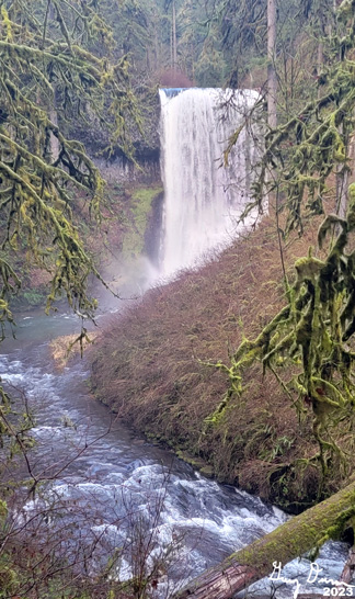
| South Falls |
We got out of Andrea’s place a bit late, a little afternoon, and headed towards Silver Falls State Park with Andrea driving. Sort of nice to be able to observe the landscape without having to worry about the road. Andrea wants to stop at South Falls then head over to the Winter Falls area. Sounds good. Last June Andrea took us to South Falls and it was wonderful. So I do not mind seeing it again. This is Steven’s first time here. Hopefully he is as enchanted with this as I am.
 |
| Sherri, Andrea, and Steven |
 |
| South Falls and Steve, Sherri and Andrea |
 |
| Winter Falls |
We come up the trail back to the edge of the creek lip and take one last look at South Falls. Then it is onward to some covered picnic tables. Yep, it is time to have lunch, even though it is approaching 2pm. It is nice getting out of the dampness.
But we still have some more
hiking to do. The main trail Andrea would like to take us on is to go
down to Winter Falls. So she drives us up to the parking area and
there is a space for us. The trail to the falls leads us down-why
does it seem like all Oregon trails to falls lead you down rather
than up to start with? Well, this is not too bad. Still it is a bit
of a down. But then after 10 minutes we see Winter Falls. These falls
are not spectacular, but in their simplicity there is beauty. We take
many pictures here.
 |
| Middle North Falls |
A little ways further down the trail we came to Drake Falls. These falls are wide with a drop of 15 feet (GNIS says 27 feet), giving the look of a white wave. There is also little fallets coming down the sides of the banks around this fall as well.

 |
| Double Falls |
Andrea has promised at least six falls today. By my count she owes us two more. So we travel down another quarter of a mile. Through a tangle of moss and trees, there is another set of falls, the Double Falls. When we get a clear view of the falls, there is an upper falls with a taller lower one. I study these falls for a while and wonder if there is water coming through the rock as well as over the top. Then again, it could just be the spray coming off the falls. It is interesting. There is some debris at the base which spoils a bit of the effect of the falls for me, still I like these falls just for the mystery.
 |
| Lower North Falls |
It is starting to get late and Sherri is slowing down. Even though in one way, Double Falls can count at two, there is one more fall which Andrea would like us to see. So she starts to go back with Sherri, while Steven and I go forward about 300 yards further. When we turn around, there is the Lower North Falls. It is hard to get a complete view of these falls. Still they are pretty nice.
Steven and I start back up to catch up with Andrea and Sherri. Steven quickly outpaces me. I like to think it is because I stop to take a few pictures, but in reality, Steven is faster. I can tell my legs are not up to snuff on this. Plus it is uphill. On a slope I used to be able to climb very easily, I easily get tired. Still I do keep Steven mostly in sight. Going back up an already trode trail does give a whole new set of things to admire. Usually not the main views, but the little things. Different reflections on the water, a side to a tree with an interesting relief, or a stone having a different outline than when you passed by it before. Things to be reminded of.
I caught up to everybody at Winter Falls. And then it is a climb back to the car. We stopped at the North Falls parking area for the outhouse there. Then Andrea continues on to Mt Angel. This is a town which in my mind is similar to Solvang in California. Instead of Swedish, it has a German atmosphere. But it is late and the shops are not open, except for a place called Mt Angel Sausage Company. That is where we decide to have dinner. As the name implies, we had a platter of sausage so we could sample different kinds. All were good, some a bit more spicy than others.
Andrea had me drive back, more
precautionary than anything else as all except me had a couple sips
of beer. The one part of this was that I forgot I had my boots on. So
my right boot comes off so I can push down on the proper pedals. We
made it home a bit tired. Lawrence was appreciative of the plate from
Mt Angel.. Then it is time to lounge until Lawrence and Andrea have
their Yoga
with Adrienne
time. After that, it is time for bed-Andrea and Lawrence have work to
go to.

 |
| South Falls |
 |
| South Falls |
 |
| South Falls |
 |
| South Falls |
 |
| South Falls |
 |
| Middle North Falls |
 |
| Middle North Falls |
 |
| Looking through the Middle North Falls |
 |
| Middle North Falls |
 |
| Middle North Falls |
 |
| Drake Falls |
 |
| Double Falls |
 |
| Lower North Falls |
 |
| Lower North Falls |
 |
| North Fork of Silver Creek |


