Showing posts with label Clouds Rest. Show all posts

Thursday, January 6, 2022

January 6, 2022- Yosemite Valley


 Title: January 6, 2022- Yosemite Valley

Hike Info : DescriptionExtra Photo's


Hike Info:

Type: Snowshoe Hiking/Walking

Trail head: Parking area on Northside Drive Yosemite Valley

Trail: Valley Loop

Destination: None

Distance:  1.53 miles 

Start Time:  3:25

End Time:   4:56

Travel Time:  1:31 (1.01 mph)

Moving Time:   1:12 (1.28 mph)

Elevation Rise:  100'

Descent: 89‘

Maximum Elevation: 3,983'

GPS Tracks


Description:

El Capitan
Going snowshoeing was not on the agenda for today. We took care of some banking business in the morning. But Sherri's hair appointment got canceled. When we got home from doing our banking around 10:30, we decided there was still enough time to make a quick trip up to Yosemite, probably Wawona. So we got ready, ate lunch and then took off

Yosemite Falls
By the time we fill up with gas at Costco, it is just past noon. Sherri took the first leg of driving up to Coarsegold. Evidently this morning’s business was a bit tiring, so I took over after that. When we got to Wawona, it was about 1:30. There is enough snow to walk with snowshoes, but then the Valley also sounds interesting. The Valley’s siren song won out.


Gary at Ahwahnee Meadow


Highway 41 into the Valley is with an R1 condition-that is: chains are required unless you have snow tires. We have mud and snow tires so we continue on, a bit cautiously. We stopped briefly at Chinquapin and then down to the Valley. Going through Wawona Tunnel is an eye opener-Yosemite is gorgeous anytime. But with it clothed in white makes it even more glamorous.

We stop along the southern side of the Merced-the slow moving water inside banks of snow just yearns to be admired. But the snow is too slippery for my tennis shoes-not icey, but very packed snow with water in it. Further on we stop at the meadow just to the north of the chapel. The view of Yosemite Falls is spectacular from here. We stop long enough to gawk and take pictures.


Sherri admiring a tree

And then we are off. We are looking for a good place to set some snowshoe tracks down. Most places, the parking is very limited and already taken; or we would go about a hundred yards and meet a road or the Merced. On the other hand, Yosemite is giving us a lot of eye candy. So we are content 
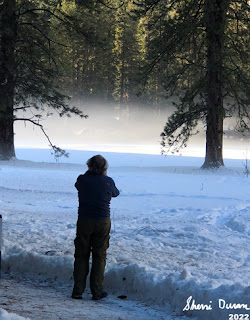
just to drive around. We stop at Ahwahnee Meadow and look at the mist rising there, with the Ahwahnee Hotel hidden behind trees. While Yosemite Falls is visible, it is not the main attraction. Just being here is.

We move on. We have not gotten our snowshoes on today and as the hour progresses, it looks less likely. Still there is hope. Eventually the car ends up on Northside Drive. There is a turnout where we have hiked part of the Valley Loop Trail from. Maybe this will present an opportunity.


The answer is yes and no. The “yes” part of snowshoeing would be there is much snow with a good track and beautiful scenery. The “no” part is that snowshoes would be superfluous. The track is pretty hard packed, but not icey. So walking with our snow boots and poles should be sufficient.

Sherri and I take off walking back eastward. A couple groups of people pass us and we walk on. One is a mother and her two sons. They are hiking to El Capitan. I noted a mileage which was probably too high. They continue on as do we.


Right before Leidig Meadow, I stop and wait for Sherri. While waiting I took a few pictures. And then as Sherri approaches, she scares this large, magnificent bird, like you would see in one of Cindy’s pictures or National Geographic. I believe it is a Great Blue Heron. In flight, it is so awe inspiring. How can such a gangly looking bird look that graceful in flight. Obviously this is a photographic moment, but I was so mesmerized, none was taken.


Sherri on Leidig Meadow
Now that we have our fauna fix taken care of, and there will not be too much in the line of flora for a couple of months. It is time to consider geology. Before we hit Leidig Meadow, we hear the thud and rumble of what we think was either a rockfall or an avalanche on the south wall. We cannot see it, nor any telltale wisp of snow dust. We think it came from the Sentinel Point area.

And now we get to what I consider at least one of the best views, if not the best, of the Valley-the western end of Leidig Meadow. The eastern end of the Valley opens up with Yosemite Falls, North Dome, Washington Column, Cloud’s Rest and Half Dome right there before you. Looking westward is El Capitan and Cathedral Rocks.

Icicles
The fading sunlight comes off of the trees. There is a path broken out into the meadow, which we follow. It is worthwhile turning around occasionally to admire the beauty of God’s creation.

The shadows are deepening which indicate it is time to return to the car. We head north to hit the Valley Loop trail again. Northside Drive needs to be crossed before we do. When we cross we meet the mom and teenage sons. They did not make El Capitan-they did not want to get caught out after dark. While holding less fear than the mother, we too would prefer to be in the comfort of our vehicle when darkness surrounds us.


North Dome Reflection


As we walk along the half mile or so of the Valley Loop Trail, we come across this huge rock-we have seen it many times, along with the rock retaining wall of the trail. But this time, there are icicles from the snow melting on top of it and freezing on its way down. Really impressive. We shot many pictures.

When we get back to seeing the Merced River, we notice there is a rubber raft beached on the other side of the River, along with a man. He asks where is Bridalveil Falls? When there are questions like this, I wonder about the sanity of a person doing things like this. At least have a good clue where you are. He has another 2-3 miles more to go.

 We got back to the car a little bit before five. It does not take us long to start driving. On the way out, we stop to admire the mist rising from El Capitan Meadow. And then again at Tunnel View. The sun has turned the stone of Yosemite Valley golden. It is a wonderful place. We hit Carl’s Jr in Oakhurst. By the time we make it home it is around 8pm.


Extra Photo's

Gary admiring a tree

Gary

Panorama from meadow in front of the chapel

Yosemite Valley from Tunnel View

North Dome, Clouds Rest, Washington Column and Half Dome from Leidig Meadow

Half Dome from Leidig Meadow


Gary on Leidig Meadow

Evening light on a tree

Eastern end of Valley from Leidig Meadow

A calm Merced River reflecting

Merced River

Evening sunlight catching a tree

Icicles

Icicles

El Capitan Meadow

Friday, October 29, 2021

October 29, 2021-Yosemite Valley


Title: October 29, 2021-Yosemite Valley
Hike Info : DescriptionBackground : Extra Photo's : Animals : Flowers and Plants


Trail head: Bridalveil Area

Hike Info:

Type: Hiking

Trail: Valley Loop

Destination: Loop from Pohono Bridge to El Capitan Bridge

Distance: 5.98 miles 1

Start Time:  12:32

End Time:     5:00

Elevation Rise: 835 '

Descent: 722‘

Maximum Elevation: 4,076'


 1Milage and elevations are a combination of GPS readings from a Garmin 60csx and drawn. The Garmin shutoff around 3.4 miles into the trip. About 2.5 miles of the trip is plotted on Garmin’s Base Camp

Gary and golden trees
Description:

I got up a little before 7 and looked for lightning activity, my contribution to society-there was none. But got the “pleasure” of wondering who paid my AT&T bill-at least the payment information is not from me. Spent about 45 minutes with AT&T explaining and waiting. By this time, Sherri is up and feeding herself to breakfast.


Sherri crossing Bridalveil Creek


We leave our house by 10:00am, but stop at Costco for gas on the way out. Sherri is driving, so I read-The Lincoln Highway by Amor Towles if you want to know. Sherri drives farther than she normally does. But our bladders give out in Wawona, so we switch drivers there. The rest of the drive was uneventful. One concern, which turned out unfounded, was how crowded is the Bridalveil parking area? This is a concern with the construction going on there.

We quickly found a place to park. It is about 12:30 when we landed. While I was waiting for Sherri, a first time visitor from Sacramento started talking to me about how beautiful the Valley is. I think she was only going to be here for a couple of hours or less. Still it should give her a taste of the Valley.


Our lunch view-Half Dome and Clouds Rest in the distance
Sherri and I set off at 1:00. We immediately were immersed in the yellows of broadleaf trees. So wonderful. The rain from last Monday is giving Bridalveil Falls some body, so the creek is flowing quite nicely. Which means it is a bit more of a task to cross it. The water is not rushing and is maybe knee deep at its deepest, and much shallower in most crossing places. I decided just to walk through since I was able to find a place where it did not top my boot. Sherri is more concerned and takes a while to pick through.

But once on the other side, we walk along, enjoying the sheer beauty of the fading forest. I try to identify where we ran into stinging bees several years ago, but to no avail. I do find where we stopped to pick the bees off of Sherri and Sonya. But before that, there are some inconsiderate photographers who have set up their tripods right across the trail, forcing us to go around them. On the other hand, Sherri stops and chats with one of them and picks up a bit about what the lady was looking for in her picture. We do stop at the trees right before Bridalveil Meadow for lunch. A good spot. We are able to gaze upon El Capitan and in the distance, Clouds Rest

Wounded hoary bat
barely pokes its head up to be noticed.

After lunch, which is getting close to two, we keep traveling west, through one of the more pleasant parts of Yosemite, in my opinion. While it is right next to the road, it is lower down so you see the river, but not close. This part of the Valley is moist and has a nice covering.


Sherri crossing logs


When we get to the Pohono Bridge which takes us across the Merced, we will start heading east. But first, we stop and enjoy the river scene. The colorful leaves grace the slow moving river-in the Spring, there is more water moving faster. One can stay here a long time admiring this. But like I said, we are half way through the afternoon.


El Capitan Climbers

 So we cross Northside Drive and continue on the Valley Loop. Soon, we come to a place where four large logs block the way-too high to go over, so I start working on going under, until Sherri says to stop. The reason? There is a bat on top of one of the logs. But the bat is not moving. Is it dead? how did it get here-I was just looking at this very spot? Should we go on? But how? Is the bat dangerous? After all, this bat looks distressed.

I make a remark about maybe making a ding, maybe it is a dingbat? Sherri makes a “ding” sound, and it moves. She makes another and it moves some more. Finally, it has moved across the tree and out of sight. Well isn’t that something? I crawl under the logs while Sherri goes over it and we both make it to the other side safe.

El Capitan
We continue on and encounter several downed logs, none as adventurous as above. Having walked this loop several times, there are spots which bring back memories, such as crossing Ribbon Creek. Today it is dry, but one Spring with our Meetup group, we did a log crossing. Or talking with Sonya about her partner climbing El Capitan. And as the base of El Cap comes into view, we spot a couple of climbers just starting out. I see two of them; Sherri thinks there may be a third. We spend a good 15 minutes just following ropes and cracks up this rock.

And now I am looking for a means to cutover since we are close to the base of El Capitan. I get out my GPS and note we probably will be walking about a quarter mile further.I think it is here is where I may have stopped tracking with the GPS. A little ways up the trail, we cut over. When we used to do this trail, we would go all the way up to Yosemite Falls, but two things have to happen: 1) my body needs to be in better shape, and 2) we need an earlier start-it is closing in on 4pm.


Autumn Leaves
The crossover comes up and we come to the El Capitan Bridge. Once again the Merced is graceful appearing. When we hit Southside Drive, there is a question: Do we take the road-easier or the trail-more ups and downs. Sherri has a good point: the trail is more scenic and has more places of pleasure, so we take the trail.


Last week there was a prescribed burn just to the east of where we met the trail. The trail going that direction is closed. But that does not stop a trailrunner. We just wonder if he will regret it or not. Along those lines, going on the Northside, we hardly met anybody. But now, it is almost a regular freeway. We meet at least 8 groups of people. 


Bridalveil Falls
But as Sherri said, it is more scenic and enjoyable. We get our last taste of hiking in the Valley in Autumn for the day, and it does not disappoint. Being in the shadows on this side of the Valley, the colors were more subdued, less intense. So we got to see a different aspect. Also when we rounded the corner, Bridalveil was there. Maybe because I see it with either more water or almost no water, or it could have been the angle, the Falls just showed a different aspect-being able to see the gap between rock and water. So glad we came.

As we got close to the car, a couple from the Bay Area asked if I would take their picture-always. I guess I must look like Ansel Adams. Sherri says it is more that puppy dog look of wanting to help. By the time we reach the car, it is 5pm, and a few minutes later we take off. A brief stop in Wawona before heading to Carl’s Jr in Oakhurst for dinner. We made it back to Fresno around 8pm. Steven has gone to Disneyland, so Korra has been caged up for a couple of hours-she is appreciative of being released. A good day. We are making plans to go back up before we lose the colors.


Background

Bat. A friend of ours is a docent with the Fresno-Chaffee Zoo. Jamie checked with the bat person there and reported back that it is a Hoary bat (Lasiurus cinereus). Unfortunately it has a broken wing and probably some broken fingers and will not survive. Yosemite notes that when you find an animal in distress, report it to a park employee. We did not see any park people after spotting this bat.


Extra Photo's
Trail through color

Bridalveil Falls

Sherri walking through a canopy of color

Merced River at Pohono Bridge

Explosion of color over Bridalveil Creek

El Capitan

Trail color

Bridalveil Falls

Bridalveil Falls


Animals

Wounded Hoary Bat


Flowers and Plants


Autumn Color