Showing posts with label North Dome. Show all posts

Friday, May 16, 2025

May 16, 2025 - Yosemite Backpack


Title: May 16, 2025 - Yosemite Backpack
Hike Info : Description : Menu : Extra Photo's : Animals


Hike Info:

Type: Backpacking

Trail head: Bridalveil Creek

Trail: McGurk Meadow Trail, Pohono

Destination: McGurk Meadow Trailhead

Distance:  2.01 miles 

Start Time: 10:47

End Time:   12:33

Travel Time: 1:45  (1.15 mph)

Moving Time:  1:13  (1.65 mph)

Elevation Rise:  539'

Descent: 221‘

Maximum Elevation: 7,087'

GPS Tracks


Description:

Bridalveil Creek
I woke up at 5:50 and must have fallen asleep again as I really got out of the sleeping bag at 8. It being pretty cold outside could have also been a factor. I took a walk down to Bridalveil Creek. I enjoy a time just watching the water rush by me like lemmings ready to go over the Valley rim. Somehow the picture of lemmings is not right because the water seems joyful in its travels.

It is Steven's birthday. I am glad he chose to go backpacking with Rachel and I. We have our Oatmeal breakfast, is this really a birthday breakfast? We talked about plans for today. Obviously we are walking out today. Originally I was going to give Rachel and Steven the option of walking to Glacier Pt and I get the car. But for obvious reasons, that will not happen. Also, there is a spring with a great overlook of the Valley about a mile and of half east on the Pohono trail. Or just go back to the car. We decided to just go back.


Our camp deer
Rachel sees something off in the distance. Turns out it is a deer-maybe a year old. It moves cautiously closer to us and we just watch it while it watches us. Something startles it and it scampers away. But a few minutes later it brings back some friends-three of them.While they never came through camp, they did get near. Great entertainment for us.

But then we do not need to get an early start, so we leave at 10:45. I have almost all of the pack I came in on-both Rachel and Steven were willing to take some of my load considering yesterday. They already have the food and our tent. The first quarter mile is a steep climb up to the junction. I am already huffing and puffing. Fortunately, the rest of the trail is more of a gradual up. We still have the snow patches and logs to contend with. This just gives an excuse to catch my breath. This definitely a leisurely walk.


Crossing a snow patch

 We get to the car about 12:30. Steven drives us to Washburn Point. There we do the appropriate oohs and ahs of the country. I tell Rachel about what we are seeing. I notice somebody listening in, so I told about the Indian legend concerning the creation of Half, North and Basket Domes.

We decide that we are ready to go home. When we reached Oakhurst, we decided to try a new place to eat at: Los 2 Carnales. As it turned out this was a good move. Rachel and I shared a chilli relleno burrito while Steven had a steak fajita. I think we will add this place to our list of eating establishments. While there I give Sherri a call about what happened yesterday.

Then Rachel drives us back to Fresno. When we get into a stable cell service area, I give Kaiser a call to talk about what to do. Just as we cross the river, Kaiser recommends going to ER to get checked out. Rachel comes in with me while Steven takes the Highlander back home and fills in Sherri.

Kaiser runs all kinds of tests on me. Most of them show I am good. There is some concern about a protein which may indicate a heart attack may be coming. So I get admitted for observation overnight. The next day I have a stress test and ECG. Eventually they come out showing that the heart does not have an issue. I get released Saturday afternoon. 


You know I said that it was good we stopped in Oakhurst to eat? With everything else, I did not get to eat until close to noon Saturday. Also when I got home, it really felt good to have a shower.


Menu

Breakfast

Lunch

Dinner

Snacks

Oatmeal and add-ins

Los 2 Carnales


Jelly Belly


Extra Photo's

Steven at Washburn Point

View from Washburn Point

Another snow patch crossing

The backcountry with Nevada and Vernal Falls

Animals


Thursday, January 6, 2022

January 6, 2022- Yosemite Valley


 Title: January 6, 2022- Yosemite Valley

Hike Info : DescriptionExtra Photo's


Hike Info:

Type: Snowshoe Hiking/Walking

Trail head: Parking area on Northside Drive Yosemite Valley

Trail: Valley Loop

Destination: None

Distance:  1.53 miles 

Start Time:  3:25

End Time:   4:56

Travel Time:  1:31 (1.01 mph)

Moving Time:   1:12 (1.28 mph)

Elevation Rise:  100'

Descent: 89‘

Maximum Elevation: 3,983'

GPS Tracks


Description:

El Capitan
Going snowshoeing was not on the agenda for today. We took care of some banking business in the morning. But Sherri's hair appointment got canceled. When we got home from doing our banking around 10:30, we decided there was still enough time to make a quick trip up to Yosemite, probably Wawona. So we got ready, ate lunch and then took off

Yosemite Falls
By the time we fill up with gas at Costco, it is just past noon. Sherri took the first leg of driving up to Coarsegold. Evidently this morning’s business was a bit tiring, so I took over after that. When we got to Wawona, it was about 1:30. There is enough snow to walk with snowshoes, but then the Valley also sounds interesting. The Valley’s siren song won out.


Gary at Ahwahnee Meadow


Highway 41 into the Valley is with an R1 condition-that is: chains are required unless you have snow tires. We have mud and snow tires so we continue on, a bit cautiously. We stopped briefly at Chinquapin and then down to the Valley. Going through Wawona Tunnel is an eye opener-Yosemite is gorgeous anytime. But with it clothed in white makes it even more glamorous.

We stop along the southern side of the Merced-the slow moving water inside banks of snow just yearns to be admired. But the snow is too slippery for my tennis shoes-not icey, but very packed snow with water in it. Further on we stop at the meadow just to the north of the chapel. The view of Yosemite Falls is spectacular from here. We stop long enough to gawk and take pictures.


Sherri admiring a tree

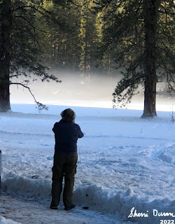
And then we are off. We are looking for a good place to set some snowshoe tracks down. Most places, the parking is very limited and already taken; or we would go about a hundred yards and meet a road or the Merced. On the other hand, Yosemite is giving us a lot of eye candy. So we are content just to drive around. We stop at Ahwahnee Meadow and look at the mist rising there, with the Ahwahnee Hotel hidden behind trees. While Yosemite Falls is visible, it is not the main attraction. Just being here is.

We move on. We have not gotten our snowshoes on today and as the hour progresses, it looks less likely. Still there is hope. Eventually the car ends up on Northside Drive. There is a turnout where we have hiked part of the Valley Loop Trail from. Maybe this will present an opportunity.


The answer is yes and no. The “yes” part of snowshoeing would be there is much snow with a good track and beautiful scenery. The “no” part is that snowshoes would be superfluous. The track is pretty hard packed, but not icey. So walking with our snow boots and poles should be sufficient.

Sherri and I take off walking back eastward. A couple groups of people pass us and we walk on. One is a mother and her two sons. They are hiking to El Capitan. I noted a mileage which was probably too high. They continue on as do we.


Right before Leidig Meadow, I stop and wait for Sherri. While waiting I took a few pictures. And then as Sherri approaches, she scares this large, magnificent bird, like you would see in one of Cindy’s pictures or National Geographic. I believe it is a Great Blue Heron. In flight, it is so awe inspiring. How can such a gangly looking bird look that graceful in flight. Obviously this is a photographic moment, but I was so mesmerized, none was taken.


Sherri on Leidig Meadow
Now that we have our fauna fix taken care of, and there will not be too much in the line of flora for a couple of months. It is time to consider geology. Before we hit Leidig Meadow, we hear the thud and rumble of what we think was either a rockfall or an avalanche on the south wall. We cannot see it, nor any telltale wisp of snow dust. We think it came from the Sentinel Point area.

And now we get to what I consider at least one of the best views, if not the best, of the Valley-the western end of Leidig Meadow. The eastern end of the Valley opens up with Yosemite Falls, North Dome, Washington Column, Cloud’s Rest and Half Dome right there before you. Looking westward is El Capitan and Cathedral Rocks.

Icicles
The fading sunlight comes off of the trees. There is a path broken out into the meadow, which we follow. It is worthwhile turning around occasionally to admire the beauty of God’s creation.

The shadows are deepening which indicate it is time to return to the car. We head north to hit the Valley Loop trail again. Northside Drive needs to be crossed before we do. When we cross we meet the mom and teenage sons. They did not make El Capitan-they did not want to get caught out after dark. While holding less fear than the mother, we too would prefer to be in the comfort of our vehicle when darkness surrounds us.


North Dome Reflection


As we walk along the half mile or so of the Valley Loop Trail, we come across this huge rock-we have seen it many times, along with the rock retaining wall of the trail. But this time, there are icicles from the snow melting on top of it and freezing on its way down. Really impressive. We shot many pictures.

When we get back to seeing the Merced River, we notice there is a rubber raft beached on the other side of the River, along with a man. He asks where is Bridalveil Falls? When there are questions like this, I wonder about the sanity of a person doing things like this. At least have a good clue where you are. He has another 2-3 miles more to go.

 We got back to the car a little bit before five. It does not take us long to start driving. On the way out, we stop to admire the mist rising from El Capitan Meadow. And then again at Tunnel View. The sun has turned the stone of Yosemite Valley golden. It is a wonderful place. We hit Carl’s Jr in Oakhurst. By the time we make it home it is around 8pm.


Extra Photo's

Gary admiring a tree

Gary

Panorama from meadow in front of the chapel

Yosemite Valley from Tunnel View

North Dome, Clouds Rest, Washington Column and Half Dome from Leidig Meadow

Half Dome from Leidig Meadow


Gary on Leidig Meadow

Evening light on a tree

Eastern end of Valley from Leidig Meadow

A calm Merced River reflecting

Merced River

Evening sunlight catching a tree

Icicles

Icicles

El Capitan Meadow

Wednesday, May 5, 2021

May 5, 2021 - Middle Yosemite Valley


May 5, 2021 - Middle Yosemite Valley
Hike Info : DescriptionExtra Photo's : Animals : Flowers and Plants
 
Hike Info:
Type: Hiking
Trail:  Valley Loop
Destination:
Actual Destination:
Distance: 8.53 miles 1
Start Time: 9:51
End Time:  3:59
Travel Time: 6:07  (1.39 mph)
Moving Time:  4:34  (1.87 mph)
Elevation Rise: 568 '
Descent: 585‘
Maximum Elevation: 4,060'  

GPS Tracks

  1There was a wide range of mileage readings. This particular one is from our Garmin 60CSX. My Garmin Foretrex401 9.94. While Rose’s InReach was above 10 miles. The 8.53 is more in line with the expected mileage. The Valley walls can sometimes play havoc with GPS signals.

Description:

Rose and Sherri examining a climber's van


It has been a couple of weeks since we have hiked with The Sisterhood. First Betty had a commitment. Then Carol had a hard week at work. So she begged out. So Rose is stuck with Sherri and I.

It has a potential of being a long day, so we get off to an earlier start than usual. We had planned on leaving Fresno at 7:15, but got off a few minutes late. We will meet Rose at Chinquapin. But first, we need to get through a couple of construction sites, but we get to Chinquapin only five to ten minutes after Rose. We continue onto the Valley. I had suggested that we park at the lower end of the Valley so we walk downhill on the way back.

El  Capitan and the Perced
We found a place to park right before the El Capitan Road on the south side of the Valley. We will go clockwise on the theory that with it being predicted to be warm today, we should be a bit more in the shadows in the afternoon.

We get ready to go just before 10. We head north along El Capitan Road. Just before the bridge, we see a climber’s van. How do we know that it belongs to a climber? There are routes drawn on the side of the van up El Capitan. We stop and look with interest.

Dead Tree Disguised as a Rope

But as much as we want to wonder about the owner, we have miles to go. Off we go. We turn east along the north side of the Merced. We move pretty good. After a short way, we met a couple. We talk and wonder if there are climbers on El Capitan. It does not look like it. I think I see a rope hanging from an overhang-Rose points out that it is a dead tree. Imagine a dead tree disguising itself as rope.

A short distance later, we hit the Valley Loop Trail and continue east. The trail follows the road, but then it leaves the road, following the river. But there is a need for some personal necessity. The El Capitan Picnic Area is a short ways ahead, so we continue to follow the road.

Gary meets a friend
 

The picnic area was a bit further away than imagined in my mind. The principal attraction of the picnic area is the outhouse, but not the only attraction. As we leave we see a lone redbud, but looking pretty nice. Looking around, there is El Capitan and Sentinel Falls, and of course, all of Yosemite Valley.

Sentinel Falls
We find a path back to the Valley Loop and continue on. The path is still pretty level. We come to a parking area and see a few more people. A bit beyond is a tree which has split--I call it the Tree of Doom. We need to walk right under it. I approach a bit apprehensive and proceed to scurry below it. Rose and Sherri come after me with none of that apprehension. A short way further we cross the Northside Road.

Now we pass by the site of the old Indian village. There is construction going on. But there is also a sign talking about an event taking place. We go past the SAR village and into a deserted Camp 4. We decide this is a better place to have lunch rather than going on to the

Tree of Doom-Rose and Sherri walkign
Yosemite Falls picnic area. Lunch is our normal stuff. But the bathrooms are not open, so we continue on.

It is a short walk to the Falls. They are beautiful like always. Maybe not as full as it should be in mid-Spring, still a thing of beauty. Also it is not too crowded, at least by Yosemite standards. Even with the decreased amount of water coming down, there is a nice wind being generated. Evidently it is enough of a breeze that if a person is not attentive, they may lose her hat. I do grab mine, but Sherri is not as quick. Her hat goes over the bridge onto the rocks before-at least not into the creek. Then yours truly, your faithful narrator, a chance to play super-hero. So he does an old man type of waddle around and down and picks up the hat. He gets a hero welcome.

Lower Yosemite Falls

The Dogwood patrol


We continued on going the long way back to the Falls bathrooms.Maybe I should say this was the scenic route. Usually not as many people, but today there is a fair number of people. There is a slight mix up at the bathroom-we were looking for each other and not finding us. Eventually we hook up and are off.


Gary Rescuing a hat


There is a decision that we should do the shorter route back to the car. So we cut through the Yosemite Lodge area. Even here we are blessed. I think we come across the epitome of what a dogwood should look like-unfortunately our pictures are not of the same quality as this tree. It seems like everywhere we look there is a dogwood gracing our vision.

And there is a fireplug. And what is one of those things good for?


Wow! Such a nice shaped dogwood
The next point of interest is the Swinging Bridge. Here we meet a guy who wants to know about some of the floods as well as landmarks in the Valley, also where is it-we are standing on it. But this is not the original which got wiped out during floods. I spend some time giving my impression of a tour interpreter. Seems to impress the guy enough. But I do think this bridge and a bit of the area gives one of the better views of the Valley. Half Dome and Clouds Rest, not to mention North Dome, Washington Column, and Glacier Point are all in view. Looking the other way, El Cap and Cathedral Rocks all dominate view to the west. What a place! I like to think that God created this place to perfection. It is up to us not to spoil it.


Fireplug


View From Swinging Bridge
 

Sherri and Rose spot a set of falls to the side of Indian Canyon. I do not know what creek that it-I do not think it is Indian Creek as that runs down the canyon. Later when I get home and look at a topo map, I figure out that it is Lehamite Creek which has a pretty good size falls, even if it is ephemeral.

The south side of the Valley Loop Trail greets us. We know that we are on the home stretch-even though we know we have a ways to go. I am beginning to feel my legs want an end soon. I do not hike as well in warm temperatures and it is over 800 today. My theory about walking on the south side is not true, at least during the Spring, and probably the Fall. Still there are miles left in them.

Crossing Sentinel Creek


We come to the Four Mile Trail, and pass by it. Then it is up and down some small ridges-this does not do much for my legs. And then I hear what looks like a chainsaw. What is one doing in the Valley? A few minutes later, we spot a fire crew working on bringing down some of the dead trees. We briefly talked with the leader and he said it was OK to go through-the guys (and gal) will pause when we are near. 


Valley Loop on the Southside


A ways later we come across a couple who we talked with earlier (I do not recognize them, but they do us.) They have also picked up a person as well. We tell them about the crew ahead. They seem to have enjoyed the trail as much as us-always a good thing.

And now we come to the trail junction which leads us back to the El Capitan Road. And then a short walk back to the car! Glad to get back. After getting our hiking stuff stowed, The three of us talk-seems like we do not want to part. After 45 minutes we do seperate, going our own ways. We stop in Oakhurst for a bite to eat before heading home. Another good day.


Extra Photo's
Yosemite Falls

Where are the people?

El Capitan

El Capitan

Gary with Rose and Sherri looking at Manzanita

Yosemite Falls

Sentinel Falls

Looking east up the Merced

Flowers on a rock

Yosemite Falls-Rose and Gary

Middle Yosemite Falls

Dogwood

Dogwood and Sentinel Point

Lower Yosemite Falls

Dogwood and Yosemite Falls

Gary and the Falls


Sherri and Rose admiring the view

Rose crossing Sentinel Creek

Gary and the Gunsight

El Capitan

Yosemite Falls

Animals

Mallard


Flowers and Plants

Manzanita


Dogwood


Redbud