Showing posts with label Kuna Creek. Show all posts

Wednesday, August 14, 2024

August 14, 2024 - Lyell Canyon


Title: August 14, 2024 - Lyell Canyon


Hike Info:

Type: Hiking 

Trail head: Lyell Canyon, Junction with Vogelsang Trail

Trail: John Muir Trail

Destination:  As far as we want to walk

Actual Destination:  About 2 1/2 miles up the canyon


Distance:  4.95 miles

Start Time: 11:02

End Time:     3:42

Travel Time: 4:39  (1.06 mph)

Moving Time: 3:07   (1.59 mph)

Elevation Rise: 816 '

Descent: 590‘

Maximum Elevation: 9,025'

GPS Tracks

Description:

Close to John's camp
I got up about 7:20 and went for a short walk, maybe about a quarter mile or so.Just far enough to see the sun starting to peak over the Kuna Crest. There were two things about this walk. One did not happen, the other did. First, when I got home, I saw that if I had walked maybe another five minutes, I would have come across where my friend John was camped. He has an InReach and I have been one of the text recipients of his locations. I guess this was not part of the plan for us to connect. Still, it would have been nice.

Sun over Kuna Crest
The second thing was that I read a segment out of Marilyn Robinson’s book, Reading Genesis. She notes that Abram went out to ponder the stars. But she also says that God sees, through Abrams’s eyes, beauty that might seem an arbitrary display of divine power if it were only a throng of stars. This got me to thinking about God seeing his creation through Abram’s eyes. I wondered if that is why we are on this earth, because God wants to experience His Creation through us. God calls his creation good. But is this something which he yearns to see it, through how we see it? Beauty like what I am seeing calls for a response to its Maker. This should be my nature’s response: to praise God in all things. Let the blessing flow. Not only in places like Lyell Canyon, but also in places like Fresno.


Sherri crossing Ireland Creek

When I got back, Sherri had gotten up. We had our breakfast. But neither of us must have been too ambitious. This confirms the decision not to go up the Vogelsang Trail. We finally moseyed out of camp about ten after eleven. We cross Ireland Creek, getting the bottom of our boots wet. Then started our stroll up Lyell.


Most of the flowers are either yarrow or alpine aster. Still pretty, even though the meadow grasses are starting to turn brown. But there are a lot of fritillaries flying around. I am not sure what variety of fritillary they are. One even lands on my leg. I try to get a picture of that, but Sherri wants to see what I am stopping for and the butterfly goes away.

The trail, the JMT, continues on its rolling way with very little altitude gain. This is a good walk for us. By 12:30 we are ready for lunch and start looking for a good place to eat. Eventually, I see a path heading off to the river and we take it. It leads to a vacant horse camp. We go a little ways further, next to the river and find a place to recline against rocks.

Lunch Time Rest
By this time, and it is 12: 45, we are ready for our lunch. Sherri finishes off last night’s peanut butter and nutella sandwich, while I have Ritz crackers with PB&Nutella spread. A satisfying meal. Evidently, too satisfying as I am content with staying here for a while and enjoying the river. Sherri does not seem too much more motivated. So we stay here until 2:00.

As we are about to head out, the pack train comes in. Rather than spook the horses-turns out that they are mules, what do I know?-we take a wide berth around them. We then head back to camp. We make about as good of time going back as we do coming up. We did talk with one guy who is on the lookout for a Northbound Dutch couple who needs fuel. The Tuolumne Meadows store has just opened and he wants to communicate that to this couple-we did not see them at all in our travels.

Tuolumne River in the Evening
At camp, I rest for a few minutes and get approached by a wilderness ranger-a different one than yesterday. I am confident and showed her the permit on the phone. She examines it and says that it is not correct. What is not correct? We told her we came in yesterday, but the permit is good for the 14th through the 16th. That can’t be! But it is. She leaves us with a warning. Sherri digs out a copy of the reservation and notes the reservation also has those dates. I guess I must have clicked wrong when I made the reservation.

After this encounter, I went down to the river to get some water. I come across Peter, a backpacker who is northbound on the JMT. We talk for a little while and then are joined by a couple from Big Sur. They look as tired as Sherri and I were yesterday. They have not slept much in the last 36 hours and are trying to decide if they go back home. I invite them to camp just below us. They go off for about 20 minutes and then take me up on my offer.

We have a freeze dried version of mac and cheese. It is about the right amount for us. Also there are a couple Girl Scout cookies thrown in-not in the dinner, but afterwards. Sherri sees some deer, but they run off before I have a good picture of them. So I walk down the path to see if I can find them. Instead, I met Peter again. We talk about various routes and what he is trying to do. This includes the old JMT route as well as where there is camping close to Sunrise High Sierra Camp.

Both times in talking with Peter, I take much longer to get back to the campsite. This time, Sherri is about ready for bed. We both end up crawling into our bags around 8:15.


Trail Lesson:

Two lessons today:

  • Don’t be so self-assured that what I do is always going to be right.
  • As I age, make allowances for mistakes. Double check my work.

Background

The John Muir Trail has changed over the years. In Tuolumne Meadows at one point it went from the Cathedral Lakes Trailhead north to Parson’s Lodge, past Soda Springs, towards the campgrounds and then past the Wilderness Office. Now it cuts south of Highway 120 over behind the campground and meets up with the PCT just south of the Tuolume River crossing. This is what Peter and I were discussing about the route change. There are other places where the route has changed as well.

Not sure what being a purist on the JMT means these days. I like to consider the trail as being more of a suggested route to enjoy the backcountry of the Sierra, a gateway to rejuvenate one’s being.

For more background on the John Muir Trail, you can see the following sites:


Menu


Breakfast

Lunch

Dinner

Snacks

Oatmeal and add-ins, such as dried peaches, strawberries, nuts, granola. Tang.

Ritz Crackers, Peanut Butter, Nutella

Freeze Dried Mac&Cheese with jerky

Clif Bar, GORP, Scratch, Jelly Belly


Extra Photo's

Tuolmne River

Lyell Canyon and the Tuolumne

Ireland Creek

Gary

Lyell Canyon and the Tuolumne River

Lyell Canyon looking north
Sherri on the trail

Gary on the trail

Sherri waiting at the campsite

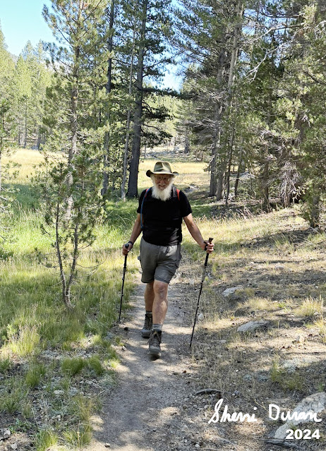
Gary moseying on in

Potter Point


Animals


Fritilary

Fritilary

Yellow legged Tree Frog

Tuesday, August 13, 2024

August 13, 2024 - Lyell Canyon


Title: August 13, 2024 - Lyell Canyon
Hike Info : DescriptionMenu : Extra Photo'sFlowers and Plants


Hike Info:

Type: Backpacking

Trail head: Tuolumne Meadows Wilderness Office

Trail:  John Muir Trail

Destination:  Lyell Canyon, Junction with Vogelsang Trail

Distance:  6.47 miles

Start Time: 1:08

End Time:   6:12

Travel Time: 5:04  (1.28 mph)

Moving Time: 3:46   (1.72 mph)

Elevation Rise:  875'

Descent: 661‘

Maximum Elevation: 8,931'

GPS Tracks

 
Description:

I slept “in” until 6. Spent a few minutes getting ready for a 7am start time. But we did not get out of the house until 7:30. This will cost us in a little while. We stop in Oakhurst and Sherri picks up a pastry and coffee from Judy’s. The cost? We joined an hour wait to get into Yosemite at its southern entrance. But we got in and went to the Wawona Ranger Station. And here we had another wait as the ranger who issues permits, Courtney, was on break. But once she came back, we were able to quickly get our permit.

Sherri starting our hike

And then it is close to a two hour drive to get to Tuolumne Meadows. I will admit that even though it is long, it is beautiful. Along the way, we see several vehicles from Stanislaus National Forest stationed along the road to work the Middle Fire. This is a fire which is caused by lightning, but through cooperative agreements, there is a sharing of resources.


Bridge across the Tuolumne


We get to Tuolumne Meadows at 12:45 and take a few minutes to get ready. Our boots touch the ground at 1:10. A friend of ours, John is walking the JMT and is going through Tuolumne Meadows. I suspect with our delay, we may be about two hours behind him. But then again, we will keep a lookout to see if we see him. It would be wonderful if we could.

Even though we have not had lunch, I would like to get a few steps in before we eat. Sherri is agreeable to this. We walk beside the road to the Tuolumne Lodge until we reach the trail which crosses the Tuolumne forks off. I have wandered here before on the wrong trail, going up the Dana Fork, but today, we crossed the Dana Fork and shortly afterwards crossed the Lyell Fork. Within a hundred yards, we joined the JMT. It is 1:35 and time for lunch, after going 7/8ths of a mile.


Gary at lunch
Lunch was pre-made Peanut Butter and Nutella sandwiches. This time also serves to provide a bit of rest for our legs. And now we are off again. The trail takes us through a forested area to Rafferty Creek. There are times when this creek is a raging torrent. But not today, there may be a puddle of water here and there, making this sturdy bridge look sort of silly. Still earlier in the season I would guess it is well appreciated by hikers.

The trail goes around the ridge which bounds Rafferty. I have told people that Lyell Canyon is the second flattest trail in the Sierra-that is why we are taking it. But it would be a mis-assumption that it is flat. It has little 5-10’ rolling terrain. We stop and talk to a hiker or two, but no John. One of the hikers asks if we are from Fresno. Bruce and I have taken Osher classes together. I did not recognize him, but he knew who I was; he just did not know my name. 


The Trail is not boring. First, you have this wandering river called the Tuolumne which meanders in a snake pattern in the bottom of the canyon. Then the Kuna Crest rises 3,000’ above us to the east. I can only see the lip of the canyon towards the west and it is only about 1,200’. Still looking up the canyon towards Donohue Peak, it is impressive. To top it off. Sherri stops suddenly and points straight ahead of us. Usually that means a deer, or maybe a bear. But I needed to fix my gaze just a little higher than that. A hawk-I am not much of a birder, so I cannot tell you what kind, nor am I quick enough on the reflexes to have taken a picture-was flying straight towards us about 20’ off the ground. Spectacular. I think God really knows how to cook!


I can tell that this hike is being made with someone not in terrible good shape-that would be me. I am walking OK, but the legs are tiring. My mind is wondering where the trail junction is so we can camp there? I am also thinking that if we felt good, of trying the loop to Vogelsang. But I do not think I could do well on the climb up.

Tuolumne in Lyell Canyon
But we get to the junction and look for a place to camp. It is Tent City. With shadows lengthening and it being 6:10, I feel like we cannot be too choosy. There is a spot above another tent, a ways down, still it will feel like we are spying on them. With the shape we are in, this seems like a good place. Tomorrow we can look for another place. I thought we were going about 5¼ miles today, but the GPS has us as 6.8. Still not a great excuse.

We sit and rest for a few minutes. The people below us are a father/daughter team. That is good to see. But the daughter comes up to our camp and I notice she has a badge on identifying herself as a wilderness ranger. Allisson checks our permit and we talk for a few minutes before she departs.


Good Night Moon
I have now had enough time to wonder. The trail junction looks different, so I go down to my now good friend the ranger and ask her if the trail has been changed. She thinks it is a possibility as there appears to be the remains of an old trail running through her camp. The other question I ask is if she has seen John? No. Oh well, it would have been nice to have seen him.

We have our dinner-another Peanut Butter and Nutella sandwich. The tent is up, the water is drawn and we do our business. We both feel tired and get into our sleeping bags at 8:30.


Menu

Breakfast

Lunch

Dinner

Snacks

At home

Peanut Butter&Nutella Sandwich

Peanut Butter&Nutella Sandwich

Clif Bar, GORP,, Jelly Belly


Extra Photo's


Moon over Potter Point

Looking north from Lyell Canyon

Sherri on the trail

Flowers and Plants

Fly Amanita


Fly Amanita

Alpine Gentain

Wednesday, August 27, 2014

August 27, 2014 - White Chief Mine

 
Title: August 27, 2014 - White Chief Mine

Trail head: Eagle Lake
Hike Info:
Type:  Hiking
Trail: White Chief Mine Trail
Destination: White Chief Mine
Distance: 6.04 miles
Start Time:  9:11
End Time:    4:01
Travel Time: 6:49 (0.89 mph)
Moving Time: 4:41 (1.29  mph)
Elevation Rise: 2,038'
Maximum Elevation: 9,554'

Description:
We got up this morning and had a pancake and bacon breakfast. Rob and Robert, our camp mates, and us take off to go to the Eagle/Mosquito Lakes trail head, where we meet John and Cathey around 9. The five of us are the "A Team" and start a head of everyone else. John stays back to wait for the rest of the meetup team. I think they get there a little before 10.
A Team


Kaweah River Valley
The first mile or so is a gradual up. We are rising above the East Fork of the Kaweah and see the trail to Farewell Gap. It is good looking down this canyon. Our group s doing pretty well, which is surprising to me, with the altitude and stuff. A little after a mile, we come to the Eagle and Mosquito Lakes trail junction. We still have not been caught which gives us a feeling of, hey, we are hiking pretty good! Not that ones hike is ever judged by the speed. I judge my hikes by how much I enjoyed the hike, whatever the component: beauty, exercise, friendship or just the plain joy of experiencing God's world.
Rainbow Peak
But now we are on the section of the trail which does some serious ascension. The trail get seriously steeper and the breathing is more labored, with stops more frequent. Rob is setting a good pace for us as he gauges our struggles. This section is where the lead hikers of the late group first appear with Lee F and Daniel in the lead. But I noticed that there s a nice sheen of sweat on them, as well as the succeeding groups of our meetup hikers-they are laboring as much as we are. Almost all of the meetup group gladly enjoy the chocolate covered espresso beans from the Jelly Belly Factory, when offered.
 Usually with Sierra mountains, when you struggle, there is a reward. In this case with the strong ascension, we are able to see the upper granite lined basins around Mineral King. Such beauty is so good to experience.  A couple creeks coming down the side of Farewell Canyon into the East Fork of the Kaweah River reminds me of Kuna Creek dropping into Lyell Canyon in Yosemite-it is that beautiful.
Ruins of Crabtree's Cabin


As we top the lip of our side of the canyon, we become the last group again, our rightful place. The walking become milder, even though there is less oxygen. Walking through a little high Sierra valleys is always fun for me-it arouses my sense of wonder. As we round one corner, I realize this is where the map says the site of Crabtree's cabin is, so I walk the 40' off the trail and find the remains of a couple pipes, what looks like a ladder and the corner of the cabin. Nobody else wanders off the trail with me. So I get to reflect on the passing nature of us all.

Meadow above the lip
But this moment of reflection only lasts that long, a moment. Off I go and quickly catch up with my group. We trudge along, gently gaining elevation, appreciating that Crabtree did this day in and day out to go to his mine. The pockets of trees on top of the ridges give pleasant relief to the rock surrounding us. We finally break out into the final walk to the mine. We cross the small creek we have been following and climb to the White Chief Mine's entrance. The entrance is above a tailings dropping in white rock. This is not your dingy mine, but one which would appeal to a person of taste. The mine is open to the public and safe to walk the full 150' length. Many of us have headlights so we can explore. Others in our group go further on up the trail about 400' above to explore the basin below White Chief Peak.
Into the Mine
Back to the Mine Opening

Mine Opening


Descending from Mine
But we  start down the trail we came up on. It is a repeat in reverse of us going up. But this time our group stops and gawks at the ruins to Crabtree's cabin. Then it is off down the steeper slope. Jean, a new hiker, both to our group and to the hiking experience falls in with us slow ones and we chat for a ways about hiking, it's equipment and enjoyment. Judy, another hiker new to our group, but one of those who went to the upper basin briefly chats with us before running off. 
We all make it in. Sherri, Rob, Robert and I go to our camp, gather stuff up and take off to John and Cathey's cabin in Silver City. Most of the group has gathered around the shop for pie and enjoy the time. Then most hurry off back to Fresno. But some of us enjoy Cathey and John's hospitality and the chili beans. Good talking with them and a pleasant way to end our hike.


Cathey, Jean and Rob

Rainbow Mountain

Juniper