
Title: January 15, 2018 - South Shore Trail
Hike Info : Description : Background : Extra Photo's : Animals : Flowers and Plants

Hike Info:
Type: Hiking
Trail: South Shore Trail
Destination: Winchell Cove
Distance: 3.46 miles
Start Time: 11:12
End Time: 1:29
Travel Time: 2:17 (1.52 mph)
Moving Time: 1:18 (2.66 mph)
Elevation Rise: 275' 1
 1The amount of rise has been
modified
to reflect that the GPS has a tendency to start at a lower elevation
than actual. So I use more the ending elevation to gauge the actual
elevation rise.
1The amount of rise has been
modified
to reflect that the GPS has a tendency to start at a lower elevation
than actual. So I use more the ending elevation to gauge the actual
elevation rise.
While the trail is the same as we hiked last Wednesday, the conditions are different.. Today there has been fog and some mist. So the lighting on the lake is a bit more subdued. Also with 16 other people, the dynamics is much more varied.
 |
| Cemetery Bound |
I walk at the end of the line while Sherri is somewhere in the middle.So I talk some with Leslie, Meera and David-Leslie I have hiked with a lot, but not much recently. So it is good just having a relaxed conversation with her. Meera and David are new to me, so throughout the trip, we talk a bit about interesting trails and best places for ice cream.
 |
| Steven overlooking Millerton |
 |
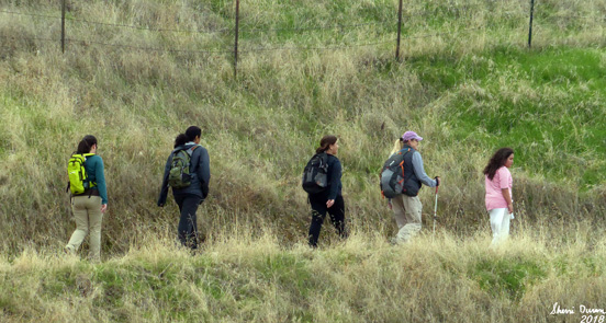
| Hikers Procession |
On the way back, I fall into a conversation with Cathy and Nancy. With Cathy, she knows a person whom we met on the JMT 4+ years ago. With Nancy, we share a common employer and I used to communicate with her department-but I must be getting older as I could not remember the names of the people. Talking with people has both the good and bad. The good, it makes the hiking go by quickly and pleasantly. The bad? Well, there is a tendency on my part to be interested in what the person is saying rather than the surroundings I am passing through. Nothing bad happened because of this. It is just we got to the parking lot pretty quickly.
By this time, we are back at
the cars and say goodbye. It has been a quick hike and not too much
different than last week. Or to paraphrase a book title, Same
Kind Of Different Hike..

Background
 |
| Cemetery Entrance |
The Winchell Cove Cemetery contains some of the oldest burials in Fresno County. Soldiers that passed away at nearby Fort Miller were buried at the fort as early as 1852 and were removed to Winchell Cove when Friant Dam was completed in 1941. Burial mounds are visible, but only one headstone remains, that of Francis Steddum. An Eagle Scout project researched and plotted out the over 80 plots, most of which are unidentified. The cemetery is located at Winchell Cove Marina on Millerton Lake above Friant, California. The cemetery is barely noticeable from the marina itself, and can be accessed by a one lane dirt road that dead-ends below it, and by a hiking and equestrian trail that is not very well maintained. The cemetery is fenced in and locked. There is no access to the cemetery itself, but you can walk around the fenced area. From Find a Grave
 |
| Monument commemorating work of an Eagle Scout |
Extra Photo's


 |
| Miniature Volcano's or Ant Holes? |
Flowers and Plants
 |
| Mushrooms |
No comments:
Post a Comment