

Title: May 19, 2021 - Weaver Lake
Hike Info : Description : Menu : Extra Photo's
Trail: Weaver Lake Trail
Destination: Weaver Lake
Actual Destination:
Distance: 3.81 miles 1
Start Time: 11:25
End Time: 3:51

Travel Time: 4:26 (0.81 mph)
Moving Time: 2:54 (1.24 mph)
Elevation Rise: 1,297'
Descent: 201‘
Maximum Elevation: 8,740'
1Originally the GPS said we did about 4.7 miles. But looking at the tracks, it went crazy at lunch time. Based upon previous hikes, this seems much more reasonable.
Last year was a bust to go backpacking and I am not getting much younger. Our initial thought was to go to Alder Creek in Yosemite, but the logistics of getting a permit in this COVID-19 times would eat up a large chunk of our enjoyment. So Plan B was to go to Paradise Valley in Kings Canyon. As the day approached, I felt less and less ready-both in preparation, physically and mentally. Plus someplace over the weekend I lost my medicine bag (sounds like I am making excuses). So come Monday night, I thought, let us postpone this a day-we can do that. So on Tuesday, the more I thought about things, the more content I got with Plan C-a short hike to Weaver Lake. Definitely less apprehensive the night before the hike.
Now, when was the last time I
was at Weaver Lake? I think it was about five
years ago
with our meetup group. Now to see if I can make it.
Bridge across Big Meadow Creek
We get in the car at 9:40-a bit later. Then it is a straightforward drive up 180. We go to the Grant Grove Visitor Center to see if we need a Wilderness Permit for Weaver Lake. The quick answer is now. We already have a California Fire Permit, so we are ready to go. It is another 20 minute drive to the Big Meadows Trailhead.
At 11:45, our boots hit the trail. It is a pleasant 57o. This is the moment of truth. That moment gets deferred for a few minutes as the trail starts by going downhill-I can tackle this. Then there is a new twist-instead of crossing on logs like I have before, there is a nice sturdy bridge crossing Big Meadows Creek.
 |
| Trail and Shell Mountain |
And now the moment gets
realized. The trail starts off by going gradually up-I am able to do
this. And then it turns up the intensity. While I am able to go up
this, my pace shortens and my breaths become more frequent. But at
least I am consistent. It looks like the weight of the pack will not
be an issue. By the way, the weight is 34 pounds. Maybe a bit heavy
for overnight, but very doable.
Sherri, the hiker
We cross a small creek, rock
hopping over it. Even if we fell in, only our shoes would get wet.
There is a log across the trail, but very doable in getting over it.
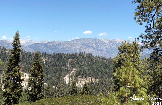
By the time we have gone a mile and a third, we are seeing some great
views, including the glint of Buck
Rock Lookout.
We meet a few people leaving, but not a wild weekend crowd. Also it
is after 1pm, so we think this is a wonderful place to have our
PB&Nutella sandwich. 
Gary inching up a hill
There is a downhill, which I am sure we will need to gain back. The trail meets another trail from the Fox Canyon trailhead. Then a short way, but steeply uphill, to the junction with the Jennie Lake trail-later we found out a friend of ours was at Jennie Lake at the same time we were here.. Now it is more uphill, climbing up a ridge.
We are now on the last half of the trek, and there is still a need to climb. While the trail starts out just as steep as before, we know there is an end. That is always something to look at. Good thing it is not a warm day, just comfortable for walking a trail like this. One thing, our good views have left as a ridge now blocks the view.
Once on top, we are anxious to see the junction to take us to Weaver. But the trail has other plans. We think we are close, but the trail goes ever on. Several low ridges and a couple of dry creeks, one we think is big enough that it should be coming from Weaver. That leaves us to wonder how much, or more concerning, how little water may be in the lake. We know there will be some, it is not a mud puddle. Still in May there should be water coming down a creek from the lake.
 |
| Buck Rock Lookout |
We cross the creek, which is flowing. This raises the question, where is that water going? Many more campsites here. It reminds me of the west side of Ostrander Lake how the campsites are laid out. Continuously. We find one which will be sheltered by a log if the wind picks up and set up our tent. It is a little after four by the time everything is ready for habitation. We rest for a bit and then Sherri gets dinner ready.
 |
| Dry Creek Bead |
Our dinner setting is one of the finest, sitting on a log, looking out west watching the start of evening to set in. I cannot say it is romantic as we share a bag of Mountain House freeze dried. But there is an element of 101 Dalmatians where Pongo and Perdita share a plate of spaghetti. Romance is wherever two hearts meet.
We clean up. While Sherri is off for a few minutes, I hear her phone ping. Evidently we have reception here. Andrea will be late for our family Zoom call. If we can get a text, can we get a phone call through? Yes! So we join the Zoom call. Sort of wild being able to be up here and enjoy a family time remotely.
 |
| Weaver Lake |
The air is cooling, Sherri decides a warmer place is in her sleeping bag. While it is still light, I wander around a bit, towards the south. I am not intending to walk very far, just enough to enjoy the area. As I approach the boulders on the south, I notice some unnatural colors and a bit of movement. We are not alone! We talked a bit. He was to go to Mineral King, but the road was still closed. So he came up here for a few days. It is better than being in Los Angeles, which is where he is from, actually pretty close to Redondo Beach.
Enjoyable little chat, but now darkness is coming and it is time to head to bed. Sherri is reading. And I read for about thirty minutes. And now the eyes are closing and it is time to sleep. A pretty good first outing.

Breakfast |
Lunch |
Dinner |
Snacks |
Home |
Peanut Butter & Nutella Sandwich from home |
Mountain House Fusilli Pasta |
energy bar |
Extra Photo's
 |
| Tired Old Man |
 |
| Our Camp Spot |
 |
| Gary entering the Jennie Lakes Wilderness |
 |
| Looking North |
 |
| More north looking |
 |
| Small Creek Crossing |
No comments:
Post a Comment