
Title: June 18, 2014 - Panther Gap
Trail head: Wolverton
Hike Info:
Type: Hiking
Trail: Lakes/Panther Gap
Destination: Panther Gap
Distance: 7.01 miles*
Start Time: 8:55
End Time: 2:12
Travel Time: 5:16 (1.33 mph)
Moving Time: 4:07 (1.70 mph)
Elevation Rise: 1,664'
 Maximum Elevation: 8,639'
*Other GPS' got 8+ miles. My Foretex GPS initially got 7.9 miles, but after removing some of the static, the mileage is lowered to 7.
Description:It is the standard meetup thing-get to Kohl's by 6:30 and pick up a couple of riders-Majda and Jerry J. Then it is off to the Wolverton parking lot. Unlike last week, we did not encounter delays due to construction. So we got in around 8:40.
 |
| Picture from Shawn S |
We can take this trail either counter-clockwise, heading south out of Long Meadow or clockwise up the Lakes Trail. We have chosen the wiser and saner clockwise direction. The other way is just super-steep. Even clockwise, the first couple miles of this hike leads you up 800'. Coming from sea level, there is a breath-taking element to this trail. But good conversation helps take my mind off of the walk.
 |
| Almost to Panther Gap |
 |
| View from Panther Gap |
When we reach the top, we see the Middle Fork of the Kaweah River stretch out before us, from the Kern-Kareah Divide to Ash Mountain. We are fortunate to have a relatively clear day. The mandatory pictures are taken, along with the customary ooh's and aah's. An all around enjoyable moment, and the only really good vista we will see on this trail. But now it is time to stop for that most important time on the trail: The Snack Break. We as a group pretty much excel in this aspect of the trail, even though a few of people decide that resting their eyelids may be more important. Either way, this is a time of refreshment and conversation.
 |
| Lunch Time |
One of these conversations was on my pack. For the past month or so, to the meetup hikes I have been ratcheting up the weight on my pack. Today I am wearing my Kelty and it is just a tad less than 50 pounds-my packing weight for an upcoming 10 day trip. This is drawing attention from other backpackers, one who tries it on. We compare relative weights of our packs-just your typical hiker gab. Also there was discussion about what food were we taking. For a sample of our food, see the 1972 entries on this blog.
 |
| Picture from Shawn S |
Now it is time to move on. Several of our group decide to do a side trip up Panther Peak, a short distance off the trail, about 500' above us. So Jeffery, Joe, Majda, Dan and John-not W, leave us for the peak and the rest of us take off down the trail, or should I say up it as there is still a 200' rise to get over one of the spurs of Panther Peak? Along this trail, it circumnavigates Panther Peak going through a shaded pine forest. Even in the midst of this walk, flowers appear and enliven our eyes. The walking is easy compared to this morning. But then we go over the spur and the trail drops steeply, about 600' in a half of a mile-no wonder we chose the clockwise direction on this trail. We level out and hit the trail junction to Giant Forest, but we head north to return to Wolverton. But first, there is another sharp 200' drop down to Long Meadow.
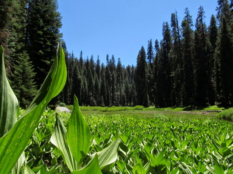 |
| Long Meadow. Picture from Shawn S |
 |
| Towards Sillman Area |
Just as we enter the Wolverton area, the Panther Peak group catches up to us. Looks like everybody got back ok, even though Majda took a spill-sorry Majda, the picture did not come out. Everybody got back to the parking lot and we decide to head to Squaw Valley for pizza at Bear Mountain. Jerry J has already left and and Majda decides to head back with Jerry K to pickup some things. So Sherri and I get to head directly home.
Trail Lesson:
 |
| Castle Rocks |
 |
| Kern-Kaweah Divide |
 |
| Lunch Time |
No comments:
Post a Comment