Hike Info : Description : Extra Photo's : Flowers and Plants
Type: Hiking
Trail head: Big Meadows Snow TrailheadTrail: Roughly the Starlight Trail (SNO-29E14), 14S11G, 14S14
Destination: 7704
Distance: 3.24 miles
Start Time: 9:54
End Time: 1:32
Travel Time: 3:38 (0.89 mph)
Moving Time: 2:38 (1.23 mph)
Elevation Rise: 687'
Descent: 648‘
Maximum Elevation: 7,832'
 |
| Start of Starlight Trail |
Even though the Starlight Trail is mostly a snow trail, we have gone over it about evenly between snow travel and a walking trail. In previous years, there has been a track to follow, this year there it is more overgrown with lupine which is past the bloom stage. But we know to look for the blue diamonds which mark the Winter trail. The one problem is that the diamonds are old, some are faded, some are no longer on the tree and some trees are no longer standing.
 |
| Sherri crossing Woodward |
This is where we typically lose the Starlight Trail and today is no different. We follow the ridge away from the road, sort of paralleling the Big Meadows Road. When we cross Woodward Creek, we start heading more southward. All of this I would consider more light cross-country work. Not much navigation as I know where the roads are, but not following a trail. I am picking my way up and along ridges and down ravines. I think I am doing it pretty well-I do not hear complaints. Maybe I am going deaf?
We pop up on the road 14S14.
The last
time we
were on this road, we were bounding over snow drifts and snow
puddles. Today, it is dry, slightly dusty. As it is after 11, I am
aiming for an area where we have eaten before, a nice area to eat.
When we got there, an RV was parked at my eating spot. Sigh, why are
my good places always infringed upon?
We dip down a little ways and find a place under a tree which looks comfortable. Too comfortable as we spend about half an hour there just enjoying life. Breaks are one of the pleasures of a hiker.
 |
| Two FunGuy, a FunGirl and a fungi |
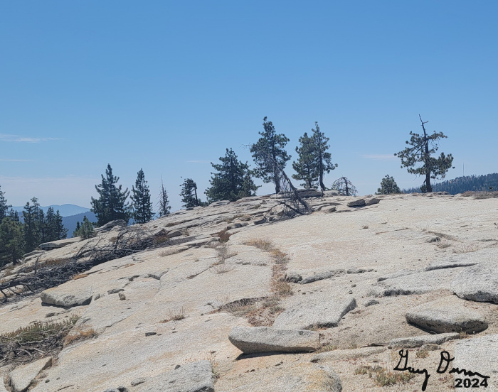
But when I look to find a route back, there it is!. So we climbed up the granite slabs which lead to the top of 7704. Here we enjoy another break, but a lot shorter than our 11ish break. Up here we have a pretty nice view to the west. I see Chimney Rock and the antenna on top of Big Baldy. Buck Rock peeks out from just above the ridge in front of it.
We now head down the ridge and re-cross Woodward Creek. Here we pick up the blue diamonds from the Starlight Trail. They follows the ridge up. Except for it being uphill, the walking is pretty easy. There is a series of small knolls which we climb. Eventually this gets us back to the campsites along 14S11G.
 |
| Hill 7704 |
 |
| Andrea, Steven and Korra |
Our return time to get back to the car was 1:30. We got back at 1:40-not bad. After getting the pods off our clothes, we get into the car with Andrea driving. We got back around 3:30. Showers were in order and then time for a good dinner at DiCicco’s. I am content. Then to end the day, we went to my book group where we talked about The Book Woman of Troublesome Creek.
Extra Photo's
 |
| Hill 7704 |
 |
| Coming down Hill 7704 |
 |
| Buck Rock Lookout |
 |
| Photographers setting up |
 |
| Fungi |
 |
| Interesting: A tree pulled up a wall of rock |
 |
| Clouds to the south |
 |
| Gary and Sherri |
Flowers and Plants
 |
| Red Elderberry? |
 |
| Red Elderberry? |
 |
| Red Elderberry? |
 |
| Alpine Aster |


No comments:
Post a Comment