Cathedral Range-13,078' (Mt Lyell, Tenaya Lake) (37.7393751, -119.2718135)
Cathedral Fork-8,176' (Tenaya Lake) (37.7671487, -119.4179341)
Cathedral Lakes-9,291' (Tenaya Lake) (37.8450182, -119.4243196)
Cathedral Pass-9,708' (Tenaya Lake) (37.8346473, -119.4148803)
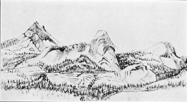 |
| From Up and Down California by William Brewer CATHEDRAL PEAK AND FAIRVIEW DOME, FROM
TUOLUMNE MEADOWS From a sketch by Charles F. Hoffmann |
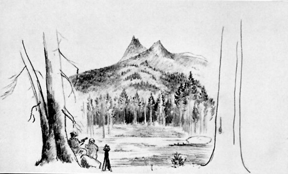 |
| From Up and Down California by William Brewer
CATHEDRAL PEAK, FROM TUOLUMNE MEADOWS From a sketch by J. D. Whitney |
“From a high ridge, crossed just before reaching this lake [Tenaya], we had a fine view of a very prominent exceedingly grand landmark through all the region, and to which the name of Cathedral Peak has been given.” (Whitney Survey: Geology, 1865, p. 425.)
“No wonder the hills and groves were God’s first temples, and the more they are cut down and hewn into cathedrals and churches, the farther off and dimmer seems the Lord himself. The same may be said of stone temples. Yonder, to the eastward of our camp grove, stands one of Nature’s cathedrals, hewn from the living rock, almost conventional in form, about two thousand feet high, nobly adorned with spires and pinnacles, thrilling under floods of sunshine as if alive like a grove-temple, and well named ‘Cathedral’.” (Muir: My First Summer in the Sierra, 1911, p. 196.)
John Muir climbed to the topmost spire, September 7, 1869. (Muir: My First Summer in the Sierra, 1911, p. 332.)
Theodore S. Solomons describes an ascent in 1897. (S.C.B., 1901, III:3, p. 236.)
From GNIS:
- Cathedral Peak:
- In Yosemite National Park, in the Cathedral Range, on the Tuolumne County and Mariposa County boundary, 1.6 km (1 mi) north of Cathedral Pass and Echo Peaks. (US-T121)
- Cathedral Range:
- In Yosemite National Park in the Sierra Nevada, highest elevation at Mount Lyell; bound on the north by the Tuolumne River and Tuolumne Meadows, on the east by Lyell Fork and Lyell Canyon, and on the south by the Ritter Range. (US-T121
- From decision card: The chief peaks in this range Mt Maclure, Simmons, Parsons, Fletcher, Rafferty, Cockscomb, Unicorn, and Cathedral Peaks
- Cathedral Fork:
- Heads between Echo Peaks and Matthes Crest, flows south-southwest to Echo Creek 14.4 km (9 mi) east-northeast of Yosemite Village.
- Also called:
- Cathedral Fork Merced Creek
- Cathedral Fork Merced River
- Cathedral Fork of Merced Creek
- Cathedral Lakes. Also called Cathedral lake
- Cathedral Pass: In Yosemite National Park, in the Cathedral Range, located between Echo Peaks to the east and Tresidder Peak to the west.
Trips:
- August 10, 2016 - Aborted JMT attempt
Pictures:


No comments:
Post a Comment