Showing posts with label Chicago Stump. Show all posts

Sunday, November 10, 2024

November 10, 2024 - Delilah


Title: November 10, 2024 - Delilah Lookout
Hike Info : DescriptionExtra Photo's 
Hike Info:
Type: Lookout

Description:

I got up even earlier than yesterday after a good night's sleep. The smoke which covered the land below us yesterday is still there, but not looking like a sea of white. Today the quality of smoke is more wispy.

The sun rises and we need to start packing. Today a crew will be coming in starting at 0930 to close Delilah. it is good to get our stuff out of the way.


We have breakfast after going into service at 0800. Then as Sherri us about to go down to put stuff in the car, I see a cloud of something over by Cherry Gap. Is this a fresh smoke? Smoke from the Happy Fire spilling through the Gap? Sherri is also looking. I realize this cloud is over from Cherry Gap, more like down from the Chicago Stump area. The cloud is more of a tan color and seems to be freshly descending. We realize that the cloud is dust, being raised from a vehicle on road 13S03. Scare resolved. This kind of false smoke is something we train on to detect, but it still gets the heart going, particularly initially. Also glad we do not need to deal with this while trying to close the lookout.

We do some cleaning up, wiping off the counter glass and mopping the floor. About the time we get mostly clean, the first person of the crew comes up, Judy, our friend. We talked for a while and observed the area. Then others come. In all, we have Richard, Mich, Kathy, Neil, Greg, Judy and us. Also P31 is here to help and as the representative of the Forest Service. Mich, who also works for the Forest Service, pretty much takes command of getting the cab broken down so that things are safe over the Winter. Yours truly tries to be helpful without being in the way. About half of us go downstairs and receive what we send down. Also they work on the shed.


Finally, everything is set in the cab. It is time to go out of service. Because I went in-service, I was chosen to go out. Going out of service for the season with Sierra is pretty straight forward and they are appreciative of our service.

But going out of service with Porterville is like the rest of the season with the radio--interesting. First, we had already pulled the base radio, so I used the handheld to get a hold of Porterville. No response. I tried several times. Then Judy tries. P31 is picking us up on his radio, so we know it is getting out. Then P31 looks at his phone and sees that Porterville is not able to respond to any radio communications, so we are to contact our duty officer. So I signal Division 3 and go out of service with him. About three minutes later, Porterville asks if we were trying to reach them. Affirmative and we officially go out of service for the season.


                                                     Video provided by Richard Kinney

During the last year, we have had two of our lookouts passed way. One of them was a very talented metal worker who spent a considerable amount of time maintaining the lookouts. He is missed, particularly since he was an all around good person. He would always be there to open and close the lookouts. One of the traditions was that at the end of the season, there was a pumpkin dropped from Delilah. Jim was the one who would have this honor. Today, the pumpkin was thrust into my hands. After Richard saluted Jim and did a countdown, I dropped the pumpkin. I was thinking I may not have gotten it far enough out, but it missed the bottom strut and the picnic bench. It was a successful drop.

                                                       Video provided by Mich Michigan

We then close up the cab and go downstairs. We enjoy a time of snacks. Nobody seems like they want to be the first to leave. But we do leave, about 1315 is when things break up. It is that kind of thing, being a fire lookout. We do not see people for most of the year, maybe about three or four times a year, if we are fortunate. When we do get together, we d not want things to end. There is a sense of community and a sense of enjoying each other.

Sherri and I leave and make our trip back to Fresno without incident. I had promised a friend that I would stop in on the way and look at her plumbing. But another friend has fixed the issue, so I am free. After I heard this, I was a bit relieved. Being in the lookout for three days, I am interested in getting home and taking a shower and then eating. Which is what we do.Our dinner is at DiCicco. A good way to end the weekend.
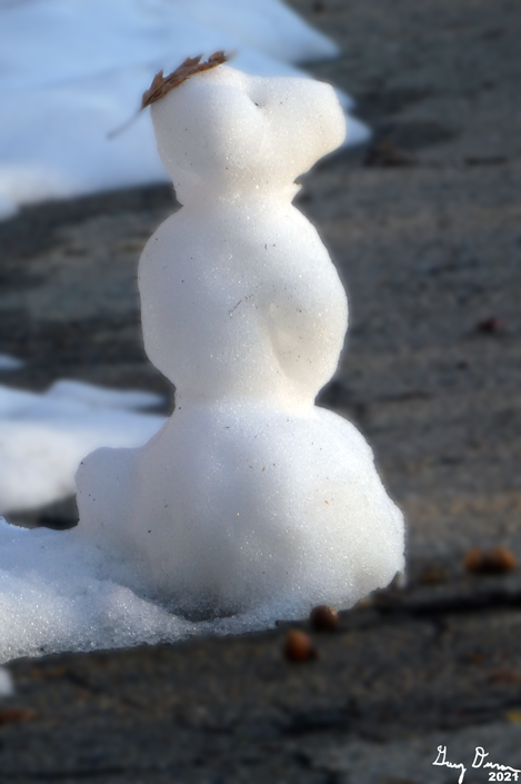
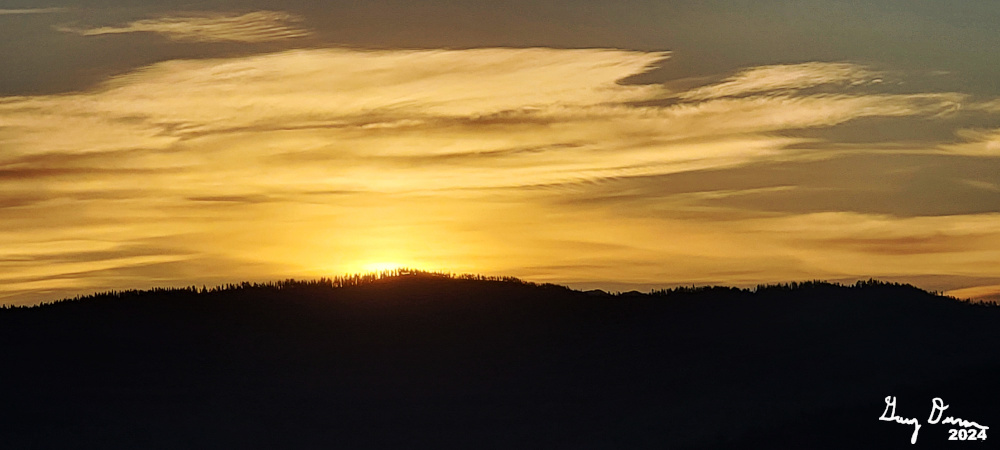
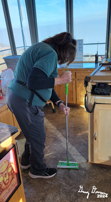


Extra Photo's


Friday, February 5, 2021

February 5, 2021 - Converse Basin Snowshoe


Title: February 5, 2021 - Converse Basin Snowshoe
Hike Info : DescriptionExtra Photo's


Trail head: Cherry Gap


Hike Info:
Type: Snowshoeing
Trail: Road 13S03
Destination:  Unknown
Actual Destination:  Top of hill 6898
Distance:  1.96 miles
Start Time:  1:21
End Time:    3:57
Travel Time:  2:36 (0.75 mph)
Moving Time:  1:40 (1.17 mph)
Elevation Rise:  404' 1
Descent: 405‘
Maximum Elevation: 6,878' 1 
GPS Tracks
 1The GPS did not measure the elevation. The elevations shown are from what Google Earth calculated.

Description:

Betty and Sherri Just Getting Started
It has been a long while since we have been out with Betty. Really looking forward to this day to be reunited with our friend. We were to have Rose with us, but things did not work out, maybe next week. I had my OSHER book group in the morning, so we are getting a late start, after 11am.


We met Betty at
Bear Mountain Pizza at lunch time and split a pizza between the three of us. Bear Mountain has added picnic tables. So we enjoy a time between us. Betty notes she has not been out for a while and feels out of shape-we are not too much better, We leave by 12:30 and get to the park by 1pm. I am thinking we will try the trail to the Needle Dump. But when we come to it, a parking space has not been plowed yet. So we continued on past Grant Grove to Cherry Gap. Only a couple of cars are parked-I was concerned about a hoard of people being there.

It is a pretty warm day for February. I go down to a T-Shirt. The route which we follow is along Forest Service Road 13S03. It cuts along the face of a ridge on its south side. So lots of sun. Eventually this road leads to the Chicago Stump. But I suspect that we will not get that for-first because of our late start-I have set a 3:15 turn around time and I am not sure that I am in condition to go that far. We do have a first obstacle: climbing over or through the gate. That done, we put on our snowshoes.

Penny Pines Plantation
Maybe 150 yards from the car, I spy a figure coming towards us. It is Don who lives in our neighborhood. I am not surprised as he said this was a possibility. He stops and we talk awhile. His hiking partner, Steve, and a woman comes up and we converse. Don leads the connections with Steve about why he should know who I am. I had told Don about Stevenson Falls and Steve really liked the place. Steve is a photographer and did the photographs for Don’s book, 101 Adventures in The Southern Sierra.


Gary and Betty climbing Hill 6898

They go on and we go on. Three more of their group passes us. We then come to the sign saying Penny Pines Plantation. From what I can tell, this is a program of the National Garden Clubs association to replant forests which have been decimated by fire or other destruction. The Exeter Women’s Club and the POW/MIA club at Moffett Field are both recognized on the sign. Special at least having known of both groups.

I start eyeballing the little hill above us and thinking if there would be a good view from up there. We go 100’ towards the Chicago Stump when I see what looks like a clearing on the west side of my hill. So after consulting with my companions, and them not saying No, I take off up and around hill 6898. First thing, I am breaking snow, I sink about a foot or so. The climb is not steep. But I do come across some bushes which are a minor impediment. Along the way, my shoe sinks into a bush hole. When I pull my foot out, I am missing my snowshoe. I dig it out and am able to reattach it without issue. Just an annoyance.


Looking West towards Hill 6898
We get to the clearing and are rewarded with a nice view both to the west and south. We circumnavigate the hill and take in the area. We descend down the east slope, back to the plantation sign. Along the way, there are several downed trees to navigate around, some buried and some exposed. One I step on and my left foot slips off backwards. So I try the other foot and the right foot slips off going forward. No harm. Betty has a similar experience. Sherri learns from us. But she loses a snowshoe as well in some brush.


By this time, it is a little after 3pm. We decide it is time to head back. Betty and Sherri take off while I attend to business. For some reason, I am feeling a bit tired in the legs. So I have a hard time catching back up again. But I do when they stop and observe their surroundings. But by this time, we are getting close to the car.


Socially Distanced Group Picture

And now we are back at the gate. Off comes the snowshoes. This time, not enough energy to go over, so I go through the gate bars, just barely. We have a long goodbye with Betty. Maybe we will see her again Wednesday, assuming things work out to go and play in the snow again.


Betty and Sherri Finishing Off The Day


 I go a bit further down the road to scope out the Boole Tree road. Looks like there is good parking. A Facebook friend went last week and enjoyed himself. Sherri and I had gone last year. Looks promising. Now we return home. We decide to see what the snow is like in the Delilah area. We can drive past the paved area up to Mike’s place. We could probably go beyond-others have, but it looked a bit sloppy, so we decided not to. Also, the snow is not more than a foot deep, melting fast with large areas of exposed dirt and brush. Does not look fun to play in. We get back to Fresno a bit before 6pm. A good day. Glad to see Betty again.


Extra Pictures


Bear Mountain in the Distance

Sherri Showing Off Her Form

Betty Having Fun

Sherri and Betty

Looking over Hoist Ridge to Delilah

McKenzie Ridge

Saturday, July 11, 2020

July 11, 2020 - Converse Basin, The Tree Quest


Title: July 11, 2020 - Converse Basin, The Tree Quest
Hike Info : Description : Trail Lessons : Extra Photo's : Animals : Flowers and Plants


Trail head: Road 13S65
Hike Info:
Type: Hiking
Trail: None-Cross Country
Destination: Finding a tree
Distance:  1.27 miles 1
Start Time: 10:19
End Time:    1:57
Travel Time: 3:38  (.35 mph)
Moving Time:  2:15 (0.57 mph)
Elevation Rise:  558'
Descent: 225‘
Maximum Elevation: 6,655'
 1These miles were cross-country and about 50% of the time was in brush
Description:
I will start this post off with some background and a quandary:
  • Background: When we are in a fire lookout, there is a lot of territory which we see, some interesting and some which seems to be rather prosaic. On the latter, Jeff from Buck Rock perked our interest last week by asking about a particular tree we both could see. He asked about the azimuth from Delilah-he was trying to locate it on his map. So we got our azimuth: 93o from Delilah and 303o Buck Rock. I was able to plot out and come up with an approximate coordinates of the tree. The key word is approximate. So finding the tree has now become something more than prosaic and risen to the level of “interesting”.
  • Bovine in the road
    Quandary: After doing this trip, we now have some doubts about whether we have the right tree. What our memories are is that there is a single tree just poking up on a ridgeline. The first branches are high up and the tree has seen a few years. Both what we found and re-examining a picture taken from Delilah do not match this description. So there is a bit of uncertainty about this. Will we need to make another trip? 

    Note from July 16, 2020: Judy at Delilah yesterday and I had her verify the azimuth from Delilah. She has an azimuth of 89o45' which is very close and within the tolerance of our equipment of my computed azimuth: 89o53'.


It is time to explore, to go to a place which I have not been to before. Saying it like that, I almost sound like Captain James T Kirk of the Star-ship Enterprise. We are going to visit a tree which we can see from Delilah. I get up a little before 6am. Sherri a bit after 6. We get ready, along with Korra and Steven and then we are off by 8am. I then realize, we will need gas. I think I took the slow way to get there. But we do. I realize that I have forgotten my mask, but there will be a limited amount of time when I will need it, so a bandana is used.
Stump at Converse Basin
We stopped at the Big Stump restroom-the parking lot did not seem that full. A person asks if I have been here before-yes. He wants to know about going to Mist Falls. I tell him where it is. Then he asks where else he should go. I give him General Grant Tree, Panorama Point and Big Baldy as he likes to hike. This may have help with Franco-American relations, just a smidge.
Korra
Now it is on to our hike. We go to Cherry Gap and take off like we are heading towards the Chicago Stump. But first, we see a flash of white. Turns out it is a cow with horns in the road. We pass by it and head on to road 13S65.We go down the right (east) branch for about a quarter mile and find a nice wide place to park. Time to get ready for our quest.
We stop about 10:15 and spend a few minutes getting ready. It is going to be a warm day. Ordinarily I would take off my pants legs-not as obscene as it sounds. But with us going without a trail and the reports talk about brush. So I leave the legs on the pants for protection.
I have the approximate location loaded onto mine and Sherri’s GPS. Unfortunately, I am not proficient in travel with GPS-I am much better with a map.So we head off where I think the GPS is telling me, about a quarter mile up the hill. We gain the top of the ridge after going through a little bit of brush.. The GPS is now saying go north about a quarter mile. This is over the top of a knoll. We are on top of Hoist Ridge, close to where Hoist and Verplank Ridges join.
Steven and Korra scouting out a path
Steven has gotten on top of a rock to see if there is a route around the buck brush to the west of the top. But looking at a topo map, that side gets steeper, so we go to the east. We definitely do go through brush. But there are also lots of small Sequoias. My guess they are less than 5-7 years old. That would put them just about the time of the Rough Fire. I wonder how many of them will survive the next 20-40 years?
We make our way around the knoll and spot a large Sequoia. I am wondering if this is what we are seeing from Delilah? We get up close and I take some coordinates. But looking a bit further north, maybe about a hundred yards, there is a taller, not as full, and older Sequoia. The first Sequoia we, or at least I, call the Younger. Now that one has real possibilities. We stop and have lunch before continuing on to investigate. Unfortunately I did not bring the picture we took last week. That would have been helpful.

Sherri in a bunch of elderberries
After a few bees drove us out of our lunch place, we went on to the other Sequoia tree-we are calling this one the Elder. I suspect it is much more middle age or even on the younger side of middle age because of the texture of the bark. But it is definitely older than the first large Sequoia we came to. We think this is our tree as it fits many of the requirements.
As we gaze around, we realize we cannot see Delilah from here. Verplank Ridge is in the way. But then the questions arise, are we at the right tree? We are close to my plotted coordinates. Maybe we are only seeing the top part of the tree? Once again, I wish I had brought my picture.
The Younger

The Elder
We circle the ridge which drops off pretty good after our tree. And now we see the road beneath us, so we crash through the brush to reach it. Something which I have not talked about is the amount of stumps we have seen in Converse Basin. This area was heavily logged in the late 1800’s. These stumps are the remnants. Sherri raises the question, how could these people be so short sighted? They were falling trees thousands of years old and for what? Roof shakes and fence posts. Seems like an ignoble end to a majestic tree.


Steven, Sherri, and Gary
We head back up the road about a quarter mile and find our car. Now what to do? I think we all feel pretty tired. Going cross-country through brush is that kind of tiring. Even though it is in the mid-80’s, the heat really sapped me. There is this road we have not finished going down, so off we go. On my old topo map, it says there is a trail at the bottom. But that trail is really a road.
We go down that a way. People are having a picnic back in there. Imagine us disturbing their peace-we are not the only ones. There are just a few. When the road goes down sharply, we do a 9-point Y turn and head back up the road until we get to Highway 180 and then it is on home. We get home around 4:00pm. We decide that DiCicco’s is a good after hike dinner so Sherri goes and gets it for us. Contentment.


Trail Lesson: When exploring, come prepared.


Extra Photo's
Some of the tangle we needed to go through

Sherri

Gay being stumped
Looking East into the High Sierra

The Younger

Lunch Time Snooze

Sequoia the Elder


The Elder's Base

Sequoia the Elder

Sequoia the Elder is a rock eating tree

Gary, STeven and Buckbrush

North, across the Kings


Rogers Ridge and Nelson Mountain

Patterson Mountain and Rogers Ridge

Korra, Steven, and Gary

Korra being intrepid

Top of Hoist Ridge with Sherri

Stump at Converse Basin

Stump at Converse Basin

Nicely shaped Sequoia off of our road

Where is this Sequoia? Seen on the way out.


Animals


Flowers and Plants
Indian Paintbrush

Maybe Elderberry

Maybe Elderberry

Buckbrush