Showing posts with label Pacheco Pass. Show all posts

Tuesday, December 17, 2024

December 17, 2024 - Go to San Francisco


Title: December 17, 2024 - Go to San Francisco


Hike Info:

Type: Hiking

Trail head: Fort Funston, Nike Missile Site

Trail:  Coastal Trail, Horse Trail

Destination:  This was a wander with hope of doing a look

Actual Destination: 

Distance:  2.45 miles

Start Time:  2:09

End Time:   3:53

Travel Time: 1.44  (1.42 mph)

Moving Time:  1:15  (1.96 mph)

Elevation Rise:  286'

Descent: 292‘

Maximum Elevation: 177'

GPS Tracks


 Description:

I slept well last night dreaming that I had failed to get in a writing assignment for a class-which I do not think I ever took. At least I think I never took it. If I did, there is an assignment which I did not do-too late to worry about it. I still woke up at 6:30 refreshed. I had gotten most of my stuff ready yesterday. This morning it is things like taking out the garbage, loading my thumb drive, and a few things. Then breakfast. About that time Sherri gets up. By the time we are all ready to go, it is 9:30. Sherri starts off driving.

Battery Davis
She drives until Los Banos when she spots a Starbucks and pulls over for a latte. When she comes back, she decides that it is my turn behind the wheel. So I became the commander of the car. I drive over Pacheco Pass and down to Gilroy. There we stop and have lunch at In-An-Out. And then we are on our way. We take 280 into San Francisco, but instead of going on our regular route towards the Presidio and Cow Hollow, we go over to Lake Merced and to the Fort Funston of the Golden Gate Park Recreation area.

We park our car where the Nike Missiles used to be pointed skywards to defend The City. We start our walk along the Coastal Trail. This trail is paved and marked by the presence of crows and dogs. The crows seem to expect handouts. While this must be one of the favorite spots for dog walkers of the area. Most of the dogs are well behaved and off leash. There just is many of them.

View from Battery Davis

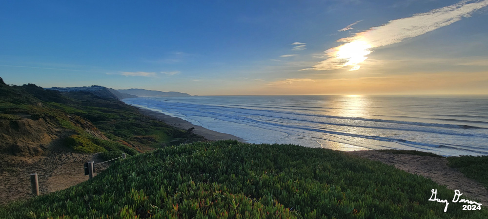
After a quarter mile, there is a big mound between us and the ocean. This is Battery Davis, a relic of pre-World War II. We walk through one of the tunnels and see where the cannon would have been mounted. Also enjoy the view of the ocean.

Sherri, the Sandwalker
Up until this point, the trail has been paved. But sand has a way of encroaching even the works of man. We start having to act as sand walkers to continue on the Coastal Trail. It is still good to look out and see the ocean beyond the sand dunes. Afterwhile we come to a junction and I ask Sherri if she wants to continue following the Coastal Trail all the way to Marin County or return via the Horse Trail. Put that way, she chose the Horse Trail.

Stairclimbing Gary
This trail is high on a dune above the Great Highway. We go along with the undulations of going up and down the vegetation covered sand, sometimes ducking under trees. Eventually we hit the pavement again and the walking is easier.


And then we come to the stairs. In San Francisco, we are suckers for stairs and start climbing them. These stairs offer access from John Muir Drive up to Battery Davis. From there it is a short walk back to the car.

Sherri notices on a map that there are some more stairs. We decided that if we have only walked about an hour, about 2 miles, we might as well find these stairs. We went out of the parking lot towards the Ranger’s Station. Google shows a path down to the beach. The idea is to go down and take the stairs up. But when we get to the cliff, there may be a way down, but for a couple of old people, we are using our acquired wisdom not to go down this. We just walked along a trail at the top of the bluff. We did find where the stairs are. But decided that there is not a lot of reason to go down them so we could go back up them again.


Gary wondering where are the Christmas lights

Once we get to the car, we take off for Cow Hollow, rejoining 280 through
Golden Gate Park into the Presidio. There we turned onto 101 and found our hotel, Cow Hollow Inn. We check in and the lady gives us the room we requested, 315. This is the same room as before. She also suggested rooms 338 and 339 being comparable with good views. Good to know.

By the time we get settled in, it is just past 5. We must be getting old as we both rest until 6. Sherri is getting hungry and I cannot say I am far behind. We decided to walk down to the Marina and see what Christmas lights there are. If we find a place to eat first, we will.

We do go down to the Marina as there are not any eating establishments which meet our fancy. When I was a child, my parents would take us up to the Marina and the boats were all decked out in lights. Also the houses along the waterfront were amazing to view. Either my childhood memories are vastly inaccurate or the Marina has lost its Christmas thrill. There was only a Christmas tree with lights and one boat. A bit disappointing. At least some of the houses had lights.

We returned to Chestnut ready to eat. We found an interesting Mexican place called Las Mestizas. A hole in the wall place. We each had a burrito. The helpings were ample. The food was satisfying, We waddled out of there and back to our hotel room. By this time, it is 7:30 and we pretty much pack it in for the night. Sherri watching a movie and I did my writing. It is a good day. Let's see if I make it to 10.


Background


Battery Davis

Battery Davis.
Major General Richmond P. Davis, a Coast Artillery officer who served in France in World War I. From Wikipedia

TripAdvisor

Las Mestizas. The sign at the entrance says authentic Mexican food. You can hear the meat frying for your order, so you know all is fresh. It is a small place on Chestnut in San Francisco’s Cow Hollow District. My wife ordered a burrito bowl-a burrito without the wrap-and I a wet burrito. The burritos were filling, and tasted good, but not overpowering. The seating was basic as they made the most of the small space they are in. The help was shy, but took care of us.


Extra Photo's

The lone boat with Christmas lights

Steps to the beach

Sherri going up the steps to Battery Davis

Top of the Golden Gate Bridge


Flowers and Plants


Tuesday, January 22, 2019

January 22, 2019 - East Entrance to Henry Coe State Park


Title: January 22, 2019 - East Entrance to Henry Coe State Park
Hike Info : DescriptionBackground

Trail head: Dowdy Gate
Hike Info:
Type: Hiking
Destination: None-walk for an hour or so
Distance:  2.3 miles
Start Time: 11:25
End Time:   12:45
Travel Time:  1:20 (1.72 mph)
Moving Time:  1:11 (1.94 mph)
Elevation Rise:  926'
Descent: 527‘
Maximum Elevation: 947'
Description:
We are on our way to Mountain View. But first we stopped off at San Luis State Park to pick up a Senior State Pass-I sort of enjoy this getting old thing. Being able to get into parks-national and state for free is great. Then we go over Pacheco Pass and go off of highway 156 at the Bell Station turn off. This leads us up to a picnic area/outhouse and parking area. The gate is closed after this so we park here.
We have a minor debate about the closed gate, but decide there is no sign so we climb over the gate and are on our way. Our route is a road which is used by various ranches to access their land. We are about seven miles away from the Dowdy Ranch Visitor Center-no way are we making it that far. The first eighth of a mile has a slight slope. Picturesque trees line the road and we do pretty good.


Oak and Sky
 
But then we see a sign saying Speed Limit: 25mph. But then the other sign says Hill. Wondering how much of a hill can this be? We quickly find out. It is about at 20-25% grade and goes on for about ¾ of a mile. We rise up over 500’ during this time and can tell it. A lot of time I have my head down just concentrating on the climb.
Pond on the way down
We are past by a young woman in a pickup truck-she waves and goes on. I guess we are OK, at least we did not look menacing.
After about 40 minutes of walking we need to turn around as we have an appointment this afternoon in Mountain View. Coming back downhill, I see things which I missed going up. 


There was as small pond framed by some oaks. Then there was a cow high up on a ridge. And a marshmello growing in a muddy pot along the side of the road.
We go down a bit slowly. There is scree on the road and with its steepness, we are being a bit cautious. But then we get to the flatter spot close to the gate and our hike ends with us reclimbing the gate.


While we walked slowly than when we are in shape, it is good just to be out walking like this. With the climb, we can start get into shape.


Background
Dowdy. There is several ranches around Henry Coe State Park. One of them is the Dowdy Ranch. Around the visitor center, which is inside the park and is only open during weekends during the summer, the area is similar to how it was when the Spanish explored it. Also the area around it is considered an ecological sensitive area. There are also roads in the area used by private ranches to access their land.


Saturday, February 14, 2015

February 14, 2015 - Dinosaur Lake and Pig Pond

Title: February 14, 2015 - Dinosaur Lake and Pig Pond
Trail head: Pacheco State Park Parking Lot
Hike Info:
Type:  Hiking
Trail: Spikes Peak Road, Pig Pond, and Dinosaur Lake
Destination: Loop with Dinosaur Lake and Pig Pond
Distance: 5.89 miles 1
Start Time:  9:36
End Time:   1:35
Travel Time: 3:59 (1.43 mph)
Moving Time: 2:24 (2.42 mph)
Elevation Rise: 1,193'
Maximum Elevation: 1,499'
 1I did not turn on my GPS until about 10 minutes into the hike. So the distance traveled, time walked and elevation rise are all approximations based upon the GPS readings of this and other hikes in the area.

Description:
Got up and found that I was missing half of my front tooth. What a way to start the day! But it is not hurting so that is a good thing. We leave the house by 6:30 and get to the Kohl's parking lot soon after.  We have about 20 people coming with us today, meeting some at Pacheco and others in Los Banos. It is clear in Fresno, with a little bit of haze. But when we cross the San Joaquin along 152, we get hit by fog for about 10 miles. All arrive safe at Pacheco State Park around 9:15.

Oak Tree Silhouette
By 9:35 we are on the trail today. We are doing three trails I have walked a couple of times before. This is the first time I am walking it so early in the year. We are doing the Spikes Peak Road, Pig Pond, and Dinosaur Lake trails counter-clockwise. So the very first part of the trail is one of my favorites. As you climb the first hill, you get to look out over Pacheco Pass, the traffic going over 152, the wide spot before the highway descends steeply on both sides of the pass. It just feels like you can watch the whole world pass you by in the tranquility of the hill.

Road to Pig Pond
Pig Pond in the distance

But I have 21 people waiting for me so I must not lose myself in thought. After going through a cattle control gate, we come to the first of many trail junctions. We take the Pig Pond trail and after a third of a mile, we see the pond coming into view. No pigs in sight and the pond is pretty full compared to the last several times we have seen it. After the hike, Sherri tells me that she talked to a couple teenagers. They said they went down into the oaks on the north end of the lake and saw a mountain lion (Sherri says they said a bobcat).  What I saw of them, they were scurrying away pretty quickly.
Pig Pond

Speaking of Sherri, I have her doing sweep, making sure she keeps tab on the back of the group. I am trying to keep towards the front. there is a lot of trail junctions-not all of them are marked. I am fortunate as I have several other organizers on this trip: Lee, Donna, John, Jerry J and Jerry K, plus several other capable people. So I feel pretty confident I will not be losing anybody going off in the wrong direction.

After passing by Pig Pond, we climb up a little hill to a picnic bench. The first place were everybody waits. But we get a good view of the Coastal Range peaks to the south and west of us. Peaks like Fremont and Spikes.

View upon descent


Coming Up To Ridge
But now that all have caught up, it is time to do a good descent into Salt Creek. There is nothing great about Salt Creek, except that is the last of a 300' descent-our longest of the day.Of course, as we are going down, we get to enjoy the greenness of the spring grass around us, along with a few early wildflowers-I do not know their names, except for mustard and the California Golden Poppy. I guess I am a poor visitor not to at least learn our hosts names.

Windmills on ridge
After a break at Salt Creek, we start our way up. Now this is where my confusion starts. I remember the trail here going up the side of a road, with a steeper access road, which is true. But my memory says that the two do not combine, but there it does just a little ways up. The climb is a bit steep, but not far. It is not steep enough that we stop talking. But after a ways, the windmills come into view. And there is the road which leads up to them. What happened to Dinosaur Lake? Wasn't that to come before? Jerry K tries to reassure me that it comes later. But I am wondering, did I miss a turn off? Oh well, as long as we are here, we might as well go on up to the windmills. We take a lunch break here and enjoy the view of Mammoth Lake in front of us, the blades slowly spinning above us and the warm sunshine on our backs.
Meetup on windmills

Sherri and gang


I am still wondering where Dinosaur Lake went to. But hiking the hill tops is still so good that I stop that wondering. Evidently the rest of meetup group is in the same frame of mind because there is the relaxed pace of enjoyment pervading our group. The air is clear and we can see the snow tops of the Sierras. The grasses at our feet gently waving in a light breeze, so good of a day-and this is February!

Dinosaur Lake
Then we start descending again, and we see it: Dinosaur Lake. I am thankful that Jerry K is right! I talk a bit about was there really Dinosaurs or not? Do you want to romantic view or those of the more practical? I side on the romantic. A few years ago, some kids from Los Banos did a paper which sort of sides with that the formations were not right for dinosaurs in these parts. Still, it is not conclusive, so I can enjoy the pleasure of seeing a giant dinosaur print where this lake is. Of course, there is the dam which forms the lake, which helps with the dinosaur paw.

San Luis Reservoir
After this bit of excitement, we hid up to the top of the ridge above Dinosaur Lake and follow it northward. After two-thirds of a mile, we hit Windmill Road and some people wander up the road to see a good view of San Luis Reservoir. Ah, but if they just waited a little bit, they would have seen even a better view. This one with wildflowers in the fore-front. The picture on the right is sans flowers-see below for an example. This is the begining of the end to our hike.

We turn back around the ridge and hit Windmill Road and walk it for a ways. There are some offshoots to this road, so I keep the group relatively close together until we hit the trail branching off to the left. I believe it is the old Dinosaur Point Road, but whatever it is, we follow it up the last tiny ridge and into the meadow/pasture we started off in.

When we get back to the car, we see two of our vehicles-not mine-have parking violations on them. One just flat out did not see the iron ranger. The other did deposit money, but forgot to tear off the tag. Hope they can work with the State Park on it. Some of us finish off our hike by going to Black Bear Dinner in Los Banos. For the most part the food was good, but there was exceptions. This was our waitress' first day on the job and there was some confusion. Also one of our members had a vastly undercooked hamburger. We make it back to Fresno by 4:30 or 5:00, pretty content with the hike.

San Luis Reservior


Trail Lesson: Make sure I know where I am going and where I am at.


Pig Pond from ridge


Dinosaur Lake


Sunday, March 23, 2014

March 21, 2014 - Pig Pond/Tunnel Monement Loop

Title: March 21, 2014 - Pig Pond/Tunnel Monument Loop
Trail head: Parking Lot at Pacheco State Park
Hike Info:
Type:  Hiking
Trail: Pig Pond/Tunnel Monument/Spikes Peak
Destination:  Tunnel Monument
Distance:  3.67 miles
Start Time:   11:41
End Time:      1:27
Travel Time: 1:45 (2.10 mph)
Moving Time: 1.29 (2.47 mph)
Elevation Rise:  966'
Maximum Elevation:   1,823


Start of Trail to Pig Pond

Description:
Once again we are on our way over to my parents in Mountain View. Pacheco State Park is turning out to be a great place to go for a mid-trip hike. We get to Pacheco around 11:30 and take off to Pig Pond. Previous hikers had not closed gates, but we leave them closed.

Climbing out of Pig Pond


Pig Pond is a familiar route-we have done this several times. While Pig Pond will never be a destination spot, it is a close one mile walk from the car. We travel beyond this, up the hill to a picnic table. This would be a great place to eat, with shade and views of Salt Creek, windmills and even Fremont Peak.
Fremont Peak
But we do not have lunch with us, so on we go, but just a little ways to the Tunnel Monument trail junction. We make a right turn onto the Tunnel Monument Trail and start a training hike up. This is really a steep climb. Glad it is not hot, but it is windy, which cools us a bit. The climb seems to be never ending, but in reality, it is only 500' up! Just straight up.
Tunnel Monument

But at the top you see back towards San Luis Reservoir, then down the west side of Pacheco. Nice, as long as the wind does not blow my hat off too many times. We hunt around for the Tunnel Monument, but do not find it. But we go down the trail thirty yards, and there it is. The monument is only a benchmark which says there is a tunnel below us from San Luis Reservoir to the creek on the west side of Pacheco. But you do enjoy thinking about all the engineering of those who bore through the Coastal Range to make this happen.
Spikes Road Trail


We continue our walk, starting on the return trip. As steep as it was coming up, it us at least as steep going down Spikes  Road. But we rejoin the Pig Pond trail, where it flattens out. From there it is a short walk back to the car. Then off to Gilroy and Subway for lunch-a Chicken Enchilada Melt if you must know.

Trail Lesson:
Say,     do you have any grey pig pond?  (Probably one of those things where you had to be there, but try saying it slightly slurred)