Showing posts with label Finger Rock. Show all posts

Tuesday, October 17, 2017

October 17-18, 2018 - Delilah Lookout


Title:  October 17-18, 2018 - Delilah Lookout
Hike Info : DescriptionBackgroundExtra Photo's : Animals

Hike Info:
Type:  Lookout

Description:
Today and tomorrow may be the last days this year which we will be able to work in a lookout this year. The season is coming to an end with only two fires noted in our area; the Buck Rock Foundation has been asked to keep the lookout open until the first rain or two gives the earth a good soaking. But our calendar does not match up well with openings. There is still a slim chance we will be up here again.
October 17, 2017
Our morning view to the west-smoke, but not ours
 We get up to the lookout at a few minutes after 0900. Looked around and looked at the white board to see if anything exciting has happened-no close fires or anything like that to worry about. Took the weather and got stuff loaded up the 80’ to the cabin.We go inservice at 0931, on time, well almost.


Clouds to the east, but no rain
Sherri gets a call from Kathy-Sierra’s radio communications is having some issues. But we seem to be talking ok with them. We go into the routine of scanning and listening to the radio.  Sherri and I talk about how we responded to our fire on Sept 12th. So we walked through how we spotted it, how we located it on the maps and how to figure out the precise location of the fire. In this case, we had full visibility of the fire, and the burn mark is still there so it is easy to reenact it.


Spanish Mountain basking in sun
Lunch comes and we have Peanut Butter sandwiches. Kings Canyon is having a prescribed burn east of Cedar Grove around Roads End. So we add SEKI to our channels we listen to. They do a test burn at 1215 and declare it a success at 1315. Then it is on to the real burn. We do not see any smoke from that fire, nor do we expect to see any. It is a ways away and we have several ridges which block our view. The smoke would have to go awfully high for us to see it. It is 25+ miles away and the smoke would need to climb over 8,000’ for it to be visible. I suspect the burn boss would have a fit if we reported the smoke.
Just an interesting looking cloud towards evenign
One of the things which we have issues with is accurately hearing what is on the radio. Particularly the latitude and longitude given. These are mostly used to give the location of a fire. Most of the time the fire is way outside of our viewing, but it is a good idea to get the information anyway. So we practice hearing and locating where fires are-some places close like Davis Flat, or Park Ridge or Buck Rock. But then I threw a few curves at Sherri: Mt Whitney and Finger Peak-not Rock. I think we are getting better at this.
Sherri reads and takes a nap. Then it is my turn. Nothing exciting. Sierra is repairing a repeater at the lookout across the way and gets it back online at 1600-that is our excitement. So at 1700, we go out of service. But we do look at the topo map for Verplank today and try to follow the drainages in our area. A good exercise.
Evening View
Dinner is Digiorno Pizza, I make a comment on Facebook that  when we stay at the lookout we dine in “high” fashion and with rather exclusive ambience. This refers to we are 80’ up and have a rather nice red tinted clouds to gaze at. Wendy suggests we should make Delilah into a revolving cabin for the lookout. I really like that woman.
Looking west and the sunset
Not much else for today. We sort of do a few things, like read or catch up on e-mails. Around 2100 Sherri hears a helicopter. Looks like it is heading down the Kings to Fresno. Getting close to 2200 and time for bedtime.
===========================
October 18, 2017
Lowering our belongings
Woke up around 0600 and watched the sky change from black to blue when I got up at 0645.  Restful morning. But is looks hazy outside and when I open the door, there is a definite smoke smell. But after looking around, the source of the smoke is not close, at least not visible. There is an inversion about at our level, 5200’ which I suspect is trapping the smoke from the prescribed burn east of Cedar Grove. When Sherri get up, we have our breakfast of oatmeal. Then get the cabin cleaned up and tote stuff down to the car before starting a new day.


Morning smoke haze
 
At 0930 we go inservice after taking the lookout weather. Nothing really exciting here. Sierra’s radio communications seem to be doing better. We are using our normal channels to go in-service and communicate with them. But there does seem to have some static there.
With the smoke and haze we have pretty limited visibility, about 4-7 miles from the lookout, vs the 15-20 which we expect. So between scans, I wash windows and the solar panels. A small bit of excitement in that there is a fire at Yosemite Lakes-a car and vegetation fire. That is 40 miles away, so well outside of even our normal visibility.
More haze
Lunch comes along and it is peanut butter sandwiches again. Then back to scanning again. Oh yeah, and taking our 1300 lookout weather. This is where mistakes can happen. Where I become complacent because nothing is happening. I wonder how a soldier on sentry duty remains vigilant night after night after night? With me, it is rushing through the scans. What makes this even more difficult is the amount of haze cuts down our viewing area. So when I look across the way, it is difficult to peer through the haze to distinguish anything on the other side of the Kings. So it becomes easy to go quickly over an area because 1) nothing happens and 2) even if something happens, could we even see it?
Clouds and a break in the haze
The inversion layer has dissipated. So instead of a layer of smoke, we get blanketed by a white-gray haze. Towards the end of the day, the west side becomes almost impossible to see beyond about 2 miles. Tivy has been gone for awhile. Cannot see the antenna’s on top of Bear Mountain. But we are seeing a bit more of Park Ridge and across the Kings.
Kathy calls and wants some materials concerning the Davis Fire from Sept 12th.  So I gathered the appropriate logs and reports. We will meet when we go out of service tonight.


More clouds, but low haze
After doing the 1600 lookout check-in with Sierra-only two lookouts on duty, we also get the next day’s fire weather and indices. Sherri starts to clean up, including mopping and stuff. I just get out of her way and make myself useful doing scan’s. Around 1630, Sherri starts to take stuff down to the car. This is like packing stuff from the 8th floor of a hotel with no elevator. But she only makes the trip once. Because now she also cleans the outhouse. The only people who use this are the lookouts, so it is not too bad, at least I am not doing it. I busy myself by starting to close out the lookout for the night and doing scans. A little after 1700, I go out of service with both Sierra and Sequoia National Forests.
Evening approaching. Our last view
On my way to put the keys back, I come across this strange little creature* having jumped and rustled some leaves. Don’t know what it is. By 1720, we are in the car and heading out. We are to meet Kathy at Hills Valley Rd at 1830. But we almost don’t make it. Going down 180, a deer jumps in front of the car. Fortunately, I was going slow enough and the guy behind me while close, was not that close when I applied the brakes. The only thing harmed was my heart and Sherri’s throat from the strangled scream. We meet Kathy and give her what she wants-I feel so much like Deep Throat handing off Delilah secrets. . Then off to Fresno where we have dinner at DiCicco’s before getting home at 2030.
Sherri and I both think  it will be a long Winter if we do not get to go back up to Delilah before it closes. But it is good that we have been able to go up there this Fall.


Background
*Some friends of our identified this as the larvae of a grasshopper. Nothing like I have seen before, but it makes sense.


Extra Photo's
Interesting Cloud

Looking Northwest over White Deer

Westward towards Tivy and Bear mtns

McKenzie and Park Ridges

Gary hauling up a sleeping bag


Animals
Hummingbird

Hummingbird

Grasshopper larvae


Saturday, August 27, 2016

August 27, 2016 - Crown Pass


Title: August 27, 2016 - Crown Pass
Hike Info : DescriptionBackground : Menu : Extra Photo's 


Trail head: Woodchuck Lake
Hike Info:
Type: Hiking
Trail: Unnamed
Destination:  Half Moon Lake
Actual Destination: Crown Pass
Distance:  4.90 miles
Start Time: 9:34
End Time: 4:12
Travel Time:   6:37 (0.74 mph)
Moving Time:  3:27 (1.42 mph)
Elevation Rise:  744'
Maximum Elevation: 10,306'
GPS Tracks
Early morning sun on Loper Peak


Description:
Note: I wrote this up once and then lost it. I think a second re-write almost always loses some of the vitality of the first. But this blog is principally about recording hikes so i can relieve them later.

I woke up around 5 and went out to do my business. When I came back in, I just laid there for the next hour and a half. It was relaxing. As light started hitting the tent, I got up. I am the first one up, even though I think I heard Rose rolling over.

Breakfast crew
I had my quiet time, enjoying the morning silence. I attempted to play my recorder but found out that I've lost any sense of fingering. Will have to work on that.  I did see Finger Rock and Mt Hoffman-not the Yosemite one-which we see from Delilah.

Bear hang and Laundry Line
The morning is a slow morning. But that is OK, it is a day hike rather than having a heavy pack on our back. Our goal is to get to HalfMoon Lake, about 3-4 miles away. So we don't need to rush or anything. That shows in how we are moving around camp, rather lackadaisical. But that is OK since there is no pressure and that is not why I hike.

Laundry water
We have our breakfast oatmeal like usual. I have my electronics all charged up. Then string a laundry line and place my sleeping bag on it. Now it is time to do the laundry. Amazing how dirty our clothes can get in two days. Then we just mosey around some more and eventually get everything packed for our day trip.


Mylar Balloon
Towards Marsh Lake

 We start walking about 9:30, traveling on the west side of Woodchuck Lake. There's not a trail on this side of the lake, even though I noticed several other sets of footprints over here. It is easy to walk, here as there not many obstacles. So far it is a pleasant relief from the climbing of the last couple of days. As a bonus, we get a better view of the lake as well as the area what we've come from. I get to show Rose and Sherri Finger Rock and Mount Hoffman. But in a tree we find a surprise: a Mylar balloon at 9,900'. How far those things travel.
North part of Woodchuck Lake

South part of Woodchuck Lake


We continue to walk towards the trail, starting to rise to meet the trail. When we come to the trail, I walk straight over it, while telling Sherri and Rose to where I think the trail actually is. After we get on the trail, we continue to climbing until we meet the junction for Marsh Lake. The trail starts gently meandering, rising without much protection from the sun. But there are many meadows. I stop and gaze at many of these. When we get to the top of the rise, we meet Adam and Jason-our friends from the past couple of days. They are heading to Woodchuck Lake, neighbors again. They tell us that where we are at is the best view of Crown Lake and that there is a 900 foot drop going into Half Moon Lake.
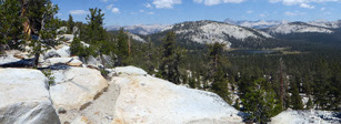

East Looking from Crown Pass
Since this is a nice place to eat lunch, overlooking Crown Lake we decide to do just that. Afterwards,  things get a lot more leisurely-I guess contentment does that to you. Rose and I take a side excursion along the ridge. Many excellent views. When we came back to Sherri, we just sit around and talk and talk and talk until the breeze cooled us off  get a bit.

One thing which catches my eye is out by the Middle Fork of the Kings River. I spot the backside of Tehipite Dome. The Dome stands high above Tehipite Valley-reportedly Kings Canyon answer to Yosemite Valley. Many years ago our family tried to make it down the Middle Fork to Tehipite Valley, but we were driven out by coming across many rattlesnakes. Ever since then, the name Tehipite evokes a since of a forbidden place. Memories of my Dad flood my mind and I wonder if he would have been satisfied with this view. It also gives me a sense of appreciation for him and how he and Mom brought both my brother and I backpacking, starting at an older age when most people are on the decline. Today is two days short of the first anniversary of his death.


And then it's time to reach race are steps back to the Woodchuck Lake. When we reach the place which we caught the trail, we decide to go off trail again to the west side of our Lake since its it is a bit shorter.

Woodchuck Lake from the trail
This gives us a couple hours just to enjoy the camp life. The laundry is mostly dry, so it is taken  down.  Besides that, I mostly read and attempt to send out our Spot messages.  Rose wades in the lake and gets her self clean. I take the hint and a little bit later I do the same. There is a nice sandy beach on the north side of the lake. A meadow flows down to almost the lake's edge with a barrier of sand before the water. It is great just wading out and getting wet, cleaning off trail dirt and sweat. After getting all wet, I sun myself on the meadow grass, getting dry and warm. What a life!

Now it is time for dinner. Sherri and I are having Tamale Pie Freestyle. I am hungry and enjoy the meal. Sherri has a little bit more than she can eat, so I devour most of that as well. It is important to leave a little room for treats. What do we have? Girl Scout thin mint cookies. Satisfaction all the way around! We are just about ready for bed. But before we retire to our tents, there is sunset. Orange skies and dark trees-fantastic! The alpine glow off of the east side of the lake is not as intense as other places, but still pretty. And now, we can go to bed, around 8pm. Evidently we are tired as we do not continue with A Walk in the Woods.


Background
Since we visited the area, a new fire  broke out on Sept 15, 2016, about 5-6 miles south of Crown Lake. Appropriately enough, it is called the Crown Fire.
Alpine Glow on Woodchuck Lake


Menu

 Breakfast Lunch Dinner Snacks
Oatmeal and add-ins, such as dried peaches, strawberries, nuts, granola. Tang. Ritz Crackers, Tortillas, Peanut Butter, Nutella Tamale Pie Freestyle ,
 Thin Mint Girl Scout Cookies
Clif Bar, GORP, Propel, CytoMax, Scrytch, Coffee Candy, Jelly Belly


Extra Photo's


Finger Rock and Mt Hoffman

Gary overlooking Crown Lake

Sherri relaxing

Northeast of Crown pass

Crown Lake and Beyond

Southeast from Crown Pass

More of Finger Rock and Mt Hoffman


Blackcap Mountain, Mt Goddard and many other peaks

Three Sister

Sample of a meadow