Showing posts with label Big Arroyo. Show all posts

Tuesday, June 24, 2014

June 24, 2014 - Big Arroyo to Morane Lake


Title: June 24, 2014 - Big Arroyo to Moraine Lake
Hike Info:
Type: Backpacking
Trail: High Sierra Trail
Destination: Moraine Lake
Distance: 9.55 miles
Start Time:  9:23
End Time:   4:30
Travel Time: 7:06 (1.20 mph)
Moving Time: 4:27 (1.92 mph)
Elevation Rise: 1,220'
Maximum Elevation: 10,621'


Description:
Not sure what happened to Ray and Rachel, but they did not appear in any of the pictures day. Maybe tomorrow.

Got up a bit late. My sleeping bag felt good this morning. So even though the first light appeared, I tucked my head further into my bag. But eventually I emerged around 6:15 to have my quiet time. We all were a bit slow this morning. So slow, that Ray and I got into a discussion on going light with our backpacks. He noted that a going light book he has advocates going sans toilet paper-I think it will take a bit of convincing for me to adopt this method. I got in a good wash of myself and clothes.  We finally left camp around 9:15.
Gary and Andrea
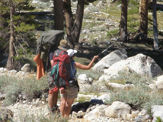
Andrea Pontificating, not Gary


The first challenge is crossing the Big Arroyo, which I crossed several times yesterday. I find where I  crossed yesterday, but I was the only one to go this way. My crossing was pretty easy.  The trail down to the junction with Little Five Lakes is pretty gentle, going in and out of tree cover. But mosquito's hit us at the junction, so we go up two hundred yards and stop for a snack break.
Lower Big Arroyo
Upper Big Arroyo


Humus, Salty MIx and Jerky
Now the trail starts climbing the wall of the Big Arroyo. It is some shade with some exposure. Not as hard as yesterday, but I think I am feeling the trail more. Maybe it is the altitude or maybe the decrease in calorie intake, or just being tired. The sun is getting warm and the trail is constantly rising. Around 11:30 we stop for lunch-humus today. The place we on a pretty good slope, but lunch is lunch. But not really a great view at all.

The temperature continues to rise, sapping our strength. Ray and Rachel go ahead and stop at the start of the descent. A word about today's walk. It pretty much is a climb up to regain what we lost yesterday, then a decline to Moraine Lake, back to an elevation where we started today. But of course, we get to see different scenery.

Little Five Lake Basin
Great Western Divide


Andrea at rest
We rest when we catch up with Ray and Rachel. But then Sherri, Steven and I take off ahead. We come to a junction which causes some confusion about that is the right way to go. The High Sierra Trail sort of forks with the one on the left going a more direct route down to the Kern Canyon. But we want to go to Moraine Lake so off we go to the left. It is a gentle descent. We go over to an overlook of the Big Arroyo and the eastern side of the Great Western Divide.

Gary and the Great Western Divide


Andrea and the lower part of the Big Arroyo


Moraine Lake
Shortly afterwards, we get to Moraine Lake. It is a big open area with lots of camping places. Also a bear box awaits us and we are the only ones here-later on a couple of men come by, but we do not see them again as they head to the western end of the lake. The lake is pretty pleasant. I wade off a ways and wash away a couple layers of dirt. But Steven swims out to an island. Just a pleasant, relaxing time. Eventually dinner is made, but no one feels like starting a fire. So its is off to bed we go after what feels like a short day.

Trail Lesson:
Even prosaic days hold wonder and beauty.

Moraine Lake

Steven in for a swim

Pitching a tent


Moraine at Sunset

Gary's Nutella Quesadilla

 Breakfast Lunch Dinner Snacks
Oatmeal and add-ins, such as dried peaches, strawberries, nuts, granola. Tang. Humus, Salty Mix and Beef Jerky on crackers Tamale Freestyle

Nutella and Jelly Belly Quesadilla
Clif Bar, Jelly Bellies, CytoMax, Propel, GORP, Bank Balls


Kaweah Range
Ghost Forest on way down to Moraine Lake
Mt Kaweah


Flowers:


Monday, June 23, 2014

June 23, 2014 - Hamilton Lake to Big Arroyo


Title: June 23, 2014 - Hamilton Lake to Big Arroyo
Hike Info:
Type:  Backpacking
Trail: High Sierra Trail
Destination: Big Arroyo
Actual Destination: about a mile before the Big Arroyo bear lockers
Distance: 6.68 miles
Start Time:  7:59
End Time:    5:07
Travel Time: 9:07 (0.73 mph)
Moving Time: 4:31 (1.48  mph)
Elevation Rise: 2,470'
Maximum Elevation: 10,736'

Description:
Got up at 5:30. Shortly afterwards everybody else got up. Even then, we got going  at 8. 
Camp Life


Hamilton Lake


There is not too much to say, except once we cross the creek coming out of Hamilton Lake, we start our ascent of Kaweah Gap. This is a 2400' relentless climb. But there is compensation for the aches we have lugging our packs. As we climb up, first we see Hamilton Lake a lot better. Ray talks about the fish he saw in Lower Hamilton. This morning I have been hiking with Ray. He is fast than I am, but I am doing OK.  Then as we climb, we can see where BearPaw Meadow's saddle is. Also the trail which got carved out of a rock cliff before Lone Pine Creek. Just some magnificent sights, every switchback brings new vistas. We can even see Moro Rock where we started Saturday. But the best was yet to come.
More of Hamilton Lake

Lower Hamilton Lake
Falls from Precipice Lake


Hamilton from high up


As we clear the chaparral level of the trail, we start hitting more granite on the trail. You can see where trail crews have carved whole sections of the trail out from granite cliffs. Other parts of the High Sierra Trail gives you we are on the edge of a cliff feel. But on this section of the trail, we are not only getting this feeling, but are on a cliff. This is accentuated when we reach this chute, which we find out is called Hamilton Gorge. We first see a role of thick steel cable, followed by a couple of cement buttresses with huge eye-bolts, one on each side of the gorge. Ray and I speculate what this went to. With an eye-bolt broken off, we think that the bridge failed its stress test. Now there is a tunnel through rock, with the trail hugging a blasted out section of cliff. Later on I find out the story behind the failed bridge:
Down the Gorge
The climb begins with a series of sweeping switchbacks across the bluffs to the north of the lake, before turning east towards the sheer-walled avalanche chute known as Hamilton Gorge. In 1932, Park Service engineers erected a steel suspension bridge across the Gorge, but in the winter of 1937, a massive avalanche tore the bridge from its moorings and swept its twisted wreckage down to the shores of Big Hamilton Lake. You can still see the bridge's concrete foundations and a few scrap metal remains, but the trail now uses a ledge and tunnel that were blasted by the Civilian Conservation Corps the next summer. From NPS' web page on Hiking the High Sierra Trail
High Sierra Tunnel


Tarn at 10,000'

As we approach a tarn, a little above 10,000', we stop for lunch. We have not traveled far in distance, but it has been a pretty good pull for us. We have stopped below a giant boulder, about the only place we can find with shade. We enjoy our peanut butter and Nutella snack, and then just plain rest for a time. But Precipice Lake is calling and so we don our packs and continue on.

Precipice Lake


From our lunch place, Precipice Lake is only a third of a mile, but it is another 500' of climbing. So when we get to the lake, we are ready for another stop. Here we find another couple of hikers enjoying an Ansel Adams scene. Craig and Paul thought about doing the whole of the HST, but were not making as good of time as they thought they would so. They are on their return trip to Giant Forest. They are the first people, and it turns out, the only people who we will have a prolonged conversation with on this trip. Later on Andrea makes a comment on the JMT Facebook page and Craig recognizes her.


Precipice Lake

Rachel and Ray Surveying our climb

Andrea Refreshed
I enjoy a patch of earth. But others have a different idea of recreating. Rachel, and then Ray, climb a far away boulder for a birds eye view of Hamilton Lake and beyond. Andrea dunks herself. But Ray tops us all by taking a running jump and gracefully diving into the snow bounded Precipice lake. He certainly looked refreshed coming out.

I do not think we would have made it up this far last night, but it is time to continue on. Kaweah Gap calls us and we must go. At this point, the hard work has been done and it is only 3/4 of a mile 300' to the top. The trail leads us through a gentle coulee which points us to the Gap. On the north side is the only real sign that this is a place where much of the Valley's water comes from. There is a bit of a cornice, a carry-over from our light winter.

Last of Cornice


Big Arroyo

Nine Lakes Basin

Craig's Waterfall


 On top of Kaweah Gap
Kaweah Gap is one of those places which is anti-climatic. We have been seeing such vistas on the way up we expected more. But what we got was this gentle break in the Great Divide where on one side we see the pleasant climb we just ascended. On the other side is the expansive Big Arroyo. But the Great Divide itself is noteworthy. At the base of the Gap is a plaque commemorating George W. Stewart by naming the adjacent Mt Stewart. We see the Nine Lake basin and the Kaweah's to the north of us. To the south is Eagle Scout Peak. With this, we rest here-you get the feeling that is all which we do today: rest and climb. but our climbing for the day is over.

Sound of Music Moment
Here we start down the Big Arroyo. I am amazed by the size-in my mind, the word big is too small for this wide expanse at the start of the Big Arroyo creek. After the rugged climb up this place seems too gentle to be in the heart of the Sierra's. Our walking is only burdened by having had to exert ourselves over the morning to the top of the Gap. Now we pick up the pace and enjoy our descent.

Looking back towards Kaweah Gap
After a ways, Rachel and Ray stop for a break while the rest of us continue on. When we come to the crossing of the Big Arroyo, we decide this would be a good place to camp. Andrea, Steven and I wander around, but cannot find a place where others have camped. But we do see remnants of places-horse poop, an occasional burnt rock, but nothing recent. Andrea does find a place to pitch tents and hang hammocks, but the site is not really an established campsite. I have even looked at likely places across the Big Arroyo to no avail. Andrea and I go back up the trail a little ways to tell Ray and Rachel what we found, when i wander off. I am not sure what I am seeing which causes me to wander, but I do. Suddenly by the creek, I find a really good place, complete with firepit. So we go back and get everything and set up camp here. That evening, we enjoy a nice campfire and a time of rest.


Trail Lesson:

 Breakfast Lunch Dinner Snacks
Oatmeal and add-ins, such as dried peaches, strawberries, nuts, granola. Tang. Peanut Butter and Nutella on crackers Szechuan Veggie Noodles

Clif Bar, Jelly Bellies, CytoMax, Propel, GORP, Bank Balls


Hiking Folks:

Hiking Twins-Ray and Gary
 
Rachel and Andrea

Successful Ray
Rachel on the Lookout