Showing posts with label Sampson. Show all posts

Tuesday, June 30, 2026

June 30, 2026 - Delilah


Title: June 30, 2026 - Delilah
Hike Info : Description : Flowers and Plants

Hike Info:
Type:Lookout

Description:

It was a bit cooler last night than I expected. Still I kept warm, I just kept inside of my bag. While I can sleep with a light on, if I poked my head out of the bag, the moon was still going strong. It probably will be the same tonight.

I do wake up before the sun rises, at 0500. I had checked last night and saw that there was some lightning yesterday, both in my local area and in Stanislaus NF. The local one is outside of my vision. It stretched from the upper Middle Fork of the Kings to east of Florence Lake. The question is how to do the report. Yesterday I realized that the travel laptop I have did not have all of the files which my home computer had. Last night I had decided on how to jerryrig things to get something useful. I was able to get to mostly working and get the information the lookouts needed.


Delilah
By the time I was done with the lightning report-I had eaten breakfast while working on the report-it was 0800. I decided to go for a walk before getting into lookout mode. Of course, when in the tower, there is a reflex of looking around and seeing if all is right with the world. I am gone for about 40 minutes, having gone just to the saddle and back. Then I clean up the cab and get ready for the day.

Nothing special to start today off. I started off doing a scan, then took the weather. Nothing alarming with either. At 0930 I go into service with both Porterville and Sierra. Then I look at the fire weather forecast and see who is on in the Sequoia Forest. The “who is on” is what staffing there is around me and most importantly, who the duty officer is on duty. It looks awfully sparse as far as staff in this area. The radio traffic from Porterville at times can have a lot of static. This is one of those times. I have a habit of recording the staffing, so I can play it back and make sure I hear the staffing correctly. Evidently Buck Rock had the same issue as they called me up and I told her what I heard.


Smoke in the Valley
When I am at a lookout for more than one day, I try to clean windows. I am able to do Delilah’s windows in a couple of hours, between other duties. Well, after finishing, I still see places for improvement. At 1230 I have my lunch. Then at 1309, I take the weather. Not too much different than this morning, except more breezy. I am hearing on the radio that the duty officer and a work group is gathering at the McKenzie helipad. That is on the road into Delilah. I wonder if they are going to head this way? Am I getting lonely? I do not think so after all the isolation of Delilah is one of its attractions for me.

I do have two 15 minute rest periods, between scans. During my scans, I see a wide variety of land. There is the Valley land, filled with orchards, farmlands, and ranches. We do not report fires in this area. Then comes the foothills, above the Friant Kern canal. For the most part, these lands hold only some interest-the people I know and the history which is part of the land. Then there are the mid-mountains where Delilah is. I have traveled through some of the areas, both in a car and on foot. It is fascinating and not many people go over to Patterson Bluffs, nor into Millwood or any of the places which this lookout is part of. Finally, on a clear day, I can look up the Middle Fork of the Kings all the way to the crest.

And that is where my heart is. And why this train of thought came as I looked over the areas which I love? I wonder if I will ever be able to go back there? It does require strength and endurance, things I am losing. There is a bit of melancholy with that thought. The reason which I love that area is because I have been able to experience it, it became part of who I am. In stories you read about how a hero cannot go home and looks longingly towards the place he cannot return to. I can place myself in the hero’s shoes.

But I am fortunate as I can still do so many things I love to do, such as hike be in a lookout, read, and the plethora of interests I have. Also I have family and friends who love me. I am not despondent, just yearning.


Evening view from outhouse


At 1600, I responded to the lookout check in from Sierra. I spot two smokes, but neither are reportable as they are in the Valley. At 1716, I called up Porterville to say I am overnighting here, my last planned night for a little while. I do have a lot to be thankful for. At 1755 I went out of service with Sierra and Porterville.

Most days after I have been in the lookout all day, I am spent. Not because I am doing anything terribly physical, nor mentally challenging. I think it is because of always being on: listening to the radio and constantly looking out for smoke. Very little real downtime during the day. Yesterday evening, I was spent. Tonight, after finishing up everything, I got right to the business of eating the quiches Sherri had sent me.

98.9% of a full moon

After washing the dishes and putting away everything, I went for a walk. I was thinking I would be about half an hour, but I was gone for over an hour. Wendy and I had a light and fun text conversation. Each of my replies would give me an excuse to pause while going up the hill which is Mount Sampson, not that the road goes over it.

When I returned, I talked with Sherri for about 45 minutes. Since I have waited this long, I think I will wait for the moon to rise. It is to rise at 2119 and be 98.9% full. Maybe not as nice as yesterday, but there will not be clouds getting in the way. By 2140, I am in my bag.


Flowers and Plants

Grove of Dandelions

Milkweed

Foxtail

Google says it is Penstemon, I am not that sure


Friday, May 19, 2023

May 19, 2023-Delilah


Title: May 19, 2023-Delilah

Hike Info:
Type:Lookout

Description:

Slept well last night. I woke up to an early morning light around 0500. The subdued orange and pinks of the early morning is always pleasant. The other good thing is, I do not need to get up to enjoy. I just can lay in bed and look out of my glass house. Just before the sun comes up, the area behind Split Mountain gathers light with intensity.

Around 0530 I start gathering information for the day’s lightning report. I know there was some activity because of the clouds I was seeing and the alerts I got. But it turned out there was only a single cloud-to-cloud which nobody cares about. So I do not need to send a report.

I mosey around the rest of the morning. Mich had sent out an email about Delilah which others responded to. Since I am the only one on scene, I take this time to respond. Also I talked with Greg about the water situation. Breakfast is granola and lemon bread, which Wendy gave to me yesterday.


Patterson Falls

Rancheria Falls


I took the weather for the morning. Nothing alarming. Wendy alerts me through a text that I will be doing a relay for Patrol 33. Not five minutes later, P33 summons me and I do it. Yeah! One of those radio things I feel I can easily screw up. I hear Engine 32 go into service to Delilah LO. Company today! And all of this is before I go in-service


At 0933 I go into service with both Porterville and Sierra. Then I start washing windows between doing scans. P33 lets me know that her crew will be raising dust along Davis Road. And I see her convey of trucks heading down, marking areas for drivers to be cautious of. At 1000 Porterville gives the weather forecast. P33 and her gang gets close to Sampson Flat, taking care of some logs and trees. Then at 1100, is the Sierra Lookout check in. Another lonely day-I would not trade it lightly.


Hillside shift above Davis Flat
This gives me a chance to review my area of the world. Usually when I am up here, there is so much which is dry. As I look across the Kings, I am seeing several waterfalls. There is Patterson Falls, at least a significant drop from Patterson Creek. Also Rancheria Falls. Then I am not sure if it is a fall or just a long descent, there is water coming down the ridge into Dinkey Creek. Several places have had mud slides. You can see the scaring in several places, including over on White Deer area, the hills above Davis Flat and on McKenzie Ridge.


Mt Nelson
Lonely not for long as Engine 32 did show up with batteries for our repeater. I got to talk with the head of Engine 32. Most of the time I only hear these disembodied voices over the radio. So it is a pleasure to greet them in person. Not only have they brought batteries, they also brought a replacement fire alarm. We talk for awhile. One of the things he said was that yesterday some Forest Service staff snowmobiled into Buck Rock with batteries. That explains why tone 2 is available.
Engine 32
He then goes down to help move the batteries. Another person comes up, a first year person and we talk for awhile, but he does not seem too interested. Engine 32 moves on and I am left by myself again.

I have my lunch and then settle into the normal routine. That is until 1334. Porterville tones out a fire and it is in my neighborhood. Unfortunately it is behind Pine Ridge, so I cannot help. But I did report I cannot see it. P33 did not catch the address, so I told her what I heard. Also we have a third radio now so we can listen to CalFire when something breaks. That is what I did. That all was worth about 20 minutes of excitement.

And back to the routine. P33 wants a few more items relayed and Division 3 notifies Delilah that our repeater tone should go in service sometime tomorrow. I had my dinner after Sierra 1600 check-in. Then cleaned the floors and generally cleaned up. Not much of a mess on my part.

As 1700 hits everybody is going out of service, except me. I do some more scans and enjoy a bit of quietness. And at 1720, Sierra calls with status of Delilah. I said I would go out of service with dispatch. And now I put the final touches on cleaning up and packing. At 1754, I go out of service with Porterville.

It takes a few minutes to get everything put away and my stuff taken down the stairs. But at 1815, the tire on my car starts to move. I get home a few minutes before 2000. A good, but tiring, couple of days.

 
Flowers and Plants


Wednesday, October 7, 2020

October 7, 2020 - Delilah


Title:  October 7, 2020 - Delilah
Hike Info : Description : BackgroundAnimals 

Trail head: Delilah Lookout
Hike Info:

Type: Lookout

 
 Description:

Not sure if I came up today because I figured this might be the last chance to be at Delilah for the season-I have been saying that for a month now. Or if I have been frustrated by all of the days I could not be up here due to the smoke limiting visibility or it could be just a sense of obligation. But now that I am up here, I am wondering if I should have just said “uncle” and not come. Optimistically, there is one mile of visibility with a bit of smoke smell, not as bad as the beginning of September. So the plan is to stay up here until at least lunch time.

This was to be a two day trip. But yesterday was even worse than today. So after looking at the cameras and the AQI for the area, I decided it was not worth coming up then. This morning when I got up, the AQI looked a lot better. And in a text I wrote, I thought the cameras showed a little better visibility. So that said, lets go. Sherri has a doctor’s appointment today, so she is staying home.

Road towards Delilah. Where is Jesse Morrow?

I left the house at 0700, filled up with gas at Costco and made it up to Delilah by 0905, without incident. You know when I was at Park Ridge last week, I said I need to pack less when going up to the day. I did better-only one backpack full. One very full backpack, but it is better.

I sanitize the areas I will be touching. And then take the weather, not quite low RH, but close enough with 21%. I go inservice with an optimistic one mile visibility and RH of 21. Buck Rock has gone in with half a mile visibility and 16% RH. Sounds pretty bad all the way around. But in talking with Mich, she said yesterday the smoke lifted about in the afternoon. Optimism reigns!

Sun, Clouds and Smoke

Life returns to normal. Listening to the radio and doing scans. Of course with only a mile visibility, the scans pretty much consists of walking the catwalk, about a minute, unless I pause for thought. Then there is no telling how long the scan can take. At 1045 I noticed that there was a bit more visibility, such as being able to see Luckett Mtn-not too clearly-or Davis Road, at least pieces of it. We will see-well, isn’t that the issue of whether I will see or not?

Only piece of excitement-and this is what passes for excitement-is responding to the Sierra NF morning check in at 11. Greg calls to check in and make sure I am OK. I am, and we talked about various things like air quality, where to get this info. Also about the Creek Fire and the fire up in Yosemite close to Tuolumne Meadows. I have lunch and then call Buck Rock on the radio. The smoke has lifted a bit, so visibility is around 4 miles-I can see Sampson Flat and just barely McKenzie Ridge, but not beyond. So I will stay around another couple of hours and hope that it lifts some more.

Sometimes you wonder about the naming of fires. On the radio just now heard the Cow Training IC reporting the status. Thinking I heard it wrong, I checked to see if there really was a Cow Fire. Sure enough, there was one which started last Saturday. Now what self-respecting fire wants to be known as the Cow Fire? Also I wonder what the guy did to be assigned to being the trainee for the Cow Fire? Questions better not asked. But it is growing up into a respectable sized fire of 141 acres.

Late Afternoon Sun and Smoke

Just doing my scans. Then reading a book between scans. Even at five miles visibility, which is stretching the distance, I am doing unaided scans. Occasionally I take to the binoculars if I see something of interest. I answer Sierra’s evening lookout check in and take down the weather.

Shortly before 1700, a fire was reported, way outside of our area. But our ears always perk up. We try to understand where it is and what resources will be taken. But then, they issued the name of the fire: the Loco Fire. I am wondering what around there is named Loco? There is a Loco Bill Canyon. Of course, that means that they have a Loco Incident Commander and the most ominous is a Loco Air Attack.It was reported as 2-3 acres, but in brush. So who knows how big this might get-the original size up is 50-100 acres.

Sun as I was departing

It is time for me to get ready to leave. Kathy calls, starting with where is the Loco Fire? But then we just enjoy a general chit-chat time. After we are done, I get the cab re-sanitized. Then go out of service close to 1800.

I was out of there pretty quickly afterwards, getting home about 1945. When I had radio reception, I listened to the vice-presidential debates. I hope I caught the answers at the wrong time, because what I heard was both candidates not answering the moderators questions. Now onto a sandwich for dinner and bed.


Background

AQI. Air Quality Index. There are a couple stations I pay attention to: Grant Grove and Pinehurst. Also I look at the AirNow site for Dunlap.


Animals


Friday, July 3, 2020

July 3, 2020 - Delilah Lookout


Title: July 3, 2020 - Delilah Lookout
Hike Info : DescriptionBackground :Animals : Flowers and Plants


Trail head: Delilah Lookout
Hike Info:
Type: Lookout


Description:


New Delilah Sign
It was a cool night out on the catwalk, but comfortable. The catwalk is a bit narrow for me, still it is only bothersome when I turn over. I wake up around 0445 and watch the glow come on the horizon, falling asleep and waking up to a bit more glow. I finally got up at 0610. The sun has broken over the Sierra. First thing I do is check my lightning report-there was none yesterday. then go down to take care of business and go for a short walk. Sherri follows me down for her morning coffee.
By 0800 I have finished breakfast and doing a bit of clean-up. We have been requested to go into service early, so we do and start our scanning. Sherri worked on Brent’s refresher quiz, getting pretty close to what I did last time I was up here.
Morning Shadows
Sherri takes the weather, without breaking the thermometer, and goes into service with Sierra. And it is back to scanning and refreshing. We get the weather and staffing. Then our 1100 check in with Sierra. So far a calm day.
For what we thought would be the highlight of the day, Division 3 showed up. He is the head honcho in fire for the Hume Lake Ranger District. He is new and is checking out his area. Delilah was the first lookout which he has gone to. We show him the area, while maintaining a distance. Hope we did our fellow lookouts proud.


Usually Kathy will call sometime during our stay-she did yesterday--but Greg called us to make sure we are still alive and kicking. Nothing really noteworthy as far as content. But it is reassuring to know that there is a support net behind you when you are in the lookout. And that would be a support net of good and knowledgeable people.
And now we return to the normal day. Listening to the radio-which can be a bit entertaining. The amount of citations picked up during holidays. So we hear reports going on about abandoned campfires, people parked in dangerous places, camping where they should not, and a few accidents. Also there seems to be more resources out. Such as most of the time we do not hear of the Kings River area being patrolled. But today it is. I suspect it is because there is a concern that people will flock to the River and disregard safety and signs.
Flag over Delilah
Jeff from Buck Rock talks with us about locating a tree up on the ridge east of us. He can see it as well as us and would like to get an idea of where it is. Once we decide on which tree he is talking about, we do a triangulation on it and come up with a location. Sometime, we will have to do a ground check. There was some speculation that it could be the Boole Tree but neither of our azimuths supports that speculation.
The 1600 check in comes and goes without too much incident-Buck Rock had a dead battery-haven’t we all. But in a perverse way, just glad it is someone else besides us. Our friend Judy calls us and we chat for a while. A lot of it is about things she saw when she was up at Delilah before us. We talk about air clarity-something important for us. Towards Auberry it is pretty hazy and so I comment on this. Judy asks can we see Black Mountain. I draw a blank about where it is-later on I realize which mountain she was talking about.
Then excitement for the day happens. Somehow Patrol 33 finds out about a potential wildfire at the intersection of MMillwood and Highway 180 (this area sounds like it is a hot spot, so to speak about fires. See the July 5th post-when it is posted). That is right next door to us!. But we cannot see it because Pine Ridge gets in our way. We look to see if there is a trace of smoke creeping over the ridge. We think there may be slightly more haze right at the edge of the ridge, but this is very probably the power of suggestion. We report to Div 3 that there is no smoke visible, but Pine Ridge would block our view. About that time we hear both Sierra and Porterville calling out resources, even planes for this. Park Ridge also reports he does not see any smoke. Within ten minutes we hear both forests calling down the resources as it appears to be more of a car accident than a fire. Later Division 3 reports out that there is a medical emergency, but no fire.
Pine Flat turning golden
About half an hour later we hear that Sierra has a report of smoke at a place called Buckeye Heliport. Where is that? We see several references to Buckeye around Mariposa. That is too far away for us to see. Then we hear about engines looking around the four-lane. That is in our viewing area. Turns out that Buckeye Heliport is close to the top of the four-lane. So we get on the stick and examine that area more closely. Remember our conversation with Judy? About the hazy around Auberry? That is now what is hampering our visuals. On the other hand, is there a fire in the area which is contributing to the haze? We cannot see anything, so we report that to Sierra. After a while, Sierra cannot find anything so they call off the search.
Moon rising over Big Baldy
We are on extended hours so we will go out of service at 2000 today. We have a second dinner of gnocchi someplace in the middle of all of the excitement. We are not looking through binoculars all the time. But our eyes are pretty much always roving around the area we can see to see if there is a wisp of smoke.
By the time we go out of service, shadows have crept across the landscape. We start getting ready for the night. Around 2100 the sun has set and the last vestiges of pink are fading. We notice that close to the antennas in Orange Cove a neighborhood is having some pretty robust display of fireworks. Then further out Reedley is having their fireworks show-23 miles away. I love being in the lookout on nights like this.
We also notice lights in places which we normally do not see them. Such as the McGee Overlook or on Delilah Road. Just before we go to bed, we see a car making its way down Davis Road. First vehicle we have seen on it. We wonder what was so imperative that they felt they needed to do this at night. We lost them before they got to Sampson Flat. But it is past 2200, we time for us to go to bed.


Background
From Wendy, concerning the Millwood Fire: The craziness started yesterday afternoon with a vehicle accident near Hwy 180 and Millwood. One car on its side but the crazy part? Road flares were set out... which, yeah you guessed it, started a vegetation fire and garnered a full wildland response. Thankfully, it was on the downhill side and extinguished very quickly.

Animals
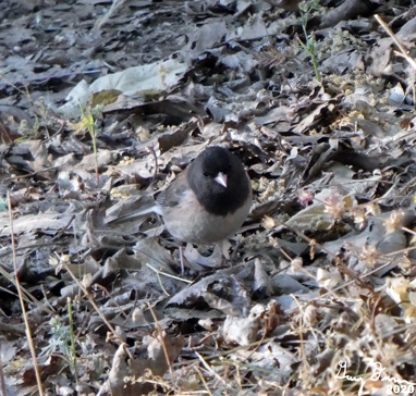
Early Morning Junko

Hummingbird

Hummingbirds on feeder

Bee getting his tan


Flowers and Plants

A few flowers coloring our world


Wednesday, May 20, 2020

May 20, 2020 - Upper Davis Road


Title: May 20, 2020 - Upper Davis Road
Hike Info : DescriptionBackgroundExtra Photo's : Flowers and Plants
Hike Info:
Type: Hiking
Trail: Davis Road
Destination: Fox Springs
Actual Destination:
Distance:  4.31 miles  1
Start Time: 11:51
End Time:     2:44
Travel Time: 2:44  (1.58 mph)
Moving Time: 1:33  (2.78 mph)
Elevation Rise:  1,106'
Descent: ‘
Maximum Elevation: 4,765'
 1Sigh, not sure what happened, but the GPS track starts at the unnamed pond we ate lunch at rather where we left the car. I think we lost about a mile and a quarter of tracks. Most of it is downhill.
Description:
Korra and Steven
March 4th at Wawona Meadow was the last time we went on a hike. It has been a long two months. So the three of us, along with Steven’s new husky, Korra, will be doing a short hike. Unless we find very many cars, we will be hiking the upper part of Davis Road to Fox Springs. This is a place we see from Delilah Lookout, but have not visited.
We leave our house at 9:25 and need to stop and get gas at Costco. This is the first time we have filled up with gas in any of our vehicles in more than two months. Also Lee had asked me about the road to Delilah. Evidently she and Kathy-who we hiked with last year-is going up there today. Maybe we will see them.


Common Madia

Delilah Lookout
We get to the junction of Davis and Delilah Roads. It takes about 15 minutes to unload and get our shoes on before we go. The road is generally downhill all the way to the Kings River. In various places you also see names like Sampson Flat Road instead of Davis Road. On this upper stretch it is a gradual decline. But what makes this hike really special, besides being on it for the first time, is the wild flowers. While there is not the WOW! factor of the fields of poppies you see lower down-actually we did not see poppies today-there is something refreshing being greeted by the multitude of colors we saw.
Of course, it is a lot easier to be refreshed when one is going downhill. During this time I play a favorite game of mine. This game goes by a couple of names: “What is that”? “ Can you name that place?” or “Can you see that from the lookout?” Between all of that and stopping for flowers or other interesting sights, it takes about half an hour to go a little bit more than a mile downhill.
Unnamed Pond
We stop at the remains of a house-only the cement floor and chimney is left. I had spotted a small pond on an old topo map just on the side of the house. You know how I am. So off we go towards it. First there are vehicle tracks which end up being a cow trail. Sherri is off taking pictures while Steven and I continue on. When we do get down to the pond, there is a sense of peacefulness which you get when nobody else is around and you probably will not get anybody else here today. Please there is a subdued sense of beauty. We decide this is a lunch place and enjoy our Peanut Butter and Nutella sandwich here.

One could be here for a while-not too long as I suspect this area will be crawling with rattlers once things heat up. Besides there is more to explore. We head back up how we came and hit Davis Road. A little snake slithers through the grass-enough to catch Korra's attention, but not enough to identify. There is a gate we are looking for and a hundred yards down the road, we find it. But where is the old dirt road to Fox Springs? We head back a few feet and I gaze across a little rivulet and a 7’ ditch. There it is. I guess the road is no longer in service. 
Bovine Guard
 
Fortunately, we are walking and can figure a way around. So we cross over, Some cows do not like our looks and run away. We pick up the remains of the road and follow it as it looks more and more like a cow track. We go through some vines, watching out for poison oak and snakes. I am in the lead with my eyes either forward or towards the ground. I had just come to a pool in the middle of the path, looking for a way around it, when Sherri says:


Smoke beyond Sacata

Gary! Steven sees a smoke!” That is something which will catch my attention. Sure enough, there is a pretty large smoke coming from the northeast, beyond the Kings River. It looks like it is on the other side of Sacata Ridge. Sherri and Steven look through the binoculars to get a fix on it; I dig in my pack for my Boy Scout compass. It is at a magnetic 3210 (as a note, there is an almost 130 declination from our location.) With this information along with our location-Fox Springs and the lat/long, I try to call Sierra Dispatch. But the number I have is old. So I call Sequoia National Forest’s Dispatch. After identifying myself and giving the approximate location of the burn, Dispatch says that there is a burn in Blue Canyon which has gotten away. At least they know about it and can take care of it.
Gary Walking back to Davis Road
We decided that with the pool of water blocking us and we would call that we have been to Fox Springs. I spent a few minutes getting my backpacked together. By that time Steve and Sherri were ahead of me. I looked around and saw a road I missed-remember my head was down. But this road should have been evident. It crossed over a ridge to the north of us. So I followed it. Nothing spectacular, except a different view of Sampson Creek area and across the Kings. Also I think this is where the campground may have been.
I catch up to Sherri on Davis Road. Korra was being restless so they went on head to the car. Now for the time going up the road. Glad it is a cooler day and with some scattered clouds. We enjoy ourselves. But the return trip is slower. Definitely not charging up the road. Note to Gary: Save some picture taking for the return trip.
A truck comes down the road. We eyeball each other. They are wondering what are people doing down here and we are wondering how they got past a locked gate. From what they said, Teresa and John own property around Sampson Flat. We talk a bit about things and they continue on as we do.
Shortly we are back in the car by 1:45. Lee and Kathy left a note for us. They walked the Delilah Road but not to the lookout. We make it home by about 3:00. I am tired, but enjoyed the day.
Background
When we got back home, I looked it up and the burn was a structure fire around the Blue Canyon Work Center and my azimuth was pretty much dead-on. The distance, not so much.
Turns out Mich and Jim were at Delilah getting it ready for occupancy. They had seen the fire and called it in at 1030.
Later on Lee told me that Lee and Kathy had seen a mountain lion on the way out. This was above the McKenzie . Wow!


Extra Photo's
Looking down into the Kings from Davis Road

Another perspective

Sampson Flat Area
Lunch-Steven, Sherri and Korra

Walking towards the Unnamed Pond

Sampson Flat

Cabin Remains
Looking North

Cows Retreating

Smoke over Sacata Ridge
Another Smoke picture

Did this really stop us?

Sampson Creek

Panorama of the drainage
Steven, Korra and Sherri Waiting

Gary looking about as good as he could get at the moment

Smoke over Sacata Ridge. Fence Lookout is on the right, we think

Delilah Lookout


Fox Springs from the car


Flowers and Plants

California Indian Pink?

Common Madia

Common Madia

Common Madia

Twining Brodiaea or Snake Lilly

Harvest Brodiea

Harvest Brodiea

Alpine Gold