Showing posts with label Quartz Mountain. Show all posts

Wednesday, August 21, 2019

August 21, 2019 - Fresno Dome and the Way of the Mono


Title: August 21, 2019 - Fresno Dome and the Way of the Mono
Hike Info : Description : Extra Photo's : Animals : Flowers and Plants
Hike Info:
Type: Hiking
Trail: Fresno Dome
Destination: Fresno Dome
Distance:  1.65 miles
Start Time: 9:41
End Time:   11:55
Travel Time:   2:14 (0.74 mph)
Moving Time:  1:27 (1.14 mph)
Elevation Rise:  512'
Descent: 277‘
Maximum Elevation: 7,512'
Description:


This will be a meetup hike, or more accurately, hikes. The first one is to Fresno Dome, maybe about 2 miles-this is where Sherri, Andrea, Steven and Lawrence went to in July when their way was blocked from going to Chain Lakes. The second hike is the Way of the Mono, about half a mile. Should be an all around easy day-at least that is what I am telling my body.
We get to the parking lot where the meetup group is gathering a few minutes late. We had a few last minute things to take care of. As we are ready to go, one of the cars had a dead battery. Not a problem for us-we were intending to take the Ranger up, but it causes a bit more reshuffling of people into cars. Sherri and I need to stop to get gas, just in case. In Oakhurst we gather a few more people at the Chevron station. Then it is off up the mountains.
Sherri on her way to the top
Fresno Dome is well off the highway. For the most part, there is a paved road-Sky Ranch Road which goes past Calvin Crest and Nelder Grove. But once you are well back, you turn off onto road 5S38-you know when you are getting back aways when the roads stop having names and are using forest service designations. As we go up the road, there are signs that logging is taking place: the road turns muddy from spraying to keep the dust down and there are stacks of logs and machinery. 


Then at the Fresno Dome Campground we get stopped by a flagger. They are bringing down some trees. We all get out of our vehicles and stretch a bit. I do not recognize the car in front of me. In talking to her, she is going up to Fresno Dme as well. Jenny is part of the meetup group, just came up here independently. After about 20 minutes, we are let through.
Those ants up there are people
We finally get to the Fresno Dome trailhead. A few minutes to get ready and organized and off we go. I would say the first part of the trail is pretty nondescript. If you have been hiking in the Sierra before, you have probably encountered much of what we walked through elsewhere. On the other hand, there is a freshness about being among the trees and meadows. Confession is that I do not see the flowers going in. I feel pretty good that it is pretty level or a slight downhill and I seem to be walking OK. I am towards the back-my choice. Just enjoyable walking with John.
And now we start our climb. It is not a bad climb at all, if you take your time. There is a side benefit for helping someone in this situation. That is besides the generally good feeling you get helping someone accomplish something they thought they may not be able to do. But the benefit to me is that we are travelling deliberate enough that my out-of-shapeness does not come into play. So up we go a few steps and then pick our way up another section. I think I will need to get someone to help on any slope :-).
When we get to the top, there is a great view. Shuteye is towards our east and Oakhurst to our south. I am not sure where Quartz Mountain or if I am seeing the Merced-I think I am. A nice little dome. While it is not crowded, except with our meetup group. There is a man and his dogs up here, but they leave pretty soon after we arrive. And then there is Jenny from our logging stop and her dog. We stay up at the top for awhile before heading down.
View to the east and south

View to the south and west
The way down-yes, those are people down there
Down is not too much of an issue. Just keeping off the scree and onto solid rock. Sherri has joined John and I in working our way down the dome. Once on the flat, my legs stretch out a bit. There has been some tree falls which has had people reroute the path, but nothing too bad as far as route finding. We get back in a reasonable amount of time. But I suspect that the road travel and the time it took to pick our way up the dome made for a bit slower travel.


Hike Info:
Type: Hiking
Trail: Way of the Mono
Destination: Loop
Distance:  0.54 miles
Start Time: 1:18
End Time:   1:53  
Travel Time:  0:35 (0.93 mph)
Moving Time:  0:25 (1.30 mph)
Elevation Rise:  105'
Descent: 198‘
Maximum Elevation: 3,675'
 We make the long trip back down to Bass Lake. We get stopped for a couple of times when they are falling a tree. While we hear trees falling at Delilah, this one made a really impressive sound with a loud thump hitting the ground. After it is safe, we get waved on. Our route takes us back to Highway 41 and then down to Bass Lake. Then we turn off onto Road 222 and drive along the west side of the lake.


The parking lot is a bit small, so we need to maneuver around the cars. We have lost five people-they needed to get back early. The Way of the Mono is a short interpretive trail showing the natural surroundings and the relationship the Mono people had with it. While short, in a few places the incline will make you want to stop and learn what the signs say. But when we reach the top, there is a broad piece of granite able to hold the entire gang-about 20 now, with room for more. The view of Bass Lake is worth the climb. After loitering on the granite for about 10-15 minutes, we decide we are hungry. So down we go. While a good downhill, we take our time and complete the loop.

Now it is time to go to Ducey’s on the Lake for our meal. I think the waitress is up to the task, but is hampered by the system. So many of us pay cash to avoid problems. The bacon-burger I ordered was huge-I was able to eat the whole thing. Now it is time to get back to Fresno. After stopping to check and make sure the car with the dead battery can leave OK, Sherri and I make it home by about 6pm. Glad we went.

Extra Photo's

Gary the photographer wanna-be

Just a nice looking tree


Bass Lake and Meetup group


Flowers and Plants


Saturday, August 20, 2016

August 20, 2016 - McGuirk Meadow to Bridalveil Creek, along with Dewey Point


Title:August 20, 2016 - McGuirk Meadow to Bridalveil Creek, along with Dewey Point
Hike Info : Description : Trail Lessons : Menu : Extra Photo's : Flowers and Plants
Trail head: McGuirk Meadow
Hike Info:
Type:  Backpacking
Trail: McGuirt Meadow
Destination: Chain Lakes
Actual Destination:Bridalveil Creek
Distance:  2.15 miles
Start Time: 12:34
End Time:    1:41
Travel Time:  1:06 (1.95 mph)
Moving Time:  0:54 (2.39  mph)
Elevation Rise: 303'
Maximum Elevation: 7,103'


Hike Info:
Type:   Hiking
Trail: Pohono
Destination: Dewey Point
Distance:  4.55 miles
Start Time: 3:04
End Time:  6:13  
Travel Time:  3:08 (1.45  mph)
Moving Time:  2:21 (1.94 mph)
Elevation Rise: 958'
Maximum Elevation: 7,329'

Description:
Some of you may have noticed that we started off going to Chain Lakes and ended up at Bridalveil Creek. A few of you who know your geography will say, "What?!!!" This is the story of a day which got rearranged.
Sometimes when you go on the trip you are focused on the destination. Other times it is more about the journey than getting there. Today was more about enjoying companionship.

I got up at 5:45 this morning and David, my brother, was already up and reading. He will be staying with my mother over in Mountain View for a couple weeks. Sherri gets up very soon after I do. We get our breakfast get our last minute things packed and are out the door about 10 after 7.

Around 8:15 we arrive at Sonya's place close to Oakhurst. This is good because we will need to get our wilderness permit for Chain Lakes at the Sierra Forest Service office in Oakhurst after 8:30. I talked to Jamie, the Ranger stationed in Oakhurst, and she gets me a permit, along with enjoying a few good laughs-it is always good to enjoy the person you are with, no matter how brief. Then it's off to find the trail head. But first, we stop at Judy's Donuts. Sonya and Sherri each grab a donut, with Sherri having a cup of Joe..

That is when Sonya realizes she needs her ID. So we go back to her house to pick up the ID. We're not sure where it is but after looking around a while she finds it in her bathroom. By the time we hit the road again it is around 9:30.  Sonya is driving-which is nice since 90% of the time I drive. We go up to Tenaya Lodge near Fish Camp and turn on to the dirt forest service road behind it.

This is where the second snafu happens. We are going along pretty good and passing by various places which I remember. And then, we come across places I did not remember. Before you know it we are wondering and wandering around the back area behind Fish Camp. After about an hour, we find the Mariposa County Transfer Station-read dump. After pondering the significance of this, we come back out on Highway 41 near Goat Meadow. This is only about 200' from Yosemite's southern entrance and five minutes drive from Tenaya Lodge. Now what do we do? We think about alternatives and decide that there's four options:
  • We can do what none of us want to do, and that is to go back over the road and try to find the Quartz Mountain trail head going into a Chain Lakes, or
  • We can find out if we can camp at Mariposa Grove since it is closed to traffic, or
  • There are camping places along the Pohono Trail, close to Bridalveil Creek, or
  •  We all like Ostrander Lake which is well within our capabilities.

I check in with the Ranger at Wawona-he has issued me two other permits this season. He thinks we can actually camp at Mariposa Grove because we are far enough away from the road. But the question is, will we have water? He does not know. I talked about camping at Bridalveil Creek from the McGuirk Meadow trail head. The Ranger checks and there is four openings. So I grabbed three of them and off we go.

Sherri and Sonya
Sherri and Sonya have gotten lunch at the Wawona store. So when we get to the McGuirk trail head, we get packed and ready to go. Bridalveil is just a short 2 to 2 1/2 mile walk. It is a rolling but mostly downhill walk. Within a mile of the trail head,  we pass by McGuirk's Meadows and his cabin. It is still standing, but as each time we pass by, we note that McGuirk must have been pretty short. A little bit further, and we come to Bridalveil Creek. We stop  and discuss if and should we establish our camp so close to the creek-it is about 85-90' from it. NPS wants us 100' or more. On the other hand NPS wants us to camp where a  camp has been previously established. There definitely has been people camping her before us. So we decide that the less of two evils is to camp at an established campsite and just be pretty careful to go a ways away to do our business.

We have our lunch-the sandwiches from Wawona. The meat bees keep us company and helps Sherri's legs from getting too stuff-they chase her around. Me? Evidently they do not like me as much since they take a sniff and just hover.

West part of Yosemite Valley
Since Sherri is already walking about, we decide to hike over to Dewey Point. This is a four mile round trip from where we are.  All three of us have really liked this place before and so it is good to revisit it. This is a popular place. Particularly because it is a weekend, we meet several people along the way. This includes a couple of men who we will meet again at Dewey Point.

It feels warm and we probably travel a bit slower than we normally. But we get there in good fashion. Here the scenery opens up for us and we enjoy the Valley. As a bonus, the clouds accentuate the Valley's natural beauty. As we look, these atmospheric nebula start to close in around us, giving both a feeling of intimacy and urgency.

El Capitan from Dewey Pt
Campsite by Bridalveil Creek
Those two men who we saw on the trail? We meet them on the point. The one is from Chicago and the other from South Africa. Both are impressed and want to spend more time. I do not think I have ever met anyone in Yosemite who thought they spent too much time here.

Gary and Sherri ready for bed
You know that urgency of the clouds? Well they are getting closer, not terribly black, But with the wind picking up, it is time to skedaddle back to camp. We come back to our camp with the sky clearing up a bit and with the fading light. Our camp is on the sunrise side of a ridge. We have our dinner-more sandwich like lunch. The meat bees seem to have subsided but then mosquitoes are now out. So we eat our dinner quickly, but still make time to enjoy each others company for a few more minutes. Then it is time to go to bed. No MacGyver tonight. Sherri immediately drops off. I read a bit, but by the time I hit the rack it is little after 8


Trail Lesson:
  • Focus
  • A morning pick-me-up works wonders on the attitude, such a as Judy's Donuts
  • Know where you are going
  • When you have problems, it is good to have people around you which you like and which like you
  • Sometimes when you go on the trip you are focused on the destination. Other times it is more about the journey than getting there. Just enjoy the  companionship and where you are at.

Menu
 Breakfast Lunch Dinner Snacks
At home Turkey sandwich from Wawona store Turkey sandwich from Wawona store Clif Bar, GORP, Propel, CytoMax, Scrytch, Coffee Candy, Jelly Belly


Extra Photo's

View of the East part of Valley from Dewey Pt


Cathedral Spires and East part of Valley

Gunsight


Horse Ridge from Dewey Pt


Flowers and Plants
Baneberry


Tuesday, September 30, 2014

October 1, 2014 - Chain Lakes

Title: October 1, 2014 - Chain Lakes
Trail head: Quartz Mountain
Hike Info:
Type:  Hiking
Trail: Chain Lakes
Destination: Chain Lakes
Distance: 10.33 miles
Start Time:  9:25
End Time:   4:59
Travel Time: 7:33 (1.37 mph)
Moving Time: 5:04 (2.04 mph)
Elevation Rise:  2,174'
Maximum Elevation: 9,152'


Description:
Today's theme is a combination of the Beetles and a bit of serendipity. We start the day  at  6am, in the dark in the Kohl's parking lot.  I have the lively, and if I may say perky, group of Jean, Ellen and Kate in my car. We stop briefly at Starbucks in Oakhurst then we are on our way to the Quartz Mountain trail head. Wayne successfully leads us through the maze of Forest Service roads. But there are other discomforts to along the road which has me thinking of the Long and Windy Road-note the gratuitous Beetles reference. Beside the long and winding way, I add bumpy and dirty to the list of discomforts. Even with the jostling my passengers had to endure, all arrived in good spirits. It takes about an hour and a half to traverse this 20 or so miles. But we get in about 9, ready to hike.
It is cool. My car temperature says 44. Which means it is warm enough for shorts and T-shirt. I am the only one in that attire. I have hiked to Chain Lakes twice before, both over nighters, the last time on a Labor Day weekend about eight years ago. Pleasant memories of friendship, beauty and lostness.
Seventeen of us set off with Jerry J leading us-in this case sheparding us from the rear. Actually Jerry K is even back further, enjoying moments of solitude. I take my accustomed place at the back. Walking is at a swift pace at the beginning, but the initial mile is mostly downhill until we get to the Chiquito Pass, the boundary of Yosemite. It is here which the memories of lostness takes hold. There are four trails which come together at the border. On one of our times where a group went down the wrong trail and each time I have had to figure out which one to take-confusing. Later on the name Chiquito will be noted on another sign in the feminine form Chiquita. Some discussion about this ensued, but apparently these have been used interchangeably over the years.
Lonely Tree
But we choose the right way and go on towards Chain Lakes. The forest is grand to walk through with some rise. Conversations abound. I talk with Kay and her husband Richard B. While I worked at Freano Unified, Kay was engaged as to figure out ways to improve transfers and enrollments-she was enjoyable to work with then and it was fun seeing her now. Another set of conversations was with Kevin. It turns out he is from El Cerrito where my daughter lives. And of course there were talking with others whom I have hiked with before-Richard M about Gene from Copper Creek or Jerry J about things in general. Of course Dennis and I talked about mutual friends.


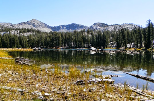
Lower Chain Lake
 While the conversation is good, the miles and the elevation fly by. We come to the last junction and start the final 300' climb and mile and a half to the lakes. There is some tiredness in the group after going 4.5 miles, but others encourage them. No great sights and it is too late in the season for flowers, so I am content with the the interplay of the morning light with the Forest greenness. But this does not last long as we climb over a low ring of rock and dirt; the lower lake pops into view with a ring of mountains in the background. There is the appropriate oohs and aahs. But like the last of the Narnia books might say, further up and farther in.
Gale Peak
We walk up another half mile to the middle of the Chain Lakes. A large island captures the view front and center. This is a good place for lunch. We drink in the sight of Gale Peak as well as munch on the food.


Islands in Middle Chain Lake


 Some of the group decide going up to the Upper Chain Lake sounds good. I stay behind to enjoy the area. Jean, Wayne, Art and Jerry K also stay back. Jean, for some reason, thinks I know how to take pictures. So she poses in several place for new ones of her. I will admit that they do come out, but I sort of think that between the human and natural subjects, it is hard to take a bad picture.
South Fork of Merced Drainage
Jean and I go out on a ridge in front of the lake. There we find a good view of the South Merced River drainage. We can see Merced and Red Peaks. And follow the river until is disappears on the south-west of us. Jerry K camels back from walking around the lake while Art turned back where there was a place which required a bit more advanced mountaineering skills. So Wayne, Jean and I decide to make  our way around the lake. We get to a place and Wayne decides to climb the ridge towering about us. He says that once on top the view is good and the top is flat, as in not rounded. But Jean and I continue around. We then understand why Art turned back and the skill which Jerry K possesses to go around a granite cliff. But the walk has been good, the sun is nice when we spot that the rest of our group has come back from the upper lake.
Tree starting Daniel Talk
Now it is time to come back to the car. Why does the trip back always seem longer than the one coming out? I hike down with Daniel and Max where we talk about a variety of stuff-car buying, house financing, how we consume food and drink from the waste of others, ... Then Jerry J and walk together and Jean joins us until we get to the dreaded boundary of Yosemite.
At this point Jerry J surges ahead, but we are joined by Kevin. We start on the wrong trail for five steps but then go to the trail leading to our cars. We stop often to rest now. On one of these breaks, Kevin sees three of our group. But how could that be? We are the last of the group. Well these three decided to take a scenic, unintentional  tour of Chiquito Lake and now working their way up the hill. We around at the cars around 5, happy. 
Now for the long, bone jarring trip to a Highway 41. The hour and a half which it takes us to do this trip  gives us plenty of time to laugh and be amazed with our conversation. At times it is sort of hard keeping the car on the road from the laughter. We stop at South Gate Brewery for dinner and get back to Kohls after 8. Another good day of hiking.

Trail Lesson:


Middle Chain lake
Lower Chain Lake

Saturday, January 17, 1970

Place: CA-Quartz Mountain


Quartz Mountain-9,045' (Sing Peak) (37.5185494, -119.4479188)
Quartz Mountain Trail Head- (Sing Peak) (long, lat)

Description:


Trips:
  • October 1, 2014 - Meetup hike from Quartz Mountain Trail Head
  • Junior High Girls Backpacking Trip
  • Labor Day trip with Andrea, Laura, Sherri and myself


References:
  •  
Pictures: