Showing posts with label Vidette. Show all posts

Friday, July 17, 2015

July 18, 2015 - Sonora Pass

Title: July 18, 2015 - Sonora Pass
Trail head: Sonora Pass
Hike Info:
Type:  Hiking
Trail: Pacific Crest Trail, south of Sonora Pass
Destination: Undetermined
Distance: approx 4  miles 1
Start Time: 12:30
End Time:    3:00
Ascending Elevation: 600'
Maximum Elevation: 10,220'
 1No GPS information
Description:
Sherri and I were invited to backpack with the Millers on a stretch from Sonora Pass to Tuolumne Meadows. We had other commitments so we could not walk with them. But we did volunteer to shuttle their car around from Sonora Pass to Tuolumne Meadows. It gives us a good excuse to be out and about, explore areas we normally do not visit, and even better yet, enjoy the friendship we established on the Trail a couple of years ago.


Sherri and I went up the night before to close to Sonora Pass.to stay the night. On the way up we stopped in at Mariposa and visited Faith Rumm at her studio. She is an artist. A good talk with her. I had been here once before, but Sherri had neverseen her. Sort of ironic since it is Sherri who had the original contact with her through Facebook. Also on the way up we stopped in Sonora for a sort of lunch/dinner at El Jardin.
Ate well, food was good. There is also an El Jardin in Turlock which Joe and Margaret have taken us to.
Sherri at camp

It is starting to get a bit late in the afternoon. While I do not mind pitching a tent at night, I feel more comfortable finding a place to camp and pitching the tent in the day.  So on the way up, we stop at the MiWok Visitor Center. Purchased a map for the Stanislaus National Forest-mine is at least 30 years old. On the way out, we met a law enforcement officer. Friendly fellow. He was very enthusiastic about a smart phone app called PDF Maps from Avenza. He showed us all sorts of things he could do with it and the map we just purchased was cheaper on the app than over the counter. Will look at it when we get back.

Night Lights
But now to find a campsite. As we go up, we would rather not stay at a place like Pinecrest just because of the crowds of people. But we do find a place to stay at a forest service camp ground called Mill Creek for $8 a night. Pretty nice and quiet. Even has a a friendly campground host who came over to greet us (and take the camping fee). We chatted for 20 minutes or so. It is quiet, but bring your own water. We had enough water from lookout to deal with this situation.

It was a quiet night and we get up before most of the other campers. Breakfast is quick and we are on the road to meet Ray and Rachel by 8am. They are schedule to get to Sonora Pass by 9:30. This is beautiful territory and we must explore a little more.

We arrive early and no sign of them. So we just wait around. I do walk over to a day use area just in case they are there. There is a couple which does PCT restock with their truck-store there. They are called the Sonora Pass Resupply. I get into conversation with Sherri-not mine, but the restocker. They have a mini-store  catering to the needs of PCTers.

Red Tailed hawk
But our friends are not there, so I go back and sit under a tree. In the meantime Sherri, my Sherri, has found what looks like an eagle perched in a close by tree. It may look like one from a distance, but we figure out it is a red-tailed hawk.
One problem with Sonora Pass is that there is.no cell phone reception.  As the hour goes to 10, then 11, we wonder what to do. But we figure we can wait at least until 5, if not later.
View from Sonora Pass


Rachel and Ray
At 12:30, the Miller's show up. Explanation? After traveling for about an hour, Ray's Jeep had issues and they had to go back and get Rachel's Prius. But they are safe and ready to hike. We get off around 1. We will probably turn around pretty soon as we have a 4+ hour drive back to Fresno.

The trail up goes pretty good. At first I am thinking Ray and Rachel have an 8 day pack on them are they going to buzz by me with just a light day pack? But no fears there. They settle down into a pace which even I can fit into. Some of it, this section of the trail is a the steepest they will face all day and it looks like they will need to go between 10-13 miles before they camp tonight.
Rachel, Sherri and Ray


But the redeeming part is with each step, the view becomes prettier. Wildflowers are poking their heads out from underneath stone and log. All of this makes even this steep hike enjoyable.As we go up, we catch up on how things are with the Millers.

Gary and Rachel talking

Ray and Gary looking over packs
After about a mile we stop and Ray and Rachel adjust their packs. Not much for me to do except to look wise.Where we stop is the last section of trees before we pop out above timberline.

Ray, Sherri and Rachel


By now, we have traveled two miles. The time is later than we anticipated, but it is well worth the time on the back end. From the time we met them on the JMT in July 2013, we have enjoyed their company. So every step we take with them is one we can enjoy their fellowship. But it is time for us to turn around. We saw our goodbyes and wish them God's speed on their way.
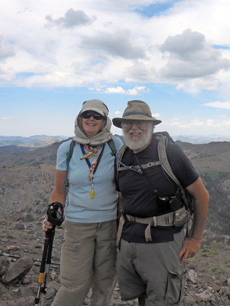

Sherri and Gary
Rachel and Ray


Parting shot


West of Sonora Pass
 Now it is time to hurry down. We are retracing our steps. But instead of being ho-hum, we see things from a different perspective. We see west of Sonora Pass, an area of many ridges. We see ravines we traveled up where there is pygmy trees lining the path. We see rock outcroppings, with flowered borders. In essence, we see things better the second time around.


 We get down pretty well in good time, about 3:30 or so. Now it is my turn to drive Rachel's Prius. Seems pretty straightforward. We come down Sonora Pass on the east side, pretty cautiously-me because I am driving someone else' car; Sherri because she is not used to driving in the mountains. All is safe and at least neither of our cars had that burnt brake smell. We hit 395 and pass through Lee Vining. We stop at the Mobil station or if you prefer, the Whoa Nellie Deli. It did not disappoint. Then through Tioga Pass and then Tuolumne Meadows. Rachel's car is left at the stables parking area and we are off home.

Small trees and PCT


Trail head: Tuolumne Grove Parking Lot
Hike Info:
Type:  Hiking
Trail: Crane Flat Lookout
Destination: Crane Flat Lookout
Distance: approx 2.5  miles 2
Start Time: 7:00pm
End Time:  8:15pm
Ascending Elevation: 450'
Maximum Elevation: 6,844'
 2No GPS information

Well we thought we would head straight home, but on the Stanislaus National Forest map I had bought yesterday, I noticed a trail to the Crane Flat Lookout. It looked pretty short, and since we still had sunlight, we thought we would try it.

The trail comes out of the Tuolumne Grove parking lot. But instead of heading north to the grove, you go to the western end of the parking lot There you find the remnants of a road-is this part of the old Tioga Road?  The trail is unmarked, but we follow it anyway. It is pretty gentle. After a little ways, we pop out onto a paved road heading northwest. We do not see any sign of our road, so we follow this one. It seems a lot longer than the map I had, of course that map had little granularity and it was not concerned with Yosemite, but Stanislaus National Forest.

Fire Helicopter
But after a ways, we find a helicopter standing through some trees. Then a imposing looking chain link fence. But it looks like it is not necessarily to keep people out. I had known there was a heliport at Crane Flat because last year when we reported our Facebook fire around Vidette Meadows, a helicopter from Crane Flat came out to pick up the division chief at Kings Canyon to fly him up there.


Crane Flat Lookout
While interesting, that is not why we are here. But there is a large paved area and we are looking around. Sherri finds a couple of people crossing this area and engages them in conversation. They point us to the lookout. And as the conversation progresses, it turns out they were the crew which came down to Kings Canyon last October. Small world isn't it?

They said to go on up and take a look around. There is the usual tools of a lookout sans radios. Things like maps and an Osborne Fire Finder.  We also get a good view. The pilots said to be sure to look to the west for Pilot Lookout. We find it as the sun sets. Now it is time to return back to the car. We do get back about 10 minutes after it turns dark. Then we take off and don't stop on our trip back to Fresno, getting home around 11pm. A good day.
Pilot Lookout


Looking east at sundown from Crane Flat Lookout


Pictures:

Eastern Sierras

West of Sonora Pass
Gary at Crane Flat Lookout


Flowers: 


Sunday, July 14, 2013

July 14, 2013 - Bubbs Creek


Title: July 14, 2013 - Bubbs Creek

Hike Info:
Trail: John Muir Trail
Starting location:  Rae Lakes
Destination:  Upper part of trail to Forester Pass
Actual Destination:  About 10,600' on way to Forester
Distance:  9.3  1
Start Time:  7:20
End Time:   6:10
Travel Time: 10:50 ( mph)
Moving Time: 5:50 ( mph)
Elevation Rise:  2,420'  1
Maximum Elevation:   11,960'

Description:
Painted Lady
I must have been anxious about today. Woke up several times last night wondering if it was time to get up. Morning is bright and crisp blue sky with no wind. Sun is just starting to hit the Painted Lady.

At 7:20, we get a good start to going up to Glen Pass. Leaving behind the blue, inviting lakes we stayed by last night creates a longing to stay. But the steady climb of switchbacks are calling us. We start taking our breaks about every half of a mile. At our second break, we are passed by a group of young men, whom we label as the singing Boy Scouts, even though they are a little older than that. But they are going up this without breathing hard, nor stopping their singing. Amazing, since we are doing what we need to do to breath-even at rest.
Rae Lakes
 
Going up to Glen Pass, I am the weak link. Usually I am waiting for Sherri. But today, she is keeping up with me. She says that my breathing is a lot more gasping, that is for air, than usually. I am having more troubles with this pass than other higher ones, or ones which we have had to climb up more. It may be steeper, or maybe I am getting weaker. I do not know.

Range after range after range to the south
But once on top, we have such a scenic view of those tarns we have been looking at on the way up. Rae Lakes have popped back into view. As Sherri said, from this perspective, Rae Lakes just looks like another big tarn. She thinks the tarns look like alien lakes, maybe because of their deep blue-green colors, surrounded by all that rock. But you see them more like emeralds, even with their own islands. Their beauty does shine out, drawing you. But then your gaze looks across at where you came from. Range upon range of mountains. Some of which we traveled several days ago. The Palisades are there; Cardinal Mountain; and maybe even Mt Goddard. Then you look where to you are going and see this same series of mountains which we will need to cross. You wonder are we up to it?

Matt and Derek with Sherri
Also on top, are the singing Boy Scouts, which now that we see them, we wonder if they are Boy Scouts. They seem older, may be Explorers. But there is an older person with them. We have seen them lift off a balloon, maybe a weather balloon. They are from San Diego area. We got our Capture California picture for the hike with Matt and Derek.

Also Larry and Paul are up here, with three others who have made it to the top with us. It does seem a bit crowded with all of us on this narrow strip marking the difference between waters going to Woods Creek and Bubbs Creek. But nobody falls off, even though we are a bit leery of any sudden movements.

On top of Glen Pass
We start the descent down the south side of the pass, with me in the lead. Why? Because I seem to be the least concerned with the sheerness of the slope. This will seem funny to my brother as he is the one who is fearless in our family. But with I in the lead, Sherri following and Larry and Paul bringing up the rear, we make it down the trail safely.

At one of the stops, we find out that Larry is a Lutheran pastor while Paul teaches the electrical trades at a technical college in Green Bay.  We sort of walk with them, then lose them, only to regain them at lunch break at the junction with the Kearsarge Pass trail. Here we also eat lunch with three others whom we will get to know through the rest of the trip-George, Chris and Steve.

Bubb's Creek Valley
After lunch we continue down the sides of the valley which Bubbs Creek form. As we go down, we see the Videttes-both east and west. Seems like it takes awhile to get down this. But we are making it down farther than we did the Rae Loop a couple of years ago. When we get down to the floor, finally, we go a little ways, then take a break. Nothing fabulous, but refreshing.  Being intrepid, onward we go. Soon we see Paul and Larry, setting up camp. Sounds like they will be about a day or two behind us. So we say farewell and it has been good walking with them.

The Videttes


Center Peak
Up a ways, we start thinking about  where we wanted to stop for the night. It is a trade-off between getting some rest tonight and  setting up to tackle Forester Pass tomorrow. The higher up we go, the easier tomorrow will be. But we have about a 2,000' climb to get up to the highest feasible camp space. We are not going to be able to do this. So we pick a campsite around 10,000'. When we get there, there is a flock of tents, so on we go. The next stop is the creek which comes out of Center Basin. People are camped there, but being eagle-eyed, I think I see a spot above the creek on a ridge.  But when I pop my head over the ridge, there is a tent and a couple of men relaxing-we will see them tomorrow. So again onward we go. About a quarter mile up the trail, it cuts back and comes reasonably close to the creek. Plus there is a little draw where we can put a tent out of sight. It is a good place, better than the others we wanted to camp at. (36.73048, -118.37161)

What a glorious evening. There are still clouds in the sky, but looking down Bubbs Creek, the sun reflecting its golden rays. What a sight. Sherri and I are the only ones to collect this sight from a rock rock outcropping just outside of our camp.

Shortly afterwards we go to bed. It is getting colder. We watch half of Dr Who episode. I read, then go to sleep around 9:20.


 Breakfast Lunch Dinner Snacks
Oatmeal and add-ins, such as dried peaches, strawberries, nuts, granola. Tang. Peanut Butter and Nutella on crackers Beans with Tortillas Clif Bar, Jelly Bellies, CytoMax, Propel, GORP, Bank Balls


 1The supplied figures above come from either the book John Muir Trail: The essential guide to hiking America's most famous trail by Elizabeth Wenk or from topo maps. There was only partial tracks for today in my GPS. Below is the readings from today's status on the GPS. I view it as only somewhat accurate.
Distance: 9.50 miles
Elevation Rise:  1,566'
Maximum Elevation: 11,910'


Center Peak


Upper Rae Lake


Thursday, January 22, 1970

Place: CA-Videttes

Vidette Meadow (Mt Whitney)
Vidette-East (12,742) and West (12,229) (Mt Whitney)
 (Long, Lat)

Description:
"Two of these promontories, standing guard, as it were, the one at the entrance to the valley and the other just within it, form a striking pair, and we named them the Videttes.” (C. B. Bradley, in S.C.B., 1889, II:5, p. 272.)  From Place Names of the High Sierra (1926) by Francis P. Farquhar
Trips:


Pictures:


References:
  •