Showing posts with label Clough Cave. Show all posts

Wednesday, May 9, 2018

May 9, 2018 - Ladybug Trail to Whiskey Log Camp


Title:  May 9, 2018 - Ladybug Trail to Whiskey Log Camp
Hike Info : Description : Trail Lessons : BackgroundFlowers and Plants


Hike Info:
Type: Hiking
Trail: Ladybug and Whiskey Log
Destination: Whiskey Log
Actual Destination: midway between the two
Distance:  5.99 miles  1
Start Time: 10:14
End Time:     4:30
Travel Time:  6:16 (0.96 mph)
Moving Time:  3:48 (1.58 mph)
Elevation Rise:  1,692'
Descent: 1,482‘
Maximum Elevation: 5,033'
 1I stopped about a mile short of Whiskey Log.
Description:
When I read the hike description on Meetup, I was thinking that this will be a bit tough. Based upon the last several outings I am not sure about the 8 miles and 1,500’. Will see.
So it is time to go on another mid-week meetup hike. We gather in Fresno at 7am and get off at 7:25. I am riding in Leslie truck-this is the second week in a row which I am riding with someone. When has this happened? Maybe never. We stop in Farmersville for a break and to pick up up a couple more people. I 
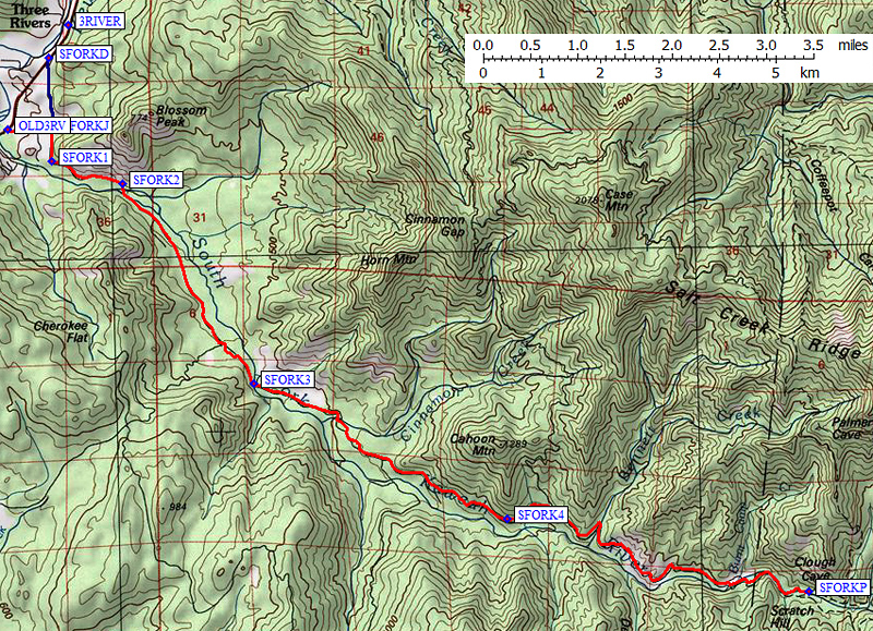
take over driving duties and on we go. The trailhead is at the South Fork Campground, just inside Sequoia National Park, a bit after Three Rivers. The road to get in is slow and bumpy-I guess that cuts down on the traffic.
A reader noted this is Salt Creek Ridge
We get on the trail about 10:30, 16 strong. Once again, John has me start out. For the first eighth of a mile, I am the strong person in front. But I know this will not last long. After crossing the Clough Cave Bridge, the trail rises up and I slow down. So I start dropping back some.
The trail is warm and the grass is green. Flowers look like they are enjoying themselves. The sounds of the Kaweah bring cheer to my ears and a bit more lightness to my footsteps-still not enough lightness to push me faster though. 


Dennison Ridge to the South
I do not remember this trail being so steep when I last did it three years ago, maybe four years ago. Of course there has been many miles and memories since then. So I am huffing and puffing some more, and fall back a bit more. Still it is good to be out with friends.

Not Homer's Nose

 When we round a corner, I see a dome like rock sticking out of the ridge in the distance. I say something like, this is Moro Rock. I am feeling a bit smug being able to identify this, particularly since I think I see railing on the top of it. But, Mike comes along and says it is not Moro as Moro is a couple of drainages away. I ponder this for awhile and tend to agree with him after due consideration. He thinks it is Homer’s Nose. But I think Homer is someplace to the east of us on one of the juts of rock on another ridge. Strike two for me; strike one for Mike. When I get home, I study a topo map to see what I can see. This dome has the majestic name of 8,940’-someplace called it Homer’s Brow. So where is Homer’s Nose? Just to the west of the dome by about an eighth of a mile.


Path close to Cedar Creek
While the above conversations took maybe a matter of 2 minutes, it filled my mind for awhile about what do I really know. So before I knew it, we were at the Ladybug Camp site, close to the river. Here we stop for a snack, or in my case, most of my sandwich, and to take a gander at the falls. Pretty nice.
When we take off again, there is a sign saying 2.3 miles to Whiskey Log, which puts the one-way distance about 4.2 miles. This is also the start of a good climb with one of the few switchbacks on the trail. By the time which we get to the top of this rise, I know that I probably will not be making it all the way to Whiskey Log. The question is how long? It is not so much that the legs are fading, but that the lungs are not getting enough oxygen into the system.


As we continue up, we hear the sounds of Cedar Creek. But a couple of us have slowed down enough that we think this is a good place to stop for the day, at the three mile mark, just before the creek. We convince John that it is OK for him to continue on and we will rest here and wait. We talk about family and the wild and why we are so tired after three miles and 1,500’ of elevation rise.
When another person comes back, I suggest that they start going on down the trail and that I would wait for John and tell him the status of everyone. This is agreeable. From experience, going down or on the flat is not a problem-just a month ago, I averaged 3.5mph over 13 miles. So I should not have an issue going back. After waiting around an hour, the whole group of people come by. I have snoozed a bit, read and wrote in my blog during this time.
Field of Common Madia
John comes up as the sweep for the group, making sure everybody is in front of him. After telling him what the situations I saw in front of him, we take off. Just as I suspected, I am feeling pretty good-may also have to do with having taken an hour and a half rest. We retreat down the trail. This time I have opportunities to take some pictures of flowers.We walk pretty steadily for and hour and a half, getting back to the vehicles around 4:30. I feel better now than when I did two hours ago.


South Fork of the Kaweah from Clough Cave Bridge
After conversing for awhile, we take off to Three Rivers and eat at the River View Restaurant and Lounge. I had their special, the Mountain Western Chicken. One note of warning-when they include jalapeno peppers in the menu, they do not skimp. Then it is off to Fresno, with me driving. In the front seat, we talk a lot of backpacking and I unload what I think would be useful to a person who has not backpacked before, but who is an excellent hiker. Sort of go over a short list of my backpacking stuff. This makes the time go by fast. I get home around 8:30, ready for a shower and on to tackle tomorrow night’s book group.


Trail Lesson: Be sure to know what you are talking about before you open your mouth.


Background
Homer’s Nose. There was a discussion about do Sequoias grow around here. Turns out that there are two Sequoia groves which flank Homer’s Nose: Homer’s Nose Grove and Eden Creek Grove on the north side of Homer’s Nose and down the slope a couple thousand feet.


Flowers and Plants


Giant Larkspur

Common Madia


Wednesday, March 12, 2014

March 12, 2014 - Ladybug trail

Title: March 12, 2014 - Ladybug trail
Trail head: South Fork Campground in Sequoia NP
Hike Info:
Type:  Hiking
Trail:  Ladybug Trail
Destination:  Ladybug Camp
Distance:   3.66 miles*
Start Time:  11:39
End Time:   1:18
Travel Time: 1:39 (2.22 mph)
Moving Time: 1:30 (2.44 mph)
Elevation Rise:  903'
Maximum Elevation: 4,378'
Description:
The motto for this hike comes from John: Never let the truth stand in the way of a good story.

We met our Meetup group at 7am at Kohl's and then it is off to Three Rivers and beyond to hike the Ladybug Trail. Getting to Three Rivers is not bad, maybe about 75 minutes. But to get to the trail-head is an adventure in itself-my kind of road. It goes from a reasonable narrow paved road to a reasonable semi-paved road through the Sierra foothills. Then the pavement disappears into a dirt road rutted with runoff cracks. But very drivable without four-wheel drive; it does take us awhile to get there and get on the trail.

South Fork of the Kaweah
The main thing about the South Fork campground is it has an outhouse, tables and firepits. We eventually make use of two out of the three. The Ladybug Trail starts at the far end of the campground and heads out on the south side of the South Fork of the Kaweah River. But within a couple hundred feet, our trail crosses the river--if we went straight we would be heading to Clough Cave, I think. One web site said the trail to Clough was on a westward heading.

About to tackle Boot Hill
The trail starts climbing for a ways, but still pretty gradual. We cross dried Pigeon Creek-not much to write about here, except that it puts us to the base of Bone Hill. Why is is called that? I don't know.  But it does get us going into climb mode. This is where the trail gets a bit dicey. First, there is some rocks which you have to maneuver around-they could be a bit traumatic if you do not watch yourself. But then as we climb, the drop-off on the south side of the trail gets steeper and steeper. Someplace in here, we get the first view of Homer's Nose. Why is it called that? Ask John. With no end to this, a couple of our group decide to go back-which you got to respect their decision as they know their bodies and minds the best. I accompany them back to the car--maybe a little more than a half of a mile. Then I turn around and start back up the trail.
At the top of Boot Hill

Did I tell you that I was carrying a 33 pound backpack on this trip? Just starting to get used to wearing one of those things. But I can tell that I have additional weight on my back as I hit Bone Hill again. I stop to pant a couple of time, but keep up a pretty decent pace above 2.0mph. Hiking alone is not something which I get to do very often. I enjoy hiking both with friends, family and Sherri. But there are times which it is just plain enjoyable to have the solitude of hearing only your own feet planting into the dirt.

That is what I hear until after I cross Squaw Creek when I meet up with Eric on the return trip. He did not think I had been that far behind. Just respond with a smile and exchange pleasantries. Shortly after that the solitude is broken with others returning from Ladybug Camp and the end of where we are hiking today. I still have about half of a mile more when I meet John and Jerry on their return trip. We talk for a few minutes, with them giving me instructions on where to find the only ladybugs up there.
Finally, Ladybugs

About ten minutes more and I come across Ladybug Camp with a nice campfire area and what looks like a couple areas to pitch a tent. But I was told to look for the Whiskey Log Camp sign-that is where they found the ladybugs. About two hundred feet later I see the sign. Where the trail zigs back up the hill, another trail heads to the river. I take the later and find the little knob with the ladybugs on it. A bit disappointing. Maybe it is the drought, or the heat or we are a bit early or late. I do not know. Still seeing the bugs is neat, even if the number is small. I do hunt around a bit more, but do not find any more bugs. I am pretty certain the group has scoured the area and would have said where else to find them.

By the way, this trail, which is not a trail, goes to the river. It is part of an abandoned trail called the Stakecamp Dome Trail. It used to head off to the Stakecamp Dome Ridge, and then continue on to the Garfield/Hockett Trail. But NPS says that the trail is in poor condition and usage is not recommended-sounds like a challenge! Or as John McKinney says in A Walk Along Land's End , We sly hikers know that just because a trail vanishes from the map doesn't mean it vanishes from the face of the earth.

Kaweah River
South Fork of the Kaweah
I turn around and start back. Imagine, it is a lot easier on the lungs hiking downhill than on the way in, uphill. My pace shows. I do need to remember that this walk is for enjoyment, not a race. While there is no roses to stop and smell, there are things to see, sounds to demanding to be listened to and senses to experience.One of the things is just enjoying the Kaweah River as it cascades down. By hurrying I missed the South Fork Kaweah River Falls-it was close to the campsite I saw earlier. For a description, see Ann Marie Brown's book, California Waterfalls.

Squaw Creek
But one thing which I did not miss was Squaw Creek. I glossed over it in my prior description, but I did stop and ponder it then and on the return trip I enjoyed the delicate nature of this creek.  It is a thin stream of water. According to the NPS description, if you go up the creek a ways, it actually disappears, or should I say it appears to provide refreshment to the eyes and soul.

Now it is time to tackle the descent of Bone Hill and  then back to the car. Once again, it is called to mind that the mountains are not made to hurry in. They helped remind me by reaching up and grabbing a toe. Did not fall, but it was the mountains subtle reminder to enjoy the walk.

As I round the curve, I see John and Jerry waiting for me on the bridge, looking very nonchalant. Thanks guys. We walk the remaining trail and find everyone enjoying some good conversations. We go into the campground for some tables and celebrate Donna's birthday-in my pack was a bear canister full of cookies for her. Then it is off to Three Rivers and the Riverview restaurant where I gobbled down a bacon, bacon cheese burger. The drive back to Fresno seemed a lot longer than going to Three Rivers. Must be tired from a good hike.
Token Ladybug
Looking down from where we came


More Squaw Creek


*The distance, elevation and time recorded above is the time it took Gary to go from the South Fork Campground to Ladybug Falls. Note: the mph is for Gary, not the group. But Gary returned back to the Campground after going five-eigths of a mile. The time below is for the entire trip Gary did.

Distance:  4.92 miles
Start Time:   10:15
End Time:     13:18
Travel Time: 3:02 (1.62 mph)
Moving Time: 2:22 (2.08 mph)
Elevation Rise: 1,385'
Maximum Elevation: 4,378'

Saturday, January 3, 1970

Place: CA-Clough Cave

Clough Cave (Dennison Mountain)


(Long, Lat)

Description:
Discovered by William O. Clough in 1885. He blasted a hole big enough to crawl through. He filed on it as a mineral claim, but the application lapsed. Clough was born in New York State, 1851, and died in the fall of 1917 on the Franklin Pass trail while trying to reach the lake in order to shut off the water from the power company’s flume for the winter. (Guy Hopping.)    Place Names of the High Sierra (1926) by Francis P. Farquhar

 David Huff adds [on Climbers.org] in 2003: The reason that you missed Clough Cave is that it is not marked and the rangers discourage entering it. I have been in it 2-3 times and it is a safe cave for novices, i.e. only one way in and out. To find it you walk north of the campground and cross the river on the bridge. On the north side of the river there will be a trail heading east. Look up the hill to your left and you will see a faint trail heading west. It is very hard to see. Walk west and the trail will climb. Eventually you will be on a narrow ledge 50-75 feet high. It curves to the right and you will see the entrance. The rangers made an attempt to put up a gate but somebody ripped it off. The last time I was there was 10 years ago. I was first in the cave in the middle 60s and took a few photographs. I returned in the late 80s and took a few more photographs. Quite a bit of damage has been done to the few formations there. Some have been sawed off. It is just a small cave but there are other openings near there that are more extensive. Only Spelunkers should enter them. This is the extent of my knowledge I have taken all of my sons there when they were 6-8 years old. The only danger is the ledge. 


Trips:


References:
Pictures: