Showing posts with label Lassen. Show all posts

Monday, June 15, 2026

June 15, 2026 - Going to Minneapolis


Title: June 15, 2026 - Going to Minneapolis
Hike Info : Description


Hike Info:
Type:Plane


Description:

Today is the start of our twelve day trip to Minnesota. I have gotten most of my stuff together Friday night and then packed on Saturday. Rachel has been helping Sherri with her packing. I have gotten everything in my carry-on while Sherri has a checked back. I have been putting the last bits of stuff since then with the final few things this morning.

I got up at 4:00am and had my breakfast. Sherri got up around 4:30. We are all ready to go with Steven driving us to the airport, leaving our house at 5:10. We checked the bag and got through TSA by 5:40 without issue, except for being patted down. We had a minor faux pax finding the correct gate. Recently FAT opened a new terminal; we had headed off to the old terminal. Once we figured out that B2 was in the new place and back tracked to the new one, we sat down and waited 30 minutes to board.

Boarding started at 6:30 and we got on one of the first groups. Then sat on the plane for 20 minutes until take off. We left the ground promptly at 7. The flight was pretty calm. I was speculating that at least on our ascent, the fifteen seconds of turbulence may have been when we went through the inversion layer, At least that is my thought. Sherri slept about half the way.

Mt Hood

As far as what we saw,when we went by Yosemite, it was rather hazy. I recognized Half Dome and then El Capitan a bit late. Further update, there was a glimpse of Tahoe, but I did not see Lassen or Shasta. Then I think I saw Mt Hood was off to the east and then we crossed the Columbia River. After that Mt St Helens and Mt Adams seemed to line up . On the whole the scenery was nice.

We got into Seattle a few minutes early. Once we settled down, we decided to take a walk. When we were here last June and the plane was not going to leave that night, I bought Sherri some chocolates from Dilettante Chocolates. Sherri liked them then and wanted some on this trip. Off we went for a stroll through the airport and found them. Just as good as last year.

I noticed that our gate had changed in the meantime from the C concourse to the D. That is where we headed on our return trip. Sherri got herself situated-she has a foot which is bothering her and will affect her walking on this trip. I, on the other hand, walked for half an hour until getting close to boarding time.

Mt St Helens and Mt Adams

The boarding is about 10 minutes later than expected, but not bad. We have exit seats which I thought would be a bit roomier. Not so. While only two seats in the row, not much leg space and very narrow. Note to Gary: do not get row 17 on a 737-800. Sherri noted later on that the back row of this plane also has little leg room. The plane sits on the ground for a while. We finally got airborne at 12:19 close to half an hour after the advertised take off time.


Mt Ranier


Not a whole bunch to see as there are clouds for most of the way. Sherri watches one of the Toy Story movies. I read some more of Deborah Blum’s
The Poisoner’s Handbook and made notes on Dorothy Sayer’s Gaudy Night. The seats after two plus hours are not very comfortable.

He plane lands in Minneapolis at a few minutes late, around 5:25. Turns out we will be doing some walking in this airport. The first order of business after going to the bathroom is to retrieve Sherri’s checked luggage. Right when we get there, it arrives. Good timing.

On the Metro
Then we start following the signs for Light Rail. This will eventually take us to terminal 2. If we were more aware, we would have found the station in terminal 1, but at least I got to stretch my legs. Poor Sherri and her foot, though. We see an information desk and ask about the Metro. They give us a map and answer our questions. Turns out we can be counted as seniors. We eventually made it to the light rail spot. But so far I have not seen any place to use our purchase. I would guess there will be someplace to use our pass. But nobody ever came by. We will have to find out how to the Metro works here in Minneapolis.

Anyway, we got off at the Government Plaza stop. From there it is only a three block walk to the Hotel Indigo. The check-in person, Sam, is very friendly and gives us all kinds of pointers. We are in room 1611. That’s right, the 16th floor. This is certainly a classy place. Our room is a corner room. We are able to see to the south and west. Rain clouds come in and the skies open up. Enjoyable watching, from inside.

After resting up a bit, we decided to try the hotel’s restaurant, the Star Bar and Bistro. I have a smash burger and Sherri mac and cheese. Both are very good. By the time we get back to the room, it is 9pm local time. It is still light. But I think we will be going to bed soon after 10.


Tuesday, November 26, 2024

November 26, 2024 - Go to Medford


Title: November 26, 2024 - Go to Medford

Hike Info:
Type: Car

Car Mileage: 489 Miles
Car Travel Time: 10 hours 
 
 
Description:

I woke up around when I wanted to get up: 6:10. This will be a long day as we are aiming to go to Medford today. At least I have reserved a hotel room there. We had planned on going the day before, but with the storms which went through, I was concerned about snow and ice on the road.

I had my breakfast, then finished getting the car packed. It is stuffed. I thought we said after the last two times of going to Andrea’s that that was the last of the car being stuffed. Sherri said this was the last time.

We left at 8:45 with Steven driving. Korra and Friday, the dogs, are with us. They both travel well. Friday is with us because Rachel will be flying into Portland Wednesday night. The trip is uneventful with Steven driving. Sherri takes over driving when we reach Livingston where she gets a cup of coffee at Starbucks. Sherri drives to Costco in Elk Grove. Then I took over driving to Leatherby’s.

We get there about 11:50, a ten minute drive from Costco. Here we have lunch. We decided to take advantage of their Two for Tuesday’s special. Sherri and I share a chicken pesto sandwich while Steven has a four piece chicken strip. While the sandwiches and fries are good, it is the sundaes which are the main attractions. Steven gets a sundae and Sherri and I share a sundae-a good size one. Two scoops of ice cream-chocolate chips and cookies and cream, along with two syrups-peanut butter and fudge. This will fill me up for today.

I drive past Sacramento to just north of Red Bluff. Both Sherri and Steven slept for part of the way.I have been trying to break up the driving into two hour segments for each driver. Even though I felt good enough to drive further, it is time to break it up.


Steven drives past Redding and into the mountains north of
Lake Shasta. We noticed the snow on the mountain sides. I think I see Mt Lassen-not sure. But Mt Shasta is very evident and very covered with a coat of white. Christmas card material-unfortunately the pictures from a moving car did not come out great.

At the Collier rest stop, I take over driving. I do not think this is my driving, but I think I ticked off one trucker. I was passing him, not quickly, but moving past him. He wanted to move over. Once I passed him, he moved in right behind me and honked and flashed his lights. There was a truck right beside me, so I have nowhere else to go, so I kept driving at my speed and moved over when I passed the truck. The truck behind me took off . By the way, I was going 65.

We get to Medford, actually Central Point, a bit before 7pm. We quickly checked into the La Quinta hotel and moved our stuff in. It is a pet friendly hotel and we bring in Korra and Friday. Once settled in, it is time for dinner. When in Medford, it means Kaleidoscope Pizza. So we left Korra and Friday in the room and got our eats. They have a 10” special which sounded good. So we ordered that for the three of us and a salad. All around content.

Then off to get gas at Costco before heading back to the hotel by about 8:30. Apparently the hotel has been trying to reach me because Friday has been barking all the time we have been out. I guess now we know that we need to take the dogs with us. The rest of the night we read and did stuff. By 10, it is lights out.


Sunday, July 26, 2015

July 27, 2015 - Kings Creek Falls

Title: July 27, 2015 - Kings Creek Falls
Description:
Today is break camp day. There are eight of us left: Karol, Lewis, Kate, Becky, Marcus-her son, Rose, Sherri and I. We are a bit slow in getting going, but that is ok. We are not pressed for time and that isn't that what camping is about? Enjoying oneself, relaxing, and in this case also enjoying friends.


When I got up this morning, I was mindful of Sherri's last command last night: she does not want to wake up at a time beginning with a 5 or 6. Since I started getting up at 5:45 and got out of the tent by 6am, I took care not to disturb her-turned out she needed to go to the bathroom a few minutes later.


Trail head: Highway 89/Lost Creek Group Campground
Hike Info:
Type:  Hiking
Trail: Noble Emigrant Trail
Destination:  none really
Distance: 3.14 miles 1
Travel Time: 1 hr, approx
Maximum Elevation: 5,797'

Since I am the only one foolish enough to be up at this time in the morning, I decide that this is my last crack at a trail I had seen on the map. Now my idea of an early morning walk, particularly by myself is more of a ramble than a hike. I enjoy singing hymns, prayer, and meditating. This morning was one of those mornings when it was too serene to be wasted upon scurrying about. So I sort of started walking west on the Noble Emigrant Trail, just about 70 yards on the other side of the road from the Lost Creek Group Campground.

I will be walking as far or short as I want to. With the air cleared by last night's rain, the sunlight is shimmering through openings in the trees. Just so glad to be out walking this morning. My feet feel light as they glide over the trail. I do not see very many footprints on this trail, so I suspect that even when other parts of the park is busy, one can find solitude out here. I think maybe this is a trail to be walked in the early morning or right before sun down.

For the first 3/4 of a mile, the path is flat. Then there is a rise of about 320' and I meet highway 89. Nobody is on the road at this time in the morning. So I look around and start back. I realize one of the draws for me is a line of blue labeled Abandoned Flume. If my bearings is correct, I have walked right over it and have not seen it. I backtrack a bit and confirm, there was nothing to be seen. No ditch, no pile of rocks, maybe, and just maybe a flat place. But that is not why I was walking this path, it is to just enjoy being out, giving praise to God.

When I make it back to camp, Lewis and Karol are up. We start setting up breakfast which will be a semi-community affair. Sherri's and mine contribution is French toast. This turns out to be a hit-sometimes the simple things in life are the best. By 9:40, we have the campsite packed up and cleaned up, fulfilling Karol's promise of leaving it better than we found it. All three cars split and go there own ways. Our path lies to the south for a hike we heard about four years ago.


Trail head: Highway 89/Kings Creek Trailhead
Hike Info:

Type:  Hiking
Trail: Kings Creek Trail
Destination:  Kings Creek Falls
Actual Destination: Kings Creek Falls and Bench lake
Distance: 4.63 miles 1
Travel Time: 3:15 (1.90 mph)
Maximum Elevation: 7,365'
1My GPS was low on batteries and I did not have a replacement. So I recorded it with my phone through PDF Maps.The stats on PDF Maps is pretty basic. When I got home, found the batteries. Hiking is not about measurement but about enjoyment.

When we were at Lassen four years ago, we heard that the Kings Creek Trail was one of great beauty and a bit of a climb coming back out. So I have wanted to do this one for awhile. On the way to the trail head, we come across a coyote crossing the road. While I will not say Lassen has an abundance of large animals, it does have a good diversity, if one is quiet and patient. The trail head is a parking area along the side of the road-not to be confused with the Kings Creek picnic area which is a bit further down the road. There is a few cars-an advantage to being here on a Monday. There is a sign which says the overlook to the Kings Creek Falls is closed for renovations. But maybe we will get a peek anyway.

This trail is facing the wrong way. Our first steps, and most of the steps down to the falls is down-I prefer descending on my return trips. But such is life that sometimes we have to take the bad with the good. And there is a lot of good on this trail. Within a quarter mile we see a nice meadow with a deer gentle grazing in it. He does not seem to be too disturbed by us, just raises his head, looks and continues to munch.


Sherri looking over Kings Creek


A short ways afterwards, the trail splits between a steeper, but shorter way, following the creek or another steep but longer way looping down to the base of the creek. We have no choice as the steeper way is closed for maintenance. We start off on what we think is the trail, but we quickly realize that even though it has some pretty nice views of the creek and the drainage area, this is no trail which NPS ever constructed. Evidently we were following a social trail. Our doubts about this "trail" grew as the trail dropped down this slope. So we climbed back up and what do we find? The real trail. 
Small Meadow


Still following the trail down, it was steep enough following the switchbacks that I was questioning do I really want to go up it. Even more so, there was a lot of exposure to the sun. Even being the morning, it is warm going down. But once down, the shade of the trees and the coolness of the creek causes my attitude to change and is more relaxed. We head the half of a mile to the overlook and it does look like the overlook is closed, if not the whole trail. Across the trail is the workers tools, but I think they are out to lunch. So we take the hint and retreat back up the trail for lunch.
Lunch Scenery

It was a good place to stop and eat our peanut butter, Nutella, and Ritz crackers. Kings Creek is flowing by us with a little bit of a cascade 30' away. The shade keeps us cool and we enjoy the rest. Now the decision does need to be made: do we go back up the way we known? Or do we go a longer, but what looks like a gentler way past Bench Lake?
Talus Slope

Our decision, being the intrepid people we are is to go the unexplored and face the unknowns of going past Bench Lake. We start off with a pretty ascent, but short climb out of the Kings Creek area. As a note, our stay in Kings Creek, we never saw anything of the falls, except for the top of it. Then the trail falls into a gentle undulation as it starts a long, but gentle climb towards the lake. We pass by the talus slope of the cliff which Bench Lake resides. So far we are pleased. It looks like once we get to the flat place by Bench Lake we can cut a triangle and go about a quarter mile cross-country, cutting off at least 3/4 of a mile and about 120' of climb. So that is what we do.


Bench Lake


Bench Lake is a large dry lake bed from what we see. No steady flow of water in and right now nothing out. But our short cut is doing pretty good. It is easy walking and when we go up 20' up a ridge, we find the trail back to Kings Creek, where we started our hike this morning. Sherri is concerned about the sun so she frantically searches for sunscreen.


Putting the pack together


Meadow at the end
Now we are on the return trip. The biggest climb, which is not so bad in respective is right at the start. We climb around the end of the long cliff above Bench Lake and come out on top. Now it is a bit more rising up and falling until we get to King Creek and its meadow. We did meet one man out for exercise and that was it. So different than the crowds on top of Lassen. When we hit the trail, just below the first meadow, we start the final leg back to the car, which we get to about 1:45.


Sundae at Fenton's
It is time to return home. First we stop at the Kohm Yah-mah-nee Visitor Center at the park entrance. I report the bear we saw yesterday. We look around a bit. Sherri gets a soda, but no volcano ice cream. Then it is off to Mountain View. We stop in Willow at Black Bear Diner for dinner-tastes good, even as good as the food has been. Then off to Vacaville and gas. But not only do we stop for gas, we stop at Fenton's Creamery in the Nut Tree area. Soooo good-probably knocks my blood sugars for a loop. We reach Mountain View by 8:30pm. Tuesday we do the final leg home and get back to Fresno around 4:30pm. Traveled over a thousand miles in seven days, but it has been a good trip.

Happy Hiking Couple


Trail Lesson:


Hiking is not about measurement but about enjoyment.

July 26, 2015 - Lassen Peak and Cold Boiling Lake

Title: July 26, 2015 - Lassen Peak and Cold Boiling Lake
Description:
John and Cathey need to figure out a better sleep schedule. They are sleeping a cabin about a half an hour down the road, so they must have gotten up even earlier than my 5:15 time. Sherri and I have a couple hard boiled eggs given to us by Sharon M. Much faster and less noisy than the oatmeal we were planning on having.

Trail head: Lassen Peak Parking Lot
Hike Info:
Type:  Hiking
Trail: Lassen Peak
Destination: Lassen Peak
Distance: 5 miles 1
Start Time: 6:40am
End Time: noon
Elevation Rise: 2,000'
Maximum Elevation:
 1My GPS was low on batteries. The mileage and elevations are based upon the standard information for the Lassen Peak Trail.

Right at 6 they come by the campground and we drive up to the trail head. which is another half an hour away.  It is much cooler and winder this morning than yesterday. Of course, we are starting 2+ hours earlier. Still, I start off with a T-shirt, I have my windbreaker in my pack. But I suspect I will be sweating soon enough. 
Cathey and Sherri at start
John must have a feeling of freedom as he just charges ahead. Sherri is walking with Cathey, so if I do not want to be left behind,  I had better get my act together and get a moving.
John and Lassen Peak
This is the same path as yesterday, so I will save you from the groanings and  moanings of getting to old for this, even though I am the youngest of the four of us.
We go up and John and I talk a lot on the way up. John plays a conversation game with me. As we reach each switchback,  we talk. Then he will say, and there is one more thing, which he will tell me at the next turn. Certainly makes the trail go faster, and keeps up the interest. John's stories, though, does not need too many devices to maintain interest.
We make it to the end of the NPS trail on top of Lassen. When I describe the "trail" to the high peaks of Lassen, it was decided we have had a good hike, why spoil it? So we rest, take pictures, and try to stay out of the cold by hiding behind a rock outcropping. Then it is time to do the descent.

Cathey and Sherri at Top
We were within the first ten people on top of Lassen. But now starting to come down, there are hoards of people.. Guess it is a good thing to be early-John and Cathey may be wise in this matter, even though I sort of would have liked to have been in the sleeping bag a little bit longer.

The good thing about going down is that all of the sights we had coming up, we can now enjoy. Brokeoff Mtn shows a bit of grace in front of us; Lake Helen with its cool blue waters looms larger as we come down. Even though the trail is steep, there is something refreshing about this descent this morning.

When we get down, we say our goodbye's to John and Cathey. It has been awhile since I have hiked with them and it was good being with them. They are heading to Stockton to be with their daughter, but we are going back up the road to look for a hike.


Wise Ones (or Guys)

Sherri on remains of a glacier

John and Brokeoff Mountain


On way down

Brokeoff Mountain


Trail head: Kings Creek Picnic Area
Hike Info:
Type:  Hiking
Trail: Cold Boiling Lake Trail
Destination:  Cold Boiling Lake
Actual Destination: Crumbaugh Lake
Distance: 2.58 miles 2
Start Time: 
End Time: 
Travel Time: ( mph)
Moving Time: 1:05 ( mph)
Elevation Rise: 200'
Maximum Elevation: 7,200'
2The mileage is based upon trackings by PDF Maps.
After leaving John and Cathey, we went back up the road looking for a lunch place. Found the picnic area at Kings Creek. So we grabbed a table and had our peanut butter, Nutella, and Ritz crackers. Afterwards, I take a quick nap. I cannot say I felt terribly more refreshed and definitely not energetic-actually Sherri looks more energetic than I am. But I would also like to explore the area.

So since we are at this area and Kate and gang were talking about Cold Boiling Lake, we might at well see it for ourselves. We move the car so that someone else can park in the picnic area and then start out. But a few steps later someone asks a few questions about the area, and of course, when has a lack of knowledge ever stopped me from answering? After giving the lady some wonderful advice, I am sure, we go ahead and start on. The trail is not too bad and Sherri and I enjoy the walk over to Cold Boiling Lake.

Bubbling water in a grassy pomd
The thing about this lake is not so much that it is boiling, but more has a flatulence problem. There is a lot of gasses escaping through the water causing the bubbling effect. Also at one time this lake must have been a lot larger and the gasses would have been coming through the lake. But now there are more ponds or puddles surrounded by grass getting gassed-sorry, just could not resist.

Cold Boiling Lake


Crumbaugh Lake
We pick a nice place to watch some ducks on the lake, while others go by.  It is quite enjoyable just laying by the lake, relaxing. There is one group of about 15 going on to Bumpass Hell. So after a quick discussion, we decide to go the other direction: Crumbaugh Lake.


The trail down is a moderate, but short downhill. We pass by some meadows and enjoy the freshness of them before they turn brown for the summer.  A couple of people come up the trail, but not many. When we get to the, we have it all to ourselves.

For so little effort, we have hiked harder for worse places. The grasses blowing in the wind, corn lilies framing the lake and you through in a mountain background, you have a nice place to stop and enjoy a snack. And that is what we did, along with just lie down for awhile.

Corn lily and lake

Grass, wind and lake


The trip back is just a retreating along the same trail. Except it is not the same. We get to be treated to the scene of a cinnamon-blonde bear scrounging along a log, looking for food. When he notices us, he wanders away, but we see him again just on the other side of the tree. At that point, even though we are a ways away, he tires of us and runs away.


Brown Bear Friend
The rest of the return trip is uneventful. When we get back to camp around a quarter to five, nobody is there. So we go on to Manzanita Lake and take a shower at the store. Refreshing. Makes me feel almost human. When we get back, some of the remainder from our group is there. It is a semi-community cooking tonight. Cathey had given us left over chicken from last night's pot luck. So we fry it in oil and bacon. Then put a BBQ sauce on it and every body thinks this is a good piece of eating.

After dinner, we sit/stand around and talk for a while I notice at sunset that there are clouds gathering and put out the alert that it may rain tonight. So we batten down the tents, clean up the camp and hit the bags. Just after I get settled in, it starts to rain. It rained pretty good for about 20 minutes and then stopped-just enough to make sure I was not lying.

Saturday, July 25, 2015

July 25, 2015 - Lassen Peak

Title: July 25, 2015 - Lassen Peak
Trail head: Lassen Peak Parking Lot
Hike Info:
Type:  Hiking
Trail: Lassen Peak Trail
Destination:  Lassen Peak
Distance:   5 miles 1
Start Time:8:50am
End Time:  2:30pm
Travel Time: 5:40
Elevation Rise: 2,000'
Maximum Elevation: 10,457'
 1These mileages and stuff is from the official trail information from NPS. My GPS is low on battery so I did not bring it.

Description:
It is around 6 and time to get up. Lewis is taking us on a hike up Mt Lassen and I suspect he will be pretty punctual, after all he is a lawyer (a pleasant one, and a fine hiker at that).  We have pancakes for breakfast and get cleaned up. Right at 7:30 we are ready and Lewis rounds up the troops who want the adventure to climb the mountain. There are 16 of us total--nine who will be more like jack rabbits and seven who will enjoy breathing heavily the elevated air.


Lewis giving instructions
We get to the Mt Lassen parking lot around 8:30. It always takes a few minutes to get everybody organized and today is no exception. I am designated the sweep, which in reality is recognition of my talent for going slowly.

Start of a long 2.5 miles

Eye of the Vulcan
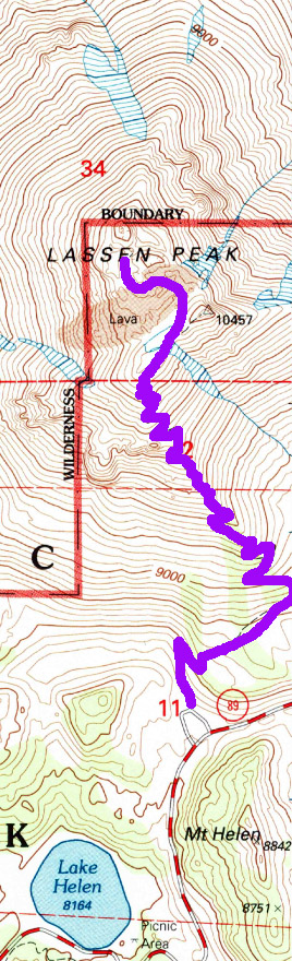
But there are several of us who have banded together and will make it up the mountain. The first .4 of a mile goes fast. Why do we know that it is .4 of a mile? Not because I am wearing a GPS, that is for sure-I could not find replacement batteries so the GPS is about dead. But there is a sign which announces that it is so, even though it seems shorter. I suspect the other 2.1 miles will go a lot slower.

But the other thing this sign says is that above us is a rock formation called the Eye of the Vulcan. No, it is not where Mr Spock from Star Trek is buried as I was saying up on the mountain, but a hole which lava poured through during an eruption Still it is both fascinating to be watched by the mountain, and I must say, a little bit eery.

But we continue on. As steep as this trail is, and we are going up pretty well, The Park Service has done a pretty good job with it. For the last four or five years, there has been restrictions on using the trail. Restrictions like it can be used only four days a year because they were reconstructing it. For that amount of time, I sort of thought the trail may be paved in gold. But I admit, this path was done well. I suspect that there was only a few modifications from the time when BF Loomis first created this trail.


Chari's Goal
Not the peak


Looking southwest from trail
Like a lot of upward trails, there is reason to stop and gawk. This one is no different.Not only do we get views of our objective, but also the surrounding area. We see Lake Helen close to the parking lot. Brokeoff Mountain loams in front of us a good part of our initial way up. When on the east side of the mountain, the Kings Creek drainage is spread before us. So there is much to ponder as we head up. I make use of every possible moment to ponder too.

Sherri on top
But we get to the top and enjoy the view. We see the nimble nine, ready to charge back down. But we are not-we want to enjoy the top of the world feeling. So our speedy friends return down the trail which we just came up for. They will be going on to further adventure.

Lassen Crater
Now the top is sort of a misnomer. Yes it is the top, but not really the top. The trail ends and there are interpretive signs there, telling about what we are seeing. There is also the crater which we can go down into. But an eighth of a mile away is the east peaks which are 60-80' taller than where we are. Many of our gang  want to ascend like others have. So we set out for the top of the top. But it becomes quickly evident where the NPS trail ends and the social trail begins.  We do make it to the top and take some pictures and celebrate the achievement.

Now I am not very wild about going down this slope. Lots of scree and loose rock can come down this pretty steep slope. While only a class 2 route, it could be interesting in the right circumstances. The good thing about helping others over areas you have concerns about is that you can stifle your own fears and concentrate on relieving the fears of others-sort of a natural relaxer. Through this all, we all got down safely.

Switchbacks and Lake Helen
Our group is not terribly fast going down. But for me, one of the good things is gaining a new perspective. Going up I have a tendency to be looking up at where we are going to go up to. But down down is so much more expansive. It seems like we have the whole world in front of us, and we do! At least the world around Lassen. It seems like there is a whole world before me which I am flying through, at least in my imagination.

Looking over the Kings Creek area

Glad we have poles to go down. Even better that the Park has reconditioned this trail. Sort of frosts me to see someone, not in our group, cutting switchbacks. I know as a Christian I am not be vengeful or wanting too much justice-I am in much more need of grace and mercy than judgement. yet when I see someone doing inconsiderate things like this, I think I would not mind if they broke a leg or something. But then there is that rescue thing which puts others in danger. So best hope these switchback cutters see the light.

Sherri and Vic
Off of my soapbox now and on down the trail. Our group of seven is getting a bit tired. Even though it is only about 2:30 when we get down, we all feel we are not up to doing Bumpass Hell today. So we beat a leisurely return back to Lost Creek Group Campground to rest and enjoy conquering the mountain.

Tonight is potluck night. So each has a contribution. I will saw that either the food was really good or our hiking worked up our appetites. All of the food was tasty and we all had enough to eat. Our contribution was Cowboy Casserole, first introduced to us by Lyndsey from REI Fresno. So it was time for good conversation around the campfire.

A ranger does show up and finds a quiet social group enjoying time together around a campfire. The only concern he found with us was needing to put food away in one of the camps, i.e., bears would not feast on our food. After that, he and I talked about the Park and where to backpack and stuff. Enjoyable and informative talk. He also had a discussion with Karol as well.

John and Cathey will be trying Mt Lassen tomorrow morning. They will come by the camp around 6am and see if anybody is going. I told them I would go with them. Sherri also volunteered to go up again. What kind of fools are we? Hiking Fools. Time for bed time for an early get up time.


Lassen Crater on top of the Peak
.


Lassen Peak


Coming down: Sharon, Christ, Vic, Elizabeth, Chari, Sherri


Lake Helen
Sherri and Chris going up