Showing posts with label Marvin Pass. Show all posts

Friday, July 4, 2025

July 4, 2025 = Park Ridge Lookout


Title: July 4, 2025 - Park Ridge Lookout


Hike Info:
Type: Lookout
 
Description:

Chuck's Flag
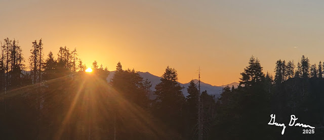
Maybe I learned my lesson from yesterday. I got up a few minutes earlier. But that was futile as there was no lightning to report. I am glad of that. I got up and started packing as today is my last day in the tower. I get about a third of my stuff down. At least that is a start. Wendy had asked for a new US flag to be put up. Her late husband had wanted that to occur each 4th of July and I am happy to be the one this year to carry on that tradition. I wanted to get a picture of it at sunrise with the wind unfurling it. But the wind did not cooperate. Later it unfurls.

I am able to go for a short walk, maybe a third of a mile. But this feels good. Then back to the tower where I have my breakfast. At 0800 I went into service with both Porterville and Ash Mountain Fire. About 30 minutes later I realize I have not heard either Buck Rock or Delilah go into service. I phoned over and had a conversation with Jeff. Both have gone into service. Maybe they got lost in the static. Or maybe I need to clear ear wax out of my ears. Then it is off the normal duties of a lookout.


Early Morning light
 

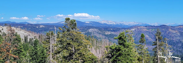
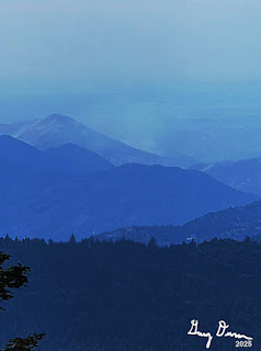
Bluebird sky days are a joy to a lookout. When you have haze, it is tough to make out anything and your eyes strain to discern objects. The white of the smoke blends in with the dinginess of the air. But today is a day which I can see almost forever. I can see the foothills of the Coastal Range plainly along with its tops. I suspect if I was at Delilah, I might be able to see into Yosemite. A day to love being up here.

On this kind of weekend you get to hear interesting stuff. At the Crystal Springs Campground a cooler and trash can was impounded. I am assuming that foodstuff was not put away and people were not around. Sounds like a bear hazard to me. Or then there are maybe too many people in a place at one time. The Wolverton Road was closed to traffic due to both congestion and too many people parking alongside the road. Just heard that Lodgepole road is closed as well, except for those going into the campground.

Then this morning as I was doing a scan, I noticed a marmot eyeballing my car. It seemed hesitant to approach it. Yesterday someone asked about marmots and I talked about how cars over in Mineral King had to take preventative measures. So I watched him pretty closely. When he goes under my car, I hurry down the stairs to scare him off. But he emerges from the other side and eyeballs me, like he should be the one who is concerned about me. He runs off to some rocks and I resume my lookout activities.

Coastal Range


Wendy called me up and told me that my relief is expected to be here around 1700 or 1800. He will call me up. Also talked about some wildlife Buck Rock saw this morning. Things could get interesting if this sighting is verified.


My Favorite Marmot

Fuzzy's Bench

Now I am hearing a woodpecker tapping out his staccato beat on a tree. Another joy of being up here is seeing and hearing the sounds and sights of nature. I wonder what the woodpecker is going to hide and will he remember where he has hidden it?

Lunch, or dinner, is the remains of a couple enchiladas which Sherri made for lookout. I cleaned up the dishes in preparation for leaving this afternoon. This is just the start of cleaning up the cab, not that I had created a huge mess or anything. Still crumbs fall and things get spread out.


Yesterday there was a fire near Marvin Pass. Yesterday when I looked on WildCAD I saw it as the Gammon Fire. Usually fires are named after some landmark around it. But there was nothing in the area we saw with Gammon nor could I find it on GNIS. Today I was hearing the Incident Commander Trainee calling himself the Gannon IC Trainee-with two N’s. I looked on WildCAD and it said Gannon. There is a Gannon Creek there. When I looked on GNIS, it had been named in 2000. Most of our maps are pretty old, so it is no surprise that we could not find why it was called the Gannon fire.

The last two hours of a shift, particularly on leaving day, are the longest. I am expecting that call saying when my relief is coming. And as that is not coming, the time is even longer. Still there is only 7,200 seconds to count. During that time I get the fire indices, clean the floor and countertops and pack the last of my stuff.

This has been an unexpected day. It is the Fourth of July. I was expecting a ton of visitors. Instead, there was not a single one. At 1800, I go out of service, and start back. I meet my relief on the road. We exchange greetings and I relay some information to him. And then we are both on our way. A short way further I realize there were a couple more things to tell him and leave a voicemail. It is an uneventful drive back home, arriving shortly before 2000.


Menu

Breakfast

Lunch

Dinner

Snacks

Granola

Enchilada

Peanut Butter and Nutella Sandwich

Ritz Cracker, Granola, Jelly Belly


Thursday, July 3, 2025

July 3, 2025 - Park Ridge Lookout


 Title: July 3, 2025 - Park Ridge Lookout


Hike Info:
Type: Lookout
Description:

It is a busy morning. I woke up at 0515 and started on the lightning report. Lots of stops and starts to it. There were 550+ strikes yesterday in our area. I did a partial report without all of the details. There was just too much with the laptop I have. It has got me wondering, should I get a different laptop? Can I do the report on my tablet? Things to ponder.

 Today will be a long day. I go in-service with both Sequoia National Forest and the Park at 0800. I am the only lookout I heard going into service at this time. Later on Jeff at Buck Rock reports a fire, but I did not hear him going into service. The fire I heard reported is behind Maddox Mountain. But initially I could not place it as I was only given the lat long. But I gradually worked out where it was. The smoke has not risen to where I can see it. It was probably caused by yesterday’s lightning. Division 3 takes charge and orders up a team. They will hike in a couple of miles over Marvin Pass to the fire.

In the meantime, the Big Stump Incident Commander is reporting on the prescribed burn. Even with the wind last night, the lines held and they will mop up. I add I saw some smoke around 1910, but it died down. He indicated that the wind had kicked up some embers, but it died down again. I confirmed that he wanted to know about any smoke there

Park Ridge Greeters

Then it is the normal routine stuff. Scan, listen to the radio, take the weather. Oh wait, I am late in doing the latter. Still not a big issue as things are pretty calm. The Gammon fire is a little interesting, but now that the crews are mobilizing, there is not much radio traffic. That will come this afternoon when the crews have tackled the fire and report back on what they found. When I asked Buck Rock where it is, he said it was a bit south of Shark Rock-I do not know where this is.

At 0931 I took the weather-nothing unusual today. Then at 1000 the weather and staffing is reported by Porterville. I got some company about 1020-a crew from PG&E had come up and was clearing the brush and tree limbs from the power lines.

But that is not my only entertainment. I watch a couple hawks gliding around the air current off towards Buena Vista Peak. Then they swoop down in front of me and disappear for away, only to reappear to do their sky dance.

I must be getting really bored. The lookout at Delilah, it is his first day soloing, so I call over to see how things are going over there. Finally a bit after noon, I got my first visitors. They ask questions and I try to explain the functioning of a lookout, along with the territory they are seeing.

We hear a little more about the Gammon Fire. The crews have made it in and gave a size up on it. It is 50’x50’ with a fire burning in the top of a tree 30-40’ up. They intend to secure the lines around the area and then hike out, starting in 2 to 2.5 hours.

Elwood Fire

Patrol 33 over in the Big Meadows area has her hand full. There is a report of a downed tree across a road. She goes out and clears it. Then found another one. An engine wants to put signs around saying no off-road vehicles-does Patrol 33 have any? None today-she usually has everything in her truck.


Elwood Fire after 30 minutes

I have continued doing my scans. There is a lot of haze, but I see a bit of something unusual around Tivy Mountain. I call over to Delilah and ask if he sees it. He does now. Buck Rock says that CalFire is responding. Delilah will call in a confirmation. SQF personnel start to respond. After about 40 minutes they are called off.

Park Ridge Lookout

The Big Stump burn reports in. I later told him that I had been seeing puffs of smoke all afternoon. Apparently that is not what Ash Mountain wants to be hearing as Wendy calls me up. She got a call and is relying on that they do not want to hear about the smoke on the prescribed burn. 

Evening


A little before 1900 I go out of service with Ash Mountain. But I keep on scanning until 2000 for SQF. Then with Buck Rock, I go out of service.

Today after putting stuff away, there is time to go for a short walk just down the road to the base of the knoll the lookout is on. Then back up to the cab. I talked with Sherri for a little bit. Then back down to the ground. I tried to get some pictures of the stars, but no success. But I did get one of the lookout. By the time my head hits the pillow it is getting close to 2200.


Background

Not really background, but as I am trying to find where the Gammon Fire is, I wonder, can I build a spreadsheet which will compute the lat/long based upon the azimuth and distance from a location? I already go the other way and compute the azimuth and distance from a lookout, based upon the lat/long.


Menu

Breakfast

Lunch

Dinner

Snacks

Granola

Peanut Butter and Nutell along with some sun chips

Quesadilla

Granola, ritz crackers Jelly Belly


Extra Photo's

Park Ridge Lookout at Night

Morning to the east

Sunrise

Sunrise


Tuesday, July 27, 2021

July 27, 2021 - Kanawyer Gap


Title: July 27, 2021 - Kanawyer Gap

Hike Info : Description : Menu : Extra Photo's : Animals : Flowers and Plants
Hike Info:

Type: Hiking 

Trail:  Marvin Pass, Kanawyers Gap Trails

Destination:  Mitchell Peak

Actual Destination:  Kanawyers Gap

Distance:  5.13 miles

Start Time: 12:32

End Time:    5:21

Travel Time:  4:49 (1.07 mph)

Moving Time:4:18 (1.19 mph)

Elevation Rise:  1,686'


Descent: 1,297‘

Maximum Elevation: 9,655'

GPS Tracks


Description:

Got up and drove to the Grant Grove Visitor Center for my morning WiFi fix. At least so I could pull down the lightning activity for yesterday-only a few of them. Then down the road to the turn off to Delilah. Why you might ask? I am meeting Greg. He is giving me a couple of cans of propane because we have run out of it. This is a real blessing. Thanks Greg. After he gives us the cans, he takes off to go to Delilah and I go back to camp by 8:15. Sherri gets up shortly afterwards.. We had french toast for breakfast.

Gary laboring on way to Marvin Pass


Now what are we going to do? Sherri suggests
Mitchell Peak. I have my doubts about making it, but we will not know unless we try. We leave our campsite at about 11. Sherri decides to drive. I do not think she knows what is in store for her, but I am glad she is going to try. The road up to the Marvin Pass Trailhead is mostly paved. But even this paved part is narrow and windy. Sherri takes it slow, which is the only way to take this road. But the pavement gives out about two miles before the trailhead. Sherri does not like dirt roads. While tense, she drives through it. The road is pretty steep, but Sherri makes it up.


Marvin Pass

Rest of the weary


The parking lot is pretty warm. We get ready and start up. Several years ago we came down this trail. At that time we said we would hate to go up this trail. But here we are about to go up it. At least we are doing it without a full backpack.

The trail does not disappoint. It starts off on a pretty good slope. I have been having trouble climbing, so I start in while Sherri is reading a sign. It turns out I do not need this head start as Sherri struggles as much as I do with this climb.. It is warm which does not help with the sweat. I take this mile and a quarter one slow, heavy breathing at a time. Finally get to the top of Marvin Pass. It is an 800+’ climb and I took a breath for each foot of climbing. Sherri is about ten minutes behind me. We both feel like it is time for lunch. It is after 1:00pm.

Meadow going to the Gap


Looking at the map, we are only a third of the way up to Mitchell Peak. We look at our options:

  • Continue on to Mitchell Peak or as far as we want to go.

  • Go up the trail towards Mitchell, but take the trail up to Kanawyers Gap

  • Mt Maddox is on the other side of Marvin Pass from Mitchell. It is only about 600; ascent rather than the 1200’ of Mitchell. But it is a cross-country walk.

  • Loiter around Marvin Pass

After resting up for a little while, we decide to go to Kanawyers Gap. The trail is more up, but does not seem to be so steep as going up to Marvin Pass. I will say that the trail is pleasant, but nothing spectacular. Of course being in the Sierra with the forest around you is special anytime. After aout ¾ of a mile we come to the junction where the Mitchell Peak Trail goes off from the Kanawyers Gap Trail.

Our trail is a trail less traveled. Still very recognizable as a trail. Prior to the junction, you could tell where the trail maintenance crew had been through. Now there are places where the trail could use a bit of clipping. But like I said, very passable.

A short ways further, we look down on an expansive meadow. Turns out this is the upper end of Rowell Creek-but not part of Rowell Meadow. This is what a high Sierra meadow should look like. Someplace which you could just stop at and stay a lifetime.Our trail goes around the upper end of the meadow. This gives us only about a hundred yards to the Gap.

Kanawyers Gap marks the boundary of Sequoia National Forest and Kings Canyon National Park. We take a few steps into the Park, find a rock to sit by and munch on an energy bar. The Gap has a fair amount of woods, so our view is hampered a bit. But we can see some down into the Sugarloaf area and across to the Avalanche area.

Path to Kanawyers Gap

We stay around for a few minutes and then we start down. The trip down is the reverse of coming up, except we are a bit more tired, but not having to push ourselves as downhill is obviously easier than the climb we did earlier. We get to Marvin Pass and pause for a couple of minutes.


Sherri on trail through edge of meadow


By this time, the pounding of going downhill is turning my legs into a form of Jello. By going down this trail, you realize how steep it was going up-as if I really needed confirmation. After walking down for 45 minutes, we reached the cars. As we reach the parking lot, we meet a family going into the glam resort of Sequoia HIgh Sierra Camp. They will walk in about a mile and then get their needs taken care of-they look excited.

Sherri elects to have me drive down. We decided on the way down that having a burger from DNC sounds pretty nice. So an hour plus later, Sherri orders us our meals. Tastes really good. I try to get WiFi at the Visitor Center, but it does not seem to want a connection to the outside world. Nothing special.


Token Bovine for trip

Back to camp we go. By this time, the light is fading and so am I. But first, we decided to make a reservation for Grand Teton in September to be with our daughter Andrea and her boyfriend Lawrence. After taking care of business, we climb into our sleeping bags, read and fall asleep, content with what we accomplished.


Menu

Breakfast

Lunch

Dinner

Snacks

French Toast

Peanut Butter and Nutella Sandwich

Grant Burger at DNC

Energy bars, jelly bellies.


Extra Photo's

Corn Lily Meadow

Rocks on the flank of Mt Maddox

Marvin Pass

Bear marks or tree cracking?
Kanawyers Gap

Kanawyers Gap

Rip Van Gary on Kanawyers Gap


Animals

Fritillary of some type, maybe a Great Basin?


Flowers and Plants

Unknown to me

Pine Drop

Corn Lilly

Cow Parsnip


Lupine