Showing posts with label Roaring River. Show all posts

Sunday, July 16, 2023

July 16, 2023 - Weaver Lake


Title: July 16, 2023 - Weaver Lake


Hike Info:

Type: Hiking

Trail head: Big Meadows

Trail:  Weaver Lake Trail

Destination:  Weaver Lake

Distance: 7.14  miles 1

Start Time: 10:59

End Time:     5:42

Travel Time: 6:42  (1.07 mph)

Moving Time:  5:39   (1.26 mph)

Elevation Rise:  1,027'

Descent: 1,560‘

Maximum Elevation: 8,721'

GPS Tracks

1The mileage is a little low as I did not turn on the GPS until we were about a quarter of a mile into the hike. Also the start time is about 10 minutes low. Other figures may be affected as well. AllTrails has this as a 6.8 mile trip.
Description:

Last night we discussed should we go up to the mountains tomorrow?And if so where? The concern is that last week I saw snow in the Weaver Lake area. But then it is to be 112 in Fresno. Seems strange being concerned about snow and heat.


Big Meadows Creek
I got up at 5:45-no lightning today to report, so I did a few things, including eating breakfast. We were trying to leave by 8am, but settled for 8:20. Then I compounded the lateness by forgetting my hat. Steven gets the car filled up with gas and then we are off. The drive, with me as a passenger, was pretty smooth. We arrived at the Big Meadows trailhead at 10:15.

The “we” in all of this is Andrea, Steven, Korra-the snow dog, Sherri and Gary. We get on our boots, get our packs situated, and our picture taken. I made a comment to Andrea that with it being as warm as it is, this might be a short hike. By the time we leave it is 10:45.


Korra, Sherri and Gary crossing an unnamed creek
We have been up this trail many a time-including with backpacks last year. So there are other places where I describe this trip. Going over Big Meadow Creek on its bridge, the greens are splendid and vibrant. We probably hit it at a good time as there are only a few mosquitos. I do OK as long as the trail is level or a bit ascending. But that does not last long. The trail starts to rise. While my legs are doing OK, I am starting to breathe harder. But with the rise, we start to see a bit of the Monarch Divide and beyond and the high mountains to the east. They are pleasant to see and gives me an excuse to stop and gwack.


As we approach the trail coming in from
Fox Canyon/Meadow, Andrea finds a nice log to sit on. Since it is 12:15, we all agree it is a good place to stop and time to eat. Andrea, Steven and Korra play catch with some sticks. A good thing about lunch in the Sierra during a hike is that you are content to let the break go on and on. Of course, that is the same attribute which can lead to less fortunate consequences, such as relaxing too long.


Andrea Charging up a hill
We did neither. We started walking. There are a few patches of snow across the trail. The snow only makes the walking a bit different, not really a hindrance. Korra is a snow dog. She loves this stuff and rolls and florlicks in it. I wonder if it is the heat or her natural tendency?

Someplace along this trail, we talked with a family who used to be with Sierra National Forest. They indicate that a group is looking for a friend who got separated. So we are on the lookout for Kirk with a lime-green pack.


A short while later, at 1pm. we get to this little unnamed creek. each time we come to it, it seems so refreshing. Maybe it is just because I am tired. Evidently Sherri is more tired as she indicates this is about as far as she wants to go. I guess we have gone up about 500’ with another 700’ to go up, some of it is steeper than what we have gone up already.

After resting a bit-didn’t we just have lunch 25 minutes ago?-I start off because I know I will be the slowest and the most likely to peter out. A short time later, Steven and Korra catch up with me, but there is no sign of Andrea. Steven goes on. I continue to trudge up the trail. The legs are doing OK, but the lungs are another story. Andrea comes up and talks with me for a few minutes. I think she is checking out the old man to make sure he is doing well enough to continue. I must have passed inspection as she goes on.

Gary Crossing a creek
One of the joys of hiking is coming across fellow hikers. One of these had been out for five days-I was amazed with him with all the snow he must have encountered. He had gone to Jennie Lake, then into the Roaring River area, up to Avalanche Pass and then spent last night at Weaver Lake-he said that it was crowded. Fun talking with him. We then went our separate ways.

A few minutes later I come across a couple of young females. We talked for a few minutes. I make a comment that I will just be happy getting to the Weaver Lake sign. They take pity on an old man and say it is just around the bend. And sure enough it is. I know that Weaver is just about 80’ up from here and less than a quarter mile. I can do this.

And I do make it. The time is 2:54, just a couple of minutes before my 3:00pm turn. Andrea and Steven are right there. It is pleasant looking at the pool of water. I relax for awhile. They have been at the lake about 30 minutes before I showed up and had gone out and cooled themselves in the lake. Right before getting to the lake, I started sucking air out of my bladder. I probably drank at least two liters if not 2½ litters. Andrea gives me half of her water.


LifeStraw in use
But about 15 minutes after getting to the lake, we left. The trip down is pretty uneventful. I take a lot less water going down than when I was coming up it. We get to the creek and Sherri at 4. A couple of years ago, Steven gave us a LifeStraw to filter water with. Sherri brought hers. I get down on my knees and start sucking water from the creek. Tastes really good. I will need to dig up mine. We rested again for a little while.

The lungs are no longer an issue. The legs are like rubber. But we are mostly going down so it should not be a struggle. I just do not feel very springy. We get down to Big Meadow Creek and the short uphill to the parking area. It is 5:45.


Korra on drive home
We load the car up and take care of business. Andrea’s Smart Watch tells her that the temperature ranged between 85 and 90 degrees. No wonder I used up my water. On our way back, with Steven driving, I let our family know we will not be able to attend the Sunday Family Zoom this evening. We make it home by 8, tired and ready for a shower.


Extra Photo's
Daughter and her Father

Steven and Korra setting up for a group shot


Buck Rock Lookout

Andrea in the lake

Steven sunbathing by the lake

Korra, Steven and Andrea by an unnamed creek

Steven and Andrea on trail

Korra

Unnamed Creek


Animals


Flowers and Plants

Western Wallflower

Indian Paintbrush

Monday, July 26, 2021

: July 26, 2021 - Cedar Grove


Title: : July 26, 2021 - Cedar Grove
Hike Info : DescriptionMenu : Extra Photo's : Flowers and Plants


Trail head:  Gate on Road 13S07
Hike Info:
Type: Hiking : Car
Trail: Road 13S07
Destination: Indian Basin Grove
Actual Destination: Junction with Road 13S50
Distance:  2.25 miles
Start Time:3:02
End Time: 4:46
Travel Time:  1:44 (1.30 mph)
Moving Time:  1:19  (1.71 mph)
Elevation Rise:  317'
Descent:  344'
Maximum Elevation: 6,253'
GPS Tracks

Description:

Neither one of us are feeling too energetic. Must be a sign that we have not gotten out enough if a drive up here and preparation has us depleted.So we have decided to take a car trip down to Cedar Grove and just do some short stuff around there.

Grizzly Falls

But first, we must get up. I got up at 6;00 and walked to the Grant Grove Visitor Center for their WiFi. No lightning was picked up, but I did load my email. I get back to camp at 7:30. Sherri gets up a little before 8:00. We have french toast for breakfast. It is a slow morning. We read until 11:00.


We get into the car and take off to Kings Canyon, Our first stop is
Grizzly Falls. This is a falls right off the road which until looking at Anne Marie Brown’s book, California Waterfalls I did not know about.We find a parking place right in front. When we stop out of the car, the heat hits us-the upper 80’s. The waterfall is only 50 yards off the road. I am expecting only a trickle, but there is enough water to make it a worthwhile walk.


Gary and Sherri at Roaring River Falls
 We head into the Canyon proper. We stop at the Cedar Grove Visitor Center to see if they have WiFi-no-so we do not even step out of the car. It is warm. Then we get to Roaring River Falls. It is a bit down from the last time we saw it. But I do not think I have ever seen it not worth the 200 yard walk. The firefighters from Engine 337 walk by us before we realize who they are. We have lunch and then I take a 20 minute nap.

Onward to Zumwalt Meadows where we intend to take a walk around the meadow-about 2 miles or so. But the parking area is full so we continue on to Road’s End. The lots there are pretty full, except for the ones at the very end. It is 92o. So we decide we are not really interested in trudging through the hot sand to the Bailey Bridge and back.


Middle Fork of Kings from Vista Point


 We turn around and drive out of the Canyon. It is Sherri’s turn to take a nap. We had said we wanted to take a look at the Princess Campground. Looks like it is well taken care of-some friends of ours like to camp here. With our Senior discount, Sunset is a bit cheaper and closer to many of the places we like to go to.


Across Highway 180 is Forest Service Road 13S07. Ordinarily, I am only moderately interested in Forest Service roads like these-they are more to get to someplace than a scenic drive. They usually are a bit rough for an enjoyable drive. But I had spotted that there was a Sequoia Grove, Indian Basin Grove, up this road. After we go up it a ways, there is a gate closing further travel via car.


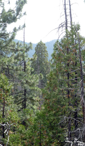
We are up higher than the Canyon and the temperature has cooled a bit. We are both interested in a short walk, so off we go. It is a moderate rise up. It feels good to be out stretching our legs. We see a few signs of tree bases having been scorched. But I wonder what fire? (From CalTopo, it looks like the Rough Fire). Will need to look it up when we get back home. After half of a mile we see what looks like a young Sequoia-by young let's say 150 years old (only a guess on my part). Even young there is a burgeoning majesty to them. We think we see a trail, more like an old road which we follow for a ways. There is a sign saying Giant Sequoia Grove Boundary. Evidently we are on the right track. Our old road is getting more overgrown and starting to head down into a ravine, so we just look around, then return to 13S07.


We continue heading up the road, not intending to go very far. But we do find a couple of places where we can look down into the Grove. Fun trying to pick out what are Sequoias and what ones are cedars. The road climbs up gradually, or flattens out. We hear the sound of thunder rippling across the sky. Will there be more? (Turns out when I checked the lightning report the next day, there was no lightning in this area. Did we hear the sound of a tree falling? If so, it was a large tree.)

We come to the junction with road 13S50. Here we look around, catching glimpses of the mountains across the Kings River. We walk back down the road to the car. No more excitement. We stopped at Grant Grove Visitor Center, but were not able to pick up an Internet connection there.

When we get back to camp, Sherri fixes us a chicken-cheese sandwich for dinner. But we run into a problem-no more propane! I thought I had brought a nearly full one-guess not. So we have a cold sandwich.


Greg had left a text about a problem getting to a web site and do I have any thoughts about what it could be? Yes I do, so I called him back. We talked about the problem. Then I ask him if the stores in the area sell propane canisters? He does not know, but he has a couple new ones which we can have. We make arrangements to meet at the Delilah turn off tomorrow. Yippee! This is so good.


Road 13S07

Sherri and I play Cribbage some more. Then it starts to sprinkle, so we throw things into the tent. When we get into the tent, discover that several of the Cribbage pegs have broken. That ends the game, that and the solar light keeps going out on us. Time to read and go to sleep


Menu

Breakfast

Lunch

Dinner

Snacks

French Toast, Syrup, and butter.

Peanut Butter, Nutella sandwich and chips


Chicken-cheese sandwich, cold


Clif Bar, GORP, Jelly Belly


Extra Photo's

Road 13S07


Ridge off of Converse Mountain

Mountain Misery looking better than it actually is

Gary wondering, "Are we lost yet?"


Looking down into Indian Basin Grove

Ridge off of Deer Spur with Spanish Mountain in background

Edge of North Dome

Roaring River Falls

Grizzly Falls

 
Flowers and Plants

Aster of some type, I think