Showing posts with label Deer Camp. Show all posts

Wednesday, February 7, 2018

February 6, 2018 - Deer Camp Trail


Title: February 6, 2018 - Deer Camp Trail
Hike Info : Description 
Hike Info:
Type: Hiking
Trail: Deer Camp Trail
Destination: As far as we can go
Actual Destination: About four miles along trail
Distance:  8.11 miles
Start Time: 11:09
End Time:    3:50
Travel Time:   4:41 (1.73 mph)
Moving Time:  3:18 (2.46 mph)
Elevation Rise:  607'  1
Descent: 435‘
Maximum Elevation: 6,430'
 1Starting elevation was 5,922’; ending 6,132’ for a 210’ difference. More like an elevation rise of 500’


Description:

Sherri and Rose were to be planning this trip after the ambiguity of times and places to hike from last time. But a couple of things happened. Our good friend Betty is up at Bass Lake and is joining us. Her recently repaired hand limits her for the time being to the trails she can be om. So we thought about doing Willow Creek near Bass Lake. But after a brief reconnaissance, that was a no go-to many place to slip and fall. Also Sherri got sick and cannot go, so it is off to Deer Camp.
Going through Buck Brush
I pick up Rose at 9 and Betty at 10. We get to the Deer Camp Trailhead a little after 11. The weather is cool, but sunny. After putting on our boots we are ready for our hike. This is a hike I have done several times and have noted it is not a destination, but journey hike. The trail is flat, so we are able to walk. But it is closing in on two years since I last walked this trail-back on Memorial Day weekend in 2016 when we backpacked into Deer Camp with Wayne and Michelle. There is a bit of freshness because of not walking on it for awhile.
We are hiking at a pretty good rate-like I said it is flat. But considering how much I have moaned about my lack of stamina and being out of breath, I am going pretty good at 6,000. Betty has not been able to hike for about four months is going good, while Rose with a 16 pound training pack is keeping right up there. It is a good day to walk. Temperature reaches the upper 50’s/low 60’s.
Cranberry Girl


There are three creeks along our path: Rail, Strawberry and Bishop. Each has some wetness to them, but the only one really running is Rail. We stop for lunch after an hour and a half of mostly walking-only a break or two to look at something interesting before lunch. This is a far cry for me from the hikes I have been on for the past month. Lunch is a bit longer than average. But it is a good rest.
I think we will hike another 30-45 minutes, then we should get to a turn around point so we can be back at the car by 4:00pm. So onward we charge. There is a long ridge after Bishop Creek. This ridge separates Bishop from Alder Creek and I would like to round the end of it. But it gets to be time to turn around. (When I check the map the next day, I found that we stopped about a tenth of a mile and 60’ short of rounding the ridge.) There is a big boulder which I rest against for a few minutes. Then we start back again.
Brush at Rail Creek


The return trip has mostly a gradual downhill slant. So we make a bit better time coming back. While the scenery is the same, and does not very, I still enjoy the walk. Just amazing that we are walking this trail this year rather than snowshoeing it. Not saying we did not see snow, or even that there was not snow on the trail. Still an inch occasionally does not mean we need to set on snowshoes!


Dishes on Henness Ridge

Towards the last mile, my legs start feeling tired, but I was able to maintain my stride instead of shortening it. Fortunately, there are little things to help you stop and enjoy. Such as spotting the data dishes at Henness Ridge or a plant along the way. So I still have a little ways to go before being in shape. But I am getting closer.
We got back to the car before 4, then get packed up. I think we all are a bit tired, but glad we hiked it today. When we get back to El Cids, Betty invites Rose and I to a Mexican restaurant in Bass Lake with her husband. After a quick glance at each other, off we went. The restaurant is Casa Velasco. Not sure if it is connected to the Velasco Mexican Restaurant in Prather. Food was pretty good, just a bit spicy making ti sharp. I guess I am getting a bit less of a spice eater in my old age. I drop Rose off at her place at 7:00pm and back home to Fresno by 7:30. I talk with Sherri a few minutes before getting into the shower-she is still pretty lethargic from being sick. Shower feels good.


Sunday, August 7, 2016

August 7, 2016 - Illilouette Creek


Title: August 7, 2016 - Illilouette Creek
Hike Info : DescriptionMenu : Extra Pictures 


Trail head: Glacier Point
Hike Info:
Type:  Backpacking
Trail:Illilouete Creek
Destination: Illilouete Creek
Distance:  3.34 miles1
Start Time: 4:26
End Time:   6:42 
Travel Time:  2.15 (1.49 mph)
Moving Time:  1:48 (1.86 mph)
Elevation Rise:  286'
Maximum Elevation:7,165'
 1I thought I had lost the tracks for my Garmin Foretex 401-I had not. But in digging around to see if I could find replacement information, I found a very promising web site called Sierra Mapper. With Sierra Mapper you can put in two points along a trail and voila! lots of trail information appears, including distances, maps and elevation profile. With Sierra Mapper, the distance it calculates is  3.23 miles and an elevation rise of 125'.

Description:
As Dylan once sang, it's been a long time a-coming. From when Rose and Shawn proposed going on the Trail right after Sherri and I got off of it to us inching towards saying yes. Then Shawn needed to drop out of this journey but Sonya, Kate and Kim got added on. During the last 7 months. its been one of the top things on Sherri and mine mind, and today it comes to life!

Yesterday Rose, Sonya and I went to Wawona to see if we could rearrange our permits, but so far it is the best we can do. But Rose, Kim, Sherri and I will probably come into the trail at Silver lake instead of Parker Pass. The pass after Parker looks scary-that would be Koip Peak Pass.

Am I all packed? I think so. My pack certainly feels like it is. Including food and water, my starting weight is 47 lbs; Sherri's is 26. But it will get heavier when we pick up our restock in Tuolumne.http://gary-summer.blogspot.com/1970/01/place-ca-tuolumne-meadows.html I expect it to be around 55 lbs and Sherri's to 32. Then even heavier at Edison. By the way, my starting weight is 267. I hope to lose 15 lbs before we end this trip.

Sherri and Rose in the Glacier PT parking lot
We are slowly in leaving Fresno. I need to take care of a stack of stuff-mine, my parents and Sherri's cousin Vera. So we get to Rose's house a little after 1:20 o'clock. And take off around 1:30. Jeff, Rose's husband, takes us up to Oakhurst where we get our dinner:  that would be a turkey sandwich.  Rose procures a sandwich from Deli Delicious. Then it is off to Glacier Point, with a brief bathroom stop at Chinquapin.

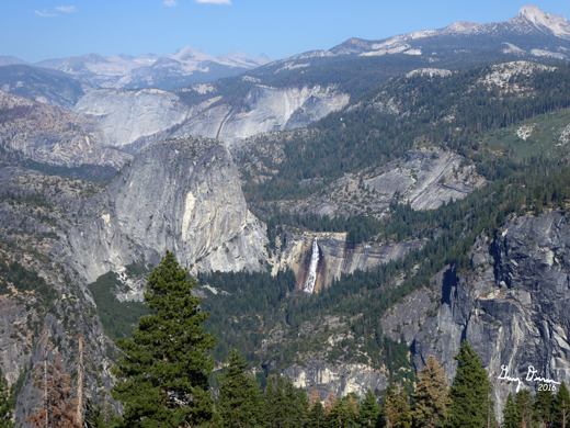
By this time it is the bit after 4 o'clock and 4:30 by the time we say our farewells to Jeff and get our pictures taken for the trail. The first mile is just an assortment of wonders. We looking over Half DomeNevada and Vernal Falls. Much of the country we will be passing through for the next couple of days is before our eyes. 


Half Dome from Glacier Pt
Rose and Sherri and Liberty Cap


Rose and Sherri and Half Dome
As we go down the trail, the path goes through buck brush, chinquapin, manzanita, and a bush with a heavy soda smell-at one time I knew what the plant was, but I cannot think of it now. This is the same plant we saw last May coming back from Deer Camp-I did not know it then and I still do not.

But I am also living in the memory of the last time I went down this trail-a year ago July. Keirnan had forgotten her id at the start of the JMT hike. I chased after her for a mile-I timed it this time and it really was a mile. Then I got to go up this trail the same mile. But today, it is down the slope.

The trail is all downhill-well, almost all 99 percent of it is down. So we make pretty decent time are packs field a bit heavy because we are not quite used to them yet.  When we hit Illilouette Creak, we feel like it is time to to make camp. But we still travel about a half mile to find a suitable, unused campsite. A couple of other places already have people. We see a camp across the way across the creek and with an easy creek crossing. Illilouette is not high so we an easier crossing than what I have feared.

Crossing the Illilouette
The campsite site looks nice from across the creek and its  even somewhat flat. When we examine it, there is some picking and choosing of spots as there is a bit of a slope. Sherri and I decide to sleep under the stars since it seems a bit warm, while Rose puts up her tent.

We have our dinner-on our part a turkey sandwich-and then make ready for bed as it is starting to get dark. We are moving a bit slow,  but there's no need to rush. By the time which we get to bed it's around 9 o'clock and the stars are coming out. Mars is hanging there just really wonderful looking, along with the Milky Way being just amazing.

Illilouette Creek


Menu
 Breakfast Lunch Dinner Snacks
Granola at home Peanut Butter Sandwich at home Turkey Sandwich from Pete's Place in Oakhurst, ate at Illilouette Creek Jelly Belly, GORP


Extra Pictures


Illilouette Creek Drainage

Backcountry from Glacier Point
 

Wednesday, July 13, 2016

July 13, 2016 - Backpacking to Ostrander Lake

Title: July 13, 2016 - Backpacking to Ostrander Lake
Hike Info : Description : Trail Lessons : Background : Menu : Flowers and Plants


Trail head: Lost Bear Trail Head
Hike Info:
Type:  Backpacking
Trail: Ostrander Lake
Destination: Ostrander Lake
Distance: 6.27 miles
Start Time:  11:10
End Time:     5:04
Travel Time: 5:54 (1.06 mph)
Moving Time: 3:29 (1.80 mph)
Elevation Rise: 1,929'
Maximum Elevation: 8,590'


Description:
This was to be a two night trip, but we needed to make a decision on getting an air conditioner, so we cut off a day. Also we decided to go to an old stand-by: Ostrander Lake. We know the trail and it will be a good training for our JMT hike in August. Also, as a side benefit, the lake is beautiful.

We leave the house a little after 8am and get to Oakhurst at 9am where we stop at Pete's Place and pick up a turkey sandwich. They were making some breakfast burritos which looked good. So we got one for dinner as well. Then stuffed them into our bear canister. Next stop: Wawona Ranger Station. There we got our wilderness permit, then headed to our trail head: Lost Bear Meadow-appropriately named since last year we saw a cub which seemed hopelessly disoriented. Also a friend of ours saw either the same cub or a close cousin around the same area last weekend.

Coming up the trail
But there is no bear today, except today is going to be a bear. We are getting started late and the  it is a warm day. The first part of this trail, until the Deer Camp trail junction is a pleasant, gradual up. We do ok, but I think the GPS has gone wacked-showing we have traveled about 3.5 miles when this section of the trail is only 2.3 miles. But even more impressive is we are traveling more than 3 mph-I am thinking only in my dream.

We stop at our disintegrating  log at the Deer Camp junction. When we first started doing this trail, it was a nice place to sit and have lunch. Today we choose some rocks behind what used to be the log. Fairly comfortable rocks too. But our lunch is interrupted by some bumble bees and biting flies. So off we go, not fulling appreciating the Pete's Place turkey sandwich.

Sherri walking the Ghost Forest


We start up the steep part of the trail, rising about a thousand feet in two miles.  The heat is wearing us down, still one foot in front of the other. There is a ghost forest from a fire two decades ago. We also cross some exposed granite which gets us a bit more baked.  And then it is more uphill.

Sherri is a bit a head of me-I have been waiting a bit more when she stops and rests. Even as slow as we are traveling, we pass a group of young teenage girls from Camp Tawonga. They look even more spent than us. I offer a few words of encouragement that the lake is really  beautiful and there is a tendency for the pain to be forgotten. I do not know how convinced they are.

When we reach the top of Horizon Ridge and take a break, that gets short lived. A bumble bee starts to attack Sherri. This gets her going fast-not hiking fast, but away from the bee with her pack. I also get attacked when I put on my pack. While killing it, I do get a measure of revenge by whacking it with the heel of my boot. I sort of wonder why anything hit by my boot survives.

We trudge up Horizon Ridge. Having been somewhat spent from the last two miles, our progress is not very fast or energetic.  Three people on horses are on their way down and we use that as an excuse to stop and talk. They are from Placerville. But our rest time ends when they move on. One of the ladies think we are cute and takes our picture.

The advantage we have is we have been on this trail many a time and know how far more we have. The disadvantage is the same. At this point, we have conquered the hard part and just need a mile more. A little before the final hump we get a view off of Horizon Ridge to the east-seeing the Clark Range. Always an enjoyable sight.

And now for an even more enjoyable sight,  Ostrander Lake comes into view. The ski hut is there, looking the same. We veer off to the west and the camp spots there. We try to leave the largest camp spot for the girls coming up.  While the intention is good, where we had set our packs, but not set up the tent yet had a bigger flat area where the girls could sleep. So we traded. You sort of expect the leader to say "Thank You". But we were really surprised and impressed that each of the girls also addressed us and thanked us.

So we set up camp and lounged around. Got a bit thirsty and found out that the filter was not working. The filter is new, why isn't it working? After the initial panic of will we have water on this hot evening, I took apart everything and then noticed the valve I had recently put in had a ball valve. Unfortunately the ball allowed flow the wrong way. So took it off when I wanted to filter water and then screwed it back on to stop the flow. Crude and inefficient, but we got water.

We had our Breakfast Burrito dinner, well most of it-this thing was large. Then went to bed for a good night sleep.


Trail Lesson:
Make sure your equipment is working before you get on the trail.


Background
The Ghost Forest is the result of a big burn called the Horizon Ridge Fire in 1994.

Menu
 Breakfast Lunch Dinner Snacks
Home-granola Turkey sandwich from Pete's Place in Oakhurst Breakfast Burrito from Pete's Place in Oakhurst Clif Bar, Scratch, Propel, GORP


Flowers and Plants
Scarlet Fritilla


Monday, May 30, 2016

May 30, 2016 - Deer Camp to Deer Camp Trail Head

Title: May 30, 2016 - Deer Camp to Deer Camp Trail Head
Hike Info : DescriptionMenuFlowers and Plants
Trail head: Deer Camp

Hike Info:
Type:  Hiking
Trail: Unnamed, east of Deer Camp
Destination:None
Distance: 1.44 miles
Start Time:  6:42
End Time:   7:39
Travel Time: 0:57 (1.51 mph)
Moving Time: 0:54 (1.60 mph)
Elevation Rise: 593'
Maximum Elevation: 7,005'


Trail head: Deer Camp
Hike Info:
Type:  Backpacking
Trail: Deer Camp Trail
Destination: Trailhead
Distance: 8.38 miles
Start Time:  9:50
End Time:    2:45
Travel Time: 4:55(2.33 mph)
Moving Time: 3:16 (2.57 mph)
Elevation Rise: 313'
Maximum Elevation: 6,616'

Description:
First one up again. After looking at the map, I decided that I would go for my morning walk back up the trail and see if I can reach the top of the ridge. It is a pretty good rise, while not pushing myself, I am not stopping very often either. I pass yesterday's turnaround point and keep on going, maybe about a quarter mile. Here I come out on an opening, but not the top and am able to look over the entire Alder Creek drainage. It is also at the 7,000' mark, making it a convenient turn around spot. So after gazing around and taking a few pictures, I started back. Going back to camp is a lot easier than it was coming up. So I made better time. 

Looking West from 7000'


Looking North from 7000'


We got a late start, but that is not too important as the walking will be quick. Why you might ask did we start back late? For no particular reason, just because we could.

Railroad Spike
As has been mentioned before, this trail is more for walking than gawking. So coming back did not bring anything new. Well there was two things actually which I did not see coming over. They both were old railroad spikes. The first was just laying their in the middle of the road. I am assuming somebody found it and put it there. The second was by Rail Creek.

Railroad Spike at Rail Creek


Michelle, Sherri and I stop for a rest, but Wayne has gone on ahead-he actually makes it to the car and then realizes he does not have the keys to it. After our rest, we continue on and try to identify various bushes. Having me as the "best" botanist is sort of like following Jack Sparrow's compass-sort of your guess is as good as mine type of identification.

We meet Wayne on his way back-he is doing double duty I guess, about 3/4 of a mile from the trailhead. A short time later, the car comes into view and we are able to take our packs off. All of us are in the mood for something to eat. El Cid is the stop followed by a Reimer's ice cream chaser. A good way to end the trip.

Data Tower on Henness Ridge

But this entry would not end appropriately if I did not address the question which we started this weekend with: What kinds of people are they? Both Sherri and I enjoyed Wayne and Michelle's company. We found out that we all had the same concerns about compatibility. These fears were unfounded. We enjoyed learning a bit more about Michelle and Wayne, trading stories, sharing tidbits of places we have been and the concerns we have for family. Two more people who were changed from strangers to humans.


Menu
 Breakfast Lunch Dinner Snacks
Oatmeal and add-ins, such as dried peaches, strawberries, nuts, granola. Tang. Peanut Butter and Nutella on Tortilla El Cid and Reimer's Clif Bar, Jelly Bellies, Scratch, GORP


Flowers and Plants
Oak or the poison kind?


Sunday, May 29, 2016

May 29, 2016 - Alder Creek Falls and Back

Title: May 29, 2016 - Alder Creek Falls and Back
Hike Info : Description : Trail LessonsMenu : Extra Photo'sFlowers and Plants

Trail head: Deer Camp
Hike Info:
Type:  Hiking
Trail: Alder Creek Trail
Destination:Alder Creek Falls
Distance: 6.20 miles
Start Time: 10:18
End Time:    4:12
Travel Time: 5:53 (1.05 mph)
Moving Time: 3:30 (1.77 mph)
Elevation Rise: 1,011'
Maximum Elevation: 6,520'

Description:
I am the first one awake, at least I do not see anybody else. So I do an early walk up the trail going east from Deer Camp. Gets a bit steep, not real steep, but enough that I am glad to be out for a walk. Even at a slow pace I was breathing heavily.  After about 20 minutes, I turn around. Nothing special so far, just pleasant to be alone.

Railroad bed
When I almost get to camp, I meet Michelle. Since nobody else is up, we walk along the old railroad bed. The bed has a slope on one side and berm on the other and a nice flat place to walk, except for how overgrown it was. We made a lot of detours around brush and rock until we sort of ran out of land as it overlooked the creek we need to cross today. So we returned the way we came. by this time Wayne was up and starting up their breakfast. Shortly afterwards Sherri emerged from the tent as well.

After breakfast we take off down the trail. There is three differences from the trail we were traveled yesterday and today's:
  1. We are no longer following a railroad bed
  2. We are traveling downhill
  3. This trail has not been maintained for years
Michelle and Sherri on trail
 We quickly come to the little creek and there is a way across-two weeks ago it was getting one's feet wet. There is a short steep slope and then down another slope to cross another small creek, scrambling up a slope and then a some pleasant hiking down to Alder Creek. Decisions, decisions, decisions. When my daughter and I came up this, a couple of weeks ago a crossing about a third of a mile down was a bit much for her-not so much treacherous, just down right cold. So after a few minutes of talking we decided to stay on the south side of the creek, and not cross it two times. This involves a little bit of following a deer track, going around brush and down a bit of rock until we rejoined the trail.

Little water on rock
Now it is about a mile and a half later, after passing by some weeping rocks, a creek or two and the the portal into a new universe. On the last, there are two posts on either side of the trail-the purpose I do not know, but I suspect it may have been support for crossing the creek. Of course, it looks like something from Dr Who or Star Trek.


Alder Falls


Once we traverse the portal, we take a few steps and pop out onto Alder Creek going over the top. It is a magical area. About five more minutes of  we get the full effect of the falls. This is Wayne and Michelle's first time here and they are in awe of it. This is a good place for lunch and we take advantage of it. The allure of these falls has always captured my mind.

Also there is an English guy and his girlfriend about to leave. I talk with him a bit and give them some ideas about where they could go in the Valley without encountering a lot of crowds.

Wayne creating a crossing

 Now it is time to return. We start by retracing our steps. When we get to the place where we hit the trail after avoiding two creek crossings, we see that someone has thrown some sticks across.  I just use these to cross, Sherri wobbles, but successfully navigates the crossing. In a couple of months she will need to navigate worse crossing. Unlike me, Wayne is more thoughtful towards his wife. He gathers up more sticks and makes a stable crossing for her.
Sherri Crossing


Now for a decision: do we take a different, but longer route back, or cross the creak a second time and take the way we came? I think we all are a bit tired and decided to return the way we came.

After a second creek crossing, I see someone is camped in my usual camp spot. Some how I wander over and talk with them for awhile, while Sherri, Michelle and Wayne continue on back to camp. They are from San Luis Obispo, with relations in Fresno. They were looking for a nice short, but not very busy spot to spend Memorial Day. They won out with this spot.
Happy Michelle

It is time for me to take off again. Fortunately for me, the gang had stopped about a third of a mile up the trail for a few minute break. Wayne goes ahead and clears the trail of many of the obstacles we encountered this morning. He has more energy than me.

I am glad to hit camp. The cloud cover has returned and there is a few drops which fell on us. is this a prelude or just all which will dampen us? We prepare for more rain, but that is all which falls, about two minutes of drops.

It is time for dinner-Beef Strognoff for us. Sherri has added some dehydrated cream cheese from a can she ordered from Honeyville Farms. Pretty good. Gives it a smooth texture and a bit more taste.

We lounge around a bit more and talk. But as it grows dark, we hit the tent. Sherri and I try to get a movie to play on my phone, but we cannot get the sound to work. But we are tired and it is time for bed. Good night.

Alder Falls


Trail Lesson: Sometimes by taking a few more minutes and clearing the way, you can make everyone's life easier.


Menu
 Breakfast Lunch Dinner Snacks
Oatmeal and add-ins, such as dried peaches, strawberries, nuts, granola. Tang. Peanut Butter and Nutella on crackers Beef Strogonoff

Clif Bar, Jelly Bellies, CytoMax, GORP, Bank Balls


Extra Photo's
Alder Creek below the Falls


Alder Creek


Sherri on the way back


Unnamed creek


Flowers and Plants

Pink Alumroot