Showing posts with label Kaweah River. Show all posts

Saturday, September 23, 2023

September 23, 2023 - Park Ridge Lookout


 Title:  September 23, 2023 - Park Ridge Lookout

Hike Info:
Type: Lookout
 
 Description:

It was a warmer night last night. I felt comfortable without tunneling into my bag. I woke up at 0500 and tried to go back to sleep-no luck there. At 0525 I queried to see what lightning there was-none. So I was content to read in my sleeping bag.

I finally got up around 0630 with the eastern skies starting to light up. Clouds have come in overnight. Smoke is now on this side of Redwood Mountain, but well below me. I start packing up so there is a minimum of stuff to take down at the end of my last day up here.

I then go on my walk. Wendy has reminded me that today is the first day of hunting season. Wendy, Jeff and I chat on text throughout my walk. I go up the Park Ridge Trail until the saddle. Because it is hunting season and the service road is on the border with the forest, I am a bit nervous about walking on it-after all it is the first day of hunting. But thinking about it, I have not been hearing gunshots, so I take to the road. I also put on my orange bandana, maybe it will be enough to give a hunter pause before shooting. I do walk the road. With nobody around, it is so quiet. Even more impressive, at least to me, is that I am keeping up a pretty good pace. Much better than I expected. But at the end of the uphill, close to the lookout, I do stop to take a breather. Still pretty happy with myself.

Dawn
Jeff notes that he can no longer see Park Ridge Lookout. What I have been walking has been nice, but now that I am on the west side of Park Ride, there is definitely the smell of smoke. I still can see, but the smoke is now higher up. By the time I eat breakfast and take the weather, my visibility is between 2 and 4 miles. Not very good. Better than Thursday, not as good as what I would want up here.

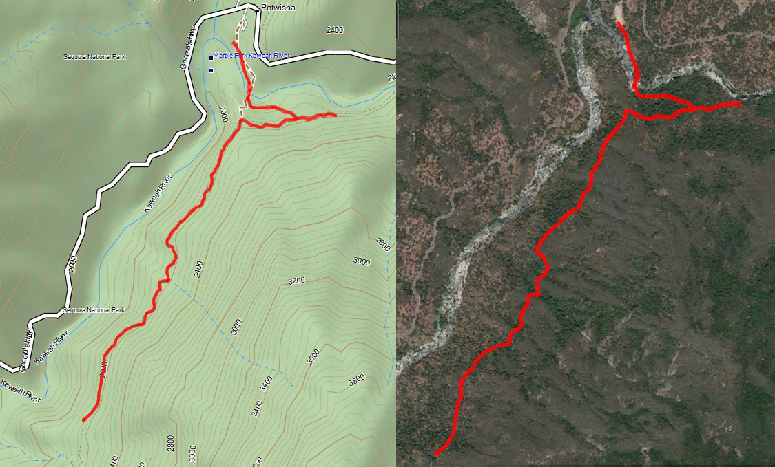
Starting at 0926, Delilah, Buck Rock and I go into service. Delilah has poor visibility and I say 2-4 miles. All of this is from the smoke from the Redwood Fire down on the Middle Fork of the Kaweah. I am also hearing shots coming from the southwest, probably from around Eshom. Even though the campground is closed, people still hunt in that area.

Smoke beyond Grant Grove
The bane of a fire lookout’s existence can be smoke, but the more common issue is radios. When I came in Thursday, the clamshell battery with AA’s was on the Park radio. When it started chirping-meaning low battery-I switched over to the good battery. That worked for a while until the next day. I thought I was charging it up, but by 1500 Friday, the battery was drained. So I switched to a rechargeable battery with a broken latch. That worked. So I let the good battery charge overnight. But the next morning, the good battery was still low. I tried various things, but nothing seemed to remedy the issue. I wrote to Wendy to say we have a bad battery. I left notes for those who will follow me.


Buck Rock in the early morning

And I do have visitors. Today they are from Wisconsin and Cincinnati and then two locals from Fresno. I think I got a bit long winded because one of them kept looking at his watch. But then his wife kept asking questions. She even wanted a picture with me. I do not think I have had so many people wanting the form of my picture as a lookout as in the last three days. I definitely do not have star quality or charisma.

For the rest of the time, I do the regular lookout stuff. The smoke has lifted a little-now I can see 5 miles in places. Still not good. The worst part about the smoke is that when I look out over this sea of white, I am trying to distinguish if a sliver of white is a smoke, granite, a dead tree or something else. I do not think there were any fires out there, still with the gun pop’s in the Eshom area I wonder what I am missing in the haze.

One of the joys of being a fire lookout is the unexpected. Lots of time, I see movement in the distance. When I follow it, I see it is a bird. Most of the time it is a crow, raven or sparrow. Sometimes a hawk. Today, a large bird with a flash of white caught my attention. And then it turns and comes straight towards me. With the binoculars attached to my eyes, I can see its beak and eyes of a golden eagle very clearly, just like in the best photographs. When I pull my eyes away from the binoculars, I see that the bird is still 200-300 yards away. Still a wonderful thing to happen today.

Looking towards Eshom and Redwood Mountain

Wendy has let me know that the person coming in after me may arrive this evening and may relieve me early. While I enjoy being up here, there is a certain amount of gladness thinking that I get to go home early. Also a bit of sadness. Unless something goes different than expectations, it is the last day at Park Ridge this season. I do look for a little bit of dust rising up on the road coming in. I can only see a couple short segments of the road.

I have one more visitor this afternoon. I have my sandwich for dinner. Then I clean up the cab, including giving it a good mopping. Not as dirty as I feared, still dirty enough. I take a load down to the truck and then I am in the midst of doing my last scan before going out of service.

Haze covering Grant Grove by the end of the day
 

Right at 1755, my relief shows up. So much for an early start home. I try to go over the various stuff which has happened during the past three days, but he does not seem to be too interested. The one thing he is interested in is that one of the horse hairs on the firefinder has been broken. In retrospect, it must have happened when I was mopping. I got it fixed-it took awhile, and then cut out.

It is about 1820 by the time I leave. The ride home is uneventful and I reach Fresno by 2000. Tired. I go over my time away with Sherri, then take a shower and go to bed, asleep by 2200.


Flowers and Plants

Elderberry

Wednesday, April 13, 2022

April 13, 2022 - Potwisha Flume


Title: April 13, 2022 - Potwisha Flume
Hike Info : DescriptionExtra Photo's : Animals : Flowers and Plants


Hike Info:

Type: Hiking

Trail head: Potwisha

Trail: Potwisha Flume

Destination: Unknown

Actual Destination:  About 1.25 miles west on the flume

Distance:  3.61 miles 

Start Time:  11:04

End Time:     2:26

Travel Time:  3:22  (1.07 mph)

Moving Time:  2:23  (1.51 mph)

Elevation Rise: 966 '  640

Descent: 954‘  645

Maximum Elevation: 2,198'

GPS Tracks

Bridge across the Kaweah

Description:

Last year Betty and I walked the Potwisha Flume on the south side of the Kaweah. Since that time, the KNP Complex fire swept through the area, ravaging anything which stood in its way. Talking to several people, they indicate that the flume has been damaged, but is still walkable. I am interested in seeing how the area now looks. Fearing the worst that the area will be devoid of trees and hoping that only patches have been damaged.

Betty will meet up at the Potwisha area around 11. We leave right at 9. This is Sherri’s second hike . after her surgery, we will be determining how far we go based upon what she can deal with-not wanting to get too close to the edge like last week. Last week she did well on a trail which proved more than anticipated. Today’s should not be as hard. Sherri and I drive straight to the park. We forgot this was Spring Break, so we were surprised by a couple things: first the line at the SEKI entry station. Second, looking in the mirror, Betty is right behind us. We got to the parking lot a little bit early, about 10:40 and got ready to go. Before we go, we help a father-son who was wondering what trails there are around here.


Spot burn from the KNP Fire


The first part of the trail leads us to the bridge across the Kaweah. This is probably the worst part of the whole trail. Lots of river rock in the couple hundred yards.In the midst of the rock, there are Indian grinding holes. Also some person thought that by writing graffiti on the rocks in the area, he is improving the looks of the trail-hardly. The bridge across is a modified suspension bridge. It swings, sways and bounces as we walk across it. Once we cross it, the trick is to find the way over or around the rock-Hint: around the rock on the east. Betty has to remind me of this.


Gary walking the flume path
As far east as we will go
And now we start our climb up to the flume.A couple of things greet us. First the trail starts very nicely-it will go up in a little while for a short distance. Second, wildflowers show us their colors: Baby Blue-Eyes, Common Madea, and Chinese Houses to name a few. And then we start seeing where spot fires burnt last year. It is a bit strange seeing a 20’ burnt area surrounded by rich green grass and trees which are healthy. When we get to the top of the climb, there is a water flow measuring house and the Potwisha Flume. This flume used to
help generate power for the Three Rivers area.

When we look into the flume, we think that the measurement of water flow will be superfluous for a while. Not only is there no water in the flume, but a layer of mud at least two inches thick lays at the bottom. We follow the flume towards the east. The going is pretty easy for a short way. And then we see where the fire has damaged a walkway. There is a long walkway, or there was. About 20’ of it is no longer there. I guess we could have climbed up, but there is caution tape warning us away.


The flume as a fire break

This is our trigger to turn around and head west. For the most part, this is a pretty nice walk. Mostly level. We can see where the firefighters have used the flume as a fire break. Most of the fire is on the other side of the flume, the south side. But this has its own issues. That is the uphill side. Whenever we come across a ravine, we see that sand and silt have swept over the edge of the flume, filling it. I would hate to be the person with the shovel scoping out all of this debris. 


Damage to the flume


After walking a mile and a half, we stop for lunch. The silt has made a nice seat for me. Sherri decides to sit on the ground while Betty also sits on top of the flume-on the other side of a pillar. After a break of 15 minutes, we continue on.. I do not think we will reach the pool at the end of the trail-we have started too late. But we enjoy ourselves in the sun, but not too hot of one. We are able to see the SEKI’s headquarter at Ash Mountain and then beyond to Three Rivers. Across the way are hillsides fully burnt. So sad. And then we look to the snow capped peaks to the east which brings a bit of joy to our hearts.


Lunch Time

Sherri and Betty walking the flume


Like when we went east, our trail came to a sudden end. Part of the flume has washed out, taking out the trail. I think we could have climbed into the flume and walked further, but we have gone as far to make us satisfied with our walk. So we will save the rest for the next time. 


End of our walk


The return trip is pretty much uneventful. I am trailing behind, not because I am tired-surprisingly, but there seems to be alot to stop, examine and take pictures of. Besides, Sherri and Betty look like they do not need me very much. They are moving on nicely. That is until we get to a ravine when I catch up. I go down first, as it turns out more for moral support. After this, it is a short walk to the flow monitor. And then down the trail. It is a bit steep, but not bad-just looks a bit unnerving at first glance.


Real ashes on Ash Mountain

Flume and Moro Rock

We cross the bridge and then go the short walk back to the cars. Everything looks good there. After resting for a few minutes and getting our boots off, we are ready to go. Betty mentions that she will stop at Reimers in Three Rivers. As we drive on, Sherri decides this would be a good stopping place for ice cream. Then it is off to Fresno. We get in a little before 5pm. After driving about 4 hours, I am beat, but feel pretty good. Glad we did this walk.

I began this blog with the fear of complete devastation. But my hope won out as there are definitely places where the KNP Complex Fire burnt and damaged both the flume and the trail. But it is still very walkable and enjoyable.


Extra Photo's

Sherri traversing a ravine where the flume broke

Trail crosses a plank

The Flume Girls-Betty and Sherri

Wall flowers?? Baby Blue-eyes along the flume

Gary looking out on the Kaweah River

Indian Grinding Holes

Kaweah River

Toys left to play with-NOT! Clean up tools

Gary walking the flume

Betty and the flume

Betty and Sherri beside the flume

Sherri and Betty walking the plank


Animals


Possibly a red fox-thanks Rose


Sierra Lizard
 
Flowers and Plants


Common Madea

Common Madea

Golden Brodiaea, Pretty Face

Baby Blue-Eyes

Baby Blue-Eyes

Baby Blue-Eyes

Baby Blue-Eyes

Miner's Lettuce

Sierra Arnica

California Indian Pink

California Indian Pink

Chinese Houses
California Indian Pink

Fireweed

Fireweed

Fireweed

Western Wallflower