Showing posts with label Hoist. Show all posts

Tuesday, December 30, 2025

December 30, 2025 - Snowshoeing along Road 13S77


Title:  December 30, 2025 - Snowshoeing along Road 13S77
Hike Info : Description 


Hike Info:

Type: Snowshoeing

Trail head: Cherry Gap

Trail: Road 13S77

Destination: About an hour in

Actual Destination: actual, about a quarter mile before the top of Hoist Ridge

Distance:  1.98  miles

Start Time: 12:50

End Time:     2:44

Travel Time: 1:53  (1.05 mph)

Moving Time:  1:32  (1.29 mph)

Elevation Rise:  300' 1

Descent: 261‘

Maximum Elevation: 6,983'

GPS Tracks

 1There is several different readings on the elevation rise. The 651’ from the GPS is certainly wrong as is the Google Earth calculated rise of 503’. The descent of 261’ is much closer to the truth. The elevation rise from a February 24, 2024 snowshoe to the top of the ridge was 541’. Steven’s watch said in the upper 200’s. The net rise from where we began to where we ended was about 160’. So I think the upper 200’s is the correct figure.

 
Rachel and Sherri at start
 
Description:

Today will be the first snowshoe this season. I do not think we went last season-a combination of being busy, the storms coming through when we were available and it not being too good of a snow year. Rachel is coming with us, but will be coming over after her 9am yoga class which ends at 10.

She gets in about 10:15-I am ready, but Steven and Sherri are still getting things together. We are all in the car with me driving by 10:45-that all includes Korra. Earlier there was some ground fog, but that has dispersed. The drive up is uneventful, except for stopping in Yokut/Squaw Valley for some gas.. We pass the 5000’ elevation sign without signs of snow-this does not look too good.

By the time we get to the Grant Grove entrance station, there is snow. We asked if there was chain control-No.Does he know if there is snow at Princess campground -he thinks so, but has not been there lately. When we pass by McGee Overlook, there is a layer of low overcast above the Central Valley, making it look like an ocean.


At 12:15 we get to Princess Campground. The ground looks pretty patchy for snow and whatever snow is on the ground is thin. We quickly decided that around Cherry Gap there was better snow. We retreat back up 180. We will go up Road 13S77-not the Converse Basin Road-that has a lot of exposure to the sun so there is bare ground there. We parked the car a little before 12:30.


Magic Elf on a tree


The first thing we do is get all of our gear together. Years ago my brother gave me some Sorel snow boots. They seemed a bit stiff, so I could not get them on. I am substituting my hiking boots for the snow boots. After having a bit of lunch-peanut butter and Nutella sandwiches, if you must know-we start on our trip. This would be 12:50 start time. Steven is on his cross-country skis, while the rest of the humans have snowshoes on. Korra, of course, is on four leg drive and does not need any assistance on snow. Then again, the snow is deep enough and hard enough that we can easily snowshoe or ski on top of it without fear of hitting ground, probably averaging a foot or maybe a generous two feet.

At 12:51, the first fall of the season takes place. I manage to have my right foot step on the back of the left snowshoe. I had two choices: try to right myself and risk a face plant or try to fall gracefully. I chose the latter. Nothing hurt, except my pride. Wonder if that will be how this day goes.

There are a few spots along this road where you can look across the Kings and enjoy the view. The first viewpoint is OK, but does not make for a good picture since there are a lot of branches obstructing the view. I turn away, walk a few steps and realize something did not feel right. I looked down and saw one snowshoe. Turning around, I see the missing shoe. It quickly gets put on. It will be that kind of day.

The road is a gradual rise. Not many people have been up the road since the last storm. After a hundred feet we see that those who came without being prepared for snow travel have turned back, leaving the only tracks we see being a few snowshoe marks, two cross country ski tracks-Steven’s is one of them, and Korra’s claw and paw marks.

I keep looking at the views. Spanish Mountain is the dominant view, with some views up the Middle Fork of the Kings, then looking west we can see Rodgers Ridge, where the Garnet Fire started. It is good to be going along this road, even if we have gone up it many times before.

But there are some things which are new. When we come to a little creek, I look at a tree and see what looks like a couple elves with a snow cap on them. In reality, it is a couple of fungi with the recent snow still covering them. From there, the road goes on its final climb up Hoist Ridge. Rachel says that I was charging right up the slope. That is until I looked back and waited for Rachel and Sherri.

When they caught up to me, I saw Korra coming down the slope towards us. Then there is speck way up at the top of the bend. That speck came barrelling down-the speck is commonly called Steven. He stops before he completely passes us by.


I had set a 1:45 turn around time and that is what time it is. We start back. Steven on his skis is quickly out of sight. For us on snowshoes, going down is a lot easier. We made good time going back down the road. There are some different views across the Kings than when we came up. It gives us a few natural breathing places.

We got back to the car at 2:45. Rachel gets a man to take our picture. Then it is time to go back home. Rachel drives us down. We do stop at the McGee Overview to look at the overcast clouds down in the Valley. I spotted Delilah and tried to take a picture.


We get home at 4:15 and unload the car. We are having the car serviced tomorrow. We have gotten back in time to take the car in. Then it is time to relax, take a shower and partake of leftovers.



Friday, June 7, 2024

June 7, 2024 - Delilah


Title: June 7, 2024 - Delilah

Coming to Delilah

Hike Info:
Type:Lookout
 
Description:
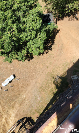
got up about 0515. Looked to see if there was any lightning in the area-none. Then I got my breakfast-nothing special, just granola, my usual. It is finally time to get myself ready to go up to Delilah Lookout. Last night I got most of my stuff packed and in the car. I just needed to load a few electronics and refrigerated foods into my backpacks. By 0640, I am off.

The reason why I am off so early is that there is construction on Highway 180 where there is a half an hour delay reported. But when I pass through, it does not look like CalTrans is ready to inhibit traffic, yet. I get to Delilah pretty early about 0835. Coming in from 180, there was more traffic than what I normally see along the Forest Service roads. Ahead of me was a pickup which stopped at a gate where Millwood heads east and we continue south. Then a couple motorcycles passed me. Finally another pickup also passes me-I see him stop at Sontag.

Wildflowers everywhere
I am staying at Delilah for three days. So there is a lot of stuff I am bringing up-food, clothing and stuff. But I get that all done by about 0910. I then take the weather and go in service by 0928. I thought I heard P33 on R5 a few minutes before, but did not hear who she was asking for. As soon as I go inservice, she comes back on R5 and asks if I want water. Affirm. But then Captain 32 asks the same thing. I think they must have had a discussion because of what happened later.

The rest of the morning was normal stuff. Doing my scans, listening to the radio, and reacquainting myself with lookout life. Also the cab is pretty warm. I am wondering if this is the portent of what I will be feeling throughout today? Reacquainting myself with the lookout is done in bits and pieces. Similar to reviving an old relationship. With the lookout, there is working the radio, making sure that I can navigate around without too much effort. Then there is looking out over the territory, finding the little cracks and crevices, the waterfall coming off of Patterson Bluff, and then there is that tree on Hoist Ridge just waiting for me to see it.


E32 pumping water


About 1230, I hear the sound of a big truck. It is E32 coming with my water. We were down to the last 25 gallons. The Captain for the engine comes up the stairs. I met Dalton a couple of months ago at our annual training. He and another firefighter, John, have the engine filling our tank. They add another 200 gallons. While that is going on, I take John up to the cab and show him around. One bit of excitement was that as the tank filled, the old soapy water turned into suds, floating to the east of the lookout. It was a sight to behold. When everything is filled, down they go to tend to other needs and I return to my duties.

Most of the rest of the afternoon is continuing to find the lookout rhythm. That is until I hear P33 trying to reach Buck Rock. I know that it is not staffed today, so I responded and let her know the status. She is concerned about some hoses at Buck Rock. So I asked the regular staffer about it. Later on in the afternoon, she tells me that there is an issue which E32 is dealing with and to leave the hose there. P33 is appreciative.


By this time, it is 1530 when I hear Sierra tone out a fire. Earlier in the day, Sierra had another fire, but that was north of Mariposa, way out of my visual range. But this one is close to Prather and is called the Garlock Fire. That is because it is on a road called Garlock Lane. Once I figure out where it should be I can see the smoke faintly through the haze. But this is off of our maps, so I am not sure how far out it is, but I give them an azimuth for it. Then I sit back and listen to the activity.


I do not quite do nothing, I continue my looking around for other smoke and monitor the smoke of the Garlock Fire. I hear Sierra telling the fire people to stay late. I went out of service with Porterville at 1800 but stay in service until 1900 with Sierra. During that time, I have my dinner.


 After my shift ends, I have just enough time and energy to go for a short walk around the lookout loop. The sunset is enjoyable. About 2030, Sherri and I talk for a bit until I start to drift off-it has been a long day.


Background
 Garlock Fire. By Sunday, it was contained at 54 acres. Once I computed it, not observed, this fire was about 26 miles away from me. There was no smoke visible from Delilah on Saturday morning.
View from Delilah: left is as I saw it, right is filtering out the haze.
 
 
Extra Photo's


Moonset over Pine Flat Reservoir-the light on the right side is from firefighters on the Garlock Fire

Sunset over Pine Flat Reservoir

Garlock Fire

Animals


Hummingbirds

Hummingbirds

Black Scarab Beetle


Flowers and Plants


Deer Brush

Dandelion

Butterfly Mariposa Lily

Butterfly Mariposa Lily


Friday, February 23, 2024

February 23, 2024 - Cherry Gap Road


Title: February 23, 2024 - Cherry Gap Road
Hike Info : Description : Extra Photo's : Animals 


Hike Info:

Type:  Snowshoeing

Trail head: Cherry Gap

Trail: 13S77

Destination:  About a mile or  maybe a bit more.

Actual Destination:  Close to the top of the hump on Hoist Ridge

Distance:  2.61 miles

Start Time:  10:45

End Time:      1:26

Travel Time:  2:40 (0.98 mph)

Moving Time: 1:41   (1.55 mph)

Elevation Rise:  541'

Descent: 338‘

Maximum Elevation: 7,094'

GPS Tracks


Description:

Start of our walk
It has been awhile since we have been out with Betty. Really looking forward to it. And then a new addition to our group, Laura. She is part of a book group I am involved with. None of us, except for Steven will be going very far today.

Korra
We will be meeting Betty at Big Stump. We do not have enough space in the car for Laura so she will need to drive up there. At 8:45 she comes to our house for a 9:00am departure. Sherri goes with Laura to use her pass to get into the Park. Steven, Korra and I are the last ones to get to Big Stump. Laura and Betty have already been introduced, so we are all ready to start our snowshoe adventure.


Spanish Mountain
We move over to Cherry Gap. Instead of going west towards Converse Basin, we are going east along Forest Service Road 13S77. We used to do this road with cross-country skis. Today for the first time we will do it with snowshoes. That is except for Steven who will be on skis and Korra with her paws. This is also Laura’s second time on snowshoes-we will see if she goes again with us.

Top of Park Ridge
We got to Cherry Gap about 10:20. Then spend some time getting ready. Our shoes hit the snow at 10:45. The first hundred yards is a bit bumpy, but then the snow levels out and we just need to contend with the upward trajectory of the road. Mind you, it is not a steep climb, but enough of one that I felt the drag of going uphill..


The Hill
 We get our first views of Spanish Mountain across the Kings. It is spectacular. But this view goes away as we turn a corner and are masked by pine and fir trees, I am feeling pretty good, with only a bit of shortness of breath. Laura calls my attention that Sherri and Betty are falling further behind. I guess I am doing better than I expected.


Steven, te skier


Steven is far ahead with Korra. The sun keeps hiding behind the clouds, poking out occasionally. It is warm enough that we start shedding some of the outer clothes and gloves. A good day for snowshoeing.

I can tell that we are starting to tire out. I have set in my mind a goal of two hours of moving. Since we are going uphill, I figure we will do about 75 minutes in and 45 back. I am asked how much longer: about 15-20 minutes. And then magically we come to the top of Park Ridge-I was mistaken at the time as I thought at this end it would be Hoist Ridge, but Hoist is to the west of us and Park Ridge curves around a bit.

The ladies are a bit tired, but I am interested in a hill to the north of us, Hill 7124. So I started up it. I see Korra coming down it and I see ski tracks. I thought Steven was going to the south. Then Steven comes down. He says there is a really good view from the east side of the hill. So I go on up and he goes down.


Hume Lake and beyond

He is so right! It makes the trip pretty much worthwhile. While I am gawking, Steven comes back up. And then I see Betty and Sherri coming up. Laura’s hips are starting to ache, so she is staying down in the flat. Steven gets a picture of us. From this vantage point, we can see up the Middle Fork of the Kings, the
Monarch Range and then eastward to the Crest of the Sierra. University Peak, near Forrester Pass is viewable as well. Then looking a bit southeast is Buck Rock and Shell Mountain. Pretty grand.


Buck Rock
And now we start our trip back. Steven, on skis will make better time, so he decides to do a bit more exploring up the road and over the hill. Poor Korra, she is confused. She starts back with us and realizes that Steven is not with us and heads back. But I do not think she can find him and we lose track of her. About halfway down, she comes bounding along, without Steven.


Peaks seen from Hill 7124 from the PeakFinder application


Going back down is easier than going up. Laura and I discuss the advisability and practicality of always hiking going up as you go in and down on the way out. I try to do that, but there are times that it is not a good plan. Surprisingly, I am doing well. After my January COVID it seemed like whenever I exert myself, I would tire pretty easily. Today, I'm doing well.

Korra, waiting for us
As we approach the cars, Steven comes up behind us. Korra seems happy to have him back. We get back to the cars at about 1:30. It is close to the time I was thinking it would be. We suggest stopping at Bear Mountain Pizza for some pizza-surprise. Betty and Laura are agreeable to this. So off we go. We order the pizza at Big Stump and it is ready when we get to the place. Here we split up and proceed to our separate homes. A good and tiring day.


Extra Photo's
 

Hume Lake and Beyond

Korra

Laura, Sherri and Betty

Looking Northwest

Looking Northwest

Looking East


  Animals