Wednesday, February 22, 2023

February 22, 2023 - Allensworth


 Title: February 22, 2023 - Allensworth


Hike Info : Description


Hike Info:
Type: Car


Description:

Today is the first Central Valley Hiking Group Meetup event which we have wanted to go on since the pandemic started which has not been canceled. So we are excited to go and to add to that, we will be going with Cathey and John. Double Good.

I get up at 6:30. Sherri a bit later, but we are able to leave the house by 8am, getting to the meeting place by 8:15. We are able to start shortly afterwards. Most of the group will meet us at Allensworth State Park. Cathey is driving us down there. It does seem strange to not be driving, but I enjoy being in the backseat with John.

First Baptist Church

We arrive at the park about 10 after 10. There are two initial impressions. The first is a sense of wide openness, of the beauty of a green expanse with clouds hanging from a blue sky. The second is looking at the whiteness of the soil. To me I wonder what, if anything will grow in this alkali soil. How desolate is this place during the summer with the heat, when the plants turn from their vibrant green to a brown-golden if you are a poetic type?


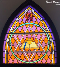
Stain Glass from the Church


Sarah, the ranger, is waiting for the thirteen of us. The first order of business is to see a dramatic video about how Allensworth started. It is informative as well as appealing. After watching the 35 minute presentation, it is time to go on a tour which John and Cathey have arranged for the group.

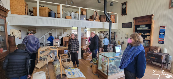
Usually individuals are free to roam the grounds and look inside of the buildings. But because we are on a tour, we are able to go into several buildings. The first one is the First Baptist Church. This is a replica of the building. The old one was structurally sound but torn down in 1967 after not being in use for 10 years. Most of the pews are replicas, but there are two of the original ones. One of the interesting aspects is that part of the stage area covers a baptistry which can be uncovered when needed. There is a rebuilt stain-glass window, which still has some of the original glass. 


Sample Stove

Stockell House
Our next two stops are the Hackett House and Stockell House. Interesting to see the interior of the houses. The first thing which strikes me is how small the bedrooms were compared to today’s rooms. In my house, the bed maybe takes up a quarter to a third of the floor space. These houses the bed was about half. If there were two beds in a room, there was only a narrow passageway between. The houses were filled with period antiques. But the decorations for the most part are not original, but more to give a sense of feel. Outside of these two houses, I saw some coyote tracks in the alkali soil.


Hindsman Store
Milk Separator
Sarah next took us to the Hindsman Company General Store. This store is set by the railroad tracks. There was a second general store just down the street from this one. Both the Hindsman store and the Baptist church had the WOW factor going for them. Hindsman was a two story affair. All were stocked with period pieces. What caught my eye was the milk separator-separating out the cream and the whey. This was because of seeing a snippet of one being used in the video. It looked like the store was stocked with most things which you would need to live in somewhat isolation.


Gas Run Water Pump
The Santa Fe tracks ran right by the store. It used to be the main stop for the area until Santa Fe ran the line over to Alpaugh-a white community. Today, you can still get a ticket to Allensworth on Amtrak, if you can convince 19 other friends to go with you.

Since we are talking about the train tracks, close by is the Allensworth Hotel. The hotel is not for general use now-sometimes workers such as the CCC crews which come through-will sometimes stay there. There were seven rooms for guests. The person who owned the hotel was not a resident, but hired caretakers for it. I was curious if only Blacks stayed there or did others as well. The ranger was not sure, but the thought was since this was the train stop for a good long ways and there was no prohibition concerning race, chances are the races mingled here.


Sarah asked if we were up to one more place. The answer was yes, of course! So she took us to Scott and Grosse Drug Store. In some ways things have not changed, just the type of prescriptions. Sarah pointed out a sign which the druggist would look at. It listed an ailment and the remedy. That is how the druggist knew what to give. A bit more informal than today. Sarah also noted that if there was a medical issue which could not be attended to here at Allensworth, the person would need to go to Delano-about 13 miles away. This would be a strong incentive not to get into trouble.

Seems like we visited a dress shop after this, but I do not have a name to it. We then walked by the library. This was the first public library in Tulare County. Mrs Allenwsworth took it over when a store vacated it. After this, we migrated back to the cars. As we look towards the northwest we can see that the timing is good. Looks like rain will be coming in a littlewhile

Cathey then took us to meet with several others at the Bravo Farms restaurant at the Tulare Outlet stores. I had a pesto chicken sandwich while Sherri had a cranberry turkey sandwich. Pretty good. Cathay got us back to our vehicle by about 4pm and we ended up at home at 4:30-there was some construction on our route.

Glad we went today. It was good reuniting with our friends from the Central Valley Hiking Group.


Tuesday, February 21, 2023

February 21, 2023 - China Creek

 Title: February 21, 2023 - China Creek


Hike Info:

Type: Hiking

Trail head: China Creek Gate

Trail: West side of park

Destination: Walking at least a mile

Distance:  0.88 miles

Start Time: 10:49

End Time:   11:42

Travel Time: 0:53  (1.00 mph)

Moving Time: 0:50   (1.06 mph)

Elevation Rise:  144'

Descent: 166‘

Maximum Elevation: 426'

GPS Tracks


 Description:

Today is a day to be with friends. Sherri and I enjoy China Creek County Park and look forward to sharing it with John and Cathey. It is a bit cold, so it will be a late morning walk there. I mosey around until it is time to leave. We get to John and Cathey a little after 10 and drive 25 minutes to the Park.


Live Oak
Well almost to the Park. I miss the turn off and drive a couple miles out of the way, but it is a pleasant drive. The comments even before our boots on the ground is that it is beautiful. There is a sense of lushness in this Winter scene. Sherri and I have only visited here in the Winter and early Spring, so we are used to it looking like this, It is a little, sedate jewel in the middle of our world.

Usually Sherri and I have done the trails in this Park clockwise. But today, we will do it differently-counter-clockwise. I guess we are living wild and dangerously, :-). We grab a park guide and are off. 


Sherri, Cathey and John
There are signs explaining what we are seeing, like the live oaks, and how they fit into the area. This gives us plenty of opportunity to stop and gaze. It is that kind of a trail, not one to hurry through, but to enjoy the area. But even a laid back trail can offer some excitement. There is a pond just beyond a line of trees and vines. But a calf and a couple cows come charging out of the trail to the pond. Not only do they come out, but they start advancing towards us. This is where Sherri earns her trail name, Cow Shouter. And she does a wonderful job of herding the cows away from us.

We continue on our walk. Towards the western part of the loop, we come to several sycamore trees. We also notice a new huge mansion going up-that was not there before. Wonder how that will affect being out here or how annoyed these people will be with people looking over at their home. But not my problem.


Red Lagoon

Now we travel along the south leg of our loop. This takes us along a tall berm which Vulcan put up to hide their gravel pits. We see an occasional vehicle going back and forth on top of the berm. But below, we look at the rushes which are in a dried up marsh. At least the part where the old rushes are. We shortly get to water. This lagoon is covered by something red. An algae? Plants? I do not know and it is beyond a barbed wire fence on Vulcan property so I so not explore further. This lagoon is just a little apart from Collins Creek. On the map it shows it disconnected, but I suspect there is some place where the Collins seeps into it. It is a fascinating view of water, redness and logs.

Shortly afterwards we come to a place where an old road bisects the park. We decided that this was enough for one day and we took the road back to the car. While the skies held some light clouds, we could see the snow on the Sierra . This is always a good sight for me.

We drove back to Cathey and John’s house. Then chatted there for a while. Then it was time to get back home for us. It is good to walk with friends. 


Trail Lesson: It is good to walk with friends.


Saturday, February 18, 2023

February 18, 2023 - Ten Mile Road - Snowshoeing


Title: February 18, 2023 - Ten Mile Road - Snowshoeing


Hike Info : DescriptionBackgroundExtra Photo's 


Hike Info:

Type: Snowshoeing 

Trail head: Quail Flat

Trail: Ten Mile Road, Road 13S45

Destination:  None-turn around at 2:30


Actual Destination:  End of improved section of 13S45

Distance:  3.28 miles

Start Time:  1:06

End Time:   3:44

Travel Time: 2:37  (1.35 mph)

Moving Time:  1:59  (1.65 mph)

Elevation Rise:  516'

Descent: 499‘

Maximum Elevation: 7,024'

GPS Tracks


Description:

Sherri
Several days ago we discussed going snowshoeing. It was too cold last Wednesday for us valley dwellers and Steven wanted to go up. Saturday looked like a good day. But what had changed in the four days or so since we made this plan? I am not sure that is still the plan. Either way, I walk over to a friend's house to retrieve my wheelbarrow. When I return, we decide it is a “go” to go up to the mountains today. It does not take us long to get ready.
Ten Mile Road

By 11:30, we are on the road. The fiddlenecks and a smattering of poppies are coming out as we approach Yokut (Squaw) Valley. Spring is getting closer. When we reach Big Stump, the parking lot is filled. So we do not even get the opportunity to use the restrooms. Onward to Quail Flat. The road past Quail Flat has not been completely plowed yet. So the parking area instead of being its usual occasional car is packed. Do we go up to Princess I think or go someplace else? Fortunately we do not need to make that decision as we spot a place to park. 


We have lunch and then get our gear on. Usually we go down Burton Road, but today Steven and Sherri head down Ten Mile Road. I am wondering is this a mistake? But the indication is they want to do something different. Steven is on skis and Korra takes off with him. That is the last we see of them for a couple of hours. I convey that I am looking at a 2:30 turnaround time. I do not have a destination objective, but even if I did, a turnaround time is good because we do not always make an objective at a reasonable time.

Gary

We watch Steven and Korra go off down the road, even though Korra keeps returning to check on us slow ones until Steven gets too far ahead. There are a couple large ruts going down Ten Mile Road. They do not look like snowmobile tracks, but I do not know what else it is. It does make snowshoeing more interesting picking our way in and out of these ruts.

We get about a half mile down and see a road going up the ridge. Steven has continued down Ten Mile Road. My thinking is going up this road is preferable, as I like going down coming back rather than slogging up a grade. Sherri and I go up, but first I leave a message in the snow for Steven in case he comes back up before we get back.

The road is Forest Service 13S45. Later on I look at a topo map and see that this is also designated as a Nordic Skiing route. The ruts not only go down Ten Mile Road, but start up 13S45.But then there is another puzzle: the tracks stop just a hundred feet in and from there on is virgin snow. Looks wonderful.

Spanish Mountain

Both from Ten Mile Road and from 13S45 we see across the Kings as well as Buck Rock. But the views for the most part have trees framing the scene or intertwined in it. Still, there is something which is appealing looking out over this section of the Sierra (actually there are very few sections of the Sierra which I feel are not worth looking at.)

We go up about a half mile up 13S45. It has good solid snow, which has been settling for a couple weeks. So walking on it is a pleasure. Even I am able to feel good going up the slope. One drawback: there are no dramatic views. “Only” trees and snow are what can be viewed.

It is getting close to our turnaround time. Sherri is ready to go back, but I would like to go on up a short way to a horseshoe turn. So I leave Sherri and continue on up. I get there in a couple minutes. The road starts to level out and since I have about seven minutes to turnaround, I continue on. I quickly came to the top of the ridge. And lo and behold, there is my view! I can see across the Kings to Spanish Mountain and the Obelisk. Looking more westward, there is the Patterson area. Then closer to me, there is he basin where Hume Lake is. And by Hume is a smoke cloud. Wait Smoke! I remember that the Forest Service was doing some burning in the area. This must be it.

Indian Basin Smoke

After taking a few pictures, I head back down. I got to the place where I left Sherri. I see her tracks heading back. I just follow these tracks down. And about a quarter mile later I caught up with Sherri. Down we go. Sherri and I both think this is a trail we will be doing again.

We get to the junction with Ten Mile Road. I check the ski tracks to see if Steven has been by. I only see his tracks going down. So I erased my message. Sherri goes on ahead while I lag behind to see if Steven will come around the bend. By my calculations he is anywhere between right behind us to 45 minutes.

There is a reason why I wanted to go UP 13S45 rather than further down Ten Mile Road. From the junction we back up to the car. I stop every so often to look behind, but no Steven=it also gives me a chance just to take a small break. After a while I hear a mechanical sound. A minute later, a Toyota ForeRunner comes into view. This is an ah ha moment. Now I understand the mystery of the tracks. They are vehicle tracks, not snowmobiles. They pass by and I go on. Shortly before the parking lot, I caught up with Sherri.

We get to the car around 3:45 and start putting away our equipment. Steven gets in as we put stuff away. And then it is off to go back to Fresno. It is a pretty easy drive back and we get back home at 5:20. Another good day.


Background

Smoke. The smoke was from a pile burn in the Indian Basin area which Sequoia National Forest had set. This was part of an effort to clear fuels from around Sequoia groves throughout all forest lands. Indian Basin close to Princess Campground. We would have been right in the middle of the smoke if we had gone there.


Extra Photo's


Snow and Pine Cones

Patterson and Spanish Mountains

Stack of rocks by Ten Mile Road

Buck Rock and its lookout

Looking to the northeast


Tuesday, February 7, 2023

February 7, 2023 -North Boundary


Title: February 7, 2023 -North Boundary


Hike Info:

Type: Snowshoeing 

Trail head: Highway 180

Trail: North Boundary Trail

Destination:  Go up the trail as far as we feel like

Actual Destination:  Abbott Creek

Distance:  1.47 miles

Start Time: 1:28

End Time:  3:23

Travel Time: 1.54  (0.78 mph)


Moving Time:  1:20  (1.10 mph)

Elevation Rise:  349'

Descent: 339‘

Maximum Elevation: 6,949'

GPS Tracks


Description:

Sherri-first time on new shoes
Today we had scheduled a day up in Yosemite to take a friend who wants to see the Valley in Winter. But it looks like he has a conflict. So Sherri and I have decided to go to the Grant Grove area instead. We leave about 11:30 and get to the parking area by 1:00. On the way I ask the entry station about getting to Big Meadow. He does not know how long it will be closed, but he thinks it will be a couple weeks still-the area north of Ash Mountain is still a mess.

We eat lunch and do not get started with our snowshoe walk until 1:30. Sherri is on her new snowshoes. After observing my shoes, she got the same model, MSR’s Lightning Trail. We will see how she likes them after our time out today.


Unbroken snow-our trail
The first obstacle on our walk comes up quickly. The snowplow has thrown up a lot of snow, making it hard to get going. But we do. There is not much in the way of tracks. But I can follow the trail well enough. There is a telltale indention in the snow. Later on the indention will turn into more of a wide shelf which I am able to follow well enough.


Sherri climbing


Also the trail goes up pretty steeply. I am feeling pretty good about how I am going up this. The snow is pretty much settled, so even with my weight, I do not sink down more than an inch in most spots. I guess when the last storm came through last weekend, this area did not get much snow. Sherri is going up a bit more slowly, but she is going up and that is what counts.

We come to one of the forks in the trail. The lower one goes off and eventually meets up with the road up to Panoramic Point. We choose the higher one and continue our progression up. There are lots of downed trees. Most of them are pretty well buried. But there are a few which offer a bit more of a challenge. But we conquer. They only slow our progress.

But what stops our progress is a small tributary of Abbott Creek. There is not much water, but there is a moderate amount of difficulty climbing the far side of the rivelet. We stop, take some pictures, admire the beauty and decide that we did not want to put forth the effort. Besides, we could only go on for another 40 minutes-I had set a 3:00pm turnaround time.


Abbott Creek

Side trail
Going back down the trail is both faster and easier. When we got back to the junction, we decided to take the other way. The path is a bit harder to follow. But the good thing is that we are on snowshoes. The worst which happens is we follow our tracks back. But evidently I am following the clues right and the path is before us. But after a little ways, so is that tributary of Abbott Creek.This time instead of one side being sheer, both sides are, something like around 4-5’ on each side. Reminder to Gary-pack a small snow shovel. I think we could have gotten over Abbotts by digging steps.

And so we backtrack to the main trail. And now we head back to the car. Not really anything noteworthy, except I notice a few footprints in the snow. Evidently someone had been up a few yards after us. We got back to the car a little before 3:30.

And then back to Fresno. There was a boulder in our lane. When we get cell reception, we call it in to the CHP. We get back home a little before 5. Steven goes out and gets us a Habit burger which gets eaten during the State of the Union address. After all of this, I am a bit tired and ready for my 10pm bedtime.


Extra Photo's

Sherri just about back to car

Sherri on the home stretch

Burnt Tree

Sherri avoiding a tree

Icicles over Abbott Creek

Gary by Abbott Creek

Gary by Abbott Creek

Thats the trail