
Hike Info : Description : Trail Lessons : Extra Photo's : Animals : Flowers and Plants

Hike Info:
Type: Hiking
Trail: Quarry Trail, Canet Trail, Crispi Trail, Chumash Trail, Park Ridge Trail, Live Oak Trail
Destination: End of Quarry Trail
Distance: 4.95 miles 1
Start Time: 11:24
End Time: 2:01
Travel Time: 2:37 (1.89 mph)
Moving Time: 2;17 (2.17 mph)
Elevation Rise: 1,020'
Maximum Elevation: 406'
1The GPS did not track for about a fifth of a mile. So I doubled the segment coming to get a truer reading.
We stayed last night at the Beachwalker Inn in Cayucos. It looked like the owners have made an effort at upgrading itself from a Motel 8 look-a-like to a low cost, comfortable lodging. The breakfast was basic: cereal and bagels. We did a walk to the Cayucos Pier before checking out. Pleasant enough morning.
We wanted to do a hike before heading back to Fresno, so we went to Morro Bay State Park. A few years ago we did a series of trails to the east of the bay. Today we shall revisit many of these trails.we park at the Quarry trail-head. The skies are threatening, but we will at least get a little walk in.
 |
| Cerro Cabrillo |
 |
| Tiki Man |
There is three things I notice right from the get-go:
- this first quarter of a mile has gotten steeper since we last walked it;
- mosquitoes are out and they are certainly buggy;
- because this is a spur of the moment, we do not have a map, so we shall rely on memory.
 |
| Hollister Peak |
 |
| Gary and the Tiki |
With as many trails as there is, most of them sort of crisis-cross the area. But rather than feeling crowded, the waist high brush tends to hide them, except when we look down on them. We meet two bikers on the trail, and five other hikers over the five miles. I also meet a tick, which I brush off. When we hit the Chumash and Crespi Trail Junction, it is decision time: go back to the car or hike for another hour. We hike.

The Crespi trail, named after Father Juan Crespi, leads south from our junction. It contours, or at least follows the edge of the hills above a plain before hitting a ravine. So we get a good view of the Morro Bay Estuary and enjoy some pleasant walking. There is a checker butterfly which dances along with us. Then the trail dips into a ravine where we encounter a small group of moss covered trees. Enjoyable.

 Shortly after the moss trees, would be a great horror show, the trail does a short climb to the top of the ridge then descends to the Chumash Trail. The Chumash Trail is follows a gas line which bisects the State Park. So it pretty much is a straight shot, which makes it short walk. But as come back to the trail junction with the Canet Trail, we rise up steeply. At the junction we turn and go Park Ridge Trail. In reality, it is a road. We quickly realize that this is going to the wrong trail head. But it is not a worry as we can see the Live Oak Trail coming up and off we go on that.
Now why is it called the Live Oak Trail? I do not know as I do not see that many oaks which would make it a noteworthy oak trail. But we are tiring and ready for lunch. So we do not go up the Portola Hill Trail, but head straight back to the Quarry Trail and now back to the car.
Once back at the car, it did not take us long to decide where to eat: Sylvester's in Los Osos, home of the best burger in the world! It did not disappoint as I got a Desperado and Sherri a California. So good and so filling. Then it is time to head back to Fresno. But on the way back, we stopped at Bravo Farms for ice cream in Kettleman City. Such a good way to end a day.

The Crespi trail, named after Father Juan Crespi, leads south from our junction. It contours, or at least follows the edge of the hills above a plain before hitting a ravine. So we get a good view of the Morro Bay Estuary and enjoy some pleasant walking. There is a checker butterfly which dances along with us. Then the trail dips into a ravine where we encounter a small group of moss covered trees. Enjoyable.

 Shortly after the moss trees, would be a great horror show, the trail does a short climb to the top of the ridge then descends to the Chumash Trail. The Chumash Trail is follows a gas line which bisects the State Park. So it pretty much is a straight shot, which makes it short walk. But as come back to the trail junction with the Canet Trail, we rise up steeply. At the junction we turn and go Park Ridge Trail. In reality, it is a road. We quickly realize that this is going to the wrong trail head. But it is not a worry as we can see the Live Oak Trail coming up and off we go on that.
 |
| Portola Hill |
Now why is it called the Live Oak Trail? I do not know as I do not see that many oaks which would make it a noteworthy oak trail. But we are tiring and ready for lunch. So we do not go up the Portola Hill Trail, but head straight back to the Quarry Trail and now back to the car.
Once back at the car, it did not take us long to decide where to eat: Sylvester's in Los Osos, home of the best burger in the world! It did not disappoint as I got a Desperado and Sherri a California. So good and so filling. Then it is time to head back to Fresno. But on the way back, we stopped at Bravo Farms for ice cream in Kettleman City. Such a good way to end a day.
Trail Lesson: Be prepared for mosquito's anywhere, anytime.

Extra Photo's
 |
| Morro Bay and Estuary from Canet Trail |
 |
| Sherri on the Canet Trail |
 |
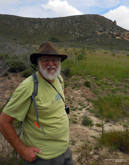
| Gary on Live Oak Trail |
 |
| Quarry Trail carrying Gary |
 |
| Crespi Trail |
 |
| Morro Rock from a distance |
Animals
 |
| Cricket maybe after being digested? |

 |
| Our friendly checker |
Flowers and Plants


