Showing posts with label Darwin. Show all posts

Friday, November 19, 2021

November 19, 2021 Death Valley: Going Back to Fresno with a stop at Darwin Falls


Title: November 19, 2021 Death Valley: Going Back to Fresno with a stop at Darwin Falls
Hike Info : Description : Extra Photo'sFlowers and Plants
Trail head:  Darwin Falls Parking area
Hike Info:
Type: Hiking :  Car
Trail: Darwin Falls
Destination:  Darwin Falls
Distance:  1.87 miles 1
Elevation Rise: 314'
Descent: 314‘
Maximum Elevation: 2,694' 
GPS Tracks
 1I lost the GPS track from this hike. I am using Google Earth data and maps for this blog.


Car Mileage: 362 Miles


Description:

Lunar Eclipse
Today we go back home. But before we even got up for the day, I had gotten up around 12:30 last night to watch the lunar eclipse. Earlier in the evening, the sky was covered in clouds. But by the time I opened my eyes at 12:30, there was clear skies. I should say semi-clear. While the clouds were gone, there seemed to be moisture in the upper air causing a glow to be around the eclipsed moon and the moon to appear a bit fuzzy. I watch this for about 45 minutes until I turn in.

Our Campsite


Cracked Water Pipe
I do not know if it was the middle of the night interlude, a hidden anxiety about leaving or something else, but I did not sleep very well afterwards. At 6:30 I got up. Sherri got up a little while afterwards. Eric from last night comes over and we talk a little more until we said we needed to eat. Sherri made french toast and then we packed and left around 10:30.

We know we need to get gas before leaving the Valley. But we think we can do better at Stovepipe Springs than the $6+ a gallon at Furnace Creek. Sherri drives along to Stovepipe Springs. There we are surprised. All the pumps have an out of order sign on them. We have enough gas to get to Panamint Springs where there is another set of pumps. But what happens if they are out of gas? Fortunately we have a good cell connection at Stovepipe and I was able to find the phone number for Panamint. Katie thankfully answers and said they have gas.

Sherri on path
We have about 100 miles worth of gas left and only 30 miles to Stovepipe. We get to Panamint and yes there is gas. While not filling up, we do put a bit more gas in. I find Katie behind the cash register an thank her. Now that our minds are at ease, we go to the trail-head for our hike-Darwin Falls.


The trail head is two miles down a dirt road about a mile from Panamint Springs. Not really far at all. A couple evidently did not like the look of a dirt road so they were doing a U-turn when we started down it.

When we got to the trail-head, several cars and vans were already parked there. Some were leaving, others were just starting out. We do our usual slowly getting ready. There was one person left when we started going. Sherri and I walked in this dry, unshaded, sandy wash for about a third of a mile. There is a pipe which parallel our route, sometimes it is iron, other times PVC. At this point, a PVC pipe has split and it is sending a thin sheet of water 15’ into the air. The little kid in me gets under the desert fountain and enjoys the cool, refreshing moisture. Sherri is more of a stick in the sand and hangs back, shacking her head.

But there is redemption. The woman who was at the trail-head? She sees me enjoying the fountain of water. When I move out of the flow, she enjoys the coolness. As Sherri and I start going further up the trail, she joins us. All three of us will walk together the rest of the way, well almost all the way. By the way, she is from North Carolina and does not even talk funny.

Darwin Creek
Shortly afterwards, a couple of things happen. We get a lunar simulation, going from the hot sun to the cool shade all within a step. What a difference that makes. Shortly afterwards, the desert wash turns from sand and scrub to trees, flowers and grasses, almost like hiking in the Sierra foothill in spring. Finally, there is a small flow of water down the middle of the canyon. Maybe there really is a water fall at the end of the trail!

Darwin Falls and Gary
But even in the garden of Eden in the middle of the desert, there are obstacles to overcome. In the dry canyon washes, if there is a boulder, you go around it. Here where there is water and lushness of growth, the boulders have thickets of trees and brush. Not only that, but I suspect the water has caused a bit more rock slides from around the canyon sides making more obstacles. I either find routes or try to guide over or around rock.

We come to a huge boulder where the choice is to climb up a steep rock slide or go over the boulder. Our friend will goes over the slide. As I am examining this, a group of females come down the boulder. I decide this is the way to go. But Sherri is having none of this and is will to stay here and wait for our expected return.

The lady and I go over a few more obstacles and then up a rock and see the falls. Not as spectacular as the pictures, but we may be at the wrong angle. Still it is pretty remarkable that this place is even in the desert. After observing for about ten minutes, we return back to Sherri. She is not at the bottom of the rock, but a little ways beyond, watching the female group finish up their lunch.

We continue on down the canyon. Shortly afterwards, the group passes, as expected. And then we have our ¾ of a mile trudge back to the cars. We stop only a couple of times when something catches our eyes. But I think Sherri and I know we need to start moving soon as we have a long drive back to Fresno.

Sherri with our new North Carolina friend

At the parking area, we say goodbye to our North Caroline hiking friend. We follow her down the dirt road until she turns to go to Furnace Creek and we to the west. We still have not had lunch, so we stop at Father Crowley Point. But all we do is eat in the car and make use of the facility. And then we are off.

We drive the long highway to Olancha, catching highway 395 there. We do not go over Walker Pass, but head towards Mojave. All of this is uneventful. Then it is over Tehachapi and down to Bakersfield. We get gas in Bakersfield. By this time it is after 6. So we pick up a hot dog at Costco to tide us over. Two hours more of driving gets us back home in Fresno. We are tired enough that we will unpack in the morning. But we get reunited with Steven, take a shower, rest so we can go to bed. After all, it is after our 9pm camping bedtime.


Extra Photo's

Looking down Darwin wash

Darwin Creek, not Falls

Stones to climb

Water source for Panamint

Gary and the North Carolina friend


Flowers and Plants


Sunday, November 14, 2021

November 14, 2021 -Death Valley


 Title:  November 14, 2021 -Death Valley 


Hike Info:

Type: Car


Description:

Today, we will resume our trek to Death Valley. I get up at 7:30, took my shower, then had my quiet time. Breakfast was the same as yesterday, Cheerios and pancakes. We get ourselves ready and leave the hotel by 10.

I am driving, heading south. A couple of miles south of the hotel, we go off on Highway 136. Later it turns into Highway 190 which will take us to Furnace Creek in Death Valley, about 105 miles away. We pretty much just keep going at the speed limit. I wonder through out the day how the people who originally crossed this area of California thought they could make it through. Where would they find water?

Sherri and I also talked about an email I got from the Central Valley Hiking Group concerning continuing on as an organizer. I need to figure out what I want to do and this talking did help.


Rainbow Canyon


About 11:15 we come to Father Crowley Point and pull in for our first and only stop it turns out. Not many people in the parking lot. We look at the canyon which I think in lower light intensity would live up to its name, Rainbow Canyon. The parking lot is where most people stop, but there is a dirt road which goes farther out-I think that is the true Point. Several vehicle drive down it. We walked it. Not a really a hard or long walk. The vehicles coming out are considerate and do not raise dust. The end of the road gives a different perspective than where the parking lot is. We do our return trip and leave the area.

Rainbow Canyon


Shortly afterwards, we see the road off to Darwin Falls-we will consider doing it when we come out. Panamint Springs is just a mile beyond that. Then the road falls into the Panamint Valley. Easy to gain speed into the flatness of the Valley. That is to prepare you for the 5,000’ climb out of the Valley into Death Valley.

Then another drop, where speed is easily gathered going into Stovepipe Wells. A park maintenance vehicle passes-going above my 60mph. Passing through Stovepipe, we come to highway 190, going south to Furnace Creek. Our trip is about to end today. We go to the Visitor Center, get our park pass, buy stuff from the gift area and continue on our way. It is just another mile to the turn off to Texas Springs Campground. The campground has lots of openings and we find the one from two years ago. But it does not look very good to camp on, but right next door is good. So we grab off site A16 and set up our tent and stuff.

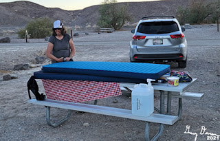
Sherri getting our air mattresses ready
It is over 90 degrees today. The redeeming feature of our site is that we can tuck our camp chairs under a tree into the shade. That is where we hide ourselves from about 2:30 on-wards, until the sun starts to set in the west.

Sherri makes up dinner, a skillet dish of noodles and chicken. It is only 6:00 when we eat and dark. We get cleaned up. I write things up and Sherri plans out what we will do tomorrow. We get to bed a bit early, around 9:00pm.


Sunday, January 4, 1970

Places: CA-Darwin


Darwin Falls-2,789' (Darwin) (36.3207742, -117.5245103)
Legal: T__S, R__E, Sec__

Darwin Canyon-1,969' (Darwin) (36.2993835, -117.5275426)
Legal: T__S, R__E, Sec__

Darwin-4,790' (Darwin) (36.2679969, -117.5917348)
Legal: T__S, R__E, Sec__

Darwin Wash-1,975' (Paramint Springs) (36.3388302, -117.4695091)
Legal: T__S, R__E, Sec__

Darwin Plataeu-5,433' (Lee Wash) (36.4568823, -117.6059030)
Legal: T__S, R__E, Sec__


Description : Trips : References : Pictures 

Description:


According to Wikipedia, the Darwin area was named after  Dr. Darwin French (1822–1902), a local rancher, miner, and explorer.

According to GNIS:

  • Darwin Canyon, also called:
    • Darwins Canyon-Hoover, Mildred B., et al. Historic Spots in California. 3rd edition. Stanford, California: Stanford University Press, 1966.
    • Darwin Canon--Hoover, Mildred B., et al. Historic Spots in California. 3rd edition. Stanford, California: Stanford University Press, 1966.
    • Darwin Wash-Work Cards
  • Darwin Falls, Also called
    • Egan Falls--Hoover, Mildred B., et al. Historic Spots in California. 3rd edition. Stanford, California: Stanford University Press, 1966.
  • Darwin Plateau
    • Bound on the southwest by Darwin Hills, on the southeast by Darwin Wash, trends north 16.8 km (10.5 mi) to Lee Flat.
  •  Coso Springs once had a name of Darwin Springs under consideration


Trips:

  • November 19, 2021 - Sherri and Gary hike to Darwin Falls on their way out of Death Valley
References:
Pictures: