Showing posts with label WY-Gros Ventre. Show all posts

Sunday, September 12, 2021

Sept 12, 2021 - Day Six-Moving Camp to Colter Bay


Title: Sept 12, 2021 - Day Six-Moving Camp to Colter Bay
Hike Info : Description Extra Photo's : Animals


Trail head:Gros Ventre Campground
Hike Info:
Type:Car

Description:

COOOOLD! Sherri says it's 37. I wake up after 6 and see no lightning in my area of the Sierra (we are in the Grand Teton). I am glad there is none both from the standpoint of the forest-two fires have broken out-and I. was wondering how I was going to do it in the cold. 

Andrea-Brithday


I stay in my sleeping bag for another 45 minutes after looking at the lightning activity until my body says to get up. After I take care of my body, I start repacking the car-this seems like almost a daily occurance. But today we are moving from Gros Ventre to Colter Bay this morning. Sherri gets up shortly afterwards. We finished breaking down camp, then headed over to Andrea and Lawrence’s place.

It is Andrea's Birthday today! Happy Birthday Andrea. This is the big reason why Sherri and I came up here (also this is an area we wanted to see.) French toast for breakfast. Then we finished packing their campsite. It is a little after 10 when we leave.


We talked about the route up to
Colter Bay. There is the straightforward route of going back to Highway 26 and following that. Or we can go the more rural route. This consists of going further east up Gros Ventre Rd and swinging around the Mormon Row/Mouton Barn area. That is our way. We talked about going towards Lower Slide Lake. There was a recommendation for it in a book I have been looking at, but there is the issue of getting Samwise, the trailer, up it, so we decided not to.


Turnout at border of the National Forest

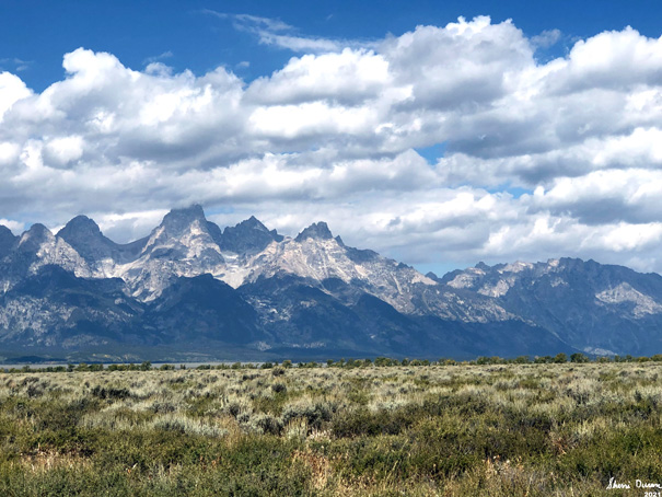
We take off with Samwise in the lead. The mountains to the west. including the Grand Teton is stunning to look at. I signal for Lawrence to pull over at a turnout. Many pictures are taken. Andrea and Sherri notice several cars have turned up the road to Lower Slide Lake. So maybe there is something up there. We clear room in our car and leave Samwise and Lawrence's Subaru at the turn out. 


When we get on the road up to Lower Slide Lake, we understand the attraction. It is a spectacular drive. The Gros Ventre River has cut a channel through the mountains. So we rise up pretty good-the first part of the drive is on pavement, which quickly changes to dirt, but pretty well graded. But the real eye-catcher is the trees with its greens turning to yellow colors. It is worthwhile traveling up the road just for that.


Lower Slide Lake
We stopped at one turn out, which is a place which has the name of Wedding Tree. We take the path over to it, maybe about 200 yards. Here the canyon falls away giving an iconic view of the Tetons. Literally breathtaking. I can see why you would want a wedding done here. Beauty all around. Then onward to Lower Slide Lake. You can almost say, you have seen one deep blue lake and you have seen them all. But like a diamond in a setting, each has its own beauty which one can assess only on its own merits. We spend about 15 minutes here, before moving on. Lawrence has spotted a bear on the western end of the lake. So we are all eyes on it, as well as binoculars.
 

Pronghorn Antelope

We return back to SamWise, all secure and ready to go. Our next stop is the
Moulton Barns, or sometimes on the maps called the Mormon Bar area. But before we get there, Sherri spots a pronghorn antelope. We are able to stop and watch-but Andrea and Lawrence missed it.


Moulton Barn in front of the Tetons

There is a settlement to the south of the road, but we walk over to the ones on the northside. Not only are there the two barns, but also some housing. These buildings look newer than the
Cunningham cabin we saw yesterday. My guess is that these were working farms until a little while ago. Particularly when there is electrical wire on the inside of the building. I do not think I do these barns justice. They are an interesting contrast with the Tetons in back, the flat valley surrounding them and the image of human presence and drive to tame where he is. We look around and wonder.


View of Mount Moran from OxBow Bend

Back at the vehicles, we have a quick lunch. Afterwards we head to Highway 29 and go north. We make a stop: Oxbow Bend. This is the site of a famous
Ansel Adams picture. He took his in the early morning light and now it is early afternoon, so there will not be the shadows which makes his images so startling. Mine will be more flat with less depth. Still it is a beautiful point to see the Snake River pointing at the Tetons.


Gary at rest


We pile into our cars and go to our campsite at Colter Bay. Andrea has reserved the site, so we just go in without a problem. We set up our tent while SamWise is opened up and got ready for our stay. The campsite is pretty flat with grasses behind our tent. Separating us from the camps on each site are some trees. So while not isolated, we do feel a measure of privacy. It also helps that throughout our three night stay our neighbors are quiet.

Andrea and I set out hammocks and take an hour’s rest in them. Apparently Lawrence has much more energy as he walks to the village on a mission of reconnaissance. When he comes back, he reports on the laundry and shower situation.

We have dinner, then get our clothing ready to be washed. We decided that we would hit the showers first thing in the morning. While the clothes are being washed, we scarf up the Wifi. That is one thing our campsite lacks or maybe it is a blessing-cell phone connection. So we take advantage of the airwaves while we wait.

After we get back, I separate and fold our clothes, while others get our camp ready for the night. We go to bed, snuggle down and fall asleep soon afterwards.


Extra Photo's

The Wedding Tree

View from the Wedding Tree

Andrea and Lawrence looking for a new scene at the Wedding Tree

Turnout at the National Forest border-across the fence is private property

Turnout where we left Samwise

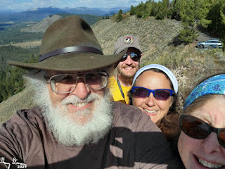
Lawrence, Andrea, Sherri and Gary at the turnout

Morning shot of Mount Moran


Lower Slide Lake

Lower Slide Lake

Moulton Barn with the Tetons in the background

Moulton Barn with the Tetons in the background

View of Mount Moran from Oxbow Bend

View of Mount Moran from Oxbow Bend

 Animals


Pronghorn Antelope


Our camp dear at Colter Bay Campground

Saturday, September 11, 2021

Sept 11, 2021 - Day Five-Car Exploring


Title: Sept 11, 2021 - Day Five-Car ExploringHike Info : Description : Extra Photo's : Animals : Flowers and Plants


Trail head:Gros Ventre Campground
Hike Info:
Type:Car

Description:

I slept in until 7. Well, sort of. I woke up earlier and saw there was no lightning to report, so I went back to sleep for an hour before getting up. Also throughout the night I woke to the patter and sometimes the pounding of rain. But the tent held up well and we were dry inside.

Female Moose
When I got up, I got the car somewhat organized. And then when Sherri arose, we went to Andrea and Lawrence's camp around 8. But they were not there, so we went moose hunting-shot lots of pictures. Andrea and Lawrence found us and we watched moose for a while. A couple of bulls were arranging the pecking order about who the dominant bull was..


Breakfast is homemade cinnamon rolls. that is interspersed with conversation about many things. Then it was time to clean up. We leave camp around 1130. The hope for today is to go to Jenny Lake, take the boat across and do some hiking.


Mount Moran and Leigh Canyon
 On the road to Jenny, we stop at the Post Office to mail Andrea’s ballot. But it was closed. We go through an entrance station, flashing our old age cards-it is good to be old, in some cases.

When we get to Jenny Lake, we find the parking is all taken up, even along the road to it. Looks too crowded for our tastes, so we decided to go on and see if Leigh Lake area is full as well. It is. I guess this is what Grand Teton NP is like on the weekend, even though I do not think of it as a weekend park and it is getting close to start of Fall.


Planing our route
 After checking out the parking lots in the area-noticing one person got a ticket for illegal parking. We take that as a warning not to push the edge. We decided to drive the Jenny Lake loop. When we pull off of the highway, there is a nice pull out. So we use it to gawk at the Tetons.

While looking, we observe a couple of bicyclists who also stop across the road. What catches our attention is how they balanced their bikes on their pedals, amazement we feel. So we go over and engage them in conversation and examine their technique. They are from Omaha and ride all over the Midwest states. They are pretty open about their travels and we have enough terms to show we know a thing or two about cycling.

Trees in a Pothole

The drive around the loop is nice. But we are looking for a place to get out and stretch our legs and hike. We do not find that. We do see a small path, but it leads to nowhere after about 200 yards. So we return back to the car and continue on.

We see the Jenny Lake parking lots are still full, so we continue on. It is past lunch time, so we stop at Mount Moran. This gives us a different view of the Tetons, with Mount Moran front and center. All I can say is, impressive. Andrea has been looking for glaciers and we see several of them, also from a different perspective. 


View from Signal Mountain
Before we move on, Lawrence spots an antelope on a hill to our right. We watched it for a while (Confession, I could never see it very clearly). And then we are off, but not for long. A couple of miles later, we see a sign for The Potholes. Now the road has been pretty good so far, so I do not think it is referring to that. What it is referencing is these giant divots throughout this area. We take a path and it wanders by one of these divots-a tree is growing on the slope of one of them. Then we circle around to go to another one. This one is pretty plain. If nothing else, it has been a good walk.


Gary, Lawrence, Andrea and Sherri on top of Signal
Are you wondering what the next stop will be? We come to Jackson Lake, but do not stop. A mile or so later, we see a sign for Signal Mountain. This looks interesting. We climb on up. The guide books say this is bear territory. But we did not see one on the drive up. But what we did see was a mishap. About half of a mile before the top, is a sharp turn with a parking area for a trail. An RV was parked in the slot at the end, sticking out so it was difficult making the turn coming down. Another RV thought he cleared it, but did not, crunching his own RV, but not the parked one. Poor guy.

Lawrence and Andrea at Cunningham's Cabin


The parking lot at the top is tight, but a spot clears out quickly for us. We get about a 270 degree view. It is a phenomenon we are used to in our fire lookouts-when looking down, the countryside flattens out. It is still impressive. Wish I had brought a map up here with me. I would have enjoyed naming off what I was seeing.


 On the way down, we stopped at a small pond, a short walk from the parking area. We look around, mostly to see if we can spot one of these mysterious bears which are said to frequent the area. But no such luck. The pond is mostly filled in with pond lily type things. A couple stops-you know in Grand Teton, somebody stops and others stop because it must be interesting. Nice talking with someone else. She tells us about some birds whe has seen recently.


View from Cunningham's Ranch

Andrea takes over the driving chores. When we hit the highway from Jackson, we turned south again. I think we are all a bit tired as there is no “let’s stop here” until we get to Cunningham Cabin.

Cunningham played an instrumental role in having Grand Teton turned into a National Park. Originally he was against it, but after talking with Rockefeller, he changed his mind. The cabin is a little off the road, which we gladly walk. The cabin seems a bit small. I wonder why someone would fight to live out here. Definitely not palatial. It would be cold most of the year. On the other hand, there is this feeling that the earth would go on forever, just by standing out here, looking at the horses.

We load into the car and keep on traveling until we get to our Gros Ventre campsite, where we park at Andrea and Lawrence’s place. Nobody feels like cooking, so we are a pizza for pickup in Moose. I drove back there to pick up our order at Dornan’s Pizza. We had a Mount Moran and Thor Peak. Tasted pretty good-were we that hungry or was this reality? What’s the difference? Tonight, Lawrence and Andrea show us the first half of their pictures: from California to Florida. Then it is time to go to sleep, about 9:30.


Extra Photo's


Panorama view from Signal Mountain

Mount Moran from lunch turnout

Mount Moran

Mount Moran


Andrea and Lawrence's campsite at Gros Ventre

Horses at Cunningham's Ranch

Horses at Cunningham's Ranch


Sunset from Gros Ventre Campground

Good Night Moon


Animals

Male Moose


Flowers and Plants