Showing posts with label Merced Pass. Show all posts

Tuesday, November 11, 2025

November 11, 2025 - The Other Wawona Loop


Title: November 11, 2025 - The Other Wawona Loop
Hike Info : Description : Extra Photo's : Flowers and Plants


Hike Info:

Type: Hiking 

Trail head: Wawona Visitor Center Parking Lot

Trail:  Chowchilla Mountain Road, Four Mile Road, Part of the Bills Hill Trail, Wawona Meadow Loop

Destination: Loop

Distance:  6.45 miles

Start Time: 12:17

End Time:     4:47

Travel Time: 4:30  (1.43 mph)

Moving Time: 3:47   (1.71 mph)

Elevation Rise:  1,121'

Descent: 1,102‘

Maximum Elevation: 4,839'

GPS Tracks


Description:

I got up at 5:30. Today we are going to do a hike up at Wawona. Unlike a couple of weeks ago, we will be doing an extended loop around Wawaona Meadows. But first, I have a 9:00am appointment with my dental hygienists. I worked on my book blog-we are having the author of Consummation for my Book Group Thursday and I need to be prepared for it. The hygienist visit went well. I think this was the first time ever that I was told I am doing well with my flossing.

I get home at 10:10. Rachel comes in shortly afterwards. Steven will not be coming with us. We are able to leave by 10:40 with me driving. It is Veteran’s Day. So I cannot understand this long line of cars heading south on Highway 41. I am just glad we are heading north. We arrived at the Wawona Visitor Center parking area a few minutes before noon. Coming in we had noticed what looks like a prescribed burn a little ways away from Wawona. When we get out of the car, there is a slight smell of smoke. After discussing it, we felt it does not seem to be too bad. So off we will go on our hike.

At 12:15 we started walking up the Chowchilla Mountain Road, but only about ¾ of a mile up. Tthis part of the trip is where we gain most of the elevation. It is huff and puff time for my part. We did not go on the first junction, but the second junction to the Four Mile Road. This second one is a bit overgrown from disuse. Maybe it would have been better to have taken the first junction.


One of the things which I like walking the Four Mile Road happens right at the apex of the triangle between the three roads. There is a tree which stands right in the center of the two roads. In the Autumn, this whole section is covered with leaves, forming a carpet of brown for us to walk on. The trail now does a series of undulations as it climbs its way across
Mt Savage-you have to go either cross-country or find a use trail to go to the top.

As we walk along the Four Mile Road-not the Four Mile Trail, it gives us a chance to talk. The subject of meditation is brought up. Particularly when walking or hiking. We discuss the various aspects of being able to meditate. There seems to be an element of calming your physical body or at least getting in a rhythm where you do not have to think about what the body will do. But there is also an element of letting your mind rest. Silence is part of this. When walking alone, you only get the sounds of nature-the birds, the wind, the crunching of your feet against the ground and sometimes the little trickle of water running down a hillside. These work to calm and help you to focus your mind on the subject of your meditation. In a Christian it is God. In the outdoors, I usually think about God, the Creator and the God who loves me.

Eventually we decide we want to stop and have a bite to eat as it is around 1:40. We spot a nice log about 15 feet above us and we scramble to it. It is a nice log just to set and eat at. I do notice there are some fungi growing under the log.


 About ten minutes later, we came to the trail junction down to Wawona Meadow. Something has changed-there is a sign. The first time we walked this, there was a barely noticeable indentation in the mountain misery to guide us where the trail was. Over the years, a bit of flagging was added to a metal pole. Now, the whole world knows where to turn. What fun is that?

This is a little used trail which I think is part of the Bills Hill Trail. I think it is one of the more enjoyable trails in the Wawona area. We see very few people on it-today the number is less than one. It takes you down from the Four Mile Road to Wawona Meadow. There has been trail work down on it as the downed trees which we used to crawl over have been sawed recently. I have never gone up it, but I think it would tax a person who is in shape, which I am not. But coming down, we see all sorts of trees and brush. Towards the bottom we run into the power lines which come into Wawona. And then there is the service road which goes up to the lower poles. The trail repeatedly crosses this road-you can take the shorter route, but the road is steep.


When we come out on the Wawona Meadow Loop, we find the log which we rested on a couple of weeks ago and eat an energy bar. I give Sherri and Rachel a choice: continue on the Bills Hill Trail up to the top of the ridge to the east of the Meadow, or follow the Loop trail around the rest of the meadow. The choice is to do the Loop Trail. That probably is wise.

Walking the Wawona Meadow Loop trail is comparatively faster than going up either of the roads. Still we found plenty of occasions to stop and take pictures while enjoying the company of each other.

Gary
The Meadow has some very historical aspects to it. Such as tucked away in some trees is the site of Galen Clark’s Inn. Or there was once a landing strip in the meadow. Or there were orchards to supply fresh fruit for guests. It is the last item which has a bearing. The Washburns ran a flume from the South Fork of the Merced over to the Meadow. You can still see the flume and where it drained onto the meadow. It has been one of my fascinations to walk the bank of the flume on the over side of Highway 41 around until we are above the hotel. So endeavored to do that. Rachel decides this type of adventuring is not for her and retreats back to the trail. I think Sherri is doing the same thing.  


Walking the Flume is Blocked
I try to walk the flume. It has gotten a lot more overgrown since I last walked it before the Pandemic. I detour around part of it. Then bushwack through other parts until I reach a solid wall of young pines. I know when I have been beaten and descend down a steep slope to the trail. I eventually come across Rachel waiting patiently on a log for me. I asked her, “Where is your mother?” “She is following you.” Oh Oh. So we took off looking for her. We were yelling her name and then we heard a response, and then had visual of Sherri. I need to back up a bit. Sherri is coming down the area which I did. When I came through, I noticed a telephone line just about 4½’ off the ground. Since I was lumbering along, I ducked under it. Sherri on the other hand makes a bee line straight for Rachel, not stopping for the line in her path and gets clotheslined, just like in the cartoons. If I was more sensitive, my first response would have been to run over and see if she is OK. But from the way Rachel and I are laughing, you would think this was the funniest thing to have ever happened on earth. After we stoped laughing, we checked on Sherri’s well-being-nothing damaged except for her ego.


Even with this mishap, we are only a short walk back to our car. We get back as the skies are darkening, as this time of year that would be 4:45. Rachel takes up the driving responsibilities. We decided that we wanted to eat before reaching Fresno. I suggested Mexican, to which there were no objections. We decided we wanted to eat at our new restaurant-at least new to us-
Los 2 Carnales.

We get home at 7, just in time for watching Jeopardy. Rachel watches it with us. At the end, she goes home and I go to the shower.


Extra Photo's


Wawona Meadow

Four Mile Road

Tree roots by the road side

Four Mile Road covered with pine needles

Autumn Colors

Rachel and Gary on the Four Mile Road


Red Leaf

Sherri and Rachel walking the Bills Hill Trail

Rachel and Sherri  walking the Bills Hill Trail

Rachel consulting Mr Garmin

Light and Tree

Christmas tree

Walking the Flume-what was bushwacked through


Flowers and Plants

Phlox


PuffBall

PuffBall

Shelf Fungus

Mushroom


Sunday, October 7, 2018

October 7, 2018 - Delilah Lookout


Title: October 7, 2018 - Delilah Lookout
Hike Info : Description : Extra Photo's


Trail head:  Delilah Lookout
Hike Info:
Type: Lookout


Description:
Morning moisture on the Kings
While we were hiking the John Muir Trail, a lot of witticisms came to my mind. But today, the thoughts which perfectly describe it are from Sherri:
The beauty you see,
words do not describe its fullness,
pictures only show shadow.


Woke up this morning about 0630. The sun not peeping over the crest yet, but there being a bit of light around. Looks so clear and beautiful. Looks like a clear day today. But we will need to see how the day progresses. In a back and forth text with Kathy, she notes that This flawless day is your reward for your patience during the not so great ones. Where she is wrong is that almost all days in a lookout are great-well maybe those where we are engulfed in smoke are not :-).
Coastal Range in the distance
We get cleaned up and ready to vacate the lookout this afternoon. So down goes our stuff like sleeping bags and pads, extra clothing and the used water bottles. Then time for our oatmeal breakfast. I have to say that maybe the accommodations are spartan, but the ambience is literally mountain top. Today, before we go in-service, we are seeing all the way over to the coastal range and up to Merced Peak in Yosemite. What a view. Too bad, as Sherri’s statement above says, that the pictures do not tell this story-I need more of a touch in my pictures. As you see in this blog posting, too few pictures.

Firefinder with lighting strike markings
We go in-service at 0928. We are told that Buck Rock had a rough time yesterday. When the lookout left, it was so cold, icy and hail had fallen that he had to walk backwards down the 237 steps there. And then this morning the road was snowy. I guess we feel fortunate with the .2” of water which fell on us last night. For a while, we are the only lookout in-service on the south side of the Kings, in our area. So I spend some time plotting lighting strikes on our firefinder. One looks like it may have gotten a direct hit, or at least pretty close, on Buck Ruck. I talked to Buck Rock a couple of times about the lighting strikes yesterday.
When Buck Rock goes in-service, the first thing he does is reports a smoke about a mile south of his place. Several resources head towards the source of a smoke. This is now called the Rock Fire-not because of Buck Rock, but because it is close to a rock called Wedding(?) Rock. It is confirmed that it is one of the strikes I put down. By the time 1530 rolls around, this fire gets put into Patrol Status-meaning that once every day or two, somebody would be by to check to make sure the fire is not growing or does not have the potential for growth.


Wonder Valley
Usually Delilah does not get any visitors. Today we have three groups which come up for a total of eight people. This is really unusual in our experience. Like some community starved people, we latch on to them. The first group is staying at Sequoia Highlands camp. Some of their party are paragliding off of Sontag Point. We had just seen them a few minutes before so Sherri points out the gliders to them. Then we go around and show a few peaks of Yosemite: Merced and Gale Peaks. After a couple of hours, three Southeast Asians come up. They are out hunting, but they felt as long as they are out this way, they might as well climb the stairs to the top. They count 86 of them. We show the sights to them as well. Finally about an hour before closing, a doctor from Fresno comes up. It turns out we have friends in common. We are able to point to some of the places he has been backpacking at. For Buck Rock, this would be a light day. For us, this is a lot.


Split Mountain and Cardinal Peak
After doing our lookout check-in with Sierra, we start the business of packing up. It is more than just packing up after our three days in the tower; this is probably the last time in a fire lookout this season. This next hour is bitter-sweet. The bitter because we will not be up here until May at the earliest. The sweet is that we are going out on a glorious day and because Delilah is helping us recover from the Summer and all which has happened in it.


So we clean up: clean the windows, scrub the floor, make sure everything is put away. Then at 1700, we go out of service. By 1720, we are on the road out of Delilah and ready to eat. We get to Fresno and have Italian food at Dicicco’s before going home. A good day and weekend. Also good to get a shower as well.
Delilah


Extra Photo's
Bear Mountain and the Coastal Range in the background

Shuteye Peak and Lookout-almost to Oakhurst

Yosemite Peaks

Fresno and Clovis

Pine Flat Reservior

Saturday, June 27, 2009

June 18, 2009 – Givens Lake to Illilouette Creek, (8.6 miles GPS)

Got up 6:15. Good quiet time with Psalm 8 and Invisible, Immortal, Only Wise God. Its beautiful morning with on side of the ridge you look down into Buck Camp and then on the east wide its gazing onto the back of the Sierras. The other side you see Given Lake (N37.58210 W119.46686)—not the best lake, but an attractive lake.

I thought David was up. But also Steven had gotten up and climbed up onto the ridge, over-looking the lake to the north. Looks like he probably got 300 to 400’ above the lake. When he came back, he was covered with sweat. But content looking.

We eat, get packed and leave around 8:40.

The trail out of Givens Lake (N37.58210 W119.46686) is an unofficial trail. Some times we are on the trail, other times we go along a sort of a trail to discover it is not. We come across a real nice meadow where I took several pictures.

We hit the main trail (N37.58069 W119.45590), and start our trip back to the car. Next couple of miles we go up over a ridge, then descend a forested area until we reach a trail junction. On the top of the ridge, David went to a knoll (N37.58486 W119.44671). He caught up with us just before the junctionHe was able to see a 360 degree view from the knoll.

We had lunch at the junction(N37.59442 W119.44059). and started a 600’ climb up to Merced Pass (N37.61633 W119.44293). About a half of a mile later, we saw the ranger from Wawona Station, Patrick Roe. We exchanged reports of snow and trail conditions. Then it is off up the trail. Snow covered a lot of the trail, but not enough to make it hard to pick up the trail after each snow patch. Steven and David went to the top. Sherri and I made it to the top around 1:30. Passed a very nice meadow. We had a Cliff bar, then left the top—lots of fly’s up there. Unfortunately/fortunately there are lots trees, so the views are limited. The top is sort of rounded.

There is lots of snow on the way down. I think Sherri is starting to get the hang of this snow walking. Of course, she is not sliding down the slopes like some of us. The snow does make traveling slower. We do find one place where there is a rock outcropping where we can get a real nice view down Illilouette Creek drainage.

Around the 8,800’ mark we escape the snow. Then comes the first of our creek crossings for the afternoon. The creek (N37.62619 W119.44386)comes out of Upper Merced Pass Lake and was going down the hill pretty good. Sherri waded across in her croc’s. The rest of us went across on logs.

Then the first crossing of Illilouette Creek (N37.63163 W119.44988) takes place. I got Sherri on a pretty big log. She crossed between David and myself—safely I might add, but a bit tense. We sort of looked like a polka line dancer going across. After recovering from this traumatic crossing, we continue out way down the trail.

We had meant to stay at Lower Merced Pass Lake (N37.62608 W119.44914) tonight. But we zoomed past it without stopping, seeing, or at least on my part, knowing that it was there. (In retrospect, looking at the map, we were about 200’ away, but it was hidden behind a ridge.) This is just as well as every step which we make further along the trail today means a shorter trek tomorrow. That trail will be putting in a few miles—at least for us.

We get to the second crossing of Illilouette Creek (N37.63584 W119.45811). There is not a suitable log in sight and Sherri probably would not be happy with us anyway if there was. The creek was running strong and there was no good places to rock hop across. So off comes all of our shoes and on comes the sandals and crocs. Water is cold and fast. Fortunately it is not deep. I slip a couple of times across, but not bad enough to fall. Sherri makes it across last.

After drying off, we head on the trail, but looking for a campsite. David found one (N37.63724 W119.45852) just a hundred yards down the trail. Looks pretty good. I had gone to examine an area up the trail, but no real luck, except to find some magnificent falls. We settle down and set up camp. Dinner and rest. There are lots of mosquito’s and fly’s. These are pests which so far we have had only at a minimum. Probably a blessing from the cold. No fire tonight, but we did go out for a couple of walks.

We walked out to the creek. Then sort of headed up, which is easier said than done. Lots of fallen logs and marshy stuff. So we maneuver around. The objective is the falls I had seen earlier. As we get closer, they are magnificent. Not high—maybe 30’ high, but just the number, width and whiteness. There are at least three creeks coming down at this place. Each one having a great deal of white water coming down. Just really a wonderful sight. Hopefully pictures come out—even though I suspect that they will not do justice. We can only see the falls partially because of the trees. Steven and David go up higher above the falls. David reports the scene up there is just as wondrous. I go up a little ways with him and then we return back to camp.

Then David asks if I want to see a little discovery he and Steven made. David then took me down the creek a little ways. The creek enters a 70 yard chute where the water rushed through this V. I do not know if it is the evening sun and shadows or just the effect of seeing this after the falls above, but this area is just wonderful. One could get lost here.

Shortly after, even before it gets dark, we go to bed. Its early and warmer. For awhile there we laid on top of the sleeping bags. A bit of a difference from the cool to cold evenings earlier in the week.

Tuesday, January 13, 1970

Place: CA-Merced

From Wikipedia
Merced River-56' (Gustine) (37.3491040, -120.9754833)
Merced Lake-7,208' (Merced Peak) (37.7382750, -119.4132319)
Merced Pass
Merced Peak
Merced Gorge-2,359' (El Capitan) (37.6763179, -119.7468370)
South Fork of the Merced-1,398, (Kinsley) (37.6538196, -119.8887868)
North Fork of the Merced-932' (Bear Valley)

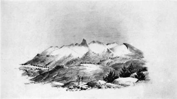
From Up and Down California by William Brewer   THE OBELISK GROUP (MERCED PEAKS) FROM PORCUPINE FLAT
From a sketch by J. D. Whitney
Description:
MERCED RIVER, GROVE, LAKE, PEAK (11,722), PASS[Yosemite, Mount Lyell]
“The river was named by the Spaniards, in honor of the Virgin, El Rio de Nuestra Señora de la Merced (the river of our Lady of Mercy). This name was given to the stream by an exploring party under Sergeant Gabriel Moraga in 1806, as an expression of their joy and gratitude at the sight of its sparkling waters, after an exhausting journey of forty miles through a waterless country.” (Sanchez: Spanish and Indian Place Names of California, 1922, pp. 282-283.) Fremont called this river the Aux-um-ne'. (Fremont: Geographical Memoir upon Upper California, 1848, p. 17.—Fremont: Memoirs, 1887, p. 444.)

Merced Grove of big trees was discovered by surveyors for the Coulterville Road in 1871 or 1872 and named by the president of the Turnpike Company, John T. McLean. (Letter from J. T. McLean, 1899.) “In the last two days travelling we have found some trees of the Red-wood species, incredibly large —some of which would measure from 16 to 18 fathom round the trunk at the height of a man’s head from the ground.” (Narrative of the Adventures of Zenas Leonard, Written by Himself, Clearfield, Pa., 1839, reprinted and edited by W. F. Wagner, Cleveland, 1904, p. 180.) Leonard was with Joseph R. Walker’s party crossing the Sierra in 1833. His mention of the big trees is the earliest known and probably applies either to the Merced Grove or to the Tuolumne Grove. (Farquhar: Exploration of the Sierra Nevada, in California Historical Society Quarterly, March, 1925, IV:1, p. 7.)

Merced Lake was called by John Muir “Shadow Lake.” (Scribner’s Monthly, January 1879, p. 416.) “1 first discovered this charming lake in the autumn of 1872, while on my way to the glaciers at the head of the river.” (Muir: The Mountains of California,; 1894, p. 115.)

Merced Peak is also called “Black Mountain” in Whitney’s Yosemite Guide Book, 1870, p. 109. “The last name had, however, been previously given to the highest point of the mass of ridges and peaks at the southern extremity of the range, south of the divide between the San Joaquin and the Merced. All these points, except Gray Peak, have been climbed by the Geological Survey.”

“The range to which it [Mount Clark] belongs is sometimes called the Obelisk Group; but, oftener, the Merced Group, because the branches of that river head around it.” (Whitney: The Yosemite Book, 1868, p. 97.)

“Merced Peak (culminating point of Merced Group).” (Wheeler Survey: Geographical Report, 1889, p. 134.)

Merced Pass was found by Corporal Ottoway while scouting for Lieutenant Denson in 1895 and named by Benson. (H. C. Benson.)

MERCED RIVER, LAKE, PEAK, GORGE, GROVE—The Merced River is the main river in Yosemite National Park, heading on the high peaks of the Sierra Crest and flowing through Yosemite Valley into the San Joaquin River. Merced Lake is located about 13 miles upstream from Yosemite Valley from Happy Isles. Merced Peak is near the southern end of the Clark Range, close to the southern boundary of the Park. The Merced Gorge is the canyon of the river west of Yosemite Valley, while the Merced Grove of Giant Sequoias is the large grove in the southern part of the park.
The name Merced (mercy) is the shortened form of the Spanish name for the river, “El Rio de las Mercedes”, or is sometimes given as “Nuestra Senora de la Merced.” It was named by Gabriel Moraga in 1806.
The Indians called the main branch, “Ahwahnee”. Up to Vernal Fall it was called “Can-o-pah” or “Yan-o-pah”, meaning water cloud. and above Vernal to Nevada Fall, “Yo-wy-we-ack”, the twisting rock branch. The north branch of the Merced, or Tenaya Creek, was called “Py-we-ack” which means “glistening rocks” because of the glacial polish. The south branch, or Illilouette Creek was called “Too-loolo-we-ack” which may have meant “the beautiful.”  Yosemite Valley Place Names (1955) by Richard J. Hartesveldt

According to GNIS:
  • Merced Gorge
    • In Yosemite National Park, extends southwest from Elephant Rock, at mile marker 118 on Merced River to mile marker 114, 2.9 km (1.8 mi) east of El Portal. (US-T121)
    • Also called Merced Canyon-Browning, Peter. Yosemite Place Names. Lafayette, California: Great West Books, 1988. p92
  • Merced Lake-In Yosemite National Park, on the Merced River at mile marker 140, 1.9 km (1.2 mi) east of Echo Valley and 2.6 km (1.6 mi) north-northeast of Quartzite Peak. (US-T121)
  •  South Fork of the Merced River
    • In Yosemite National Park, heads on the south slope of Merced Peak, flows southwest, west, and northwest to it junction with Merced River, 4.8 km (3 mi) southwest of Trumbull Peak. (US-T121)
    • Also called the South Fork of the Merced-Miscellaneous Sources - A brief description and the year of publication (if known) follow: 1871/CA Geological Survey Annual Report
    •  Also called Illilouette-Miscellaneous Sources - A brief description and the year of publication (if known) follow: 1871/CA Geological Survey Annual Report
  • Merced River
    • Named by Spanish explorers under Sergeant Gabriel Moraga on September 29, 1806, five days after the feast of Our Lady of Mercey. (US-T121)
    • In Yosemite National Park, heads at the junction of Lyell Fork Merced River and Merced Peak Fork, flows west through Lake McClure to the San Joaquin River 45 km (28 mi) west-northwest of Merced. (US-T121)
    • Also Called:
      • Aux-um-ne
      • Aux-um-nes
      • Auxumne River: Sanchez, Nellie Van De Grift. Spanish and Indian Place Names of California. San Francisco, California: A.M. Robertson, 1922. p283
      •  El Rio De Nuestra Senora De La Merced
      • El Rio De Nuestra Senora de la Merced:  Browning, Peter. Yosemite Place Names. Lafayette, California: Great West Books, 1988. p91
      • Noto River: Smith, Jedediah S. The Southwest Expedition of Jedediah S. Smith; His Personal Account of the Journey to California, 1826- 1827. Glendale, California: Arthur H. Clark Company, 1977. p144
      • Rio De La Merced
      • Rio De Nuestra Senora De La Merced: Smith, Jedediah S. The Southwest Expedition of Jedediah S. Smith; His Personal Account of the Journey to California, 1826- 1827. Glendale, California: Arthur H. Clark Company, 1977. p144
      • Rio de la Auxumnes: Browning, Peter. Yosemite Place Names. Lafayette, California: Great West Books, 1988. p91
      • Rio de la Merced: Browning, Peter. Yosemite Place Names. Lafayette, California: Great West Books, 1988. p91
      • Rio de las Mercedes: The American Guide Series, Compiled and Written by the Federal Writers' Project of the Work Projects Administration. A state by state guide series published by various publishers, in the late 1930's and 1940's. Each book studies and describes each state's history, natural endowments, and special interests. Use code US-T125/Name/YYYY/p#. California/p443
      • River of Our Lady of Mercy: The American Guide Series, Compiled and Written by the Federal Writers' Project of the Work Projects Administration. A state by state guide series published by various publishers, in the late 1930's and 1940's. Each book studies and describes each state's history, natural endowments, and special interests. Use code US-T125/Name/YYYY/p#. California/p443
      • Wa-kal-la: Gudde, Erwin G. California Place Names: A Geographical Dictionary. Berkeley, California: University of California Press, 1949. p211      

Trips:
  • May 14, 2014 - Backpack trip to Little Yosemite Valley
  • May 15, 2014 - Return trip back to car from Little Yosemite Valley
  • May 28, 2014 - West Yosemite Valley Loop hike
    March 11, 2015 - Hite Cove day hike with Meetup group
    April 11, 2015 - Meetup day hike around the East end of the Valley April 15, 2015-Meetup hike from Briceburg to the BLM boundary
    October 31, 2015 - Walk around West end of Yosemite Valley with meetup group
    November 11, 2015 - Meetup day hike around the East end of the Valley
    March 16, 2106 - Hike up to Hite Cove
    March 24, 2016 - Meetup hike, wildflowers galore
     April 23, 2016 - Meetup hike around the east end of the valley
    April 30, 2016 - Meetup hike around the west end of Yosemite Valley
    • March 23, 2019 - Meetup hike from Briceburg going west towards Railroad Flat in the rain.
    • November 10, 2019 - Day hike on the Valley Loop Trail with Steven, Andrea, Sherri and Gary
    • March 24, 2021 - Walked Incline Road with Betty, Rose, Sherri and Gary 
    • April 16, 2021 - Walked from Railroad Flat to the North Fork of the Merced-Andrea, Lawrence, Sherri, Korra, and Gary 
    • May 5, 2021 - Walking the middle portion of Yosemite Valley on the Valley Loop Trail with Rose, Sherri and Gary
    •  November 2, 2021 - Day hike around the central part of Yosemite Valley
    • January 6, 2021 - Afternoon trip to the Valley in the snow. Walked around Leidig Meadow. Spectacular in the snow
    •  April 28, 2022 - Stroll along the east end of Yosemite, a lot of it along the Merced.
    • May 10, 2023 -  Same stroll as on April 28, 2022. We walk this with Jessi, Sherri and Gary
    • May 23, 2023 - Exploring Yosemite Valley, tourist style, with Connie, Steve, Sherri and Gary
    • November 6, 2024 - Walking around the east end of the Valley from Camp Curry to Mirror Lake and over to the Ahwahnee 
    • November 13, 2024 - Sherri and Gary walked the west side of the Valley from Bridalveil up to the base of El Capitan, down to the Pohono Bridge and back.


References:
Pictures:

South Fork Drainage near Merced Peak
South Fork

South Fork
Around Briceburg

Around Briceburg

Around Briceburg


May 10, 2023 - From Happy Isles bridge

May 10, 2023 -From a trail along the Merced


May 10, 2023 -From Valley View