Sunday, February 16, 2014

February 16, 2014 - Butler Gulch


Title: February 16, 2014 - Butler Gulch
Trail head: Henderson Mine
Hike Info:
Type:  Cross-Country Skiing/Snow Shoeing
Trail:   Butler Gulch
Destination:  Butler Gulch
Distance:  4.03 miles*
Start Time: 11:43am
End Time:  2:45pm
 Travel Time: 3:01  (1.34 mph)
Moving Time: 1:59 (2.03 mph)
Elevation Rise: 706'
Maximum Elevation: 10,998'

Steven, Andrea and David
Description:
We were a bit slow in getting up and going. David made waffles for us. Like usual, pretty good. While the others were getting ready, Andrea Steven and I went to get Steven added to the car rental agreement. But we went throughout Lakewood trying to find an open Enterprise place. First two places were closed on Sundays. The third one the GPS suggested was no longer there. So we took off and met the other at Starbucks in Dumont.


From there, we headed off to Henderson Mine, up Highway 40. Weather not bad-sun shining, but a bit windy. There are clouds gathering. But we take off about noon. David, Andrea and Steven on ski's; Sherri, Rachel, and I are on snowshoes. We parked at the lower lot and walk up to the upper lot, about a quarter mile or so. The skiers ski it up. There is now a light snow which falls somewhat periodically-I suspect it may be snow blown off of trees and ridges.

Red Mountain
The snow is packed and we do pretty good. The first bit is along the Jones Pass Road, until it headed up, westward. We take the left road, going southward. This quickly leads us across Clear Creek, where the road stops and the trail starts. We are able to see some of Colorado eye candy to the east of us-Red Mountain shows itself to us. Also you can see that California is not the only state impacted with less water this year.  At this point, we enter this path through the forest. It climbs up amongst the the pines and firs, with the snow still laying in the trees. 


I walk with Rachel and Sherri, at a slower pace than the skiers. We enjoy the air, the snow, the exercise. That is until Rachel's hips start to bother her. She continues on. She has her lunch of almond butter and jam. Feels better, but hip still bothers. So Sherri and her turn around, this is close to two mile along the trail, most of the way along a Meadow, beside the trail.
Sherri and Rachel

I continue on up the trail until I find David, Andrea, and Steven. They have been doing runs down a slope at the end of Butler Gulch. We have our sandwiches and then start back. The skiers enjoy the downhill and I have a good pace going on my snowshoes  We get down it pretty good.

The end of the day is pizza at BeauJo's in Idaho Springs. Then back to Denver. We top off the day by watching the The Life of Pi.

David, Steven, Andrea, and Gary


Saturday, February 15, 2014

February 15, 2014 - Echo Lake


Title: February 15, 2014 - Echo Lake
Trail head: Echo Lake Parking Lot
Hike Info:
Type:  Snow Shoeing, Cross-Country Skiing
Trail: Echo Lake loop, CO
Distance:  2.03
Start Time: 3:30
End Time:  5:44
Travel Time: 3:14 (0.63 mph)
Moving Time: 1:09 (1.76 mph)
Elevation Rise: 388
Maximum Elevation:  10,727'

Description:
The California group: Gary, Sherri, Andrea, Steven, and Rachel, flew into Denver in the morning and got to my brother David's a little after noon. After a bite of lunch we all took off, except for Rachel, to REI to rent skis for Steven. Then David drove us up to Idaho Springs where we took off on the road to Mt Evans. Going up about eleven miles we came to the Echo Lake turnout.

Unlike California, there was snow on the ground. The loop around the lake was pretty well packed, making for easy snowshoeing and skiing. Andrea, Steven, and David ski'd while Sherri and I tagged along and snowshoe'd. The temperature is in the mid-30's, but when we are not in the trees, there is a wind blowing, chilling us.  But as we move, we warm up.

We wandered around the shore for a ways. Nice easy time. David takes us back always towards the Chicago Creek area-not far that way. The skiers in the group take a few runs while Sherri and I trudge up to where they are then go down. In the packed snow, we do pretty good, but when we go off into the powder, I sink to my knees, even in a big set of snowshoes. But still a lot of fun.

We continue on around the lake to the closed for the season Echo Lake Lodge. We stand around for a few minutes, in the wind, and then decide we have had a good time today so it probably is better to go back. So we make good time going back around the lake to the car.

When we get back, I do about 10 minutes on Steven's skies. Fun. I got the first butt-plant of the group. Get back to Denver and David fixes us fish taco's. We watch the Olympics-I nod off during the commercials. Good first day. But no pictures. All of us forgot our cameras. But in a way, that is good. It is fun just being in the snow for its own, rather than always looking around for a shot.


Wednesday, February 5, 2014

February 5, 2014 - Million Dollar Mile

Title: February 5, 2014 - Million Dollar Mile
Trail head: Italian Bar Road, Audberry

Hike Info:
Trail:       Million Dollar Mile
Destination:  Stevenson Creek Falls
Distance:  7.26 miles
Start Time:  9:54am
End Time:  1:09pm
Travel Time: 3:15 (2.23 mph)
Moving Time: 2:39 (2.74 mph)
Elevation Rise: 1,046'
Maximum Elevation: 2,355'
  
Description:

Unlike some of the other mid-week meetup group hikes, this one actually allowed us to sleep to a somewhat a normal time. We gathered at Kohls at 8:00am for a trip to a local trailhead just outside of Prather. Even with it being local, it took us to just before 10am to get there. But the road was fun. Bill rode with us and we picked up Betty in Prather, so we had a merry carful.
Power Lines


The Million Dollar Mile is something which we walked on last year with the meetup group it was a new experience for us, not so much from the adventure of walking it, but that it actually existed so close to us without us knowing it. This is a discovery which opened our eyes to other wonders close to our home-beauty does not always need to be far away, but can exist in you own backyard.


San Joaquin River
The morning was cool-in the mid-40's. But I quickly shed one of the layers of shirts I was wearing. There were 30-35 people on this hike, a larger number than usual. Usually the locality will limit the hikers allowed. Also, this was a dog friendly walk, so we got to see several hounds enjoying themselves--they were very well behaved. 

A little ways in, a Southern Cal Edison truck passed us. Were were able to talk with the driver and found out a few things, such as when Stevenson Creek Falls is fully flowing, do not go over the bridge-SCE had some trucks damaged by the force of the water.


Stevenson Creek Falls
The walk is along pavement, there is no traffic, except for an occasional SCE truck. There are some nice uphill climbs, but not strenuous, just a bit long at times. If the sun is out from behind the stop slope to our southeast, the walking is enjoyable while basking in its warmth. But when the sun hides itself, it is time to bundle up some. 

I walk with Bill, John, Jerry and a few others on the way in. Enjoyed the walk. Nat pointed out where the Aspen fire was last summer. That hillside is scorched. But beyond that is more concern-the mountains should be white with snow. But you can see that the snow is barely covering the highest peaks. What a dry year.


Meetup Lunch

We get to the Stevenson Creek Falls around 11:30am where we find some boulders in the sun. We enjoy our lunch and the conversations around us. That is until the shadows bring back the coolness. At that point, John rounds us up and we head off back to the car, the same way we came.


Adit Tunnel
On the way out,  I walked with Nat. We discussed some of the history of the Big Creek project-we can see some of the history around us. We had lunch by a large adit tunnel-a tunnel which allowed access to the main water pipes going through the mountain. We see tailings at another place and soon find a second adit, as well as the large pipe bringing water to the Powerhouse #3 station. An enjoyable conversation.

We get back to the cars a little after 1. Several of us decide to go to Velasco's Mexican restaurant in Prather. Good food and good company. Made it back to Fresno just before 4pm. A pretty good day, if I say so myself.


References:

Sunday, February 2, 2014

February 2, 2014 - San Luis National Wildlife Refuge

Tufted Duck
Title: February 2, 2014 - San Luis National Wildlife Refuge
Another meetup group hike, or walks and drive as you may call it. Karol saw Sherri's Facebook post a couple of weeks ago on our brief visit to the San Luis National Wildlife Refuge (SLNWR) just above Los Banos. So she scheduled a meetup hike there. There are several units to SLNWR. We will visit to two of them: San Luis Unit and the West Bear Creek Unit. But others include Kesterson, Freitas and Merced areas. SLNWR was a joint development between the National Wildlife Refuge system and several duck hunting clubs. Its mission is to bring back the marshlands which permeated the Valley. Consequently, duck hunting is allowed, in season and today is the last day of duck hunting. SNLWR is not really hiking friendly. There are several auto tour loops in the refuge. But the hiking trails are usually pretty short-about 1-2 miles and very level.

We left Fresno around 7:40 in the morning and got to SLNWR around 9:30. We had stopped at Starbucks on the way.  We paid a visit to the Visitor Center, where we were properly impressed with the exhibits. Then we went for our first walk.

Trail head:  Visitor Center
Hike Info:
Trail:  Upland/Riparian Loop Trail
Distance:  0.91
Travel Time: 0:29 (1.88 mph)
Moving Time: 0:23 (2.37 mph)
Elevation Rise:  43'
Maximum Elevation:  65'

Great Blue Heron
Description:
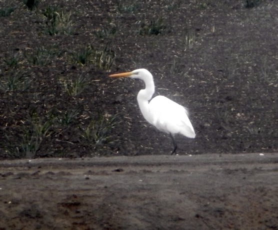
This first hike, which in reality is more like a nice walk. The sky is cloudy, threatening rain. A nice breeze is blowing, providing a winter coolness to our faces and hands. Right from the get go, we see a blue heron standing across a pond of water. Of course there are ducks paddling along. The trail is very level, stretching in a loop around several ponds. We just enjoy walk and the people. The path is wide, so we get to talk as we walk. A few egrets are on the back side.


Male Tule Elk
Marsh Land
Golden Eagle


When we get back around the loop, we decide to take one of the car tours on this particular part of the complex. The first loop we did is the Wetlands and Waterfowl Route, about 8.5 miles. This was so much better than I thought it would be. First, we see some magnificent male tule elk looking so majestic. After about a mile, we were treated to a golden eagle in the distant.  Swinging east we see all sorts of waterfowl, which is good because it starts to rain. Geese in the distance, snowy egrets along the side of the road, and great blue herons hiding in the rushes, maybe even a few ibis'. Our car was slow, but we enjoyed seeing so many things along the way.
Snowy Egret


We ate lunch--pot luck feast style close to the visitor center, under the cover of an information kiosk-love those things.

Then it was back into the cars for the Tule Elk Tour. The route goes the same mile as before, but then swings westward. There is a 10' high barricade, we think to keep the elk in surrounding this tour. Of course, it may be to keep predator's out, such as coyotes, mountain lions and people away. In our car, much of the tour is spent interpreting signs in ways which the creator of them never intended. Lot less birds here and the elk are on the far side of the fields.

After the tour, we traveled up to the West Bear Creek Unit to go on two more hikes.


Trail head:  West Bear Creek
Hike Info:
Trail:  Woody Pond Loop
Destination:
Actual Destination:
Distance:  2.02 miles
Travel Time:  0:43. (2.82 mph)
Moving Time: 0:40  (3.03 mph)
Elevation Rise:   64'
Maximum Elevation:  125'


Description:
 West Bear Creek is several miles up Highway 165 from the San Luis Unit, at least by car. About the time we despaired of finding it, the sign popped up, in fine print West Bear Creek. There is a long drive in to the trail-head, which is at the northeast corner of the auto loop. Thankfully, there is a cinder-block restroom by the trail-head. There are two loops which start here. The first we go on is the Woody Pond Loop, the longer one. The trail is level. While there is not much relief except for the distant coastal range with the clouds and sunshine playing hide-and-seek, there are the birds. Seems like there is more water fowl in this unit than in the San Luis one. but it may be the time of year. We enjoy the conversations around us. Sherri talks a lot with Dennis and some others. I talk with Lee and Caroline, a new meetup group member. Turns out Caroline and Karol understand the nuances of scat. We came across some coyote scat and there was a discussion of the scat. I brought out my scat handkerchief which my brother got me.
 

Trail head:   West Bear Creek
Hike Info:
Trail:  Racoon Loop Trail
Distance: 1.28 miles
Travel Time: 0:29 (2.65 mph)
Moving Time: 0:26 (2.96 mph)
Elevation Rise:  66'
Maximum Elevation:  75'
Description:
Raccoon Loop is the shorter of the two trails. We have lost some of the people who needed to get back to Fresno. But we still have a good group. Enjoyable walk, even got to say farewell to a red-tailed hawk on the way out of the loop.

After our walk, we head back to Los Banos and regroup at Starbucks. Everybody is in awe of what we saw. I suspect this will appear on a few more non-summer time hikes. We make it back to Fresno around 6. One of the people invites the group over for soup. Tasted good and was nice and warming.

For more on the  Woody Pond and Racoon hikes, see Tracy Salcedo-Chourre's book, Best Easy Day Hikes-Fresno. They are hike 17 in the book.

Wednesday, January 29, 2014

January 29, 2014 - Nightmare Gulch

Title: January 29, 2014 - Nightmare Gulch
Trail head: Abbott Dr.
Hike Info:
Trail: Nightmare Gulch Trail
Destination:  head of canyon
Distance:  6.76 miles
Travel Time: 4:35 (1.47 mph)
Moving Time: 3:37 (1.87 mph)
Elevation Rise:  1,0000'
Maximum Elevation:  2,834'


Description:
We left Kohl's in Fresno around 6am. Rachel is taking her RV, so we hopped a ride we her, rather than drive the three hours to Cantil, close to Mojave. It is only the second time which we have not driven on our meetup hikes, so riding in Rachel's RV is really going in style for us.


Scenic Cliffs
Another View of Scenic Cliffs
Red Rock Canyon State Park is close to Cantil which 20 miles north of Mojave. We get to Red Rocks Canyon State Park a touch before 10am. After a brief bathroom stop break, off we go to the Abbott Rd parking area. Since October, this area has been closed to motor vehicles. So we pretty much have the area to ourselves.

We start down a moderately taken care of dirt road. After a brief, very brief climb, we drop down into the wash where we will spend the rest of the day. When we reach the bottom, we make a left turn and head north. We pass by our first set of scenic cliffs, which coincidentally is the name of the cliffs. These cliffs are the opening shot of a Huell Howser California Gold episode.  There is a reason why. These red colored cliffs rises 350' above the gulch floor. They are rutted with the years of water cutting curtain-like texture through this soft stone. In a few days, raptors will be mating in the area.

Our Dry Creek


Secret City
Now the edges of Nightmare Gulch start narrowing in. After another 3/4 of a mile, red dropping rock loams to the west of us. We have entered the "secret city". And it does resemble a city of high rises with windows and curtains looking down on us. Some place behind us is a rock called Ronald Reagan's rock. In one of his Western scenes, he was shot from here.

As we continue on up Nightmare Gulch, the dried creek wanders and winds around, where ever the stone would let it. In places the cliff still appear as high, but they are lowering, particularly on the east side of the gulch. But the group still looks up and examines our surroundings. In other words, we do a lot of gawking. There is much speculation on the type of stone we are seeing. There is some volcanic rock and formations which resemble cement castings-my guess this is gypsum.

Lunch Break

We come to an area where the creek head east and we head up. Lunch is held while enjoy the surrounding area. Most of us head off to another outcropping a couple of hundred of yards away. I take the way least traveled, that is going to the top of a ridge and head on down to where everybody else are.  The top gives a good view of the surrounding area.

Maze of Creeks


After our break, Jerry K leads us up another ravine. While there is nothing extraordinary about the ravine, we enjoy a short walk up it. We stop at 1:30pm and start our return trip back to the parking lot. It is the reverse of our hike up. Still good seeing these interesting cliffs from the reverse perspective. The afternoon soon now start to make its prescience known. The direct sun turns several faces red with heat and perspiration. Still it may be only in the upper 70's-what would this hike feel like in June? Of course, the early folks who crossed the desert experienced this-some died.


Hiking in the Creek

We got back to the parking area around. 2:45pm. John and Cathey had arranged a picnic lunch at the Visitor Center-which was closed in the winter and summer. Nice affair. Somehow it was cooler here, with a slight breezing coming through. Then off to Bakersfield. Here we visited Dewar's for ice cream. Tasted soooo good. We finally got back to Kohl's. Around 8 after a good and pleasant day of hiking.

Wednesday, January 22, 2014

January 22, 2014 - Pt. Lobos Trails

Title: January 22, 2014 - Pt. Lobos Trails
Trail head: Whaler's Cove Parking Lot

Hike Info:
Trail: North Shore Trail, Cypress Grove Trail, Sean Lion Cove Trail and Whaler's Knoll Trail
Destination: Seal Lion Cove
Distance:  3.09 miles
Travel Time:  2:49. (1.10 mph)
Moving Time: 1:44. (1.78 mph)
Elevation Rise:  585'
Maximum Elevation:  261'


Blue-Bird Island; Red-First hike
Trail head: Bird Island Parking Lot
Hike Info:
Trail:  Bird Island Trail
Destination: Observation area
Distance:  .74 miles
Travel Time:  0:33 (1.35 mph)
Moving Time: 0:21  (2.12 mph)
Elevation Rise:  102'
Maximum Elevation:  125'

Description:
Two hikes, really walks or strolls which we took with our meetup group. The first started at Whaler's Cove, going along the North Shore Trail. This trail climbs above Whaler's Cove and heads west towards the end of Point Lobos. Along the way, we get to see Bluefish Cove and the East Grove. Close to the west parking lot, we go on the Cypress Grove Loop, through the Allan Memorial Grove, where we properly oooh'd and aaah'd. This is followed by going to Sea Lion Cove-the point itself was closed for restoration.  Our return trip takes us back to the North Shore Trail. But instead of following the shoreline, we climb up the Whaler's Knoll Trail. From there we descend back to the Whaler's Cove Parking Lot.

What makes this place worth a three hour trip from Fresno, not to mention the trip back? There is something magical in the air when sea meets land. The crashing of the surf, the sounds of birds, and the wallowing of seals all draw our attention. Just starting off the hike, we shed our cooler clothes to bask in the sunshine. Then we spot some porpoises with there little blows of water-we do try to see if they are whales, but the size leads us to believe they are smaller mammals. The moss in the cypress trees gives a feeling of the old South. When we come to the cypress trees of the Allan Memorial Grove, we see our first clear view of the ocean. Here we first hear the harbor  seals. Shortly afterwards, they become visible on an rock island bellowing away with the ocean surf not quite reaching them.  Finally, we spot the spouts. The air mistized with water from the exhale of migrating gray whales. These magnificently huge beasts were heading south, about a quarter mile offshore. Fascinating watching them.


We then went down to Toney Pines picnic area and had lunch. After that, it was time to head down to the Bird Island Trail parking lot at the southern end of the park. The Bird Island Trail is a short one, maybe about 3/8's of a mile one way. It is ADA compliant and has a pretty easy grade. It takes you right along the ocean cliffs, past China Beach, which was closed. Then loops you to an observation area, facing Bird Island. We saw lots of Cormorant's-not sure what brand of them.  Then back to the car and just about ready to call it a day. We make one stop to enjoy a beach view and then head on home. In San Juan Bautista, we stopped at a favorite restaurant of John and Cathey's: Jardines de San Juan Bautista.


Saturday, January 18, 2014

February 2, 2014 - Birthday Party Invitation

CS Lewis says that in friendship, that one feels humbled before all the rest and that sometimes he wonders what he is doing there among his betters, lucky beyond desert. We, Sherri and Gary, feel so blessed to have a circle of friends who have been so good to and for us.

So what better way to show our appreciation than to invite family and  friends to celebrate our 60 years of life on this earth? (we turned 60 in October. I guess we are slowing down) On Saturday, February 8th we will be holding our celebration between 4 and 9 at our home. It will be more of a drop in, enjoy some eats and company. Stay as long as you would like and leave when you would like.  No RSVP is necessary, but if you do let us know that you are coming, it can help with our planning. To us, the important thing is we get to enjoy your company.