Sunday, February 2, 2014

February 2, 2014 - San Luis National Wildlife Refuge

Tufted Duck
Title: February 2, 2014 - San Luis National Wildlife Refuge
Another meetup group hike, or walks and drive as you may call it. Karol saw Sherri's Facebook post a couple of weeks ago on our brief visit to the San Luis National Wildlife Refuge (SLNWR) just above Los Banos. So she scheduled a meetup hike there. There are several units to SLNWR. We will visit to two of them: San Luis Unit and the West Bear Creek Unit. But others include Kesterson, Freitas and Merced areas. SLNWR was a joint development between the National Wildlife Refuge system and several duck hunting clubs. Its mission is to bring back the marshlands which permeated the Valley. Consequently, duck hunting is allowed, in season and today is the last day of duck hunting. SNLWR is not really hiking friendly. There are several auto tour loops in the refuge. But the hiking trails are usually pretty short-about 1-2 miles and very level.

We left Fresno around 7:40 in the morning and got to SLNWR around 9:30. We had stopped at Starbucks on the way.  We paid a visit to the Visitor Center, where we were properly impressed with the exhibits. Then we went for our first walk.

Trail head:  Visitor Center
Hike Info:
Trail:  Upland/Riparian Loop Trail
Distance:  0.91
Travel Time: 0:29 (1.88 mph)
Moving Time: 0:23 (2.37 mph)
Elevation Rise:  43'
Maximum Elevation:  65'

Great Blue Heron
Description:
This first hike, which in reality is more like a nice walk. The sky is cloudy, threatening rain. A nice breeze is blowing, providing a winter coolness to our faces and hands. Right from the get go, we see a blue heron standing across a pond of water. Of course there are ducks paddling along. The trail is very level, stretching in a loop around several ponds. We just enjoy walk and the people. The path is wide, so we get to talk as we walk. A few egrets are on the back side.


Male Tule Elk
Marsh Land
Golden Eagle


When we get back around the loop, we decide to take one of the car tours on this particular part of the complex. The first loop we did is the Wetlands and Waterfowl Route, about 8.5 miles. This was so much better than I thought it would be. First, we see some magnificent male tule elk looking so majestic. After about a mile, we were treated to a golden eagle in the distant.  Swinging east we see all sorts of waterfowl, which is good because it starts to rain. Geese in the distance, snowy egrets along the side of the road, and great blue herons hiding in the rushes, maybe even a few ibis'. Our car was slow, but we enjoyed seeing so many things along the way.
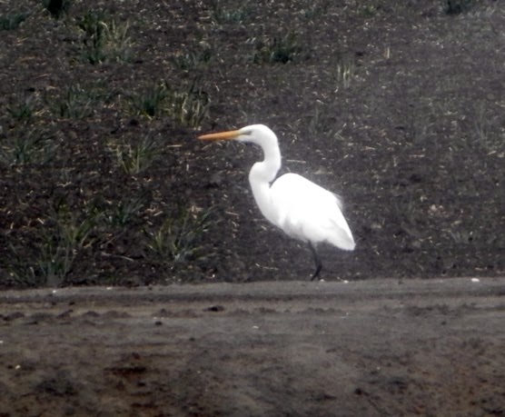
Snowy Egret


We ate lunch--pot luck feast style close to the visitor center, under the cover of an information kiosk-love those things.

Then it was back into the cars for the Tule Elk Tour. The route goes the same mile as before, but then swings westward. There is a 10' high barricade, we think to keep the elk in surrounding this tour. Of course, it may be to keep predator's out, such as coyotes, mountain lions and people away. In our car, much of the tour is spent interpreting signs in ways which the creator of them never intended. Lot less birds here and the elk are on the far side of the fields.

After the tour, we traveled up to the West Bear Creek Unit to go on two more hikes.


Trail head:  West Bear Creek
Hike Info:
Trail:  Woody Pond Loop
Destination:
Actual Destination:
Distance:  2.02 miles
Travel Time:  0:43. (2.82 mph)
Moving Time: 0:40  (3.03 mph)
Elevation Rise:   64'
Maximum Elevation:  125'


Description:
 West Bear Creek is several miles up Highway 165 from the San Luis Unit, at least by car. About the time we despaired of finding it, the sign popped up, in fine print West Bear Creek. There is a long drive in to the trail-head, which is at the northeast corner of the auto loop. Thankfully, there is a cinder-block restroom by the trail-head. There are two loops which start here. The first we go on is the Woody Pond Loop, the longer one. The trail is level. While there is not much relief except for the distant coastal range with the clouds and sunshine playing hide-and-seek, there are the birds. Seems like there is more water fowl in this unit than in the San Luis one. but it may be the time of year. We enjoy the conversations around us. Sherri talks a lot with Dennis and some others. I talk with Lee and Caroline, a new meetup group member. Turns out Caroline and Karol understand the nuances of scat. We came across some coyote scat and there was a discussion of the scat. I brought out my scat handkerchief which my brother got me.
 

Trail head:   West Bear Creek
Hike Info:
Trail:  Racoon Loop Trail
Distance: 1.28 miles
Travel Time: 0:29 (2.65 mph)
Moving Time: 0:26 (2.96 mph)
Elevation Rise:  66'
Maximum Elevation:  75'
Description:
Raccoon Loop is the shorter of the two trails. We have lost some of the people who needed to get back to Fresno. But we still have a good group. Enjoyable walk, even got to say farewell to a red-tailed hawk on the way out of the loop.

After our walk, we head back to Los Banos and regroup at Starbucks. Everybody is in awe of what we saw. I suspect this will appear on a few more non-summer time hikes. We make it back to Fresno around 6. One of the people invites the group over for soup. Tasted good and was nice and warming.

For more on the  Woody Pond and Racoon hikes, see Tracy Salcedo-Chourre's book, Best Easy Day Hikes-Fresno. They are hike 17 in the book.

Wednesday, January 29, 2014

January 29, 2014 - Nightmare Gulch

Title: January 29, 2014 - Nightmare Gulch
Trail head: Abbott Dr.
Hike Info:
Trail: Nightmare Gulch Trail
Destination:  head of canyon
Distance:  6.76 miles
Travel Time: 4:35 (1.47 mph)
Moving Time: 3:37 (1.87 mph)
Elevation Rise:  1,0000'
Maximum Elevation:  2,834'


Description:
We left Kohl's in Fresno around 6am. Rachel is taking her RV, so we hopped a ride we her, rather than drive the three hours to Cantil, close to Mojave. It is only the second time which we have not driven on our meetup hikes, so riding in Rachel's RV is really going in style for us.


Scenic Cliffs
Another View of Scenic Cliffs
Red Rock Canyon State Park is close to Cantil which 20 miles north of Mojave. We get to Red Rocks Canyon State Park a touch before 10am. After a brief bathroom stop break, off we go to the Abbott Rd parking area. Since October, this area has been closed to motor vehicles. So we pretty much have the area to ourselves.

We start down a moderately taken care of dirt road. After a brief, very brief climb, we drop down into the wash where we will spend the rest of the day. When we reach the bottom, we make a left turn and head north. We pass by our first set of scenic cliffs, which coincidentally is the name of the cliffs. These cliffs are the opening shot of a Huell Howser California Gold episode.  There is a reason why. These red colored cliffs rises 350' above the gulch floor. They are rutted with the years of water cutting curtain-like texture through this soft stone. In a few days, raptors will be mating in the area.

Our Dry Creek


Secret City
Now the edges of Nightmare Gulch start narrowing in. After another 3/4 of a mile, red dropping rock loams to the west of us. We have entered the "secret city". And it does resemble a city of high rises with windows and curtains looking down on us. Some place behind us is a rock called Ronald Reagan's rock. In one of his Western scenes, he was shot from here.

As we continue on up Nightmare Gulch, the dried creek wanders and winds around, where ever the stone would let it. In places the cliff still appear as high, but they are lowering, particularly on the east side of the gulch. But the group still looks up and examines our surroundings. In other words, we do a lot of gawking. There is much speculation on the type of stone we are seeing. There is some volcanic rock and formations which resemble cement castings-my guess this is gypsum.

Lunch Break

We come to an area where the creek head east and we head up. Lunch is held while enjoy the surrounding area. Most of us head off to another outcropping a couple of hundred of yards away. I take the way least traveled, that is going to the top of a ridge and head on down to where everybody else are.  The top gives a good view of the surrounding area.

Maze of Creeks


After our break, Jerry K leads us up another ravine. While there is nothing extraordinary about the ravine, we enjoy a short walk up it. We stop at 1:30pm and start our return trip back to the parking lot. It is the reverse of our hike up. Still good seeing these interesting cliffs from the reverse perspective. The afternoon soon now start to make its prescience known. The direct sun turns several faces red with heat and perspiration. Still it may be only in the upper 70's-what would this hike feel like in June? Of course, the early folks who crossed the desert experienced this-some died.


Hiking in the Creek

We got back to the parking area around. 2:45pm. John and Cathey had arranged a picnic lunch at the Visitor Center-which was closed in the winter and summer. Nice affair. Somehow it was cooler here, with a slight breezing coming through. Then off to Bakersfield. Here we visited Dewar's for ice cream. Tasted soooo good. We finally got back to Kohl's. Around 8 after a good and pleasant day of hiking.

Wednesday, January 22, 2014

January 22, 2014 - Pt. Lobos Trails

Title: January 22, 2014 - Pt. Lobos Trails
Trail head: Whaler's Cove Parking Lot

Hike Info:
Trail: North Shore Trail, Cypress Grove Trail, Sean Lion Cove Trail and Whaler's Knoll Trail
Destination: Seal Lion Cove
Distance:  3.09 miles
Travel Time:  2:49. (1.10 mph)
Moving Time: 1:44. (1.78 mph)
Elevation Rise:  585'
Maximum Elevation:  261'


Blue-Bird Island; Red-First hike
Trail head: Bird Island Parking Lot
Hike Info:
Trail:  Bird Island Trail
Destination: Observation area
Distance:  .74 miles
Travel Time:  0:33 (1.35 mph)
Moving Time: 0:21  (2.12 mph)
Elevation Rise:  102'
Maximum Elevation:  125'

Description:
Two hikes, really walks or strolls which we took with our meetup group. The first started at Whaler's Cove, going along the North Shore Trail. This trail climbs above Whaler's Cove and heads west towards the end of Point Lobos. Along the way, we get to see Bluefish Cove and the East Grove. Close to the west parking lot, we go on the Cypress Grove Loop, through the Allan Memorial Grove, where we properly oooh'd and aaah'd. This is followed by going to Sea Lion Cove-the point itself was closed for restoration.  Our return trip takes us back to the North Shore Trail. But instead of following the shoreline, we climb up the Whaler's Knoll Trail. From there we descend back to the Whaler's Cove Parking Lot.

What makes this place worth a three hour trip from Fresno, not to mention the trip back? There is something magical in the air when sea meets land. The crashing of the surf, the sounds of birds, and the wallowing of seals all draw our attention. Just starting off the hike, we shed our cooler clothes to bask in the sunshine. Then we spot some porpoises with there little blows of water-we do try to see if they are whales, but the size leads us to believe they are smaller mammals. The moss in the cypress trees gives a feeling of the old South. When we come to the cypress trees of the Allan Memorial Grove, we see our first clear view of the ocean. Here we first hear the harbor  seals. Shortly afterwards, they become visible on an rock island bellowing away with the ocean surf not quite reaching them.  Finally, we spot the spouts. The air mistized with water from the exhale of migrating gray whales. These magnificently huge beasts were heading south, about a quarter mile offshore. Fascinating watching them.


We then went down to Toney Pines picnic area and had lunch. After that, it was time to head down to the Bird Island Trail parking lot at the southern end of the park. The Bird Island Trail is a short one, maybe about 3/8's of a mile one way. It is ADA compliant and has a pretty easy grade. It takes you right along the ocean cliffs, past China Beach, which was closed. Then loops you to an observation area, facing Bird Island. We saw lots of Cormorant's-not sure what brand of them.  Then back to the car and just about ready to call it a day. We make one stop to enjoy a beach view and then head on home. In San Juan Bautista, we stopped at a favorite restaurant of John and Cathey's: Jardines de San Juan Bautista.


Saturday, January 18, 2014

February 2, 2014 - Birthday Party Invitation

CS Lewis says that in friendship, that one feels humbled before all the rest and that sometimes he wonders what he is doing there among his betters, lucky beyond desert. We, Sherri and Gary, feel so blessed to have a circle of friends who have been so good to and for us.

So what better way to show our appreciation than to invite family and  friends to celebrate our 60 years of life on this earth? (we turned 60 in October. I guess we are slowing down) On Saturday, February 8th we will be holding our celebration between 4 and 9 at our home. It will be more of a drop in, enjoy some eats and company. Stay as long as you would like and leave when you would like.  No RSVP is necessary, but if you do let us know that you are coming, it can help with our planning. To us, the important thing is we get to enjoy your company. 


Saturday, December 21, 2013

Christmas 2013

December 2013


At the end of each year both of us say “What A Year! Can this coming year get better than the last one?” 2013 is no exception. We have done so many things and been blessed in so many way, it has been making our heads spin. We have been able to explore a bit more of the Sierra's and been able to spend time with Gary's parents.

Like we said last year, we have been a blessing to be able to spend time with Gary's parents. This year instead of going out of the country, we spent time with our relatives. Such as going to San Diego to visit Gary's Aunt Dorothy and cousins. Or up to Grants Pass, Oregon-we even dropped in on Gary's best man, Dennis. Dad saw his sister before she passed away. Sometimes there are blessings received even in the midst of grief.

Our travels with Mom and Dad included Denver to see Gary's brother David. Enjoyed staying there for a few days. Then Sherri and Gary took off and did a tour of a few of Utah's National Parks. We must be getting older as we treated ourselves to comparative luxury-hotels rather than tents. Arches NP in Moab, was our first stop and our first time there. What a place—it really is different than our Sierra's. On one walk, we climbed up a shear sandstone slope, went through arches, and then descended several fin's-and yes, this was a trail. Onward we went to Zion, one of our favorite parks. The vertigo-inducing red rock canyoned walls with the Virgin River thrills our memories. The walks both in and out of the canyon are an adventure to ones legs and minds.

But these trips were just the hors d'oeuves before the main course. Unless you have been hiding under a rock, you probably have heard us rattle on about our summer trip. We returned to our own backyard, our incomplete trail from 2012-a three-week backpacking trip along the crest of the Sierra's, commonly called the John Muir Trail. THIS YEAR, WE DID IT! In our way of thinking there is no more alluring, stunning, lovely and delightful journey (is that enough adjectives?) in this country, if not the world. The soaring peaks, deep forested valley's, deep azure lakes, raging streams-even in a drought year, and wildflowers dotting our path. Even more, the wonderful people whom we met: Ray and Rachel, Larry and Paul, John, Fritz and Ethel, and a whole cast more. If you want to read more, the link to our completed blog can be found below.


Steven and Sherri

Gary and Rachel
Family time: Andrea has her first full-time, permanent teaching assignment: a fifth-grade class. From the glow on her face, we would say she is enjoying her experience. Steven has returned to school to complete his BS in Computer Science, while being president of the FREAKS, the Fresno State gaming club. Looks like Rachel has found her niche in accounting, working for a firm called OpenX.
Andrea

If you wonder what we may be doing with all of our time in retirement, well there is our House Church and Book Group which we deeply love and cherish. While these are not new to retirement, they are a source of friendship and strength for us. We have also gotten involved in a meetup group called the Central Valley Hiking Group. If it is Wednesday, chances are you will see us on the trail with John and Cathey.

If you have studied your Duraniology, you would realize both Sherri's and Gary's  birthdays are in October. Not only that, but this year they celebrated their 60th birthday. Even though we are late with a party, we want to share this occasion with a party. We are planning on having a get together on Feb 8th. If you are available and around Fresno, you are invited. Look for more in your e-mail.

Our lives has been blessed. Gary's mantra on The Trail was, Lord, make me a blessing today. We were able to be, but in return our lives have been blessed. Blessed with our kids-they are no longer kids, but they will always be so to us. With our parents and with each other. We were blessed on The Trail with friends and wonders. So we can say no more than what Paul says, may the peace of Christ rule in your hearts...Let the message of Christ dwell among you richly (Col 3).


If you want to read more about our adventures, see:
  • More pictures and an electronic version of our Christmas letter:
We love to hear from you, send us your e-mails, give us your face or drop us a line:
2947 E Saginaw Way
Fresno, CA 93726
559-222-6061


Wednesday, December 4, 2013

December 4, 2013 - Kaweah Oaks Preserve

1926 Map-look at red lower map

Title: December 4, 2013 - Kaweah Oaks Preserve
Trail head: Parking Lot of Kaweah Oaks Preserve
Hike Info:
Trail: Sycamore, Swamp, Wildrose, Grape Trails
Distance:  4.09 miles
Travel Time: 3:12 (1.28 mph)
Moving Time: 1:57 (2.10mph)
Elevation Rise:  214'
Maximum Elevation:  396'


1993 Map


Description:
It's another mid-week hike and it is cold, the coldest day of our winter so far. But that is not saying too much as we are just at the beginning of the cold season.today's hike takes place a little east of Visalia, close Exeter, at a place called Kaweah Oaks Preserve. It is an area which is like it was before Europeans came to the Valley.  There are four short trails we will be walking on today. All of the trails are essentially flat. But our group is built for enjoyment, not speed, so we spend a lot of time strolling, enjoying the sights. There are several geo-caching sites on the property.

The first is the Sycramore trail. This is loop to the north of the parking lot. It takes a road to the west, past a couple of portable outhouses. Then we take a right at a corral and walk along a fence. This look, as would be appropriate for its name, takes us past several sycramore trees. While the colors are slightly past their prime, there are still reds and yellows to admire.  One tree has fallen and sprouted new trees from its limbs which are vertical. We come across a wire fence which still has the cold dew drops on it, catching the morning light.


Being a dry year which not much rain so far, the next trail is sort of mis-named, "The Swamp". It heads out west from the corral, amongst a creek or canal bottom. I suppose when there is mosture, we would have mud on our boots. But today, it is more of just  leaves on the group, which some gentle rays of the sun, filtering through the trees, starting to provide some warmth.

The next two trails are each under half a mile, the Wild Rose and The Grape.  Wild grape vines  have managed to climb high into the trees, creating these alcoves of shelter. Several people remarked that it would be perfect for children of all ages to play in. I agree.

With the mountains of the Sierra's so close, we did get some enjoyable sights of them before heading back home. A lot of people stopped at Bravo Farms on the way home for lunch. But my card did a bee-line for for starting place at Kohl's. A good and pleasant day. Not strenuous by any imagination. But glad we came.