Wednesday, June 24, 2020

June 24, 2020 - Shuteye Peak


Title: June 24, 2020 - Shuteye Peak
Hike Info : Description : Extra Photo'sFlowers and Plants


Trail head: Road 8029
Hike Info:
Type: Hiking
Trail: Central Camp Road
Destination: Shuteye Peak
Actual Destination: Not even close to Shuteye
Distance:  2.85 miles
Start Time: 12:14
End Time:    2:26
Travel Time:  2:12 (1.29 mph)
Moving Time:  1:34 (1.82 mph)
Elevation Rise:  453'
Descent: 293‘
Maximum Elevation: 6,518'
Road to our starting point


Description:

Caution: this is being written up three weeks after the day we had. So my mind may be creating a few things.
I thought I got up early enough. But then I saw that Korra and Steven had gone for a walk down to Chilkoot and Willow Creeks. Judging by Steven’s pictures, early morning is when you should go down there. So quiet and still. Plus the gentle colors of morning makes the whole beauty of it stand out.
Willow Creek
I enjoy the quietness of the morning in the chair Sherri got me for Christmas. A bit low, but comfortable. Andrea and Lawrence emerge after a while. And Sherri comes out as well. By this time Korra and Steven have returned.
This morning’s breakfast is pancakes. We have several versions of mix, but mostly Krusteaz. We managed to finish off the other mixes and left with only about half of a box of the Krusteaz. I cook the pancakes and I can tell it has been awhile since I made them as each person gets a unique version of pancake. Some have black bottoms, others raw in the middle (actually I think some are both), some are scrambled, but some are noumenon and come out according to specs. But nobody is complaining. I think we are just all happy to be together.
What are we going to do today? Seems like we want something and that something is just not going to be sitting around enjoying the air and each other and trying to avoid the mosquitos. But what to do? After talking it over I have said that I have wanted to go up to Shuteye Lookout since we hear him over Sierra’s radio. So that is our destination for today.
We make our lunch-peanut butter and something. Mine is Nutella, obviously. And then we are off in two cars-the Oakland and the Fresno car. We continued on up Beasore Road until we hit Central Camp Road. We take the dirt road which at least starts off OK. As far as dirt roads go, not too bad. I am in the lead because we have the higher clearance vehicle. I try to pick my way around obstacles knowing the Subaru which is following me will have a bit more issues with clearance.


Korra and Steven, with Sherri and Andrea in background
We make a turn-still on Central Camp Road, but it is a sharp turn otherwise the road goes on to Gaggs Camp. About a mile later we came to a creek. I stop and look at it. I think my Highlander would make it across OK. But everybody else thinks this is the end of the line for the cars. So we backup and find a place off the road to park. We get ourselves ready for our hike. Not sure how far away from Shuteye we are, but I think it probably is out of reach today.
We cross the creek without incident. Korra does not seem to mind the water. The road gradually slopes upward, but not bad. It is a bit hot and a bit dusty. We are pretty much masked up anytime we get close to a person outside of our circle. Still, it is pleasant enough walking with Andrea and Lawrence.

Lawrence and Andrea
We come to another no-name creek. But we can tuck ourselves into the shadows and out of the sun. There is a small crack in a rock where the water splashes down. Relaxing on the eyes. Besides, it is after 1pm, so it is time for lunch. It is a nice spot to eat, even if I do say so myself.

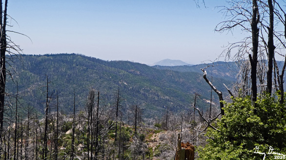
I think the heat is getting to me a bit. Not like in heat exhaustion, just feeling it sap my strength. After lunch there is no spring in my step. We continue on up until the road makes a sharp turn. By now, everybody else has come to the conclusion that we are not making it to Shuteye. So before the final ascent to Little Shuteye Pass, we turn around.
Even going downhill the spring does not return to my step. But we do make a bit faster time. We all stop in front of a sugar pine tree. Now that I think about it, it may not be in awe, but in fear as those cones are hanging straight down. One of them hits you and it will do damage.
We make it past the tree to cross our creeks and back to the car. It certainly is hot. Even though I have been sipping water like crazy, I do not feel refreshed and maybe a bit dehydrated. The drive out is the same as coming in.
Steven
When we reach Beasore Road, we decide to go on up it aways, maybe take in Chilkoot Lake. But I passed that, and Jones Store. By the time I realize it, I am five miles past the store. We turn around and stop at the store. But they are closing, having run out of food around 2:00pm. Still have not eaten there.
So what do we do? Why go back to our camp at Chilkoot. There we rest. I also have a first: that is falling asleep in the hammock Steven got me for Christmas two Christmas’ ago. Felt much better when I got up. You sort of get the feeling that I am using Christmas gifts this trip.


Jones Store Hold Up: Steven, Lawrence and Andrea
Now the question is where to eat or more accurately, where to pick up the food, around Bass Lake. Several places were mentioned, but we decided to try Miller’s Landing.A friend of Andrea’s had recommended it. So Andrea and Lawrence go ahead and we order it when we have a phone connection. When they get to the place, this looks like a cesspool of potential COVID-19 incubation. They tell us there is no social spacing, about a quarter of the people are wearing masks and even the staff have a very “relaxed” attitude about the potential dangers.
Andrea and Lawrence risk their lives while we go back and search for a place to eat. We find a day use area called Lakeside. A bit of a mess this late in the day. But we found a clean set of tables to eat at. The food was good enough. We watch the crowded boats swish by and wonder and hope that nobody is on board with COVID-19. As we are leaving, somebody from the California Land Management comes into the parking lot. This gives us impetus to leave as technically this is a $10 fee area, which seems a bit steep for 40 minutes of use.
Dinner view of Bass Lake
Back at camp, we sit and talk and enjoy each other as the skies darken. We get to bed around 9:30. I read for a while and quickly fell asleep


Extra Photo's

Morning on Willow Creek

Hiking the road: Korra, Steven, Lawrence, Andrea and Sherri

Korra and Steven

Korra
Andrea, the bandit

As far as we would go

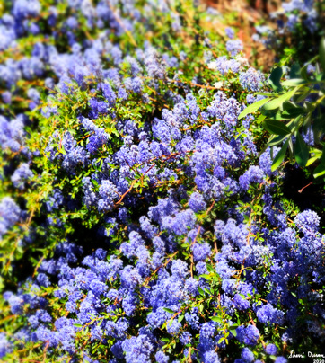
Hill of flowers

Shade and shady characters: Lawrence, Andrea, Gary, Steven


Flowers and Plants
Indian Paintbrush

Indian Paintbrush

Sugar Pine


Tuesday, June 23, 2020

June 23, 2020 - Bass Lake


Title: June 23, 2020 - Bass Lake
Hike Info : Description 

Trail head: Chilkoot Campground
Hike Info:
Type: Car
 
Description:
Korra at Fresno Flats
We are about to begin a three day camping trip with Andrea and Lawrence. While the closeness will be welcomed, we will also try to keep good practice to keeping up separation. This will be a good test to see how to do this and still enjoy the physical company of each other. We will not be giving each other hugs or handshakes, still it will be good to see them. We have not been with them since Christmas.
I get up at my normal time and start getting everything together. But we do not get going until about 10:45. The car is fully loaded. But we have three people and Korra in the car and supplies for three days. I wonder how we did this in the RAV4?
We stop in Oakhurst at Carl’s Jr for burgers, but go to the Fresno Flats Historical Park about a mile or two off of Highway 41. It is warm, but a nice stop. There is a recreation of Oakhurst’s original buildings-it was called Fresno Flats then. It is a nice historical park just to stop in. Besides, it gives Korra time to recuperate from the drive.
It should be a short drive to Chilkoot, our campground. But when we get to Beasore Road and travel up a couple of miles, there is a flagger. She tells us that ahead, just before Chilkoot, there is another flagger anda two hour delay. She suggests we go up and around on Sky Ranch Road.
Old man crossing a creek
So what is a trip without adventure? So we go back that way. This gets us by Calvin Crest and Nelder Grove. After that, we go down a road which is my type of road. But instead of me saying to go this way, it is Steven. He has grown up to be like his father.


Andrea and Gary
This road goes through Soquel and Greys Mountain Campsites. Both seem pretty remote-nut I know of people who do like these sites.At Grey’s Mountain we stop at an outhouse. The map shows a split in the road-but it looks like there might be three ways to go. One of them warns of the type of vehicle not to use. So we take that one. The road is not too bad, at least for our Highlander. Only in one place do I need to pick through a hole. This gets us to Beasore again and it is a short drive down to Chilkoot.
We see if our friend, Jerry, the campground host is in. He is not, but we quickly find the spot picked out for us. Soon after getting our car parked, Jerry wanders up. It is good to see him as it has been close to a year since we last hiked with him. We talk and he also explains the campground layout and amenities. Andrea and Lawrence come up shortly and it is a good non-physical reunion.


Primrose
Jerry gave us a few minutes to get settled, then he led us down his favorite trail. It is pretty steep and leads us down to Chilkoot Creek. There Korra gets her first taste of crossing a small creek-she does well, a bit wet. We do not stop there, but continue on around a ridge which separates the North Fork of Willow Creek from the Chilkoot. A family is here enjoying the water and scenery. The scenery is one which given the right lightning would make this a place one could just live forever at. Jerry has us do a group photo with him-one of the family takes it for us.


After about 10 or 15 minutes we started our return. All made it over the Chilkoot without falling in. Technically Korra did not fall in, she just waded across. Then it is up a steep hill. I can tell my lungs are no longer in the shape they were in six months ago. Andrea stays back with me and we make it back to the campsite.
Lawrence getting the kitchen ready
Jerry takes his leave of us-we are thankful for his kindness and consideration in making sure we have an enjoyable time at his place. He is off for the next couple of days. Camp is set up. We are together, but not crowded. Sherri, Andrea and Lawrence get the fajita’s made up for us. Pretty nice meal.
We all relax with a fire going. So good to be with your son and daughter. Of course we also miss Rachel. But this is a good start in having ways to be with family. While nothing special is really discussed, it is just special being here.


Wednesday, June 17, 2020

June 17, 2020 - Chicago Stump and Road 13S03


Title: June 17, 2020 - Chicago Stump and Road 13S03
Hike Info : Description : Trail LessonsExtra Photo'sFlowers and Plants

Delilah and Road 13S03


Trail head: Chicago Stump Trailhead
Hike Info:
Type: Hiking 
Trail: Chicago Stump Trail and Road 13S03
Destination:  None-just wandering
Distance:  3.22 miles
Start Time: 11:33
End Time:    2:23
Travel Time:  2:50 (1.14 mph)
Moving Time:  2:06 (1.53 mph)
Elevation Rise:  666'
Descent: 465‘
Maximum Elevation: 6,647'

Description:
I am glad I went on this walk for several reasons. First, I have not really been in the area before. Next got to see Delilah from a different view. Third, I figured out how badly out of shape I am in. Having been thankful for all of that, would I put this down as a hike to look forward to doing again? Probably not. Even though at certain times of the year, early Spring or late Fall this might be nice. But probably the gate to the area will be closed.
Sherri and Steven hiking
I get up around 6:15, knowing that we will not be going anytime soon. Steven is up with Korra around that time. But Sherri is up later on. I think we leave a little before 10am. Sherri is driving. Korra is not used to being driven and it upsets her tummy. But on the whole, she travels without too much bother.


We stop at the Grant Grove visitor center-it is closed due to the virus. But the restrooms are open. We decide that we will head towards the Converse Basin and decide what to do there. The Chicago Stump sounds like a good place to go. I suggest we can also hike some on Verplank Ridge.
Gary and the Chicago Stump
Steven and Korra
The hike to Chicago Stump is really nice-also short, only a quarter mile or so, one way. Only people on it, until we came out. The stump is huge. No wonder the people back East did not believe. Who would? As has been observed before, it was a sad day when this magnificent tree was cut down only to be scoffed at.
Coming out, there were four people coming by who were not wearing masks-we were, when we saw them from a ways away.. We put on our masks and stepped off the trail. I think they were pretty oblivious to any need to have protection.
Now where to? I suggest we go down a road which I had not been down before, Road 13S03. It follows Verplank Ridge. Nobody else has a better idea, so off we go. We walk back to the junction. There I find a wall and wonder what the wall is for. 
 
Rock Wall
There is a chained gate which we go through-it is a forest service area. The gate is to keep cows from grazing outside of their confines. It does seem strange to have cows wandering around so close to the park, but never seeing them.

Guardian Bovines


We soon do see them as they herd together a little ways down the road. Not sure who is more concerned-them or us. They have horns while we have poles and a dog. They back away-I wonder for how long? But as indicated, this is a dirt road. It does not look like it is driven often-there are some tire tracks in the dust. And it is that word, dust which may describe the road. I think the cows' hooves have pulverized the road’s dirt. While not choking, it has a feeling of we will need a shower when we come out.
Hilltop lunch
There is a little ephemeral creek following the road for a ways. And where there is water, plant life will follow. Which means we are gladdened by the sight of color from an assortment of flowers. We meet up with our bovine friends again. This time we decide to head up a hill to have lunch. It is a nice little spot-just glad it is not a hot day. We can see some of the surrounding area and to the park boundary.
Now back to the road, and the cows. They seem to be driven off by our presence. For now, they exit the road and go down a ravine. While the road is hot and dusty, fortunately the day is not. After a decline of about a mile, there is a leveling where we go over some small ridges.
Korra keeping watch on the cowe
We meet the cows again. I think Korra is getting more fascinated by them. She does not chase them but eyes them. Steven has her under pretty good control.
I have been glancing over to the west. McKenzie Ridge is what we see. Sort of interesting seeing the back side of McKenzie from what we normally see. But what I am really looking for is Delilah. We top a ridge and I think it is time to turn back. The road will take another long descent. But I go over a ways to the edge and spot Delilah! Now I am satisfied.Of course, from this distance, even under full 30x magnification, Delilah looks pretty small. Now I wonder how much we are actually seeing through our binoculars from Delilah.
Walking Road 13S03


Time to start back. Korra and Steven are setting a pretty good pace. Even Sherri is doing well. Me? Well I am trudging along, falling further back until Sherri waits for me to catch up-sounds familiar? Sounds more like role reversal.

Not a whole lot of interesting stuff on the way back. It is just the reverse of what we did coming forward. When we reach the top, we poke around the rock wall and only discover there is cement dumped around the bottom. Also there is a mound behind it, like a retaining wall. Wonder if it was a mine or something.
Steven has moved up the car a little ways. Bless you my son. Steven is driving us back and I am with Korra. Both of us nod off at times. No stopping for food on the way back-not sure if it is a positive or not. We make it back home before the 5:00pm traffic. Maybe not content, but happy.
Delilah Lookout


Trail LessonAn early start avoids the heat.

Extra Photo's
Backside of McKenzie Ridge
Korra chasing a lizard

Pine Ride and Delilah Lookout

Bear Mountain in the background

Terraced Manzanita?


Flowers and Plants

Indian Paintbrush

Blue Elderberry

Blue Elderberry

Blue Elderberry

Mountain Strawberry

Young Sequoia Gigantiea


Wednesday, June 10, 2020

June 10, 2020 - Delilah Lookout


 Title: June 10, 2020 - Delilah Lookout
Hike Info : DescriptionBackground :   Animals : Flowers and Plants


Trail head: Delilah Lookout
Hike Info:
Type:Lookout
Description:
I think rhythm is a good word. Yesterday, I did not think I had gotten into the rhythm of being a fire lookout. I always seemed to be missing stuff on the radio or being slow in doing my scans. But maybe with a day under my belt and a good night’s rest, I will be up to speed.
I woke up at 0530 after a restful night’s sleep. There was a glimmer in the east showing the coming of the sun. There is something about the rising of the sun which gives both hope and joy as the colors change from darkness to light. I got up just before the rays of the sun poked through. Even then, when I glanced over, I knew I missed a prime photo opportunity to catch the sun's rays before the sun peeked over the crest. I agree with GK:
I enjoy stars and the sun or trees and the sea, because they exist in spite of me; and I believe the sentiment to be at the root of all that real kind of romance which makes life not a delusion of the night, but an adventure of the morning.
--GK Chesterton, The Illustrated London News,
November 22, 1913, "The Fulfillment of Wishes"

Morning Has Broken
And now back to the amateur writer. Once up, it is a trip down 80 steps, unlocking a gate and then another hundred feet to the outhouse. Nothing like relief. But why waste a good morning? So I went on a walk down the same road as last night. Only thing went up the other side of the saddle a little ways. What a way to spend the morning! Flowers everywhere and I am the only one up here to enjoy it. While I know what some of these are, some names do not come into memory. You will just have to look at the bottom.
When I got back up the stairs, I had a granola breakfast. Somehow, simple tastes good. I then cleaned up and got my stray stuff packed away. For such a small space and only one person, it is very easy to get things cluttered. By now it is 0900 and time to start getting ready for going in-service. I take the weather-still calm and beautiful.
Pine Ridge at Sunrise
Delilah’s cabin is getting a bit warm. Sort of like being in a glass cage, it heats up quickly. Once the sun gets high enough and the wind kicks in, then it is very pleasant, even on hot days. So what did I do in the meantime? Lets just put it this way. Nobody is around for at least three mile and I am behind two locked gates, 72’ up. Who will ever know?
I go in-service with both PTV and SNF at 0930. And now it is part of the daily routine. The duty officer calls me up today and checks to make sure everything is good-it is. This does give me warm fuzzies in that there are people in the Forest Service who care about the lookout and my well being. Actually there are a lot of people who do.
Today I get both the weather and the staffing? Why might you ask? Because I got my voice recorder on the phone to work. Also the dispatcher who was reading the staffing was well modulated and spoke at a normal rate. Afterwards Brent and I talk. Nothing serious. Brent did indicate that he had not received my refresh quiz-sent it yesterday. I sent it again this morning from Sherri’s account. And then it is back to the normal scan and refresh cycle. That rhythm I talked about earlier is kicking in.
Brent calls back in the afternoon. Yippee! I have aced the fresh quiz! There is always that little apprehension of how good did I do, hopefully I did not totally screw it up.
Common Dandelion
In yesterday’s blog, I did not say that close to quitting time, the carbon monoxide detector started chirping. Am I about to be asphyxiated? I change the batteries and the chirping goes on. But the relief is that I placed the detector outside and it still chirps. So chances are I will not die because of that. I talked with Buck Rock about the situation. So she sends PT31 with a fresh batch of batteries. I guess I am not totally isolated. He comes up and I talk with him. But then he needs to go off and examine a burn line from last year’s fire over on McKenzie Ridge.
While I was with PT31, Kathy called. Told her I would call back. We talked for a while on our call back. She was wondering how the sanitation process went? I think pretty well. She mentioned some things and I realized I had not sanitized the weather instruments. Hopefully the person before me did. She had been rafting the Snake River. Sounded like a good trip.
1600 comes along and the SNF checkin and the PTV weather/indices take place. But I am ready. Maybe it is just a bit of catching up on yesterday’s misshapes, Buck Rock calls me and asks about tomorrow's burn status. I was just beginning to listen to the recording when she called on R5. I call her back with No Burn Reporting.
Now for my final two hours in the tower this trip. It has been good to be back up here, but I am also looking forward to returning home, even though it will only have been a day and a half away. I know as the season goes on I will enjoy longer stays.
Common Madea
Besides looking for smoke during these last two hours, I am also getting packed. The Covid-19 protocol calls for the cabin to be cleaned twice during our stays. Once when we come and once when we leave. So I am on the leaving sanitation process. There is a twofold reason for the leaving. First, it gives time for the various agents to work against the virus. Second is that whatever I miss, there is a pretty good chance that the next lookout will sanitize.
1800 rolls around and I go out of service with PTV and SNF. It has been a good day. I lower what can fit into the basket down to the ground. The rest is packed into my backpack. I do the final look around to make sure I have left things OK and lock up everything. After unloading the basket and my pack into the car, I put away the basket. I then glanced up and realized I have left one last thing undone, about 65’ up. Do I really need to go back up those stairs? Yea. So my day is not done yet. I go up and turn off our water supply and re-lock the gate. I put away the keys and drove off.
For the first time out, not bad. I am sure things will go smoother when we come up in three weeks. I get home around 2000 and had dinner.

Background
Two days after I was up at Delilah, my replacement got a smoke, actually it was three smokes. Brent saw the smokes right when they were infants and nailed their locations. SNF was able to hop right on it, even before those who were close by phoned in. This is the Hog Fire on the northern banks of Pine Flat Reservoir. The total acreage is 533. There is a mixture of admiration for Brent for finding and being able to accurately report the fire; a bit of jealousy-one never wants to have a smoke happen on their watch, but if it does, I want to be the first to report it; and a touch of relief that it did not happen on my watch.
 
Animals
Tiger Swallowtail


Flowers and Plants
Common Dandelion

Common Dandelion

Common Madea

Butterfly Mariposa Lily

Butterfly Mariposa Lily

Butterfly Mariposa Lily