Type:
Backpacking
Trail:
Alder Creek
Destination:
Usual campsite above Alder Falls
Actual
Destination: Campsite about a quarter mile above Alder Falls
Distance:
4.5 miles 1
Start
Time: 10:30
End
Time: 4:00
Elevation
Rise: 2,164'
Descent:
914‘
Maximum
Elevation: 6,082'
1I
forgot my GPS. So this is based upon estimates from previous hikes
and from plotting route on Google Earth
Description:
 |
| View from 6S10 |
 |
| Fresno Dome |
This trip is not turning out
as expected. The original plan was to go on a three day backpacking
trip to Chain
Lakes
with all five of us in our family, plus Lawrence-Andrea’s
boyfriend, and another Andrea who our Andrea went to high school
with. But Rachel needed to work Friday. So I stayed home with Rachel
and we would go up Saturday. The rest of the group went up. They got
a wilderness permit for Chain Lakes-the person in the Forest Service
office said the road was clear to the Quartz
Mountain
trailhead. But it was not. There were at least three snow berms-the
last one stopped them, damaging the protection under the Rav4. At
that point, the group decided it was time to turn back, that is with
help getting off of the berm. Instead they took a day hike to Fresno
Dome and came back home to Fresno.
 |
| Mosquito Creek Trailhead |
 |
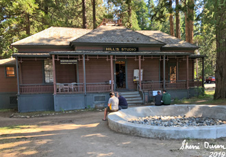
| Wawona Ranger Station |
Now we will try again, this
time to Yosemite. Our options are Alder
Creek,
the Pohono
Trail
and Ostrander
Lake. We
will see which we get. The plan is to leave by 7am and get to
Yosemite before the long line at the entrance station. We are
thinking of trying for the Alder Creek trail, mostly because it will
give us a quick route back, along with a nice experience. The two
Andrea’s and Lawrence have not been there yet, so it would be new
to them as well as someplace Sherri and I like to go, just not in
mid-season.
 |
| Rachel, Sherri, and Andrea |
We did manage to leave at
7:30. Andrea, Lawrence and Rachel are going over to pick up the other
Andrea while Steven, Sherri and I go straight to Wawona
and negotiate for a backcountry permit. We get to the southern
entrance to Yosemite about 8:30. There is a line, but fortunately not
that bad. It is moving quickly, until we get about six cars from the
entrance station. There I had Steven get into the wrong line. This
line took forever. We got to Wawona around 9:00am.
Alder Creek from the Mosquito
Creek
trailhead was available, so we gobbled up that permit. We only had to
wait about 10 minutes for the other car. So off we go. Lawrance’s
car went ahead of ours-which was a mistake. When we got to the
trailhead, no second car was there. We waited around another ten
minutes for them to show up. They had missed the hairpin turn and
gone up the road a little ways.
Sherri and I start out before
everybody else does, mostly because we will be the slowest. That is
borne out as the rest of the gang passes us pretty quickly. But in
our defense, the first ¾ of a mile goes up 700’, so this part of
the trail is not for wimps. I take things one step at a time and pull
away from Sherri. But Andrea and Rachel stay with her. I am glad for
the break when we get to the junction with the Wawona trail. A man
and his grownup son passes by and we talk with them. While they have
been coming to Wawona for 30 years, they have not made it to the
falls yet. We encourage them to. The father says that the cap Sherri
bought me in Wawona was a Shirly Spenser design-she is from Fish
Camp.
 |
| Andrea the exerciser |
The air is a bit warm, but not
as warm as I expected. The trail goes along the familiar route back
towards Mosquito Creek. But when we cross it, or should I say, some
of its legs, it is more of a trickle. We have been climbing, but more
gentle than the first ¾ mile. After going over several ridges, it is
time for lunch. Lunch is along the side of a hill. We devour the
peanut butter, nutella and crackers. I think someplace some humus is
reconstituted. Then Andrea shows her exercising skills-I am still on
recovery mode from the climb up so far.
 |
| Trail above the falls |
But fortunately, we only have
on more real climb to tackle. Once we get to the top of the climb, we
come across the old Sugar Pine Lumber Railroad bed. That means it is
a flat walk to the Falls. We walk at a leisurely pace, taking in the
forest around us, occasionally crossing a little stream of water. I
admire the work which was done to build this bed.
I know that going around a
certain bend, we will meet one of the pleasurable sights in the
Sierra’s-the initial view of Alder Falls. It does not disappoint.
We have also caught up with the rest of our group as they are
reclining under the shade of a lone pine tree. But the view is
keeping them there. I will admit I am also glad just to be off of my
feet as well as being able to enjoy the Falls.
 |
| Evening at Alder Falls |
We enjoyed the falls for over
an hour. But then the debate was where to go? Should we go up to
where we regularly camp or try for someplace with less distance.
Everybody thought that if we could find a place for all seven of us
closer to the falls, that would help us get out earlier in the
morning. So off we go.
 |
| Our Campsite |
We walk about half a mile to
three-quarters up the trail. I am in the lead, mostly because I have
a pretty good guess about where a campsite is. We walk through a fern
laden forest with azaleas sprouting everywhere. Very fragrant. We
will have the best smell campsite that I think we have ever had. But
the azaleas are not the only flowers. We see snow plants and western
wallflowers, lupine-of course-and many other flowers. It seems like
this is how Spring should be in this area, not a month into Summer.
Presently I see what I have
been looking for-a little worn path away from the trail. We follow it
and there about 40’ from the trail is a great campsite complete
with an established fire ring, not that we will be burning tonight.
There are three tents and two hammocks. While the space is occupied,
it does not seem crowded. My one item of concern is that we are
closer to the creek than I would like. But looking up the trail a
ways, all which I really find is a campsite on a slant and a pair of
sunglasses. So this will have to suffice for tonight.
 |
| Evening at Alder Falls: Rachel, Lawra\ence, Steven, Andrea S, Andrea, Gary, Sherri |
Dinner is beef
stroganoff-dehydrated. Sherri had this stuff already packaged for us.
After we clean up, we decide to go for a little walk. I think most
people wanted to go further up the trail, but I was interested in
seeing the Falls at sunset. So since I set out first, that is the way
I chose. As it turned out, it is a good choice. The Falls and the
area while not stunning, they are pleasant against the darkening sky.
We stay around for half an hour and then head back, getting back just
in time for darkness to fall.
 |
| Evening Sky |
As you might have guessed by
now, when darkness falls, it is time for bed. We all hit our sleeping
bags around 9:00 and I stop reading by 9:30. Tired but feeling good.
 |
| Alder Creek close to our campsite |
Breakfast
|
Lunch
|
Dinner
|
Snacks
|
At home
|
Crackers, Peanut Butter,
Nutella, Humus
|
|
Clif Bar, GORP,
CytoMax,Coffee Candy, Jelly Belly
|
 |
| Alder Falls |
 |
| Sherri coming up the trail |
 |
| Mother and daughters |
 |
| How Far???? Andrea and Sherri |
 |
| Here we sit like birds in the wilderness. Andrea, Rachel |
 |
| Up the trail: Rachel, Sherri, Steven |
 |
| Lawrence |
 |
| Sherri and Andrea |
 |
| Sherri, Steven, Rachel, Lawrence, Andrea S, Andrea, Gary |
 |
| Evening Sky |
 |
| Alder Falls at dusk |
 |
| Andrea styling mosquito netting |
 |
| Rocks andFlowers |
Animals
 |
California Legless Lizard??? Rubber Boa |
 |
| Tiger Swallowtail |
 |
| California Sister |
Flowers and Plants
 |
| Mariposa Lily |
 |
| Mariposa Lily |
 |
| Columbine |
 |
| Snow Plant |
 |
| Snow Plant |
 |
| Azalea |
 |
| Azalea |
 |
| Indian Paintbrush |
 |
| Indian Paintbrush |
 |
| Maybe an Elderberry??? |
 |
| Western Wallflower |
 |
| Western Wallflower |
 |
| Is this a strawberry??? |
 |
| Maybe an Alpine Gold??? |