Title: April; 14, 2021 - Million Dollar Mile/Stevenson Falls
Hike Info : Description : Extra Photo's : Animals : Flowers and Plants
Type: Hiking
Trail: Million Dollar Mile Road
Destination: Stevenson Falls
Distance: 7.38 miles
Start Time: 11:06
End Time: 3:46
Travel Time: 4:40 (1.58 mph)
Moving Time: 3:45 (1.97 mph)
Elevation Rise: 1,969 ' 1
Descent: 2,043‘
Maximum Elevation: 2,347'
Betty and Rose cannot join us. But Carol, a friend of ours and who has not hiked with this small group, can go with us today. But Sherri is not so sure she can go-not because of Carol, but because of our schedule. We thought about going to Williams Peak and then possibly back to Briceburg, but if we alter our location, then Sherri should be able to get a good night sleep and still enjoy a hike with our friend.
 |
| Jose Creek |
 |
| Field of Lupine |
The Million Dollar Mile Road is a Southern California Edison (SCE) paved road, part of the Big Creek project. As a private road, it is gated to most motorized vehicle travel, but open to walkers and bikers. So it is a wonderful place to walk. We go around the gate and start our walk.

Gary and Carol exploring an adit
You can read my
other entries on the hike
for the general trail description. But what is interesting is that
Carol starts to apologize for slowing us down. It is not that she is
walking slow, rather there is so much interesting flora along the
way. And to my surprise, there is a lot to examine. I am expecting
more dryness now.
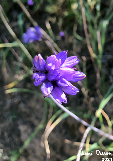
Flowers are blossoming more than I anticipated. I thought this late, we would see more dryness: more dried flowers and grass. But we found so many that we stopped every few feet to examine a different type of flower So unexpected. So delightful. We do tell Carol not to worry. We are out here for enjoyment, not the miles.

Burn area from the 2020 Creek Fire
I should also say that I also
enjoy showing off my knowledge of an area-it really helps that I have
been along here many times. In this case, I get to enlighten Carol
about some of the history of the Big Creek project. And then
particularly what an adit
is. It
is helpful that we can walk right into one.
Our next major stop is Stevenson Falls. Everytime I have seen these falls, they are impressive. Sometimes,they can be overpowering. But today, they show that being restrained can leave a good impression. The volume of the falls are governed by the amount of release SCE lets out of Shaver Lake. Today it looks a bit lean. But it allows the green moss on the side of the falls to accent the whitd water falling from above.
 |
| Finding a WiFi Signal |
 |
| Who Died? |
We enjoy our lunch across the bridge over Stevenson. After getting rested up and dutifully admiring the Falls, it is time to go back. Somehow our return trip does not feel like a trudge-sometimes my legs have just been tired and the road goes ever onward-to steal a like from Tolkein-but not in a good way.
There were some markings on
the road which we paused to examine a bit closer. One looks like a
person with three fingers and no neck may have met their demise. But
then again, it may be just somebody having fun. And then there is
this mysterious symbol consisting of a series of arc? Could there be
wifi at this spot? The mysteries of the road!
Shadow People
We pretty much “march” on back to the care, with another brief stop at Jose Creek. That is a relaxing area to view. We reached the cars at 3:45. Now for the drive back. We have a bathroom stop in Prather. Then we say our farewells to Carol as we are driving back separately.
Extra Photo's
 |
| San Joaquin River |
 |
| Field of Poppies |
 |
| Field of Poppies |
 |
| Sherri and Carol |
 |
| Adit Opening |
 |
| Have Camera, Will Take Pictures of Flowers |
 |
| Carol and Gary |
 |
| Jose Creek |
 |
| San Joaquin River |
 |
| First sighting of Stevenson Falls |
 |
| Stevenson Falls |
 |
| Stevenson Falls |
 |
| Stevenson Falls below the bridge |
 |
| Stevenson Falls |
 |
| Grass and Rock |
 |
| San Joaquin River |
 |
| Road and Poppies |
Animals
 |
| Velvet Ant-related to a wasp |
Flowers and Plants
 |
| Note: We were trying to capture this flower and identify it |


No comments:
Post a Comment